|
||
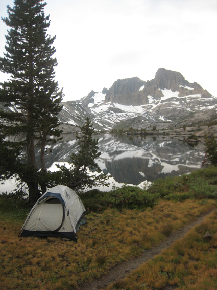
Garnet Lake on the last morning of the trip with Banner Peak in center - cloud covered |
 |
 |
|
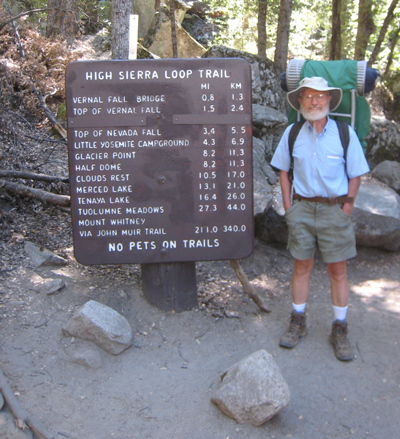
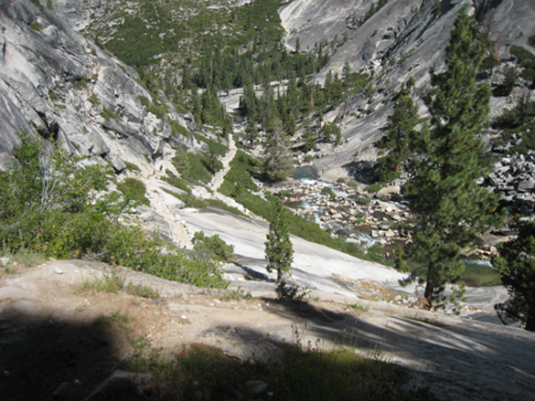
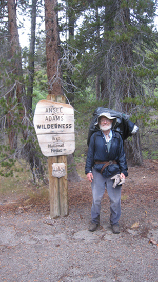
Bob just starting out - 44 lb pack | On the way to Little Yosemite Valley, looking back down the canyon |
|
 |
||
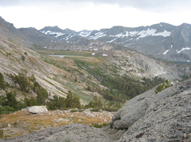
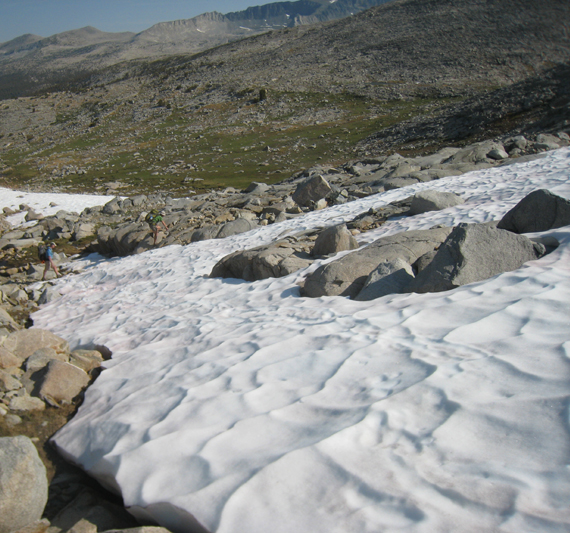
First lake on way to Foerster Peak/Blue Lake Pass - no longer on trail | ||
 |
 |
|
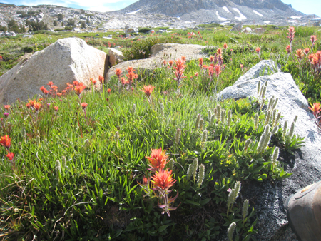
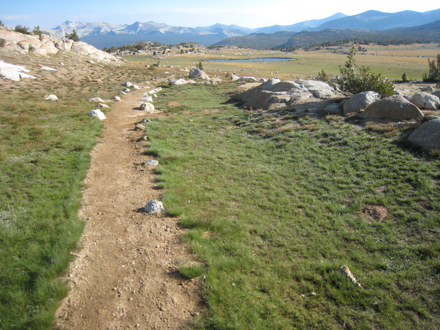
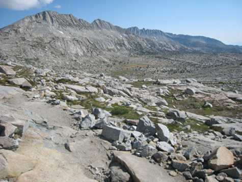
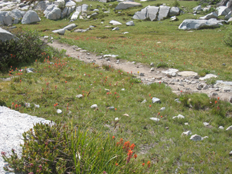
Meadows were covered with flowers at 10,000 to 11,000 foot elevation |
||
 |
||
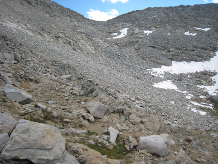
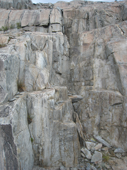
This is Blue Lake Pass below Foerster Peak. I was hoping to continue cross country over this, but decided it was too risky. On my very first backpacking trip in 1969, I and two others had come across and down Blue Lake Pass coming from the other direction. I was hoping to backtrack along that route. I have no idea how we successfully came down that rocky incline. |
||
 |
 |
|
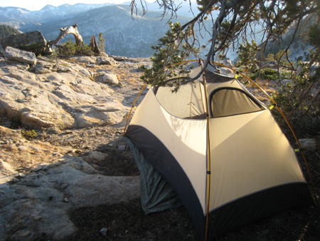
This campsite near the edge of a cliff had a beautiful view at sunrise. |
||
 |
 |
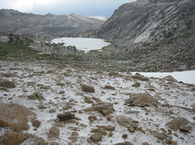 |
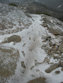
As I crossed Vogelsang Pass, the temperature dropped, there was thunder, and a substantial hail storm hit. The path quickly covered in ice. The third photo shows Vogelsang Lake. | ||
 |
 |
|
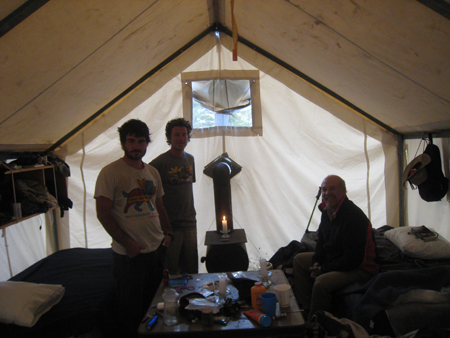
First view of Vogelsang Trail Camp. When I got there, employees told me all tent cabins were full, but for $100 cash, I could have a cot with mattress in an employee tent cabin with a woodburning stove. I had $90 cash, which was acceptable. Cajun and Bry helped get the tent in order. Kevin, on the right, had also gotten a bed. Kevin is moving to Sonoma, near where we live, so I hope to see him again. |
||
 |
||
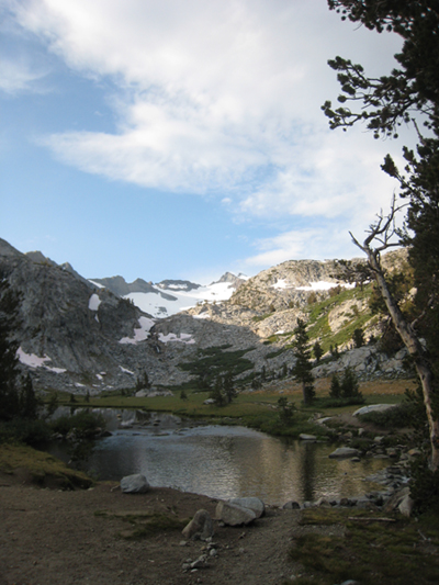
Evelyn Lake, on the way down from Vogelsang Camp to Lyell Canyon, on way to Donohue Pass |
||
 |
 |
|
This small lake is on the way up to Donohue Pass. Using the stepping stones was tricky. Someone camped there said others had waded it, barefoot. I made it over the stones. In the second picture, I am on the wrong track. Fortunately, the two guys below, JC and Martin showed me the right way. |
||
 |
 |
|
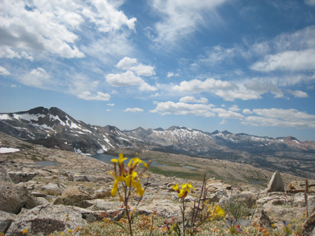
Just after crossing Donohue Pass. Magnificent scenery and meadows covered in flowers. |
||
 |
||
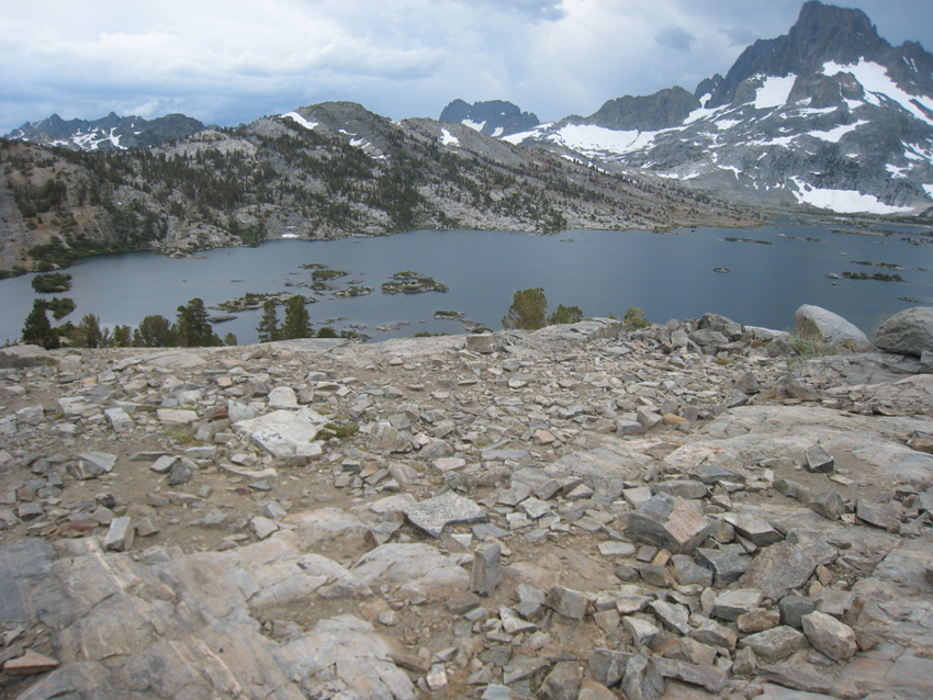
Thousand Island Lake, the last large lake before Garnet Lake. | ||
 |
 |
 |
||
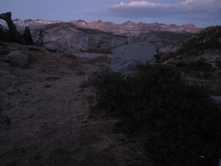
Garnet Lake campsite with Banner Peak in background in morning. An hour later I took the photo at the top of this webpage. What a difference! Then I spent a couple of hours hiking along Garnet Lake looking for a long lost camera, before packing up and heading out. |
The last of the hike. An insane, vertical, slim "staircase", followed by a wet and cold day of hiking, including getting lost. Fortunately, 3 German astrophysicists were backpacking out, ran into me, and kindly led me to safety. They took this last photo of me (the battery in the camera was going dead) - soaked and shivering, then they even gave me a ride to Mammoth Lakes, where I stayed at a Motel 6 and took the longest, hottest shower I have ever had. All in all, this trip was a wonderful, wonderful trip. |
|||
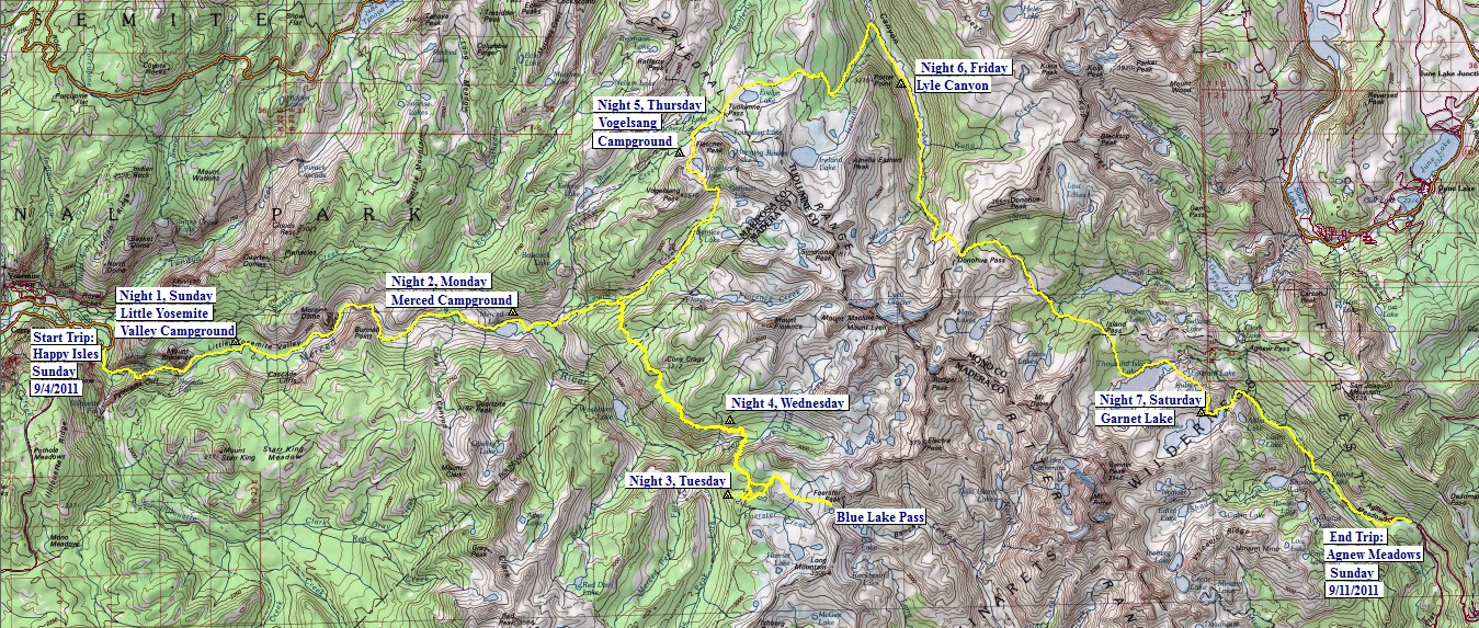
Trail RouteClick on map locations to see photos of that location, some not shown above, e.g., Blue Lake Pass has several more photos. |
||
| ||
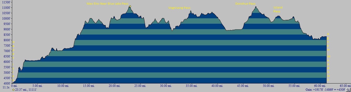
Elevations Along Trail |
||
 |
http://www.youtube.com/watch?v=6zqEwRlLSt4
http://www.youtube.com/watch?v=Xz3Re0t_ml4
 |
 |
|
I walked across the first jumble of logs, then sat and straddled the long log, pulling myself across. |
||
I also measured my own weight and % body fat (my scale tells me both) before and after.
In summary:
My food consisted of dried fruit, nuts and seeds, cheese, salmon, brewers yeast, Triscuits, and a packet which included vitamin C and some other vitamins. (see detailed chart here) None of this requires cooking, so I did not have to carry a stove. The food by itself weighed almost 14 lbs at the beginning of the trip and could barely be crammed into the bear canister.
I also included the two bananas and basket of fresh black figs I had the day I drove up to Yosemite, since that was also my first day of backpacking and I wanted to include all food eaten over the 8 backpacking days.
I ate an average of 2,424 calories a day, compared to my normal consumption of 1,850 calories, a 31% increase in calories.
My diet was 39% fat, compared to a normal 19%.
I ate 94g of protein a day, compared to a normal 70g.
Of the 21 vitamins and minerals I tracked, I was low in recommended amounts of the following 5:
If I had not consumed the 1 packet of "Supplement-Emergen-C, Raspberry flavored,9.4g" - which was awful, even mixed with water (and I normally avoid all supplements), I would also have been deficient in:
I was surprised at first at how little Vitamin C one gets from dried fruit, of which I ate a lot.
My weight did not change, but my % body fat dropped from its usual 17% or so to 15% and below. This low a body fat measure on this scale is very low for me. Looks like hiking 9 miles a day with a 40 lb pack and, on average, ascending 2,400 ft per day and descending 1,860 ft per day burns fat and builds muscle.
A couple of days after I got back, I jogged (as fast as I could) 3 miles. I was hoping for a faster time than usual, which I got, but the pace only dropped from 8:57 a mile to 8:52 a mile. I'm 64 years old, 5'7" and currently weigh between 139 and 140 lb.
As far as water goes: For 10 years my family has used the First Need Water Purification system on our backpacking trips. I highly recommend it. To test it before you start on a trip, you are supposed to put in a couple of droplets of red dye in some water, then use the filter, which is supposed to give back pure water. In fact, we find it more fun to take a glass of red wine and run that through. It turns the wine into water. It is easy to use. I used it throughout the trip and found myself filling a quart bottle 3 to 4 times a day, so I was drinking just under a gallon a day of water.
 |
|
 |
||
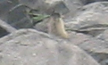
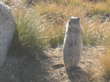
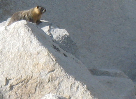
If I am right, these are photos of a gopher, pika, and a marmot. |
||||
 |
 |
|||
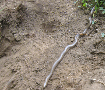
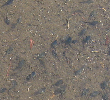
Rubber Boa. Identified for me by Gary Nafis of Californiaherps.com. The second photo shows it was springtime at 10,000 ft - tadpoles in abundance. This is a tiny section of a pond that was filled with them in the meadows below Foerster peak. |
||||
 |
||
 |
 |
|
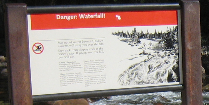
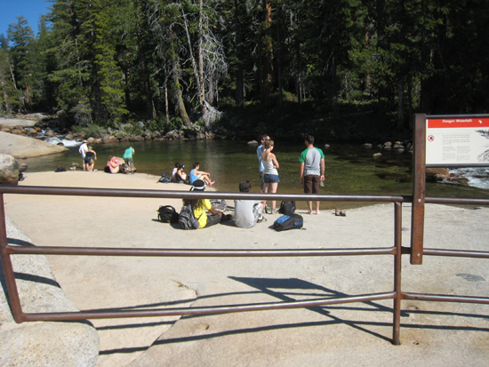
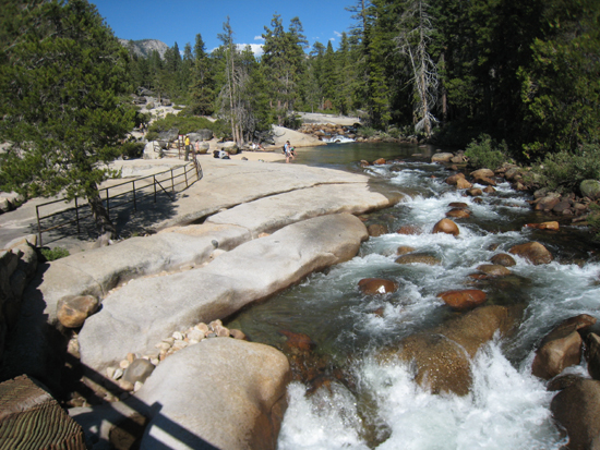
Where the water begins to churn, the Falls begin. Note that the rocks in the churn in the second photo match the picture in the danger sign. |
||
Bob Phillips [phillips bob 27 at yahoo dot com - no spaces]
Santa Rosa, CA
September, 2011