|
Video suggestion: All videos shown below are very short and HD (1080p). I find best YouTube settings (for all but the few with Bob, Jennifer, or animals) are HD (1080p), slow motion (0.25 or 0.50), and full screen. Actually, watching Bob and Jennifer in slo mo can be amusing.
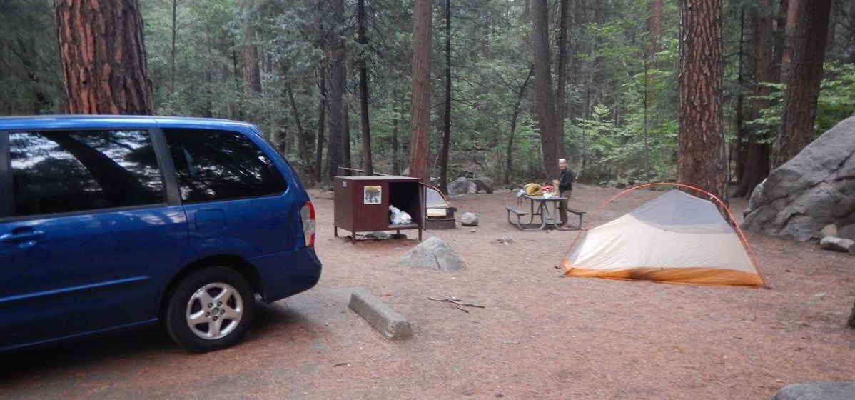
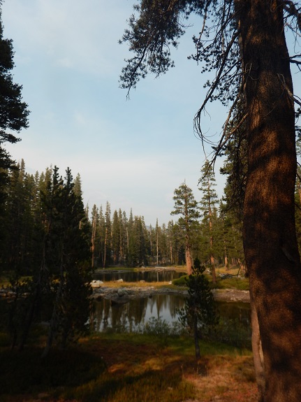
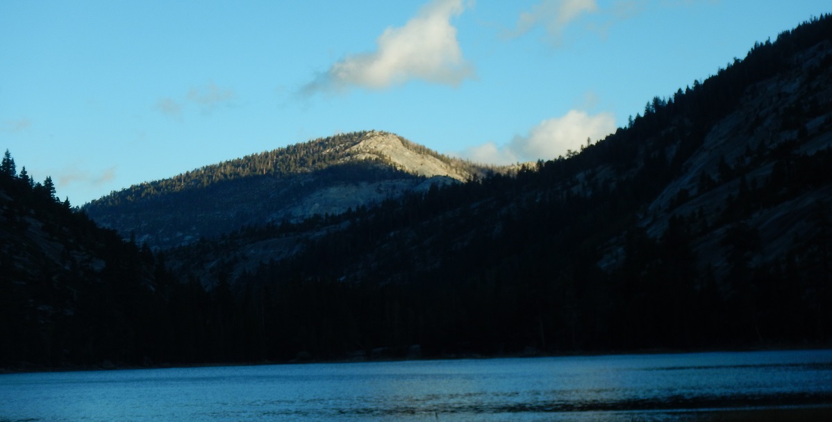
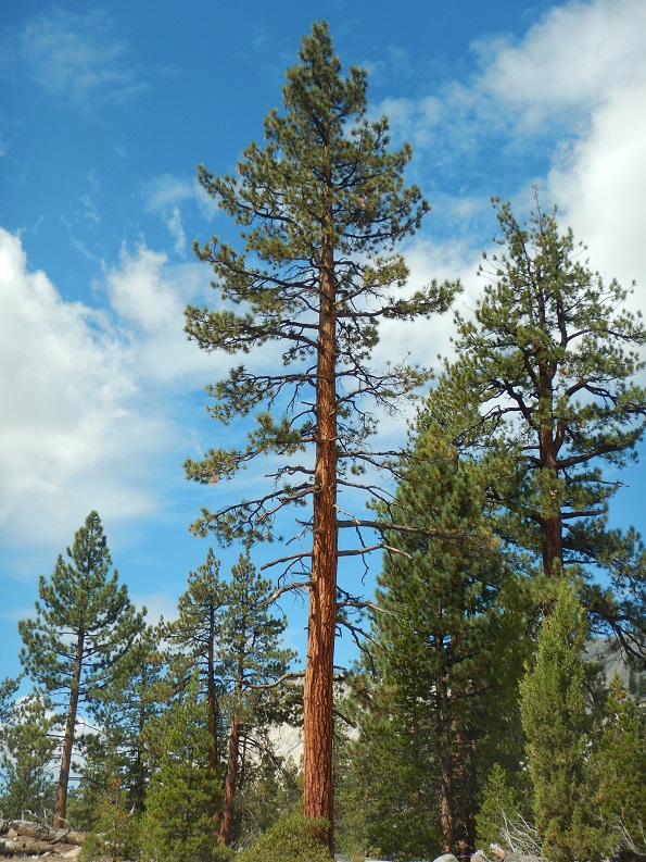
Drove to Yosemite and camped in Upper Pine campground next to a stream with running water.
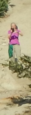
Bob drove to Oakland to meet Jennifer, that is, Bob drove for 1/2 hour, then it dawned on him that his hiking boots were sitting in the garage, so he drove back, got them, and headed back to Oakland. Bob's car trunk was no longer shutting, so it was partially closed using a rope. In Oakland he and Jennifer finished packing for the trip and headed out to Yosemite Valley in two cars, Bob following Jennifer. It was necessary to stop in Manteca at Chipotle's for Jennifer, then in Oakdale at Subway for Bob, all the food to be eaten later.
Got to our campsite at 6:45 PM, ate "lunch" we had bought, walked around the campground in the dark, meeting a lost French couple, to whom we provided info.
|
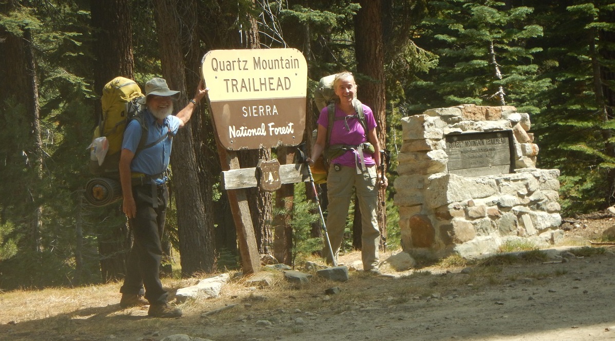
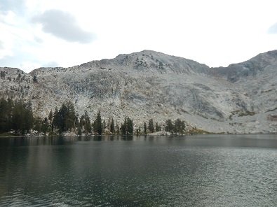
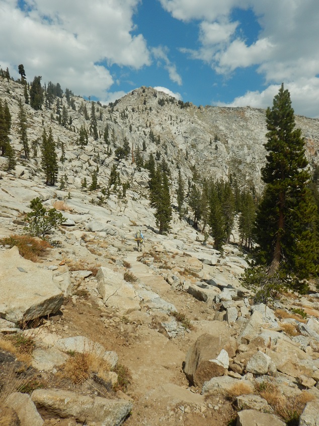
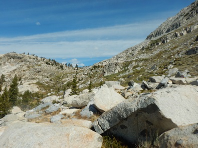
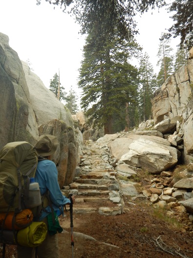
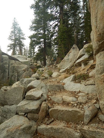
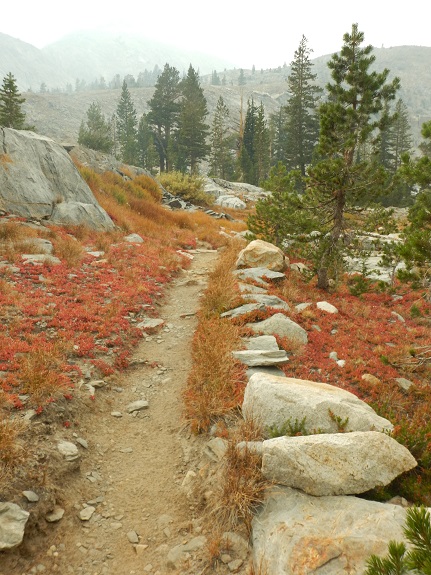
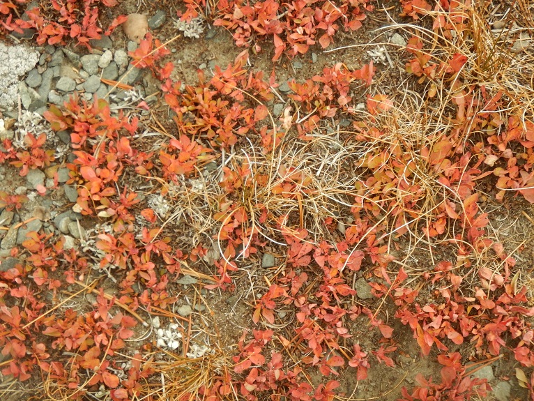
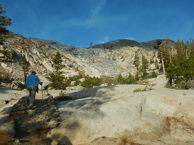
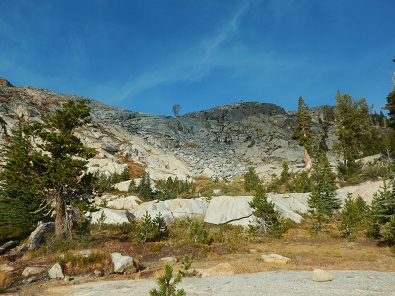
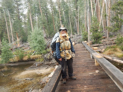
Backpacked 4.5 Miles from Quartz Mountain trailhead to first of 3 Chain Lakes via Chiquito Pass. (net gain 860': 8,040' to 8,900').
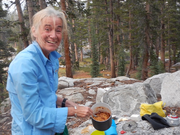
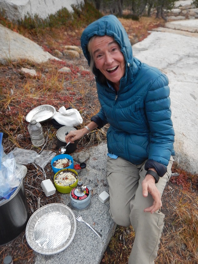
Dinner: Curry lentil stew and feta cheese, with green beans
Overnight Jennifer's sleeping pad had developed a leak. The Yosemite stores did not have an adequate replacement, so Jennifer decided we would pick one up in Oakhurst, where we were next headed to get our Wilderness Permit. We moved everything out of Bob's car - except backpacking items - into Jennifer's, left Jennifer's car in Curry Village in Yosemite, and headed to Oakhurst. At the Oakhurst Wilderness center we had no problem getting our permit for the hike from the Quartz Mount trailhead to Yosemite Valley.
However, the Oakhurst sporting goods store did not have an ideal replacement for Jennifer's sleeping pad, at which point Jennifer was wishing she had not left the sleeping pad in her car in Curry Village, since it might have been repairable. So she bought a heavier pad and we headed out to the trailhead - along the worst road Bob can ever remember having driven on.
It took Bob 2 hours to traverse 13 miles of "road" in the Sierra National Forest to get to the trailhead. Apparently, the road had once been asphalt. Now it was chunks of asphalt, dirt, rocks, potholes, ditches.
On this first traverse of the road there was absolutely no traffic and after about an hour both Bob and Jennifer decided to answer nature's call. Since there were no other cars on the road, neither sought the complete privacy of the nearby woods. Shortly after stopping and getting out, another vehicle showed up. Such is life. This video captures a few minutes of traveling on the road when we returned at the end of the trip to pick up Bob's car. It includes trying to pass a horse trailer.
At one point, Bob felt the car could make it over a small rock in the road. Bob was wrong, had to stop the car and crawl in the dirt under it to move the rock out of the way. Bob's pants were now a nice, uniform brown.
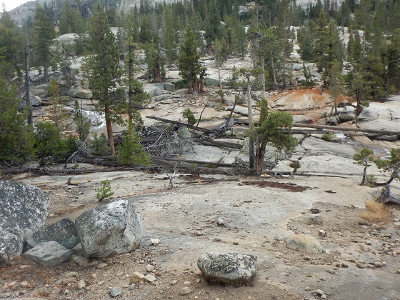
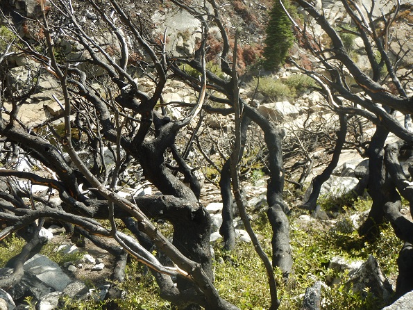
Once at the trailhead, all was well. It was nice weather and a nice trail. We even crossed over our first of 3 passes: Chiquito Pass. However, by sunset we saw some smoke, presumably from the forest fires to the south of us.
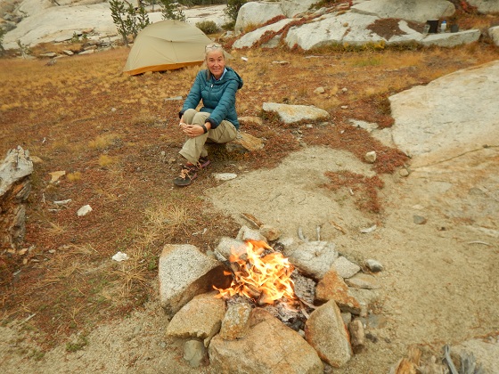
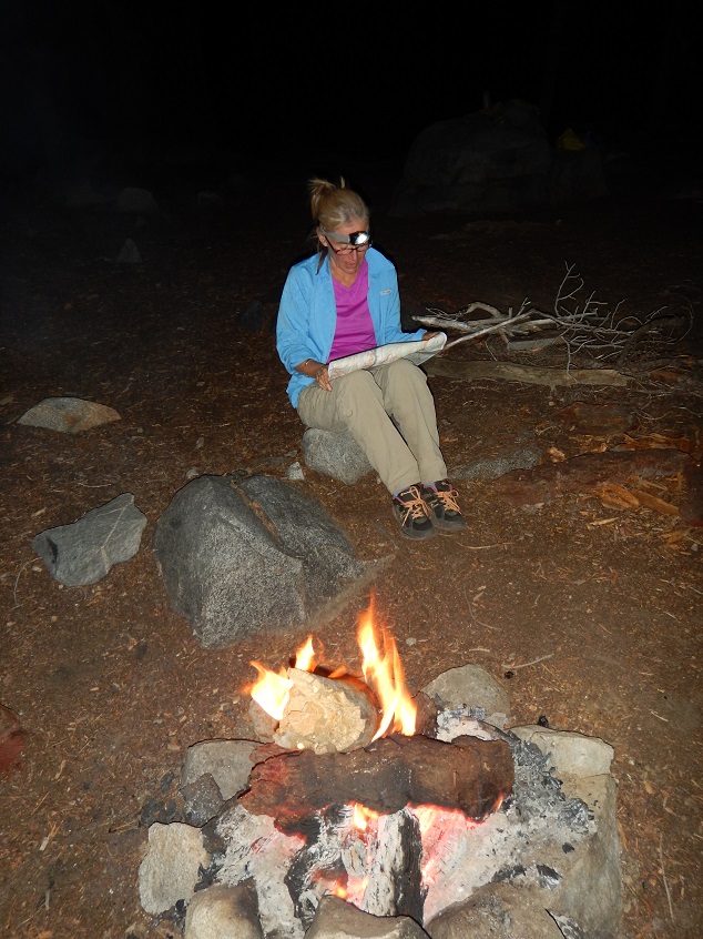
We met a group from the San Francisco Friends School, who told us they were staying at the second Chain Lake, so we stayed at the first Chain Lake, which we had to ourselves. We also built a nice fire around which we ate the dinner Jennifer prepared. One mishap: Jennifer fell and bruised herself on her leg.
 |
 |
|
|  |
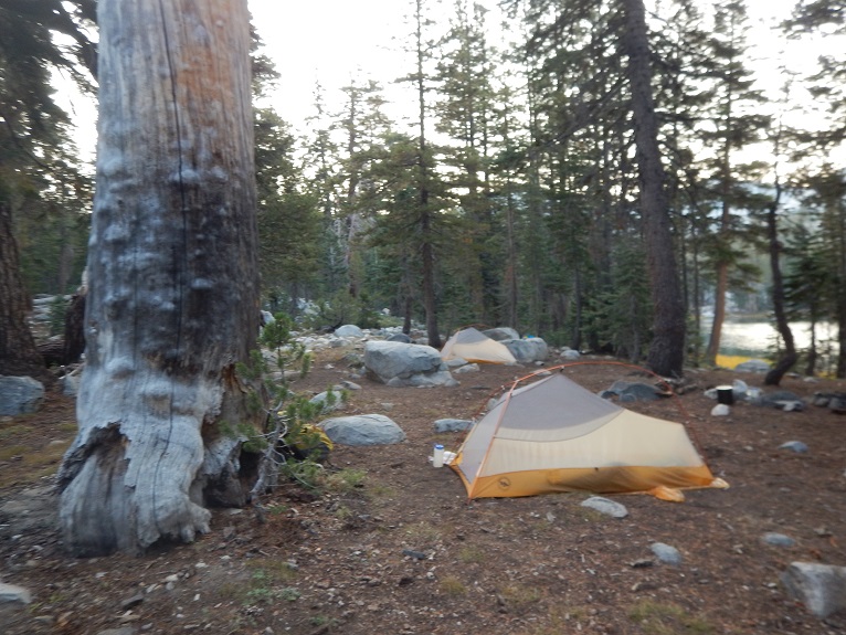
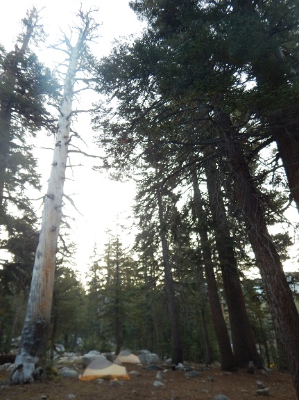
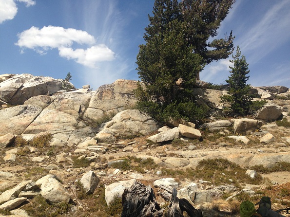
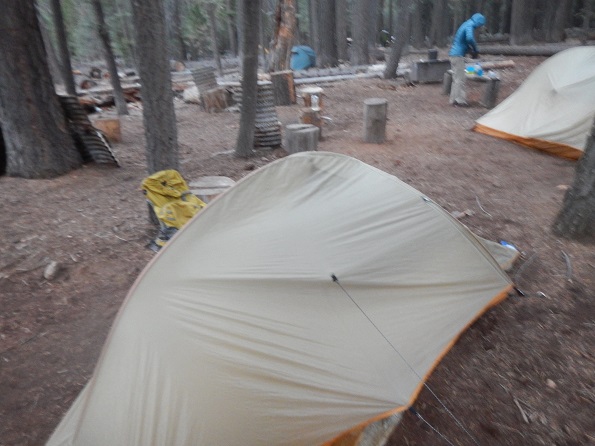
Bob put his tent up next to a large, dead tree that did not look stable and in the morning decided that perhaps that was not the wisest move. However, nothing occurred and all was well.
 |
 |
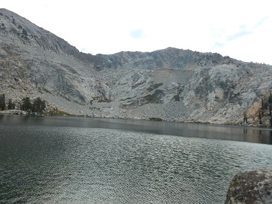
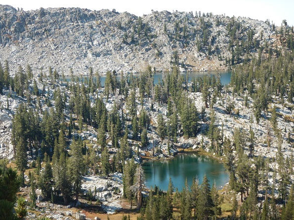
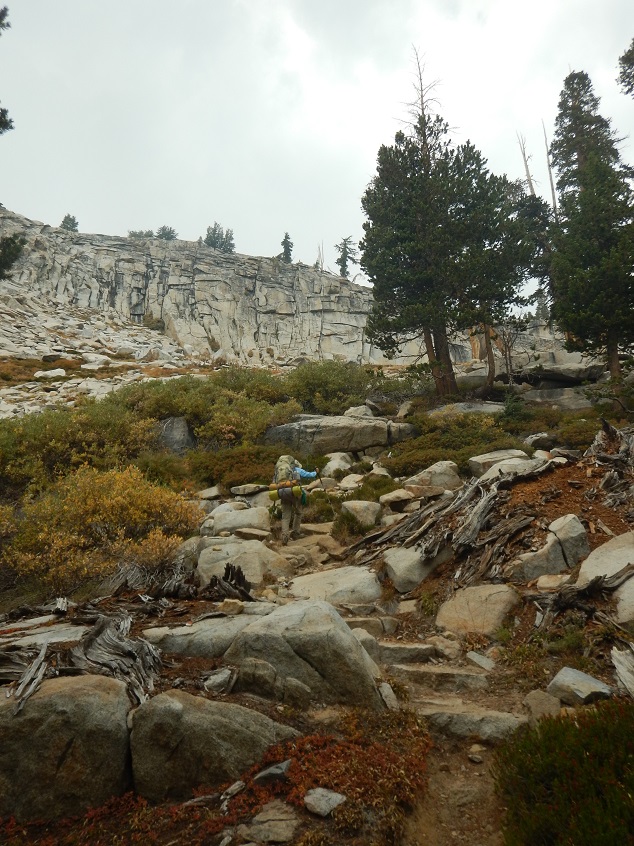
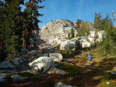
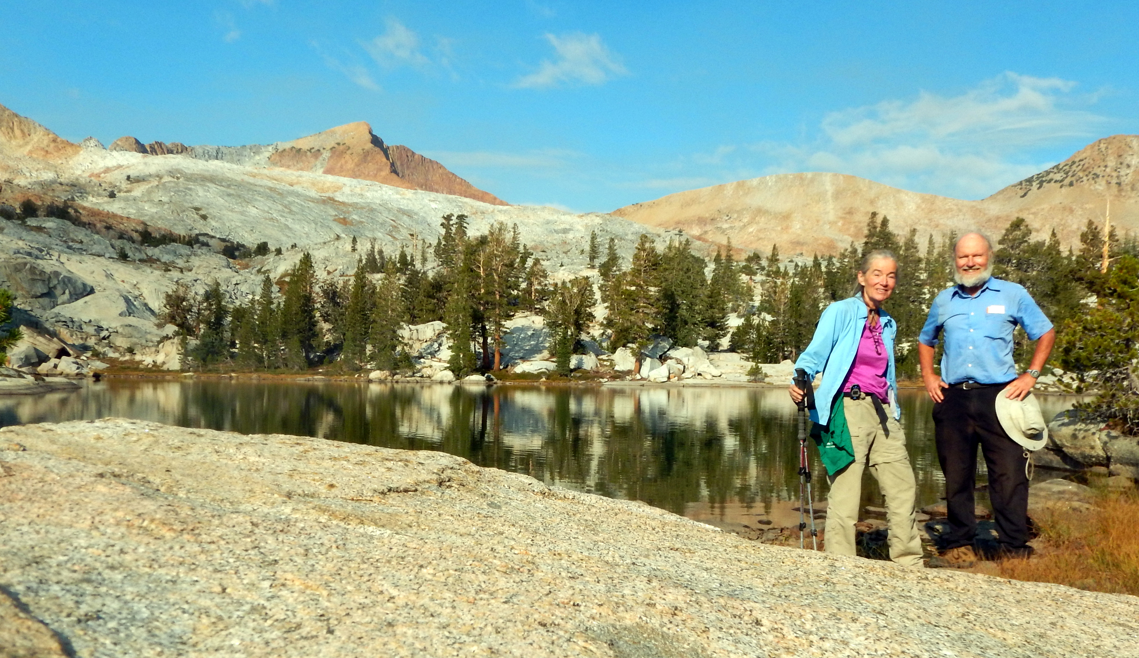
Day hiked 3 miles from lowest to highest Chain Lake and back. Then backpacked 5.3 Miles to Lower Breeze Lake (max elevation change = 1,270': 8,280' to 9,550').
Dinner: Teriyaki noodles with tuna and vegetables: carrots, onions, squash and spinach
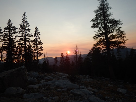
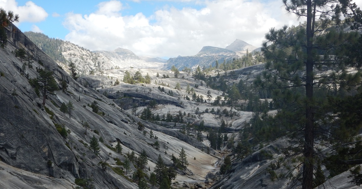
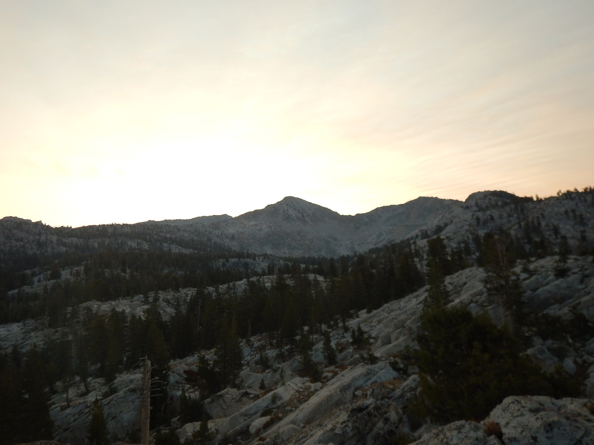
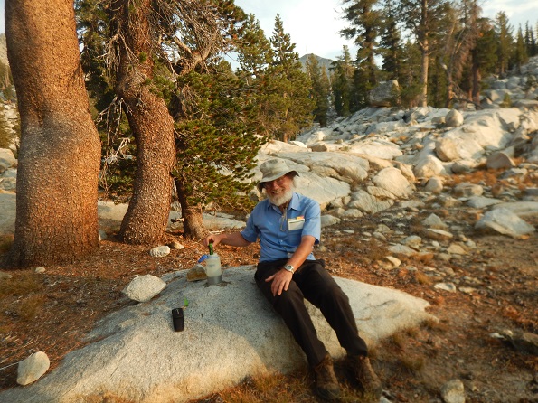
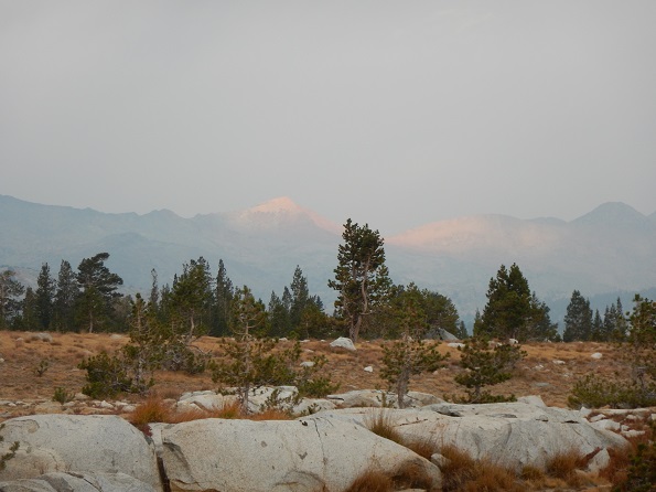
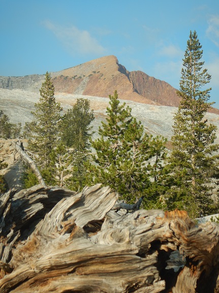
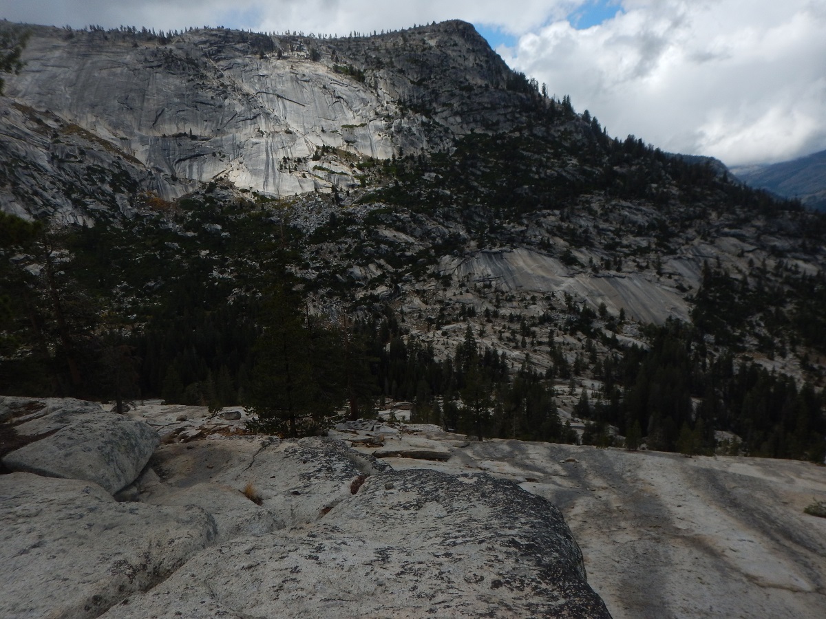
Bob got up at 6:15 AM (typical for Bob on such trips) and went first to the nearby lake, where lots of dragon flies zipped around, none of which posed for a good photo, at least not while Bob was pointing his camera in their direction. Then he hiked to a nearby high point to get a view of the surrounding peaks as the sun rose. The photo below is from that location.
 |
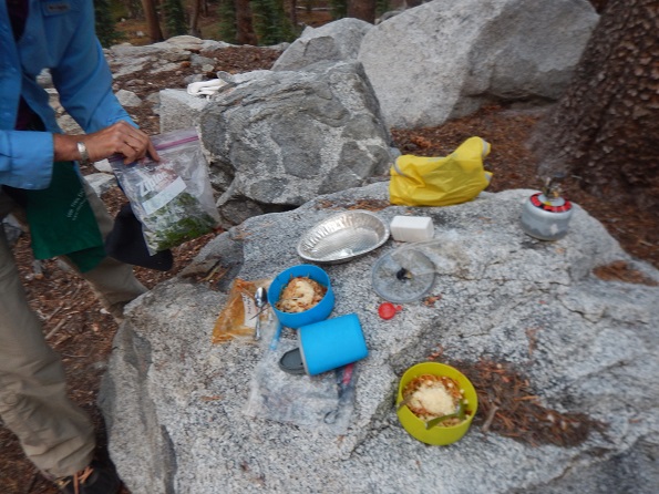
Upon returning to camp, Bob and Jennifer had breakfast, took down the tents, packed the backpacks and put them out of the way. In the process we found: a pair of dark glasses, a deck of cards, and matches - all left by some previous campers.
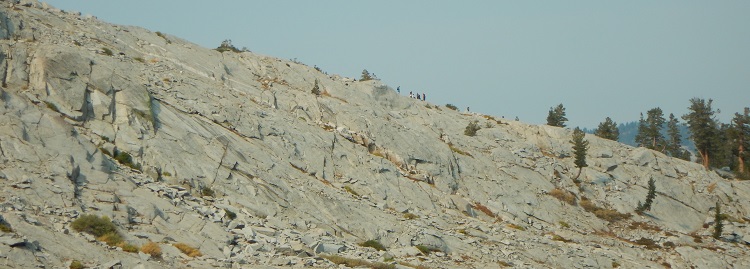
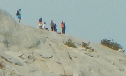
Leaving the packs, we day hiked up to the top Chain Lake. As we passed the second lake, we saw (and heard) the SF Friends School kids and then saw a group of them on a high ridge as they began to summit a nearby peak.
 |
 |
Between the 2nd and 3rd Chain Lake, we met 2 pairs of guys. One pair had been at Red Devil Lake, a goal of ours, and were a bit negative about camping there, although nothing specific. The other pair had just walked through our camp at the 1st Chain Lake, not seen our packs but had seen the dark glasses someone left behind.
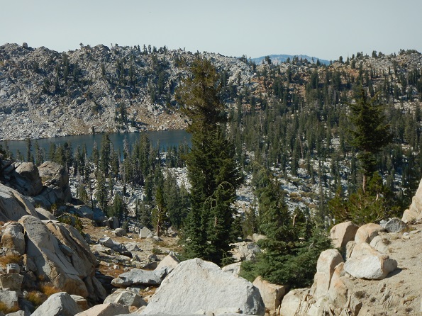
We had the 3rd Chain Lake to ourselves for about ten minutes and discussed whether it would be possible to go up and over the surrounding ridges to get directly to our next destination, Breeze Lake. We took some photos, but decided it was too questionable.
 |
 |
 |
 |
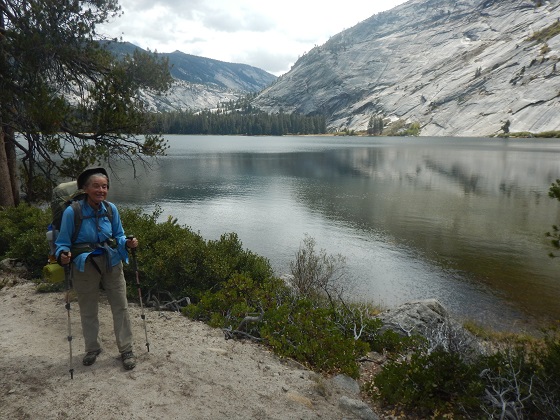
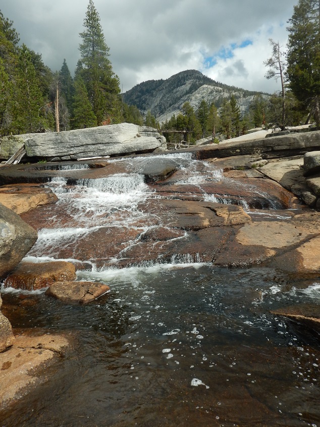
After visiting upper Chain Lake, we returned to our campsite, donned our backpacks, and started hiking toward lower Breeze Lake. The weather was warm, but because of overcast, not too hot. For the rest of the day we saw no one, and in fact saw no one the next day, and only in the evening of the following day after we had gone over Post Pass did we see someone.
We had encountered no large animals during the trip until Jennifer suddenly saw a deer "leaping and bounding" in front of her. At the very end of the hike we found it a bit confusing to follow the trail to lower Breeze Lake, but found the lake and stayed at the same campsite we had on a trip 2 years earlier.
 |
 |
 |
Backpacked 4.6 miles from Lower Breeze Lake to a small unnamed lake, (the second of two) along the trail to Post Creek (maximum elevation gain 630': 9,550' to 10,180').
Dinner: Spaghetti with chard and vegetables: tomato, onions, basal
Our first goal was Ferdinand Pass, to which we began climbing as soon as we left lower Breeze Lake.
|
|  |
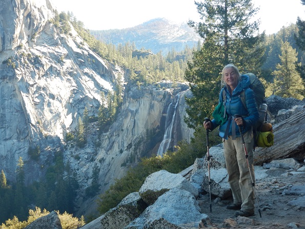
As we climbed, we got very nice views of both Breeze Lake and lower Breeze Lake. We got a good chance to view where we might have come over to Breeze Lake from Chain Lake, had we decided to do so the day before. It actually looked very doable, particularly over in the area of the ridge that had a reddish color.
 |
 |
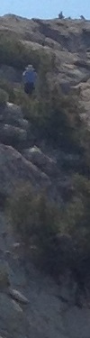
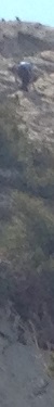
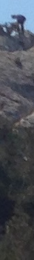
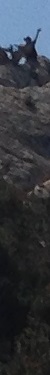
At Fernandez Pass, Bob decided to climb up the nearby "peak". Jennifer declined to do so. Turned out there was a very safe route up, so Bob got a nice 360 degree view at the top. Jennifer took photos of Bob as he climbed up and when he was at the top, while Bob took photos of Jennifer below.
 |
 |
 |
 |
 |
 |
 |
 |
 |
 |
 |
Jennifer felt a bit under the weather, perhaps from the elevation and/or not eating enough. Worse, she took a fall which much worried Bob, as we traveled down a steep path just after Fernandez path. However, she was not hurt.
Although there had been water in Fernandez Creek, other creeks were dry. Our destination was one of 2 small lakes on the way to Post Pass. The first had water and it was still early, so we went on to the second, which was almost dry. Bob hiked ahead, without backpack, to the next creek, which was also dry. So we camped at the nearly dry lake, which turned out to have an adequate supply of water after all.
 |
 |
 |
 |
 |
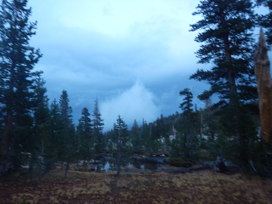
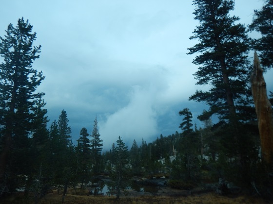
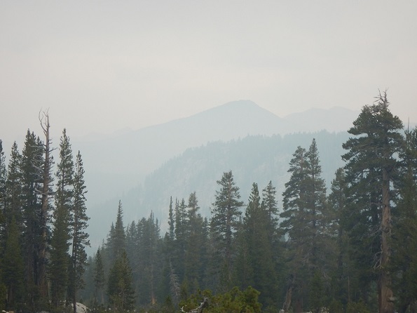
During the backpacking, we saw a lot of smoke high in the sky and in the distance. It caused no problem for us because it did not come down, but it did obscure distant peaks.
While getting ready to set up her tent, Jennifer's tent bag tore. Both Jennifer and Bob used Big Agnes tents, and though both tents work well, the bags pretty much suck and both have torn badly. Actually, Jennifer's bag was a replacement provided for free by Big Agnes for an earlier torn bag.
Backpacked 5.6 Miles to lower lake below Isberg Pass (max elevation change = 1,780': 9,000' to 10,780').
Dinner: Stroganoff with mushrooms and green beans
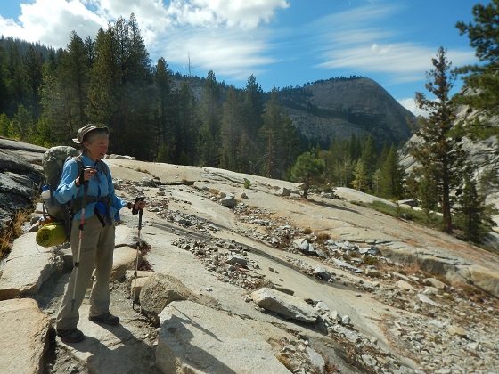
We left the lake at which we had been camping at 8:30 AM, one of our earliest starts, quickly got to Post Creek, about our lowest elevation of around 9,000', then headed up to Porphyry Lake at 10,150'. We had expected to pass the junction to Post Peak Trail, but never saw it, which was a bit worrisome. However, that turned out not to be a problem.
 |
| On the way to Porphyry Lake which is just before Post Peak Pass. Post Peak Pass is on the ridge separating Ansel Adams Wilderness from Yosemite. This would be our second time entering Yosemite, the first being at Chiquito Pass (we left Yosemite and entered Ansel Adams at Fernandez Pass). | ||||
 |
 |
 |
||
 |
 |
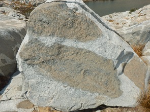
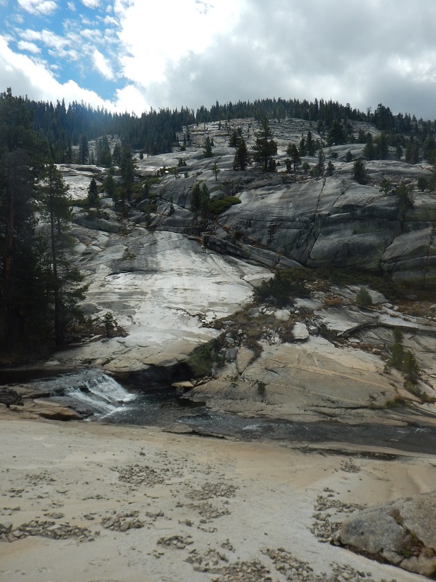
| Porphyry Lake gets its name because of the geology so clearly displayed in the rocks. "Porphyry, according to About.com, means 'an igneous rock with conspicuous larger grains floating in a fine-grained groundmass.'" [Lifted from Examiner.com]. As you can see from the photos below of the lake and its surrounding, the rocks really do stand out. | ||||||
 |
 |
 |
 |
|||
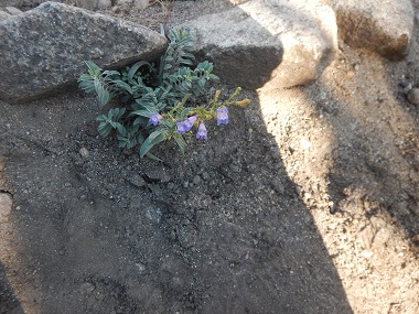
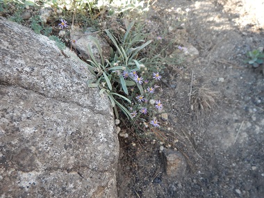
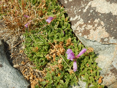
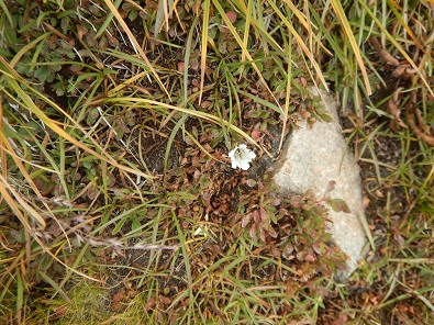
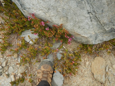
| For almost the first time we saw some wild flowers at the high elevations. They had been largely absent at lower elevations. | ||||
 |
 |
 |
||
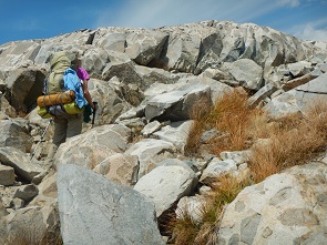
We decided Porphyry Lake was not a good place to camp because of lack of trees, so began to head over to Post Peak Pass.
Porphyry and Post Lakes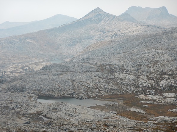 |
Zoomed in to Post Lakes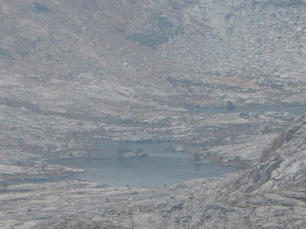 |
Almost at the pass! |
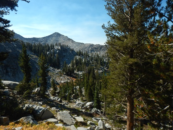
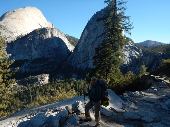
Once we were on the ridge beyond Post Peak Pass, several lakes came into view: McClure, Wood, Turner and various unnamed lakes, including the two unnamed lakes below Isberg Pass, the lower of which we would camp at. The views were beautiful along the ridge line after Post Peak Pass where we could see both Yosemite and Ansel Adams Wilderness, but there was a lot of smoke from the fires to the south.
Turner Lake |
McClure Lake and unnamed lakes above it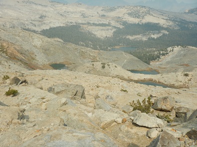 |
Closer View of unnamed lakes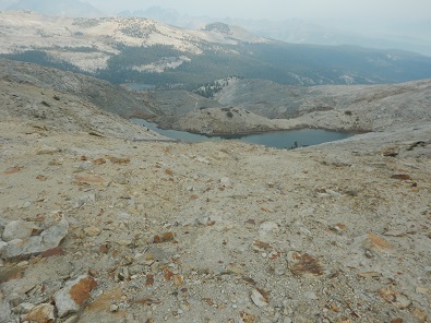 |
We decided to head down to one of two lakes below Isberg Pass (we came down from Post Peak Pass and did not actually go over Isberg Pass). At the top of Post Peak Pass Jennifer got reception, so we were able to text home that all was well. The lakes were down around 10,000 foot elevation. Today would be the steepest ascent and descent we did during the trip.
Jennifer's phone also provided information on our elevations as we hiked, which combined with our topo map gave us a good idea of where we were from time to time.
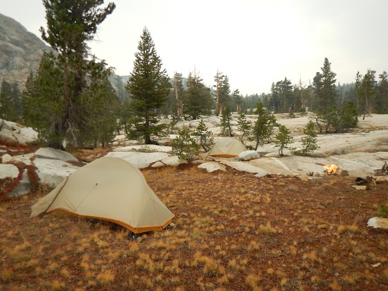
When we reached our lake for the night, we set up camp and had dinner. At one point 3 other campers arrived and went to the other side of the lake. We got into our tents to go to bed around 7:45 PM. Then later, after dark, another guy showed up and called out "David" to us around 8 PM. We told him that was not us, but he should try the other end of the lake.
Lakes below Isberg Pass where we would camp.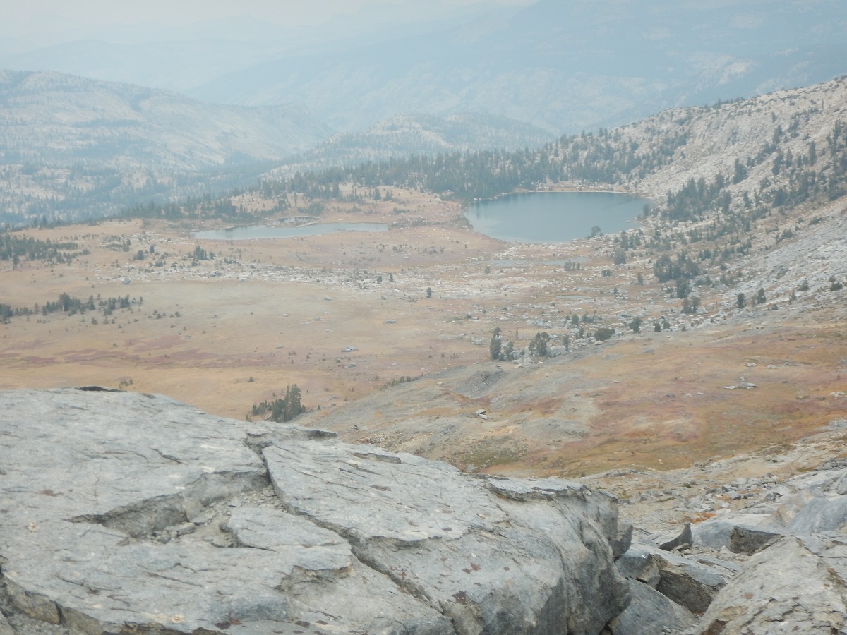 |
Backpacked 4.8 miles to pond just below trail intersection with Merced Peak Fork river (Elevation drop 480': 10,000' to 9,520')
Dinner: Brocolli and beans and rice with salsa, corn, and cheddar cheese
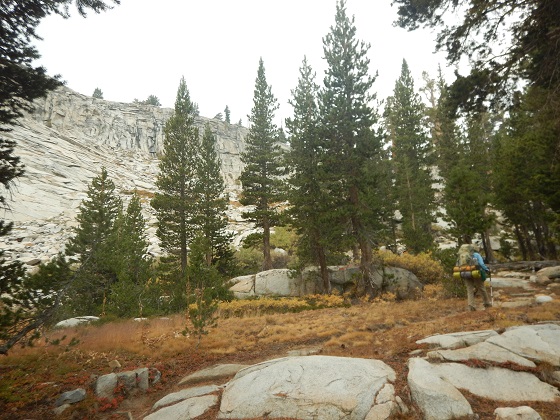
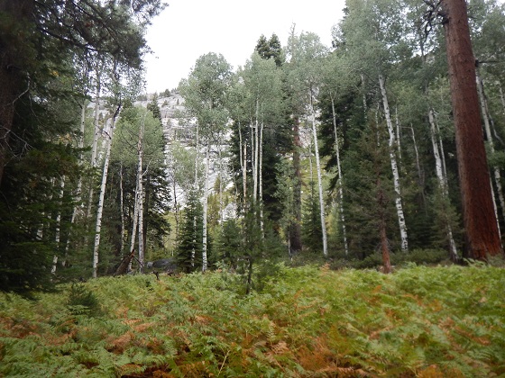
The morning was cold. The weather during the day was variable. Over one short period it went from smokey to blue skies, to rain drops, to very breezy, and back to smokey. We hiked through some beautiful forest with great rock formations (but dry creek beds) on our way to the Merced Peak Fork, where we decided to set up camp just a little downstream. There had been thunder and lightening during the day, also. Given the on-again, off-again drizzle, we put rain flies on the tents.
At a break in the drizzle, Bob hiked about 15 minutes up the trail on the way to Red Devil Lake. However, it again started to splatter rain, so Bob headed back to camp.
Prior to starting the backpacking, we had divided each of our food items in two, just to see where we were in terms of food supplies at the halfway point. We now saw that the first half of the dried blueberries, the gouda cheese, and the Wheat Thins were gone, as were almost all the cashews and raisins. We had lots of pecans, pumpkin seeds, and almonds left.
 |
 |
 |
 |
 |
|  |
 |
 |
|  |
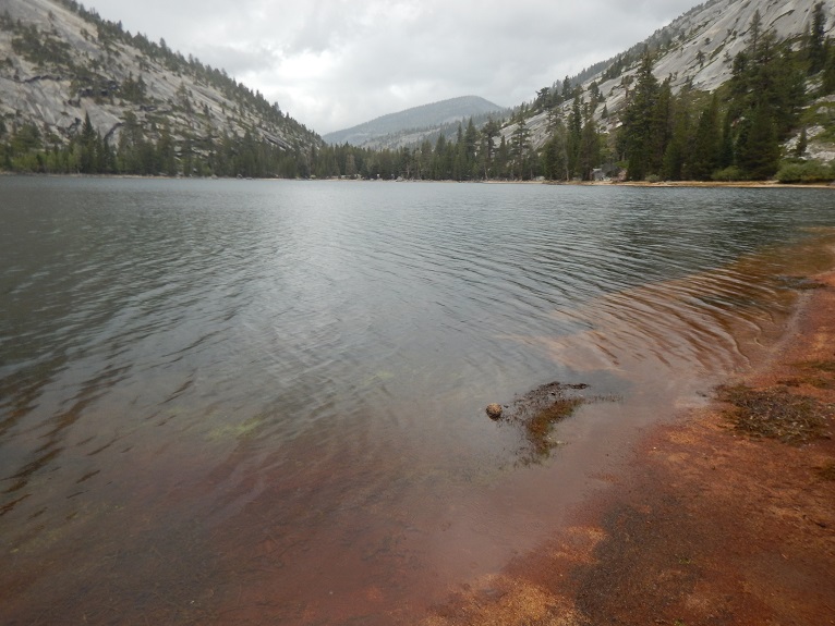
Day hike about 2 miles to Red Devil Lake and then back. And got the photo matching a 44 year old photo we had come to get.
Dinner: Because it was raining, we ate lunch food/snacks in our tents.
The day started out beautifully with blue skies. Bob built a fire. By 8:30, however, when hiking started, the sky had begun to cloud over.
 |
 |
 |
The first lake we encountered, just before Red Devil Lake, was very pretty, with Red Peak now showing in the distance.
 |
 |
 |
After stopping for a short while, we continued along the trail and soon saw Red Devil Lake below, so we began the off-trail part of our hike.
 |
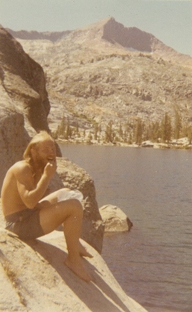
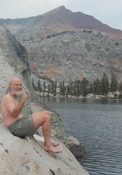
We were now trying to find a location at which Jennifer had taken a photo of Bob 44 years earlier along the shore of Red Devil Lake. Jennifer had brought a copy of that picture on her phone, but it was not at all clear looking at the lake where that might have been. We looked at the GPS, the photo, particularly the view of Red Peak and the tree line, to decide how to walk around the lake.
As we walked around the lake we kept looking at the photo, red peak, tree ridges, and cliff markings. At the end of one part of the lake we looked back up shore and spotted a likely location based on the shape of a rock, markings on the rock, and a small rock just in the water. We walked back and down to the spot and confirmed this was the place. So we took a few photos with Bob fully dressed.
However, the original photo had Bob sitting on a rock wearing nothing but shorts - no shirt, no shoes, no socks, no hat, and sitting on the now cold rock. Bob had brought along shorts for the occasion. So in spite of the chill in the air, Bob changed and adopted the pose of decades ago. Jennifer took many photos - both Bob and Jennifer laughing at how cold Bob was. We then compared the photos, decided we were close enough to the original, and Bob hurriedly got back into warm clothes.
| The two photos below were taken from the same spot, one 44 years after the other. The first was from this trip in 1971. | ||
 |
 |
|
Jennifer was pretty sure we had also camped at Red Devil Lake 44 years ago, but Bob was pretty sure we had not. We had not brought that camping photo and found out upon returning home that in fact we had camped there and should have looked for the spot.
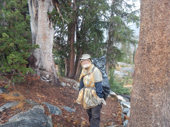
It begins to drizzle, so Bob and Jennifer both put on their ponchos. The drizzling increases. We pass by the first lake we had seen, although Bob is so focused on hiking he completely misses it. Upon getting back to camp, we both immediately get into our nice, dry tents and warm sleeping bags, although Bob first retrieves the food sack (Ur-Sack) and hands it to Jennifer to take into her tent, while Bob takes the day pack with food into his. Drizzle and cold weather continues.
 |
|
The Steripen used to sanitize the water had not been working that day, but once back in the tent, Bob found the replacement batteries and that solved the problem.
After a couple of hours of rain, it stops for a bit and Bob and Jennifer both get out. Looking north in the far distance, we see snow on peaks and ridges. That was the direction from which thunder had been coming earlier. Soon clouds cover all and the rain begins again. Later, the rain would stop, but it stayed cold and the weather looked threatening.
 |
Backpacked 10 miles to Washburn Lake. (1,500' elevation drop: 9,100 to 7,600).
Dinner: Corn chowder and spinach
During the night the rain continued, sometimes pouring and with strong winds. In the morning, we decided to get up and leave when the drizzle diminished - no breakfast, no coffee. Jennifer discovered her tent was now sitting in the middle of a newly formed stream, as shown below and in this short video.

|
Bob used a black plastic bag to cover his backpack and a light weight emergency poncho. In spite of the rain, ponchos, and black bags, the hiking was not actully bad. All day long there was on-again, off-again drizzle. Although it was cold in the morning, it got warmer as we descended. We met two pairs of guys, the first people we had seen for a couple of days.
 |
 |
At one point we stopped and rested while Bob took photos. Suddenly realized Bob had lost his glasses. Fortunately, not too far up the trail, Bob found his glasses lying in the dirt on the trail where he had dropped them.
|
 |
 |
 |
|  |
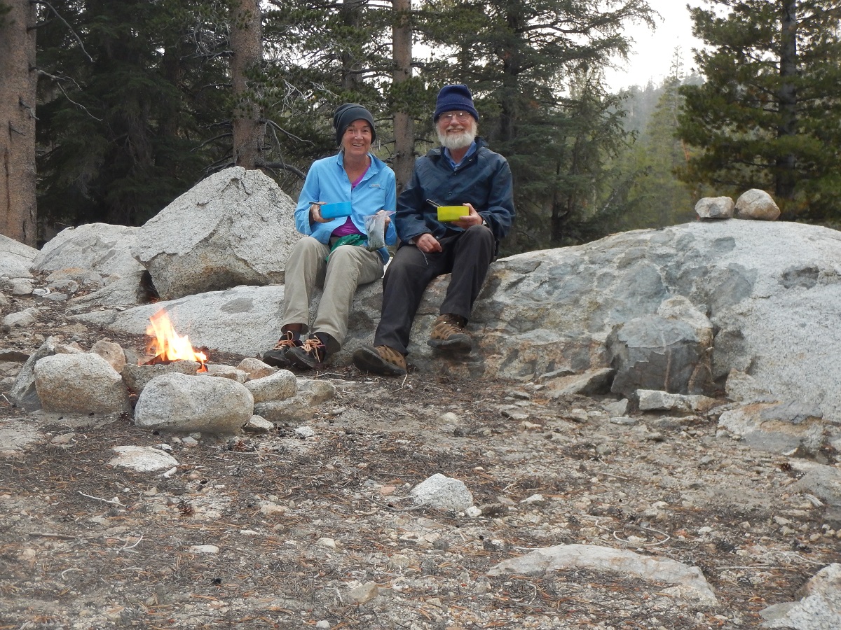
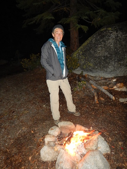
That night Jennifer and Bob jointly built the fire. We had Washburn Lake to ourselves.
 |
 |
Backpack 10 miles from Washburn Lake to west end of Little Yosemite Valley (1,500' elevation drop: 7,600' to 6,100').
Dinner: Ratatouille with cous cous (and Jennifer washed dishes afterwards because it was Bob's birthday).
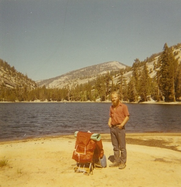
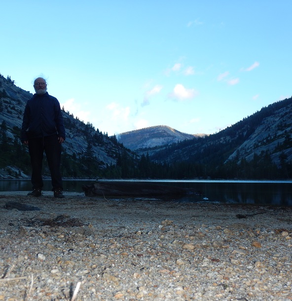
During the night there was a howling wind on occasion and some rain with a few big gusts. However, the day began with bright, blue skies and puffy clouds and the good weather lasted all day. Bob started out the day by getting up early and walking to the other end of Washburn Lake, where, without the benefit of the 1971 photo, he attempted to match that photo with a current one, as he and Jennifer had done at Red Devil Lake. Below are the results.
 |
 |
 |
It took until 10 AM to dry out the tents and at one point Jennifer's almost blew into the lake. Today, Jennifer loses her glasses and did not find them again.
| Just after we arrived at Merced Lake we met 4 guys, who were pleased we took their picture - using 3 different of their cameras - but did not offer to take ours :-(
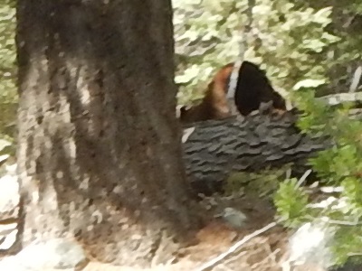
We then started down the trail. Bob looked back at Jennifer just as her eyes widened and she said "Bear!". Looking back, Bob saw the bear on a fallen tree and the bear saw us. Bob rushed to get out his camera, the bear rushed to get away, and Bob got no good photo, even though he quickly walked after the bear and took a video, too. Chasing a bear is not encouraged in backpacking guide books. |
 |
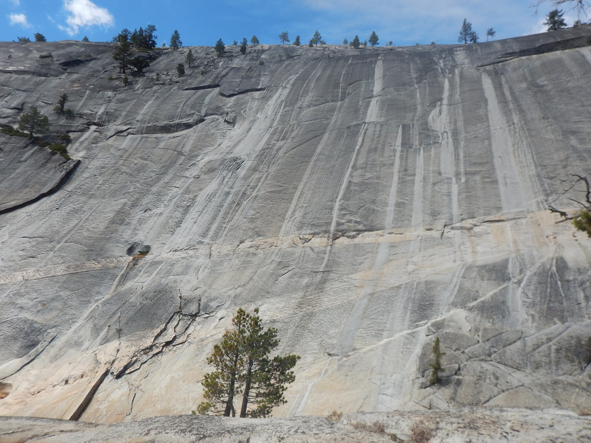
We left Merced Lake and continued along the trail as it descended with the Merced River. The scenery was very, very pretty.
|  |
|  |
At one point Jennifer identified where she believed Bob had taken her photo 44 years ago below Bunnell Point. So this time, she posed while Bob photographed. Even though we did not have an old picture to compare, Jennifer was right and we got a nearly matching photo. The first of the two photos below was from this trip in 1971.
 |
 |
The following photo is from the opposite side of the pond shown in the above photos to give a better idea of rock positions. |
At a different point along the river we found a solar array and other instruments.
 |
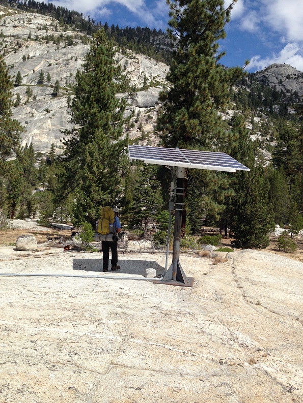 |
 |
We heard a helicopter for quite a while, though we never actually saw it. We guessed it might be looking for someone or letting people off to look for someone. Later we met someone who confirmed that was exactly what was happening. So far, the person had not been found.
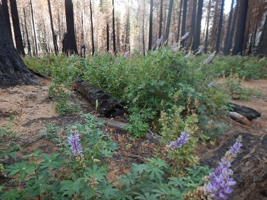
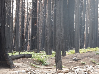
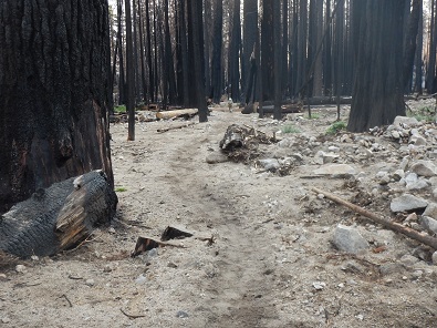
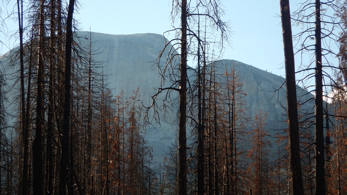
As we approached Echo Valley and Little Yosemite Valley, we saw evidence of a recent forest fire up on the ridge, where there was a blackened forest. However, it was not until we got down into Little Yosemite Valley that we got the real view of how horrible that fire was. Every single tree trunk was black. Few or no live trees were left. It was terrible. Eventually, as we walked most of the way through Little Yosemite Valley, the damage gave way to a live forest.
Along the upper ridge the forest has burned. |
As the trail continues, the extent of the devastation becomes more and more apparent.
 |
 |
 |
 |
 |
 |
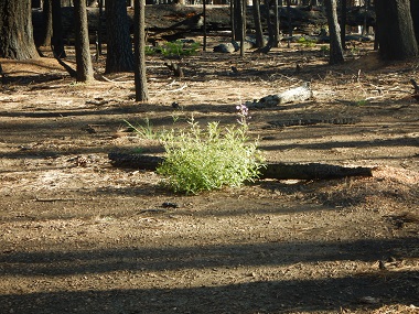
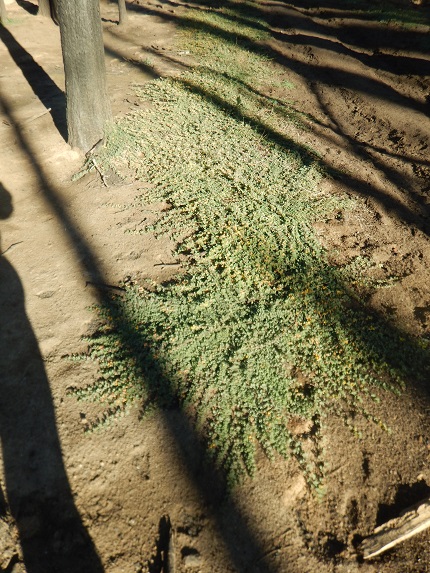
On the other hand, with the tree foliage gone, other plants had begun to take advantage.
|
|
Near the end of Little Yosemite Valley we arrived at the camping ground, where we found a nice, dry campsite. It was a bit of a walk to the Merced River to get water, but no big deal. There we met a small group, including younger folks and an older man, who were pumping water. When we simply filled our bottles, the older man asked if we needed water purification tablets. We then talked about the Steripen. That night, Jennifer not only prepared dinner as she always did, but also cleaned up the dishes afterwards which Bob usually does, saying it was her birthday present, this being Bob's birthday. Bob thanked her profusely for both dinner and clean-up.
 |
 |
Backpack 6 miles to Yosemite Valley. (2,100' elevation drop: 6,100' to 4,000'). Day hike 1.5 miles round trip up rocks near Tuolumne Meadows.
Dinner: Went to Yosemite Tuolumne Lodge. Bob had curry, Jennifer had beef stew. Ate with 3 couples, two from England, 1 from Israel.
We got our earliest start of the trip, leaving camp at 8:05 AM after waking to a cold morning, but with a spectacular, sunlit view of Half Dome. Whereas we had been seeing very few people on the trail, now there were lots. From the time we left camp to the time we got to the Vernal Falls Trail junction on the John Muir Trail, Bob counted 102 people. One of the people was a young woman just starting her traverse of the John Muir Trail all the way to Mt. Whitney. After the junction, there were literally hundreds more and Bob no longer counted.
 |
 |
On the other hand, for the first time ever, there was absolutely no one at the top of Nevada falls.
At the end of the hike, at Curry Village, we had a number 1 priority after 8 days of backpacking: a free shower with towel at Curry Village. That was so great! Jennifer then ate lunch at the Yosemite Village Deli, while Bob went to the nearby grocery and bought strawberries, bananas, carrots, and grapes and pigged out on fresh fruit and vegetables. Next stop was the Wilderness Center where we weighed our packs, to confusing results. Apparently their scale was different than Jennifer's. At this point, neither pack having water, Bob's was 29 lbs and Jennifer's was 28.
Next we drove to Tuolumne, where we got a campsite even though we had no reservation - the advantage of getting there early.
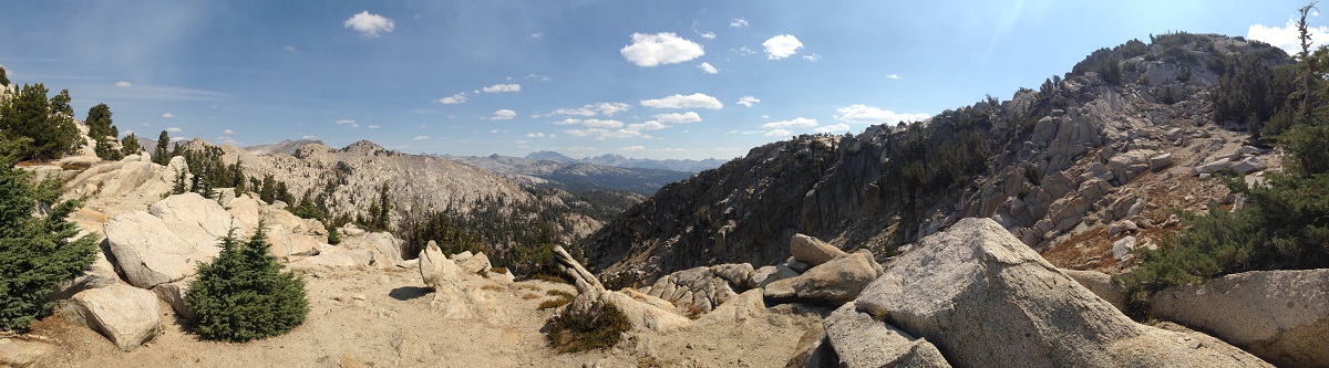
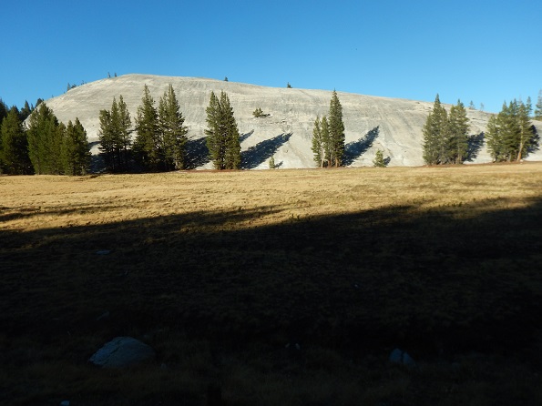
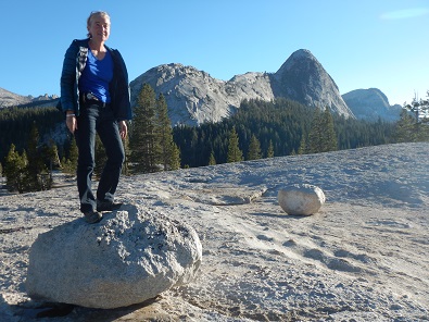
Then we climbed up Pothole Dome, which is quite an experience. It is not a difficult hike and every few feet higher in elevation peaks behind a nearby forested ridge become more and more visible. Finally, at the top of the dome, there are peaks in all directions with Toulumne Meadows and River below.
 |
 |
 |
 |
 |
We then drove back to our campsite (all campsites were now taken), set up our tents - with rain flies - and drove over to Tuolumne Lodge where we got the last available reservations for dinner at 7:45 PM. At the lodge we also were able to charge Bob's phone and camera. We ate at a round table with 6 other people, all couples. One woman said she had gone to Israel, found her husband as so many do, and was now intent on convincing him to move to California.
No backpacking or hiking, just drove from Tuolumne Meadows to Quartz Mountain trailhead.
Dinner: Got a sandwich at Subway and drove home - No where near as good as Jennifer's cooking says Bob!!
The drive south through Yosemite from Tuolumne was, as always, as beautiful as could be. However, the road from Oakhurst to Bob's car parked at the Quartz Mountain trailhead was just as horrible as we remembered. Since Bob was in the passenger seat with his fully charged camera, he took lots of video. This video, editted down to a couple of minutes, captures to some extent just how bad it was. It includes trying to pass a horse trailer. The 26 mile round trip to the car took us 4 hours. When he got home, Bob had to have some muffler work done on his car (and the trunk got repaired), but this was all just a minor hassle at the end of a very wonderful trip!
 |
||
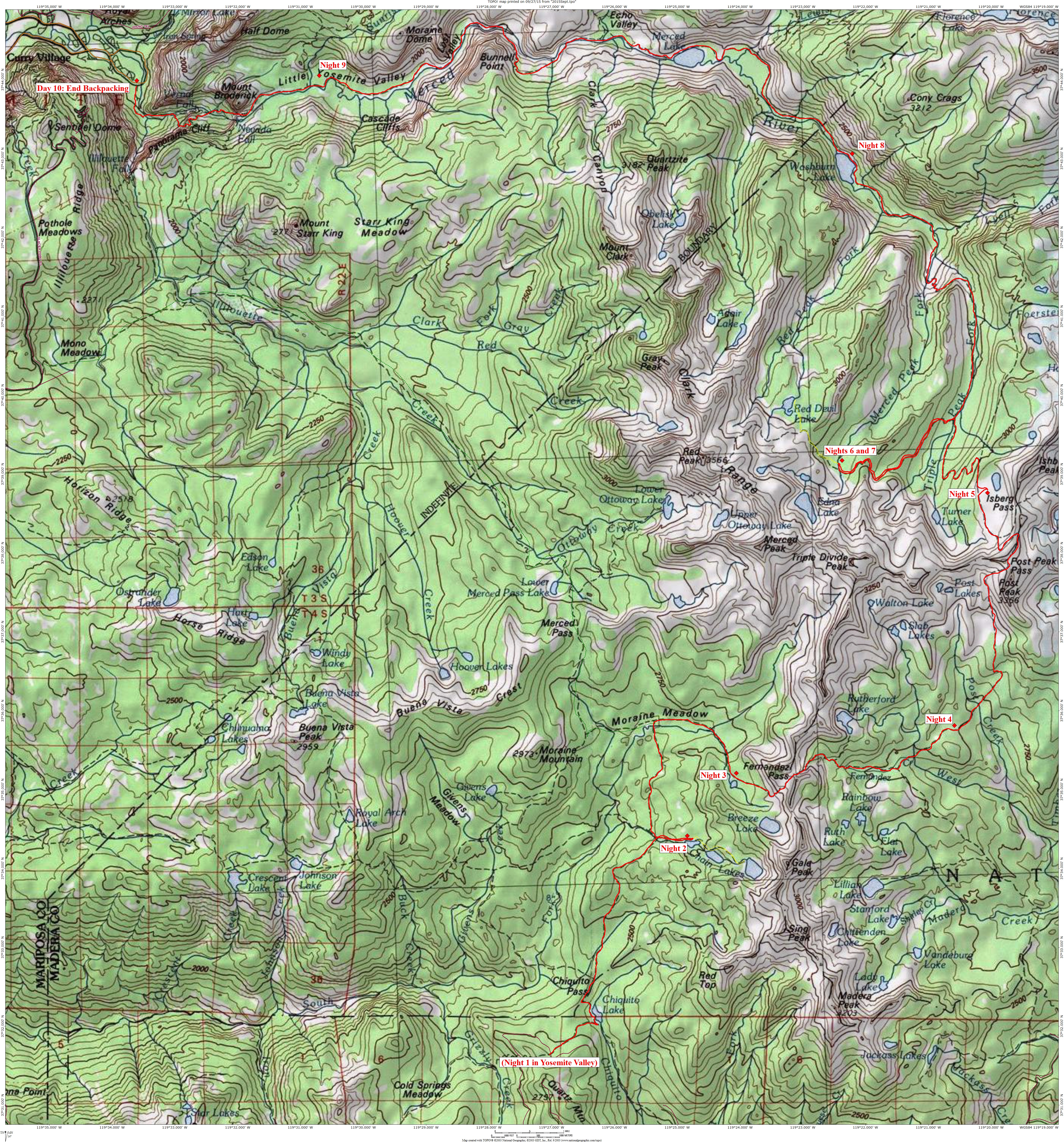
The map below shows the route we followed as we backpacked from Sierra National Forest and crossed into Yosemite National Park. The backpacking route is in red, the day hikes are shown in yellow dotted lines.
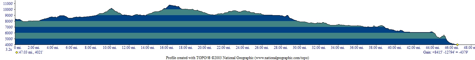
The elevation profile below the map shows in feet the elevations of the backpacking route (it does not show day hike elevations). The distances shown on the profile seriously underestimates the actual trail distances. The profile does give a good idea of the climbing involved, however. Click on either image to get a higher resolution version.
 |
 |
Photos and narrative were contributed by both of us: Jennifer and Bob
Other Websites
By Bob:
Bob Phillips [phillips bob 27 at yahoo dot com - no spaces]
Santa Rosa, CA
August, 2012