Rainbow Lake
Rainbow Lake |
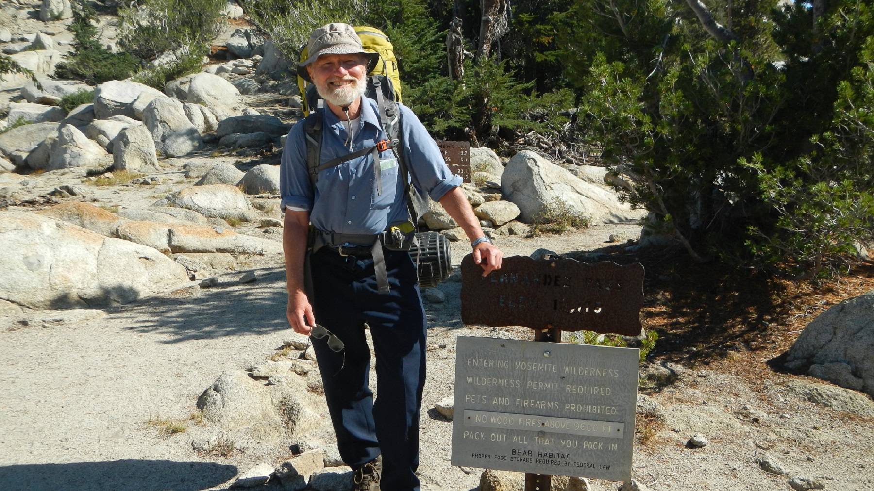
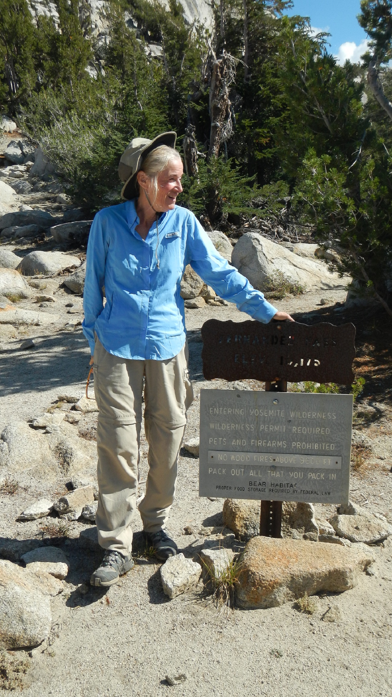
We drove to Oakhurst, where we picked up our permit. At Oakhurst we had to wait for about 45 minutes because the ranger was on a lunch break, so we took one too. Then on to the Fernandez Trail Head, giving a hitchhiker a short lift. The last couple of miles of the road were in terrible shape - a sign pointed out the road was not recommended for cars.
 |
 |
 |
At the trail head we met a couple of young women, who not only took our photo, but also warned us about the dry conditions and even gave us the water remaining from their own backpacking, which they had just finished.
 |
 |
We then hike about 2.9 miles into the Ansel Adams Wilderness and camp just off the trail, the one time in our trip where we were not next to a lake. Water, however, was not far away. We had our first of dinners which Jennifer had prepared and dehydrated prior to the trip. Every one of them would turn out to be very good.
 |
 |
 |
We hike about 4.2 miles from our first campsite to Lillian Lake, where we set up camp at the far end of the trail spur to Lillian. During the hike, we pass several lakes and ponds, including Vanderburgh Lake (see video), one of the Staniford Lakes, and an unnamed lake that feeds Shirley Creek. As we hiked from Vanderburgh Lake to Staniford Lake, we got a marvelous view of the ridge lines defining the Sierra National Forest in this area, shown in this video.
 Vanderburgh Lake |
 Staniford Lake |
 Lake feeding Shirley Creek |
Of course, as we hike, we get view after view of far mountain ranges, such as the Ritter Range and a long ridge line in the far distance.
 Ritter Range |
 |
When we get to Lillian Lake, we set up camp and are fortunate to meet a guy who has just traveled cross country, as we had decided to do. He gives us some suggestions, and also takes our photo.
 Lillian Lake |
 Campsite at Lillian Lake |
 Lillian Lake |
We decide to take some time and climb up the beginning of our next day cross country route to check it out. Gives us another great view of the Ritter Range. Here are videos that give a wonderful view of the area as Jennifer hikes up and then back down the granite rise above Lillian Lake.
 Lillian Lake |
 Lillian Lake |
 Ritter Range |
After we get back down to Lillian Lake, it is time to start dinner, the first step being to purify water, as Jennifer is doing below using a great little device, a SteriPEN Traveler UV Water Purifier, loaned to her by a neighbor.
 Lillian Lake |
 |
First thing in the morning, Jennifer has some coffee sitting next to a beautiful view of Lillian Lake as shown in this video. We begin the first cross-country part of our trip, heading up to our first landmark, a distinctive dead tree first pointed out to us by the guy yesterday. We consult our topo map often, Jennifer takes the lead, and we successfully get to Rainbow Lake, one of the prettiest lakes on our trip. Here is a short video of Rainbow Lake upon our arrival. Our route is about 1.5 miles, as opposed to 3.6 miles by trail.
 |
 |
 |
 |
 Rainbow Lake |
Ruth Lake is just above Rainbow Lake, so we hike up there, getting more views of both the Ritter Range and Rainbow Lake enroute. Here is a video of Ruth Lake. We also see our first and only large animal of the trip - a deer.
 Ritter Range |
 Rainbow Lake |
 |
 Ruth Lake |
 Ruth Lake |
We return to our campsite at Rainbow Lake, where Jennifer once again prepares a delicious evening meal:
 Rainbow Lake Campsite Cooking |
Friday morning Bob goes out to Rainbow Lake to get a good reflection picture, because breezes and lake surface are calm before 7 AM (see the first photo at the top of this web page.). Here also is a morning video of Rainbow Lake emphasizing the beauty and calm. We have decided to do another day of cross country hiking to get to the Fernandez Trail. Here is a video of Jennifer backpacking up the climb with no trail from Rainbow Lake We have not yet decided whether we want to go just to Rutherford Lake or to follow the trail over Fernandez Pass to Breeze Lake.
 Cross country hiking |
|
We decide to go over the Fernandez Pass into Yosemite Park and stay at the first lake, which is just below Breeze Lake. Total mileage for the day will be about 4.1 miles, climbing just over 1,000 feet in elevation to the pass at 10,125 ft.
 Fernandez Pass - note the blue sky and white clouds |
|
 Breeze Lake and the lake just below it at which we camped. Here is a close-up video of Breeze Lake in the afternoon of the day before the smoke moved in. The blue skies would disappear in smoke the next day. |
 Breeze Lake |
 |
 Hiking down to our campsite lake |
We get up early, Jennifer hopping with joy at the campsite and Bob takes a photo of the "lower" Breeze lake. There is some indication of smoke, but nothing like what is to come.
 Our campsite in the morning |
 The nearby lake in the calm of the morning |
As we climb back up to Fernandez Pass and particularly as we go further on the way to Rutherford Lake, the smoke gets heavier and heavier. Here we are looking back at Breeze Lake, and beside it is a similar picture yesterday as we came down from the pass.
 Breeze Lake with smoke moving in |
 Breeze Lake the day before, no smoke and ridge on right shows in background |
The smoke kept getting worse as we hiked down from the Fernandez Pass to the Rutherford Lake junction. Looking into the valley which would be our exit route, the smoke was so heavy almost all of the landscape was obscured. Here is a video of just how smokey and dangerous looking it was. Neither Bob nor Jennifer had any experience with such a situation. Fear was that some large fire was burning and would endanger them. That this was not simply smoke drifting over from the Rim Fire that was north and west of Yosemite, while this was south and east of Yosemite. The decision was to go up to Rutherford Lake, which was above tree line, rather than hike down into the smoke.
Although we had not seen anyone for days, as we headed up to Rutherford Lake we met a couple. The guy was a former fire fighter. What incredible luck!
He agreed that going up to Rutherford Lake was a good idea and that if things did not clear up, we might want to exit through Yosemite, rather than through Fernandez Trailhead. The two of them were heading up and over Fernandez Pass, from which we had just come. He pointed out that if a forest fire were nearby, we would see black, roiling smoke, not just the thick, gray haze that was now obscuring so much. He also thought that if there were a fire down in the national forest, it was likely to be coming up towards Fernandez Trailhead. They agreed to contact Bob's wife Shirley and pass along our Forest Service permit number if two days hence the situation was still bad.
We had backpacked a total of 3 miles from below Breeze Lake over Fernandez Pass to Rutherford Lake.
 Fernandez Pass |
 Smoke obscures forests and ridges across the valleys below |
 Smoke at Rutherford Lake |
As the sun goes down, it glimmers in red through the smoke and produces on the Rutherford Lake surface a very distinctive red sparkling. Here is a video including the sun and smoke, and here is a shorter, very pretty video focused solely on the sparkling.
 |
 |
 |
 |
In the morning, the sky had cleared, the smoke dissipated. Here is a Rutherford Lake morning video.
 |
 |
 Lots of topo map reading was done |
 Wonderful mushroom |
We arrive at Lady Lake, which turned out to be the first night we stayed at a place with many other people. However, we also learned that some people had left because of the smoke the previous day. Here is a video of Lady Lake. The next 3 photos emphasize how many different colors a lake has, depending on time of day, viewpoint, etc.
 |
 |
 |
There is a small lake above Lady Lake, which we walk up to.
 |
Two extremely pleasant rangers, Mike Nolen and Tim Crosby, stop by our campsite and talk informatively about the need to preserve the environment. They point out that campfires not only endanger the forest by exposing it to unnecessary fire risk, but also because the firewood and any other debris that is burned by humans, is taken away from the environment, where it would normally support the entire ecology. They also point out the need to keep campsites far enough from lakes and streams. And they give us Wilderness Patches as shown below.
We thanked them profusely for all they did, because hiking the trails of the national forest emphasizes over and over just how critical the work of these folks is to making the forest and meadows and mountains, the lakes and streams, accessible to all of us. In fact, Jennifer had noticed at one point on our backpacking along the Fernandez trail an incredibly large tree trunk that had fallen across the trail. A huge piece had been sawed out of it so the trail was now passable. As it turned out, these guys had been on a 7 foot long hand saw for 4 hours on that particular log.
The next day we pass another older, smaller, yet as you can see, still huge, log that had been similarly taken care of.
 |
 |
 |
 |
Our last night Jennifer prepares a wonderful spaghetti dinner, our last dinner of the trip. As often happened, food was kept warm in a nice muffle - her hat.
 |
 |
We wake up early at our campsite and Bob gets a last photo of Lady Lake.
 |
 |
Amazingly, at 7 AM we hear an incredibly loud buzzing, that Bob first thinks must be a huge swarm of bees, while Jennifer supposes it is some equipment. It turns out to be a model helicopter that some young guys had brought along with them. It is intensely annoying to be in such a wonderful environment and to have such a disruptive noise. We saw no rules against doing that sort of idiocy in the national forest.
We then start the 5.5 mile backpack to the Fernandez Trail Head. It was of course pleasant and beautiful. And being mostly downhill made it even better. A wonderful end to a wonderful trip. Presumably because it is Monday of the Labor Day weekend, we run into several other backpackers heading out.
We get to the trailhead with no problem.
 |
 |
Bob's 1989 Toyota Camry burns oil badly and although it had been filled just before the trip, it was now below the low mark and required 1.5 quarts of oil. We find it easier to navigate the horrible first couple of miles of road going down than it had been coming up. Although one might have expected heavy traffic back to Oakland and Santa Rosa, particularly given that it was Labor Day and the Bay Bridge was closed, in fact the trip back went smoothly and quickly.
Trail Route |
Red numbers indicate where we camped each night. The red lines give the general direction we followed going out, while the black lines show the general direction we followed coming back. Except for the cross-country between Lillian Lake (2), Rainbow Lake (3) and the intersection with the Fernandez Trail, we followed the paths shown near the black and red lines. Click on the map to get a higher resolution version.

|
Elevations Along Trail |
Profile outward bound |
Profile returning |
Equipment Recommendations |
New equipment used on this trip:
Other Websites
By The Author:
Bob Phillips [phillips bob 27 at yahoo dot com - no spaces]
Santa Rosa, CA
August, 2012