For any of the following Favorite photos, click on the image to bring up the full resolution, uncropped version. Day by day photos and narrative follow these.
|
Video suggestion: All videos shown below are very short and HD (1080p). I find best YouTube settings (for all but the few with Bob, Jennifer, or animals) are HD (1080p), slow motion (0.25 or 0.50), and full screen.
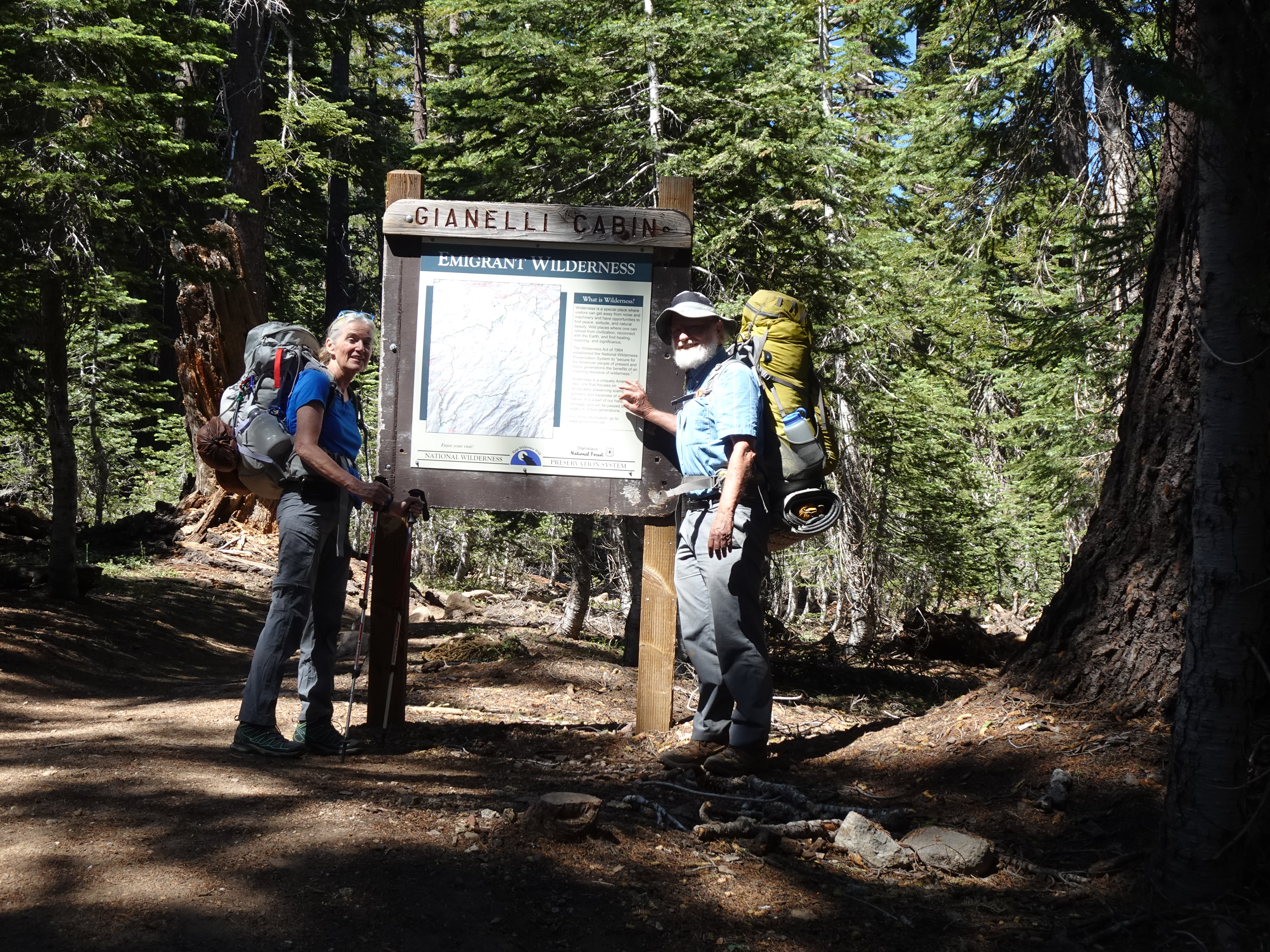
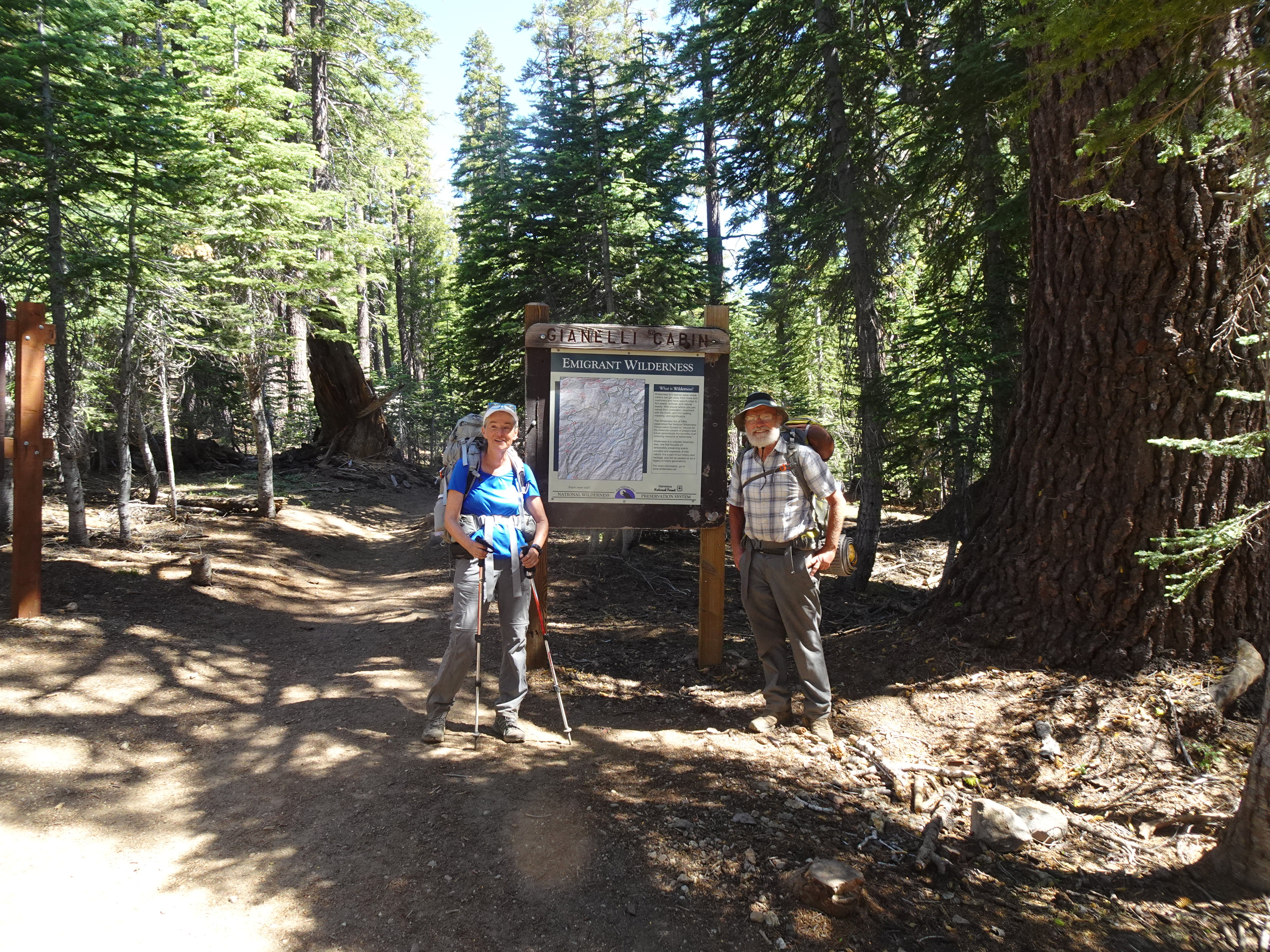
Drove from Santa Rosa to Jennifer's home in Oakland, sorted through food, then drove to the Gianelli trailhead in Stanislaus National Forest and backpacked to Powell Lake in the Emigrant Wilderness.
 |
Map from Gianelli trailhead to Powell Lake (solid red line) and day hike at Powell Lake (dotted white line):
 |
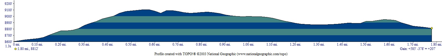
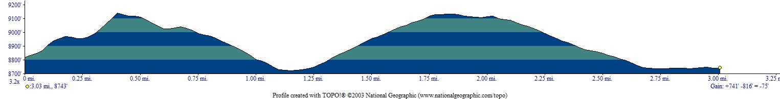
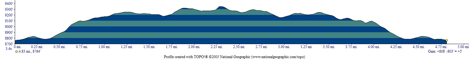
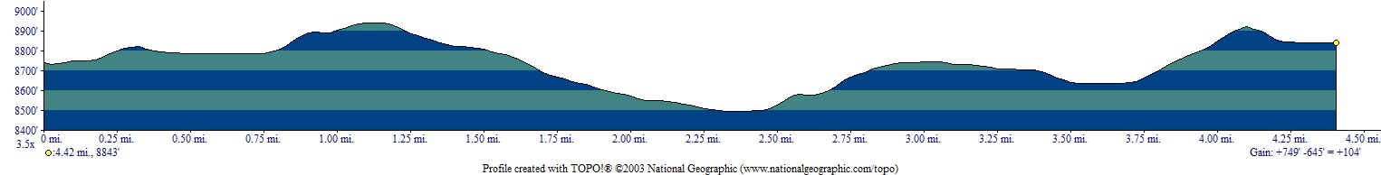
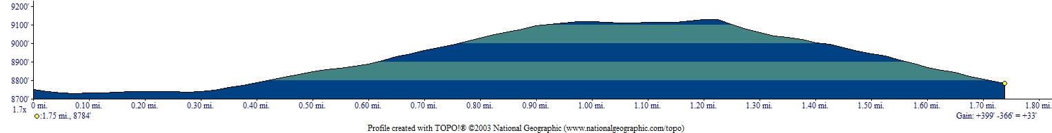
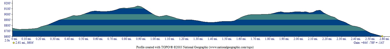
Backpack Elevation Profile (understates distance) - trailhead to Powell Lake 2.3 mi:
 |
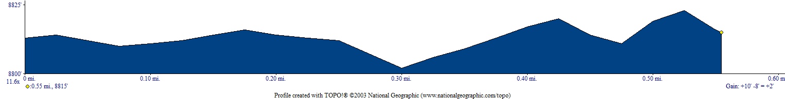
Day Hike Elevation Profile (understates distance):
 |
Dinner: Bear Creek Brand Minestrone (that we will not eat again).
Diary:
Bob drives from Santa Rosa to Oakland and there Jennifer and Bob finish sorting food and packing backpacks. Because of issues with Jennifer's feet and knee, Bob carries all food, so Jennifer's pack weighs around 25 lbs and Bob's around 42 lbs. As it turns out, we carried at least 6 lbs of food which is never eaten (nuts, dried fruit, a bit of cheese and one package of salmon).
We then drive first to the Mi Wuk Village ranger station, which is closed, then to the Summit Ranger Station in Pinecrest, where we pick up our wilderness permit. The ranger says not to take the forest road near Pinecrest to our destination, but rather go back to the Crabtree turnoff from the highway and take that road. Before doing so, we drive to Mia's Restaurant in Cold Springs, where the waitress agrees it is ok for Bob to eat his Subway sandwich bought earlier if Jennifer is ordering her lunch. Jennifer did not find Mia's lunch tasty and we decided not to come back to Mia's.
Next we drove to Crabtree Road and followed it to Gianelli Trailhead. The road was mostly paved and easy to drive the entire way. We were a bit surprised at how large the parking lot at the trailhead was - lots of cars. We met many people on the trail and often asked where they lived. We estimated 80% came from the San Francisco Bay area, including several from Oakland.
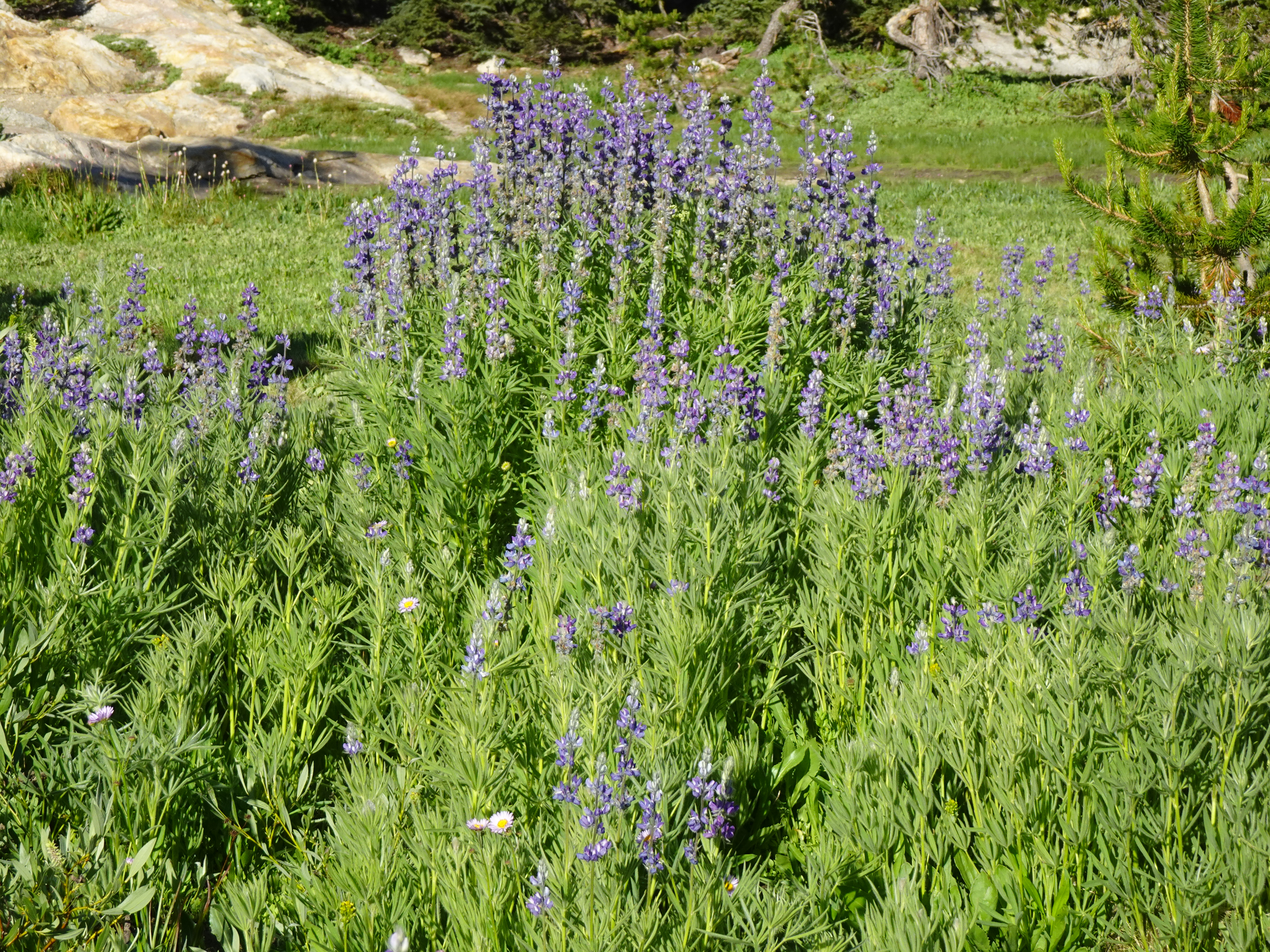
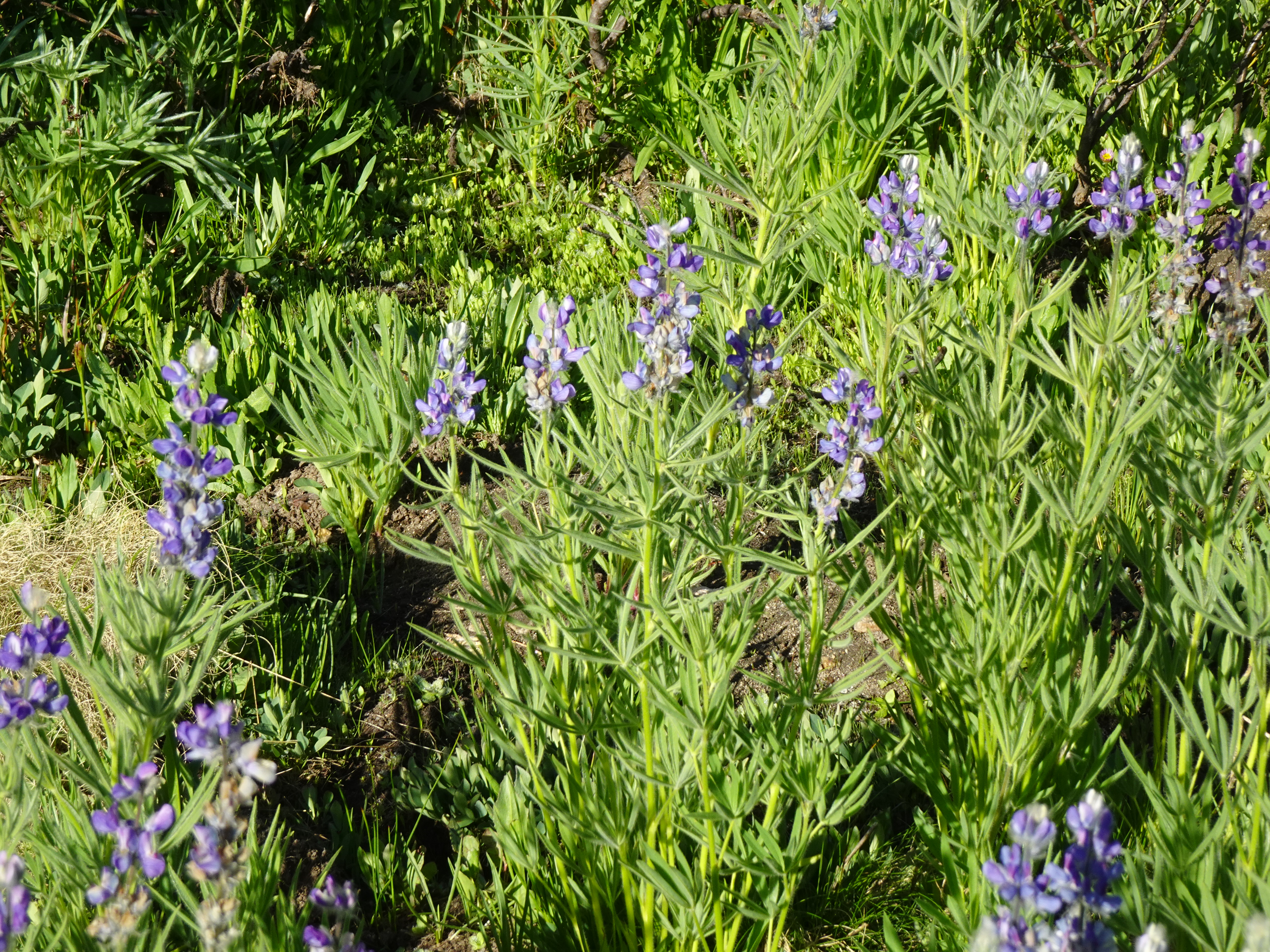
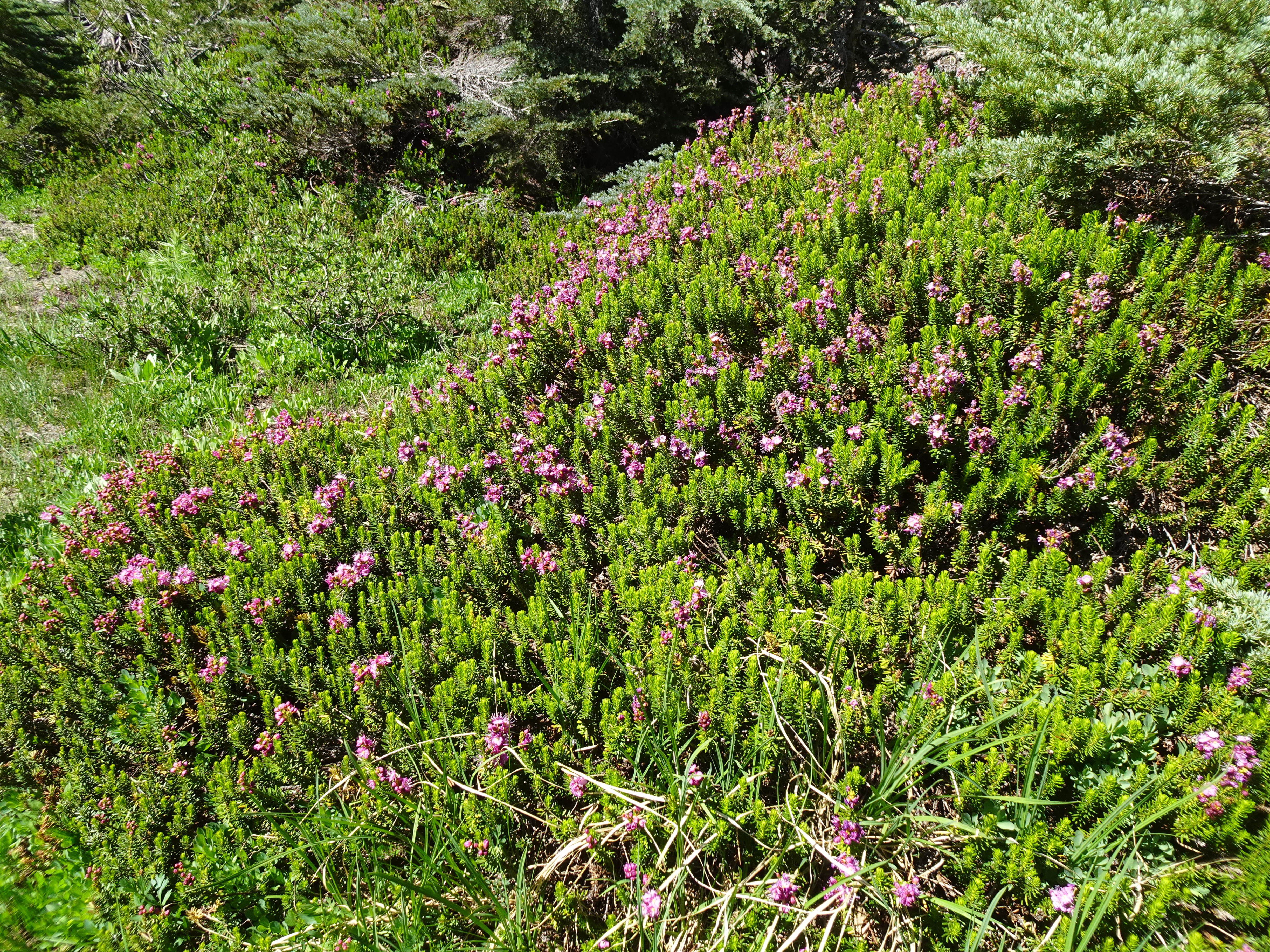
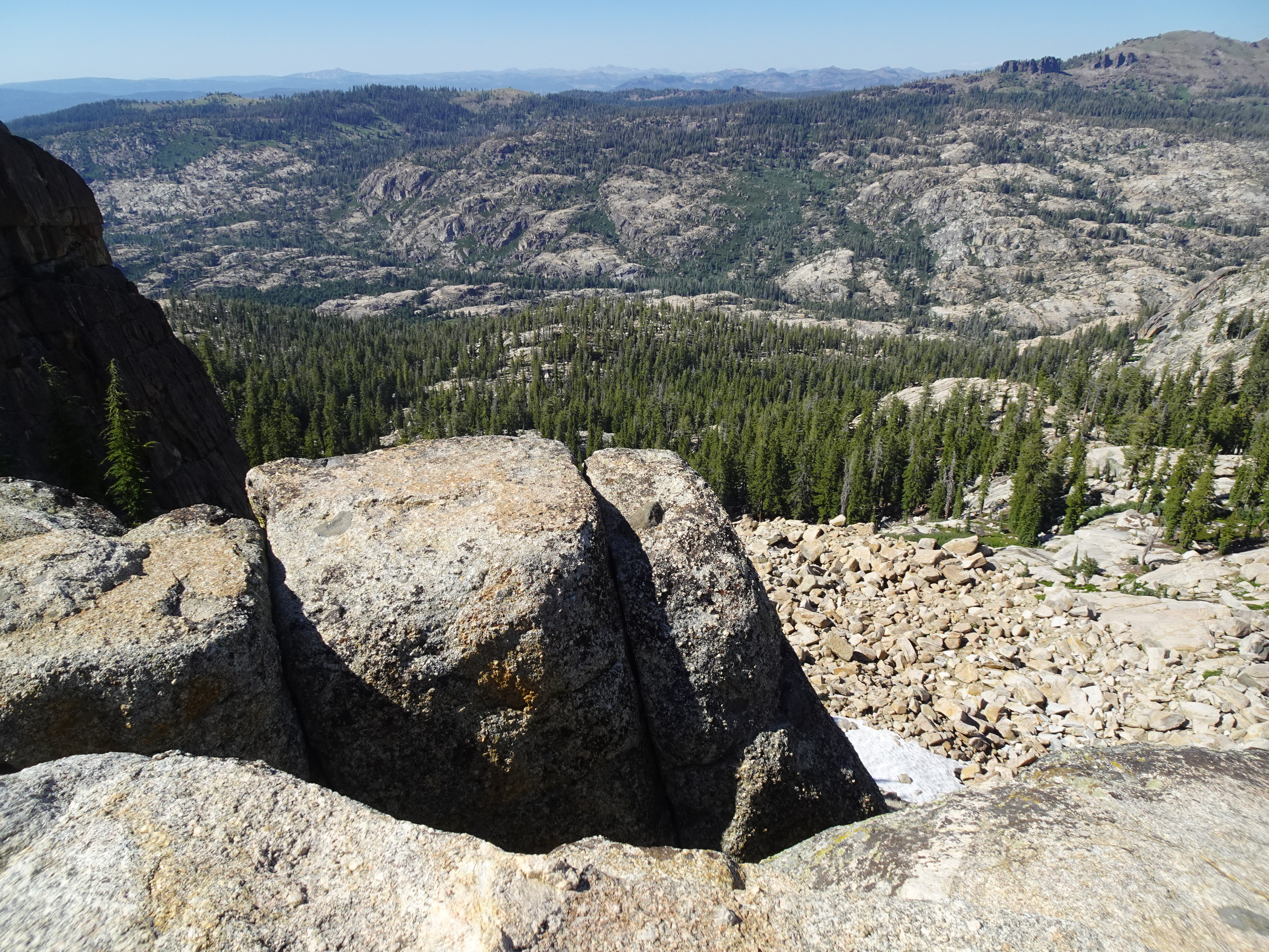
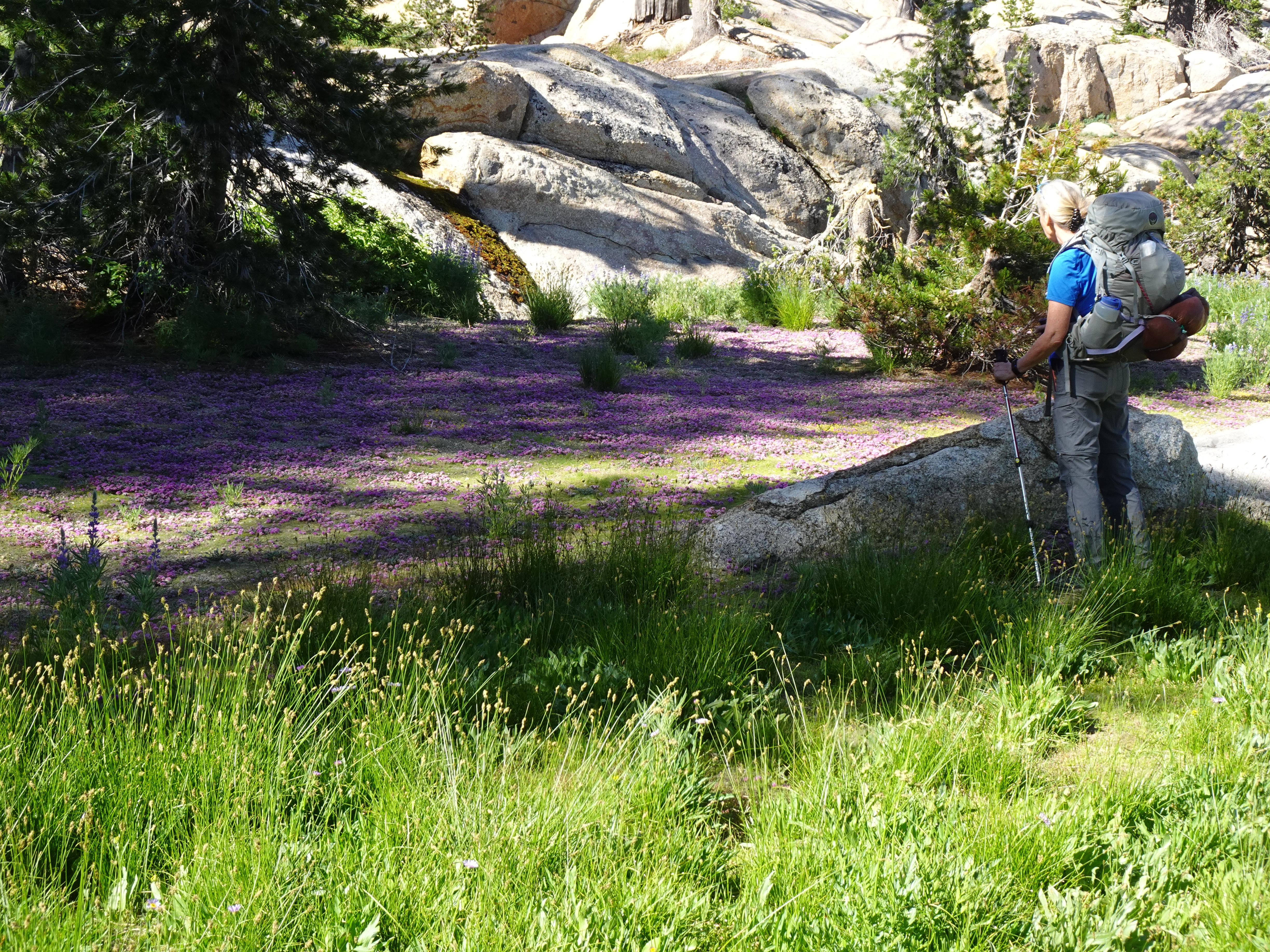
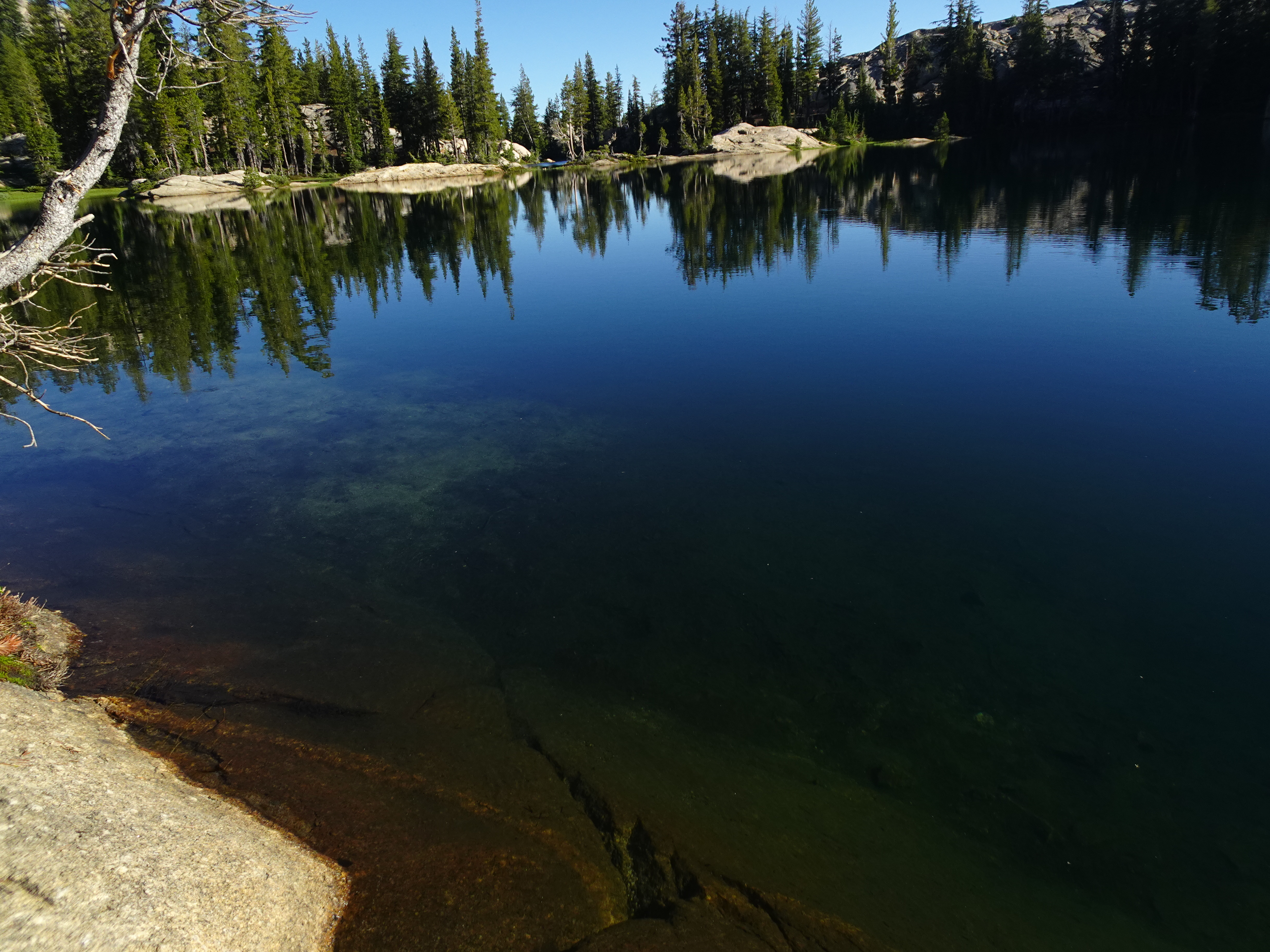
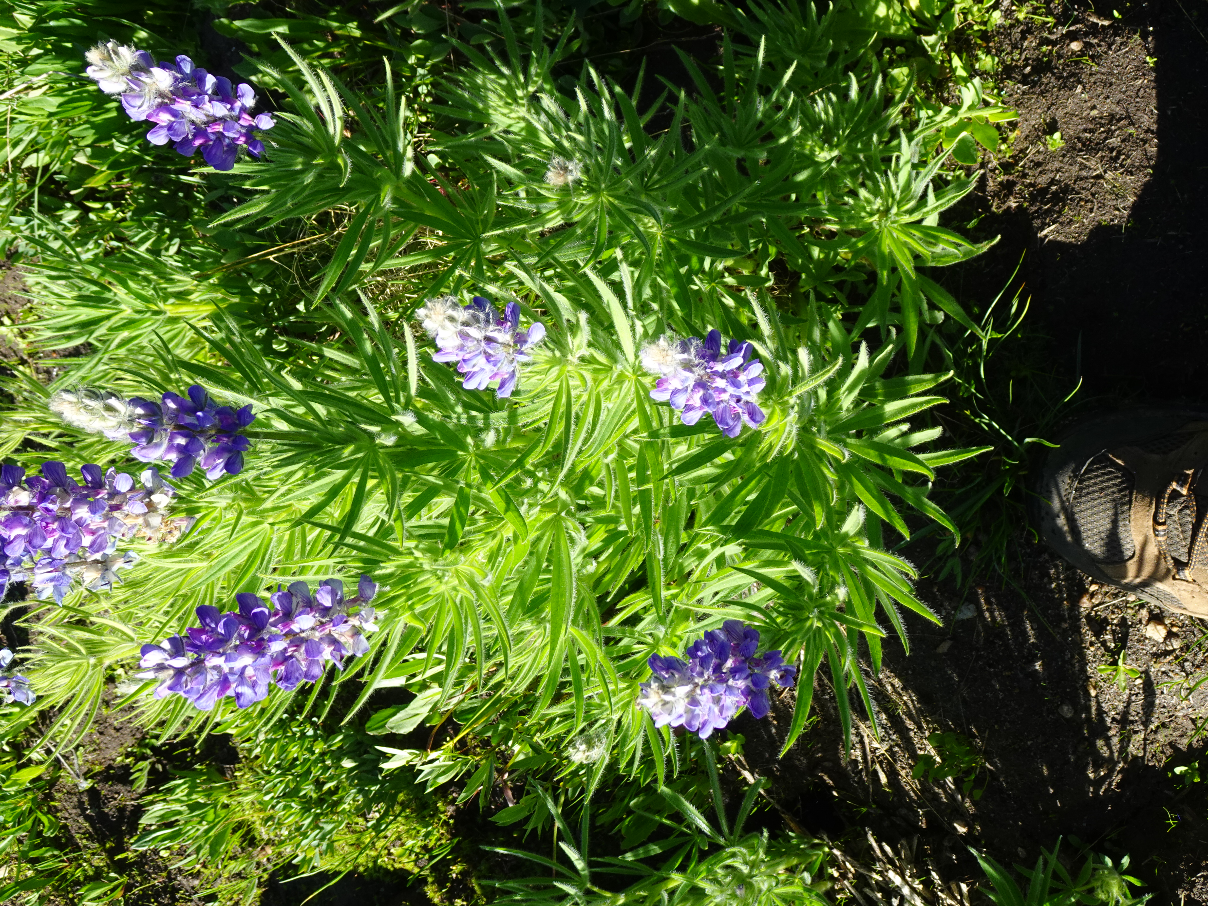
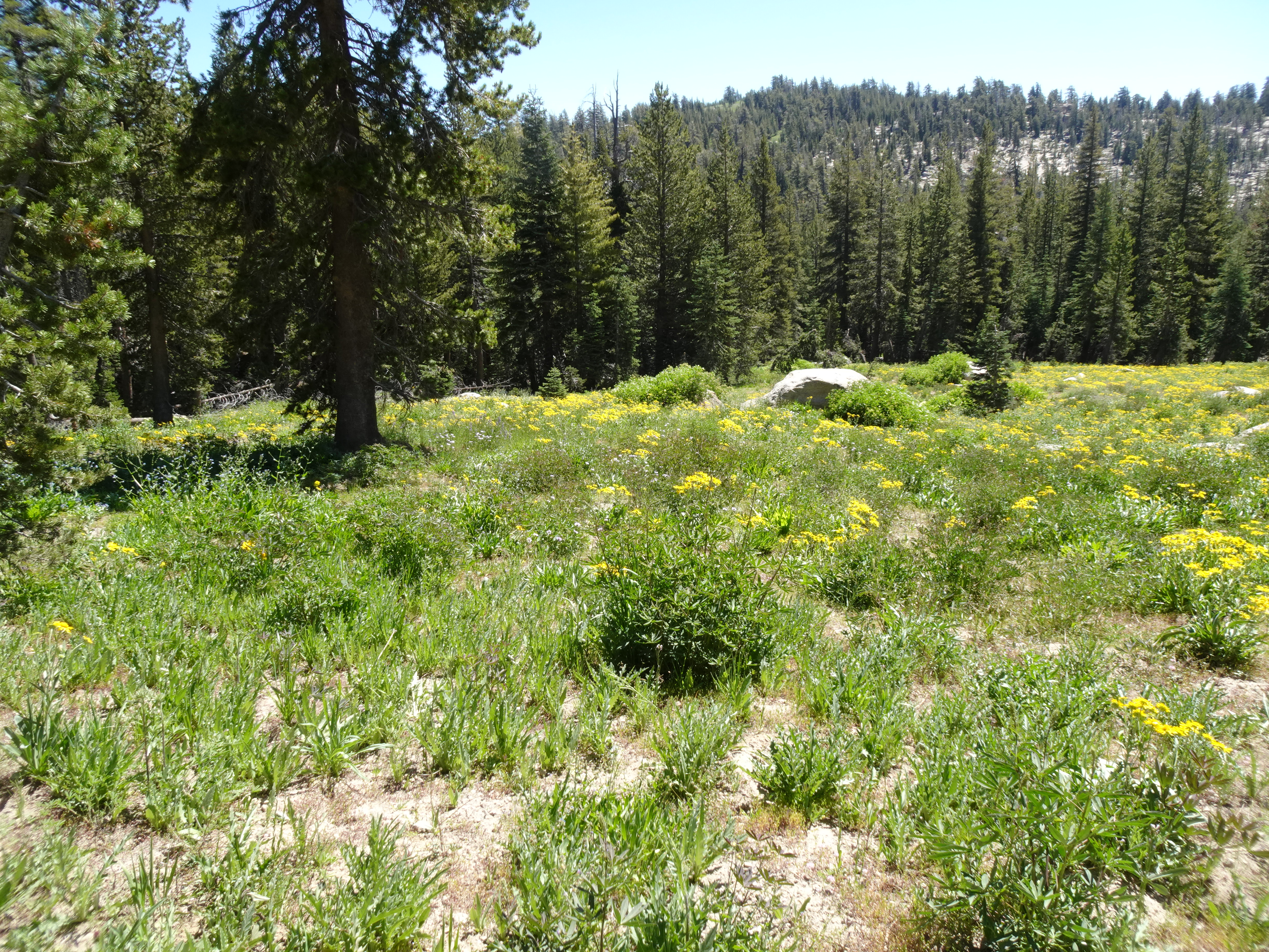
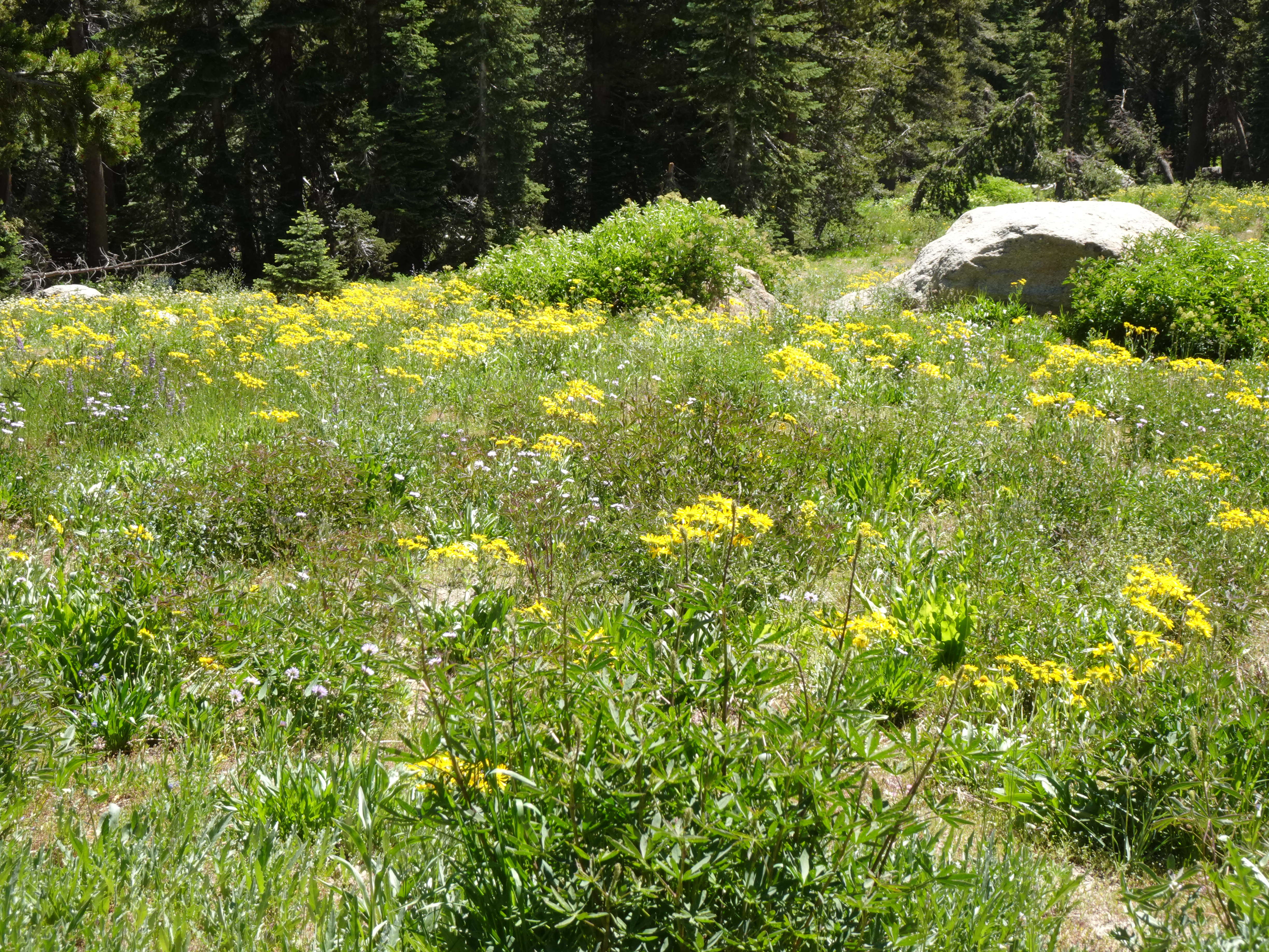
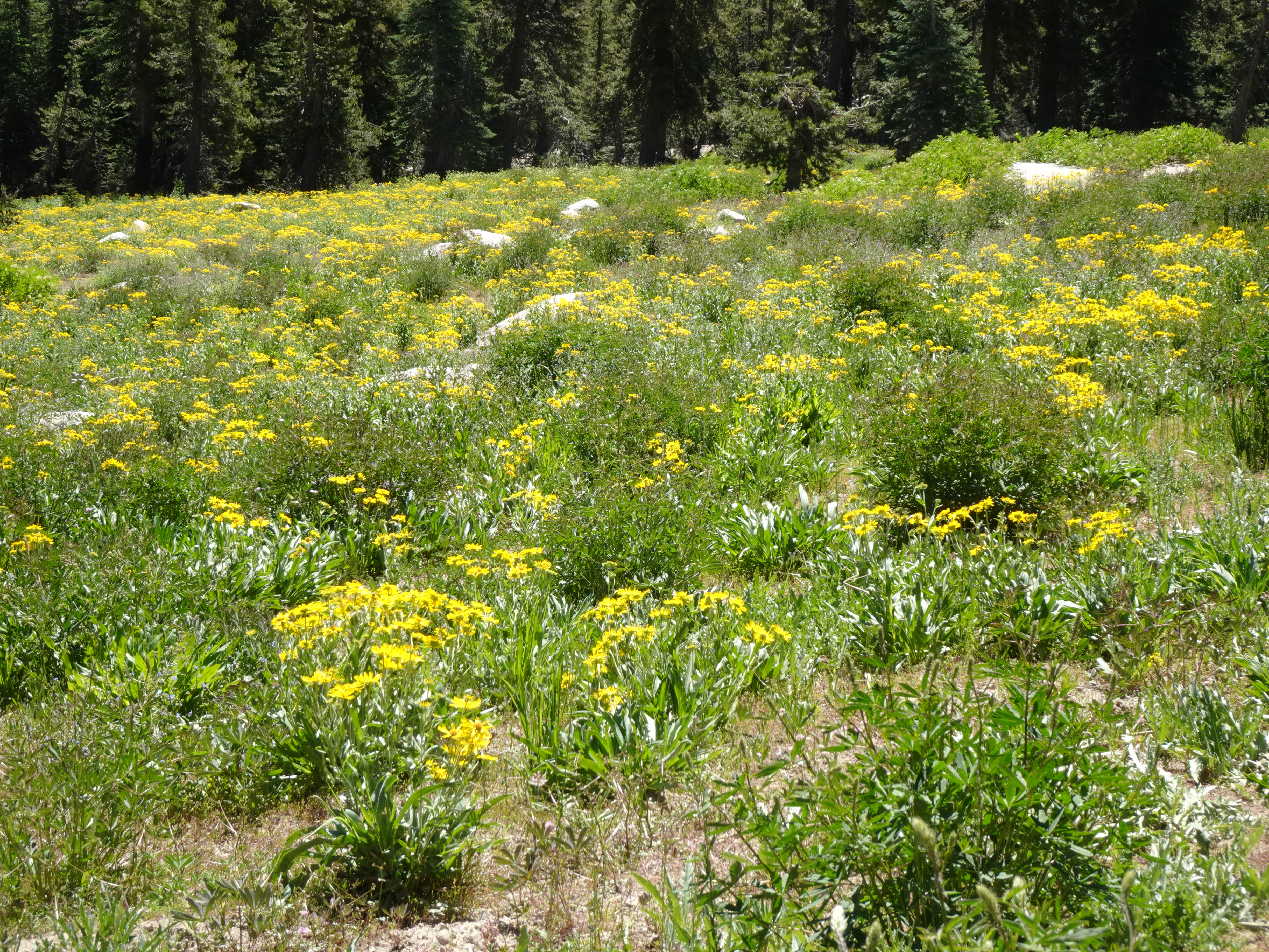
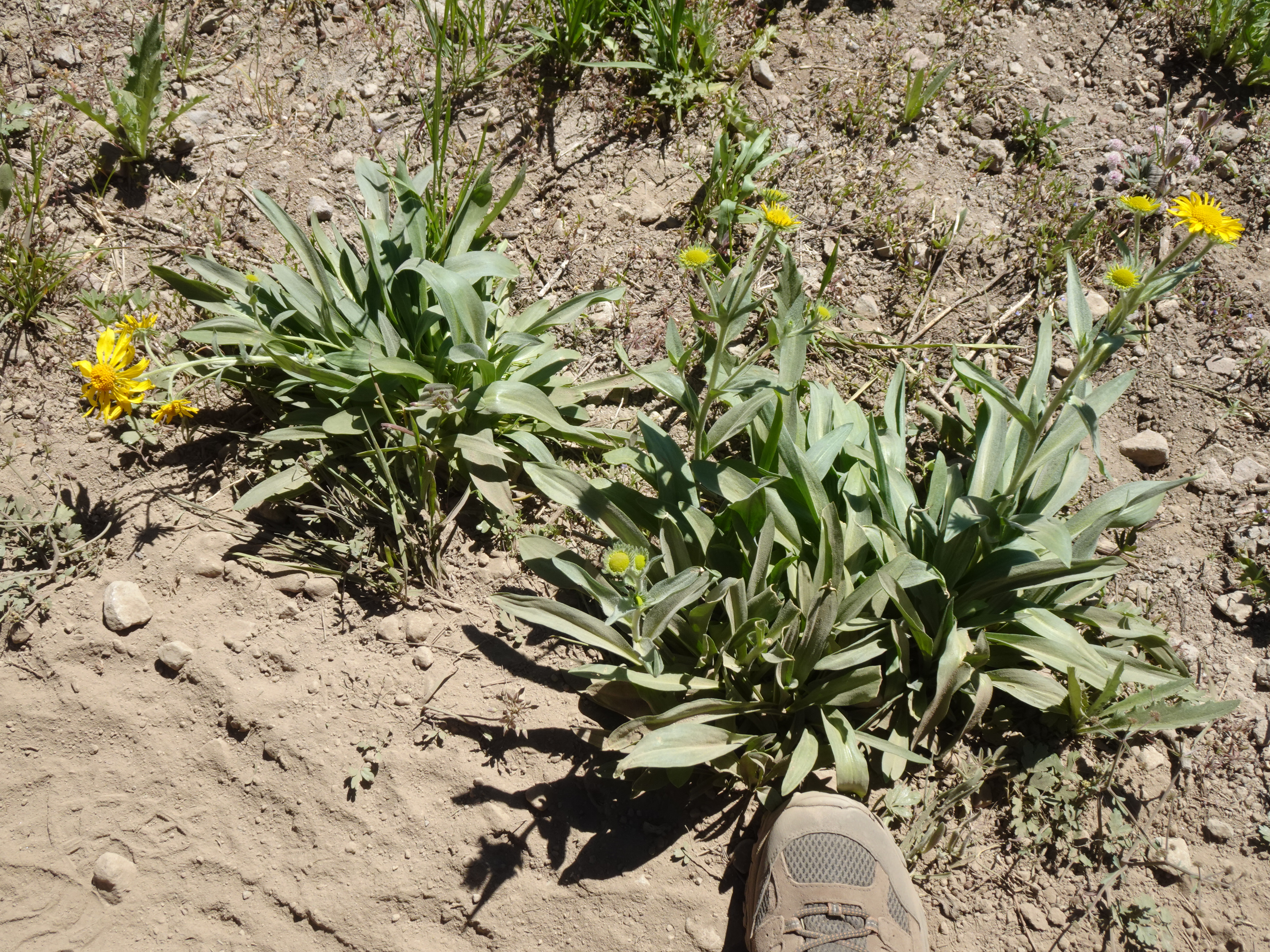
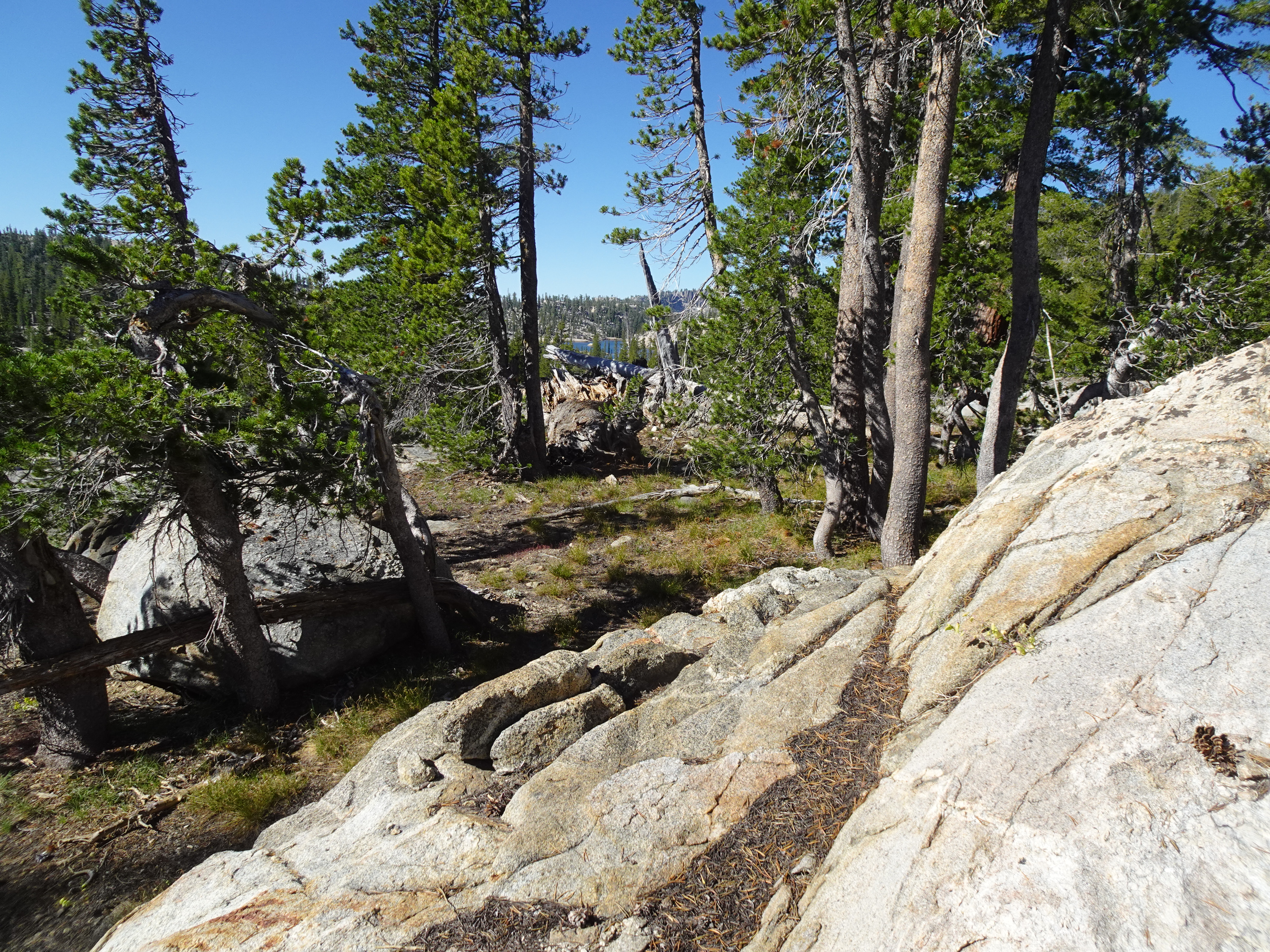
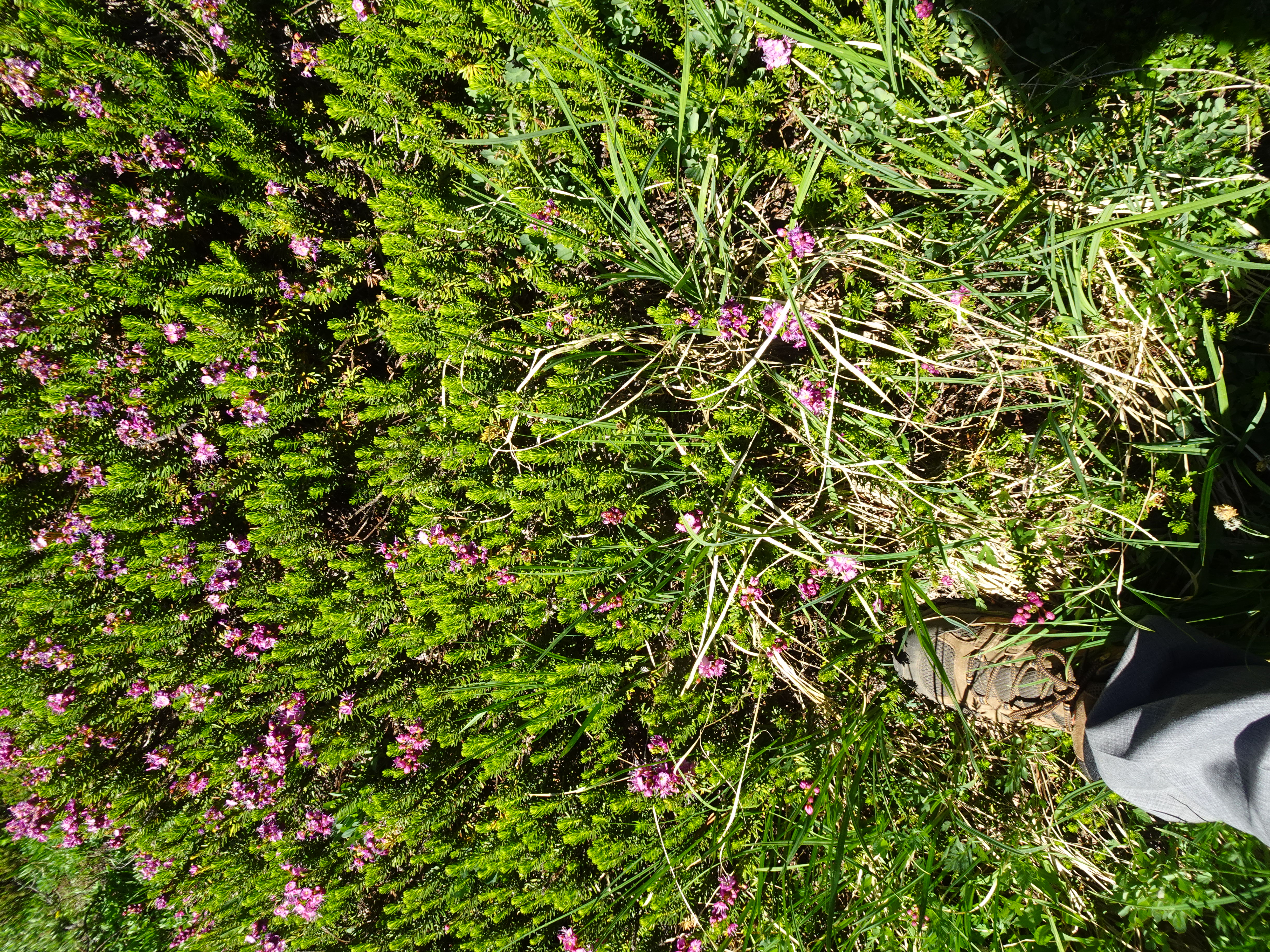
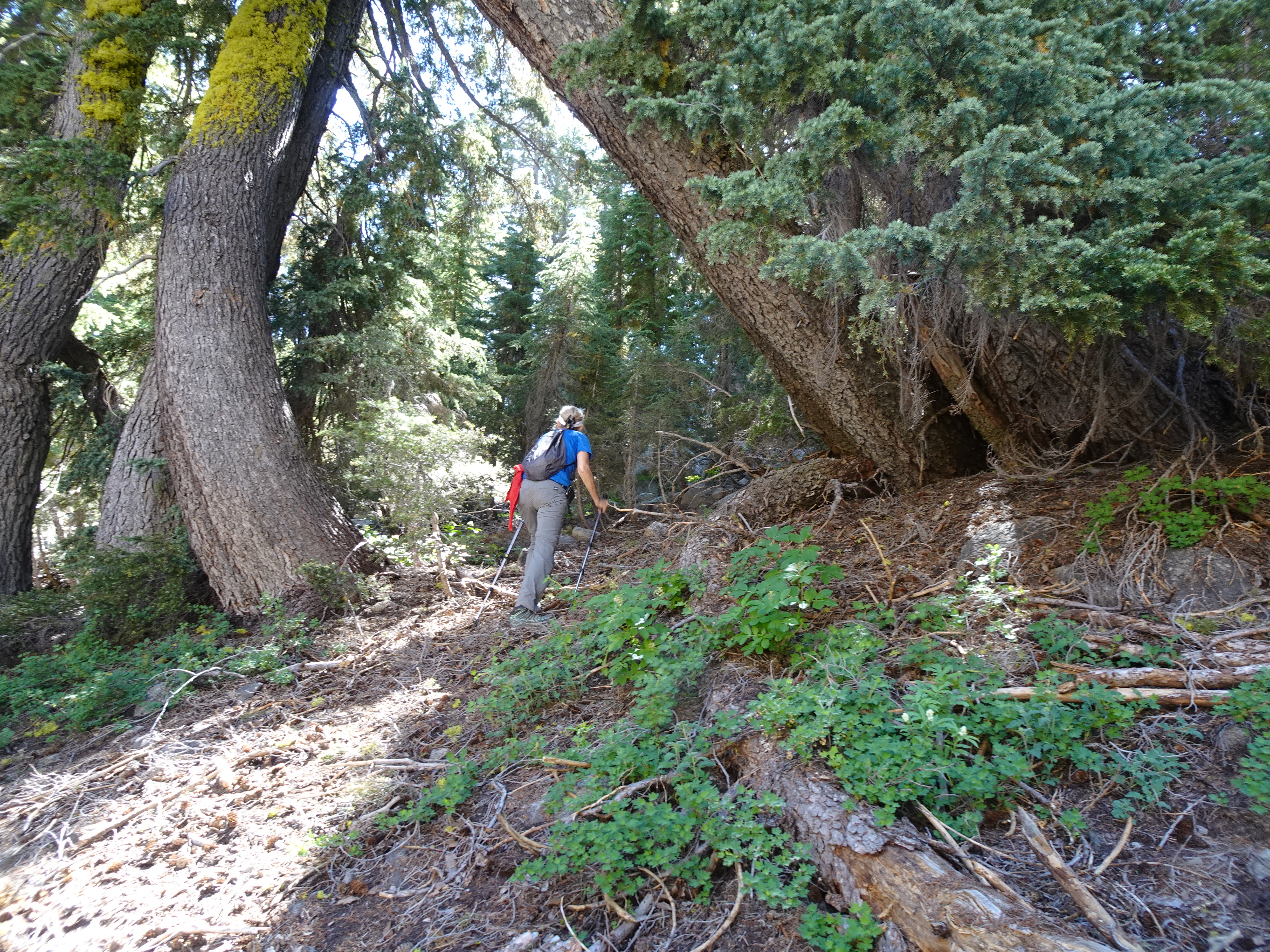
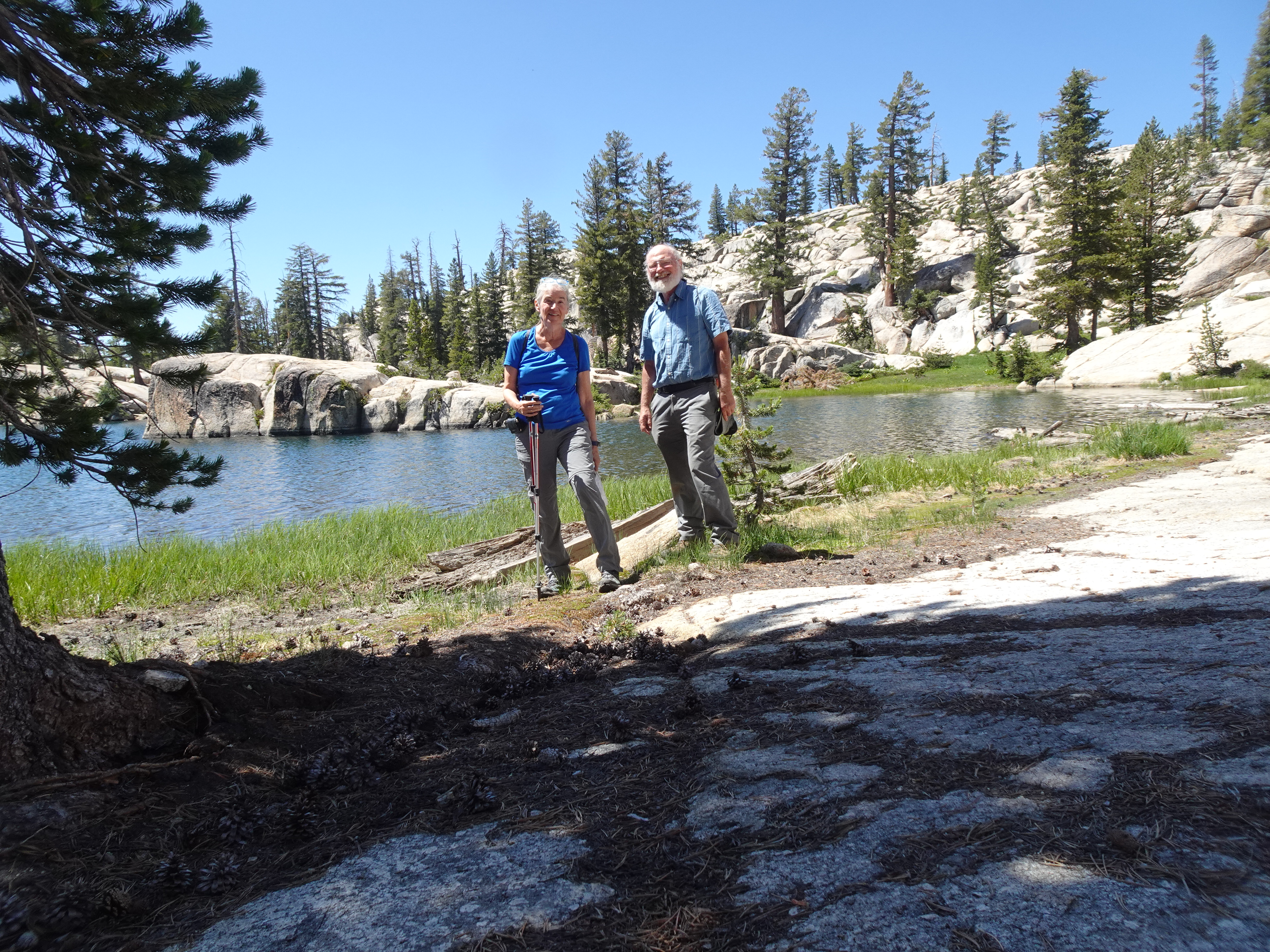
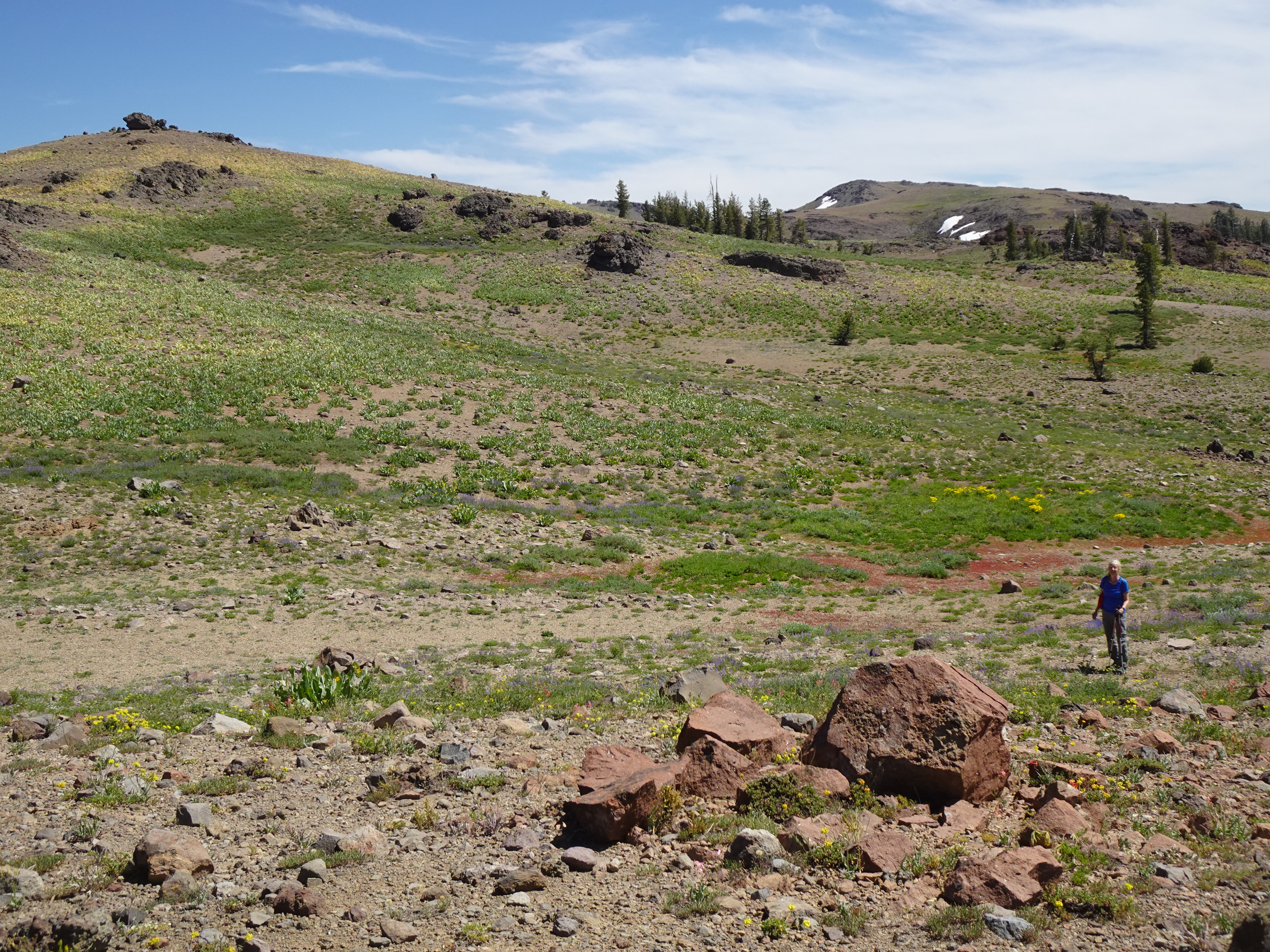
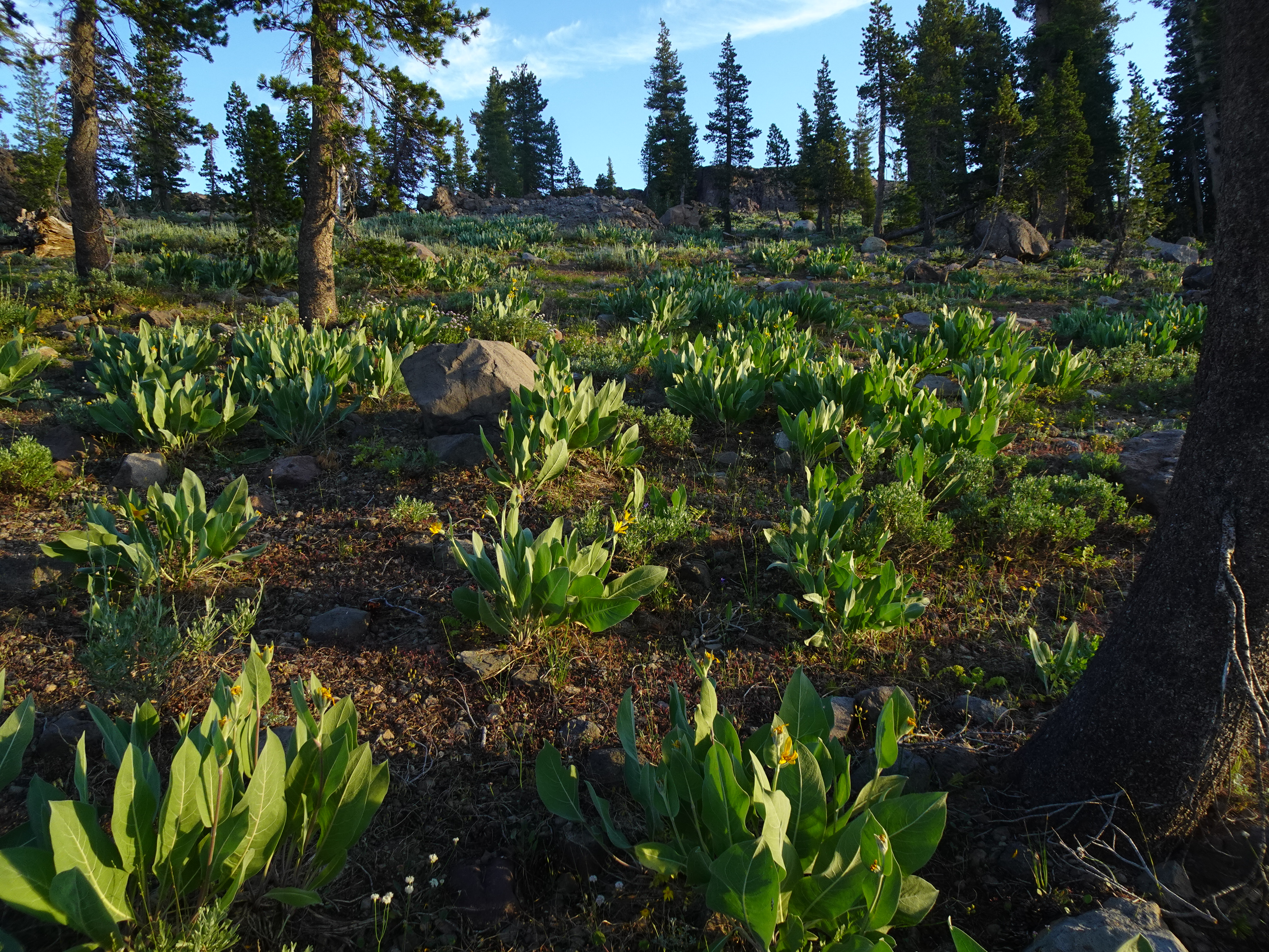
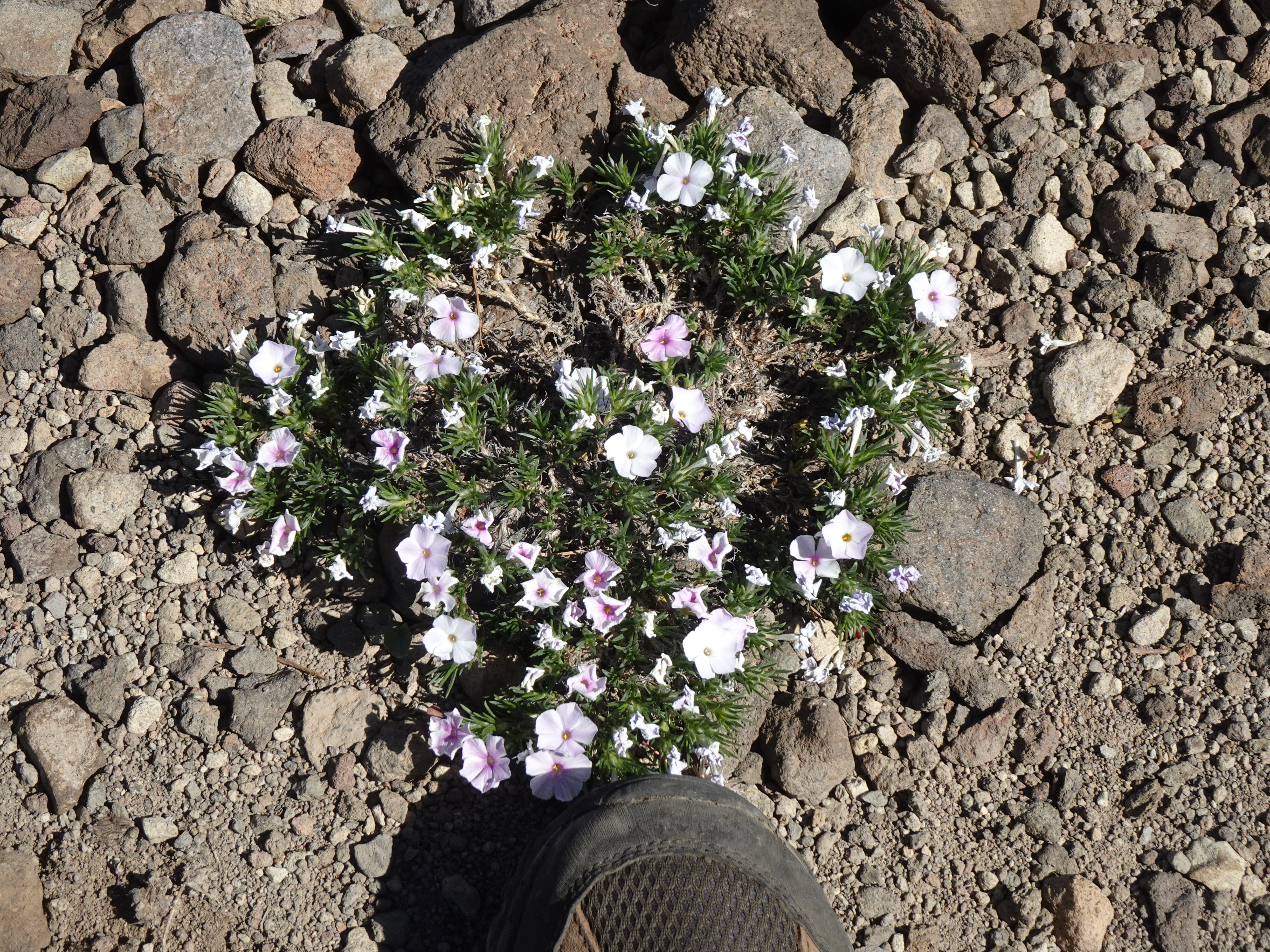
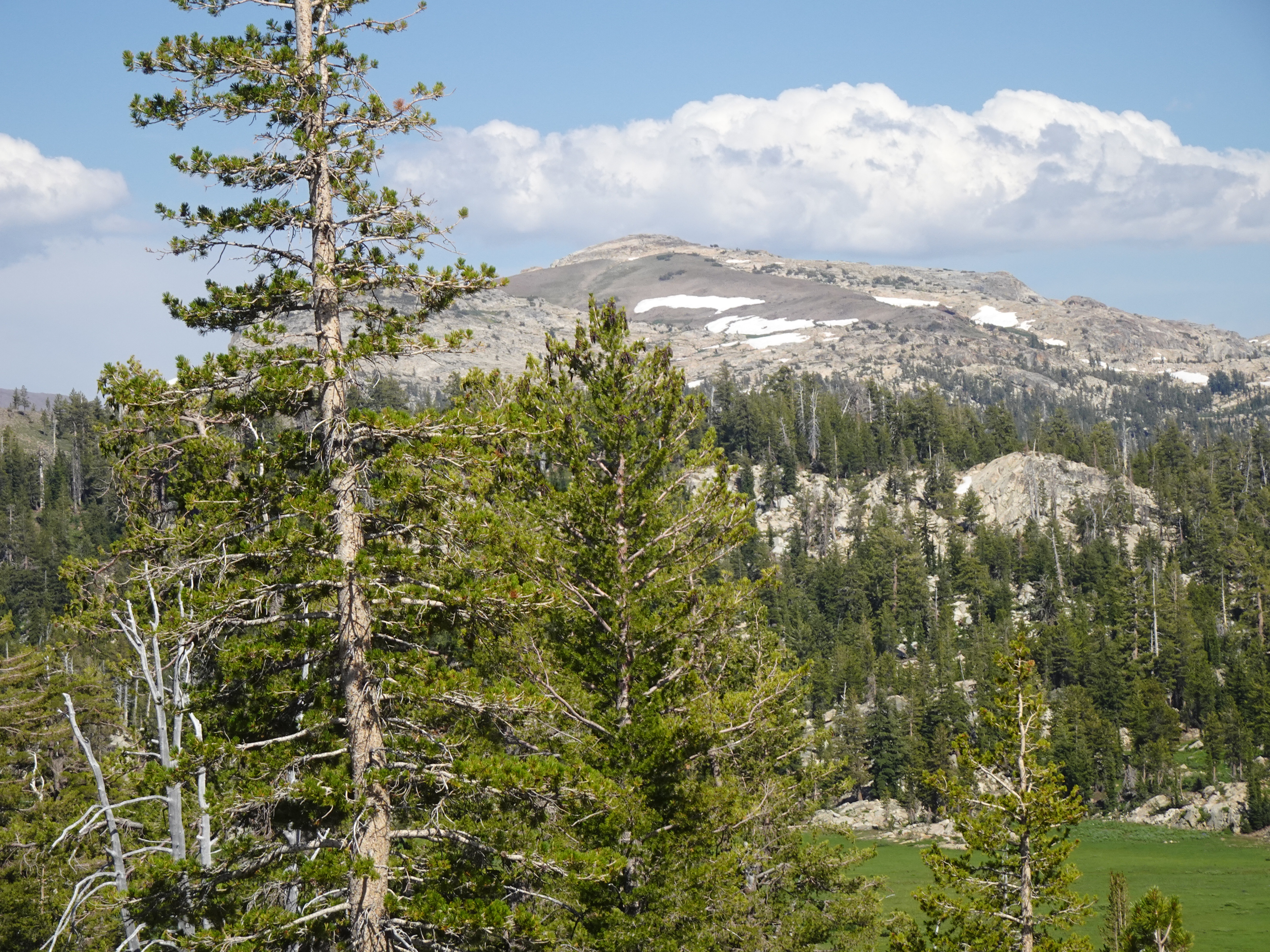
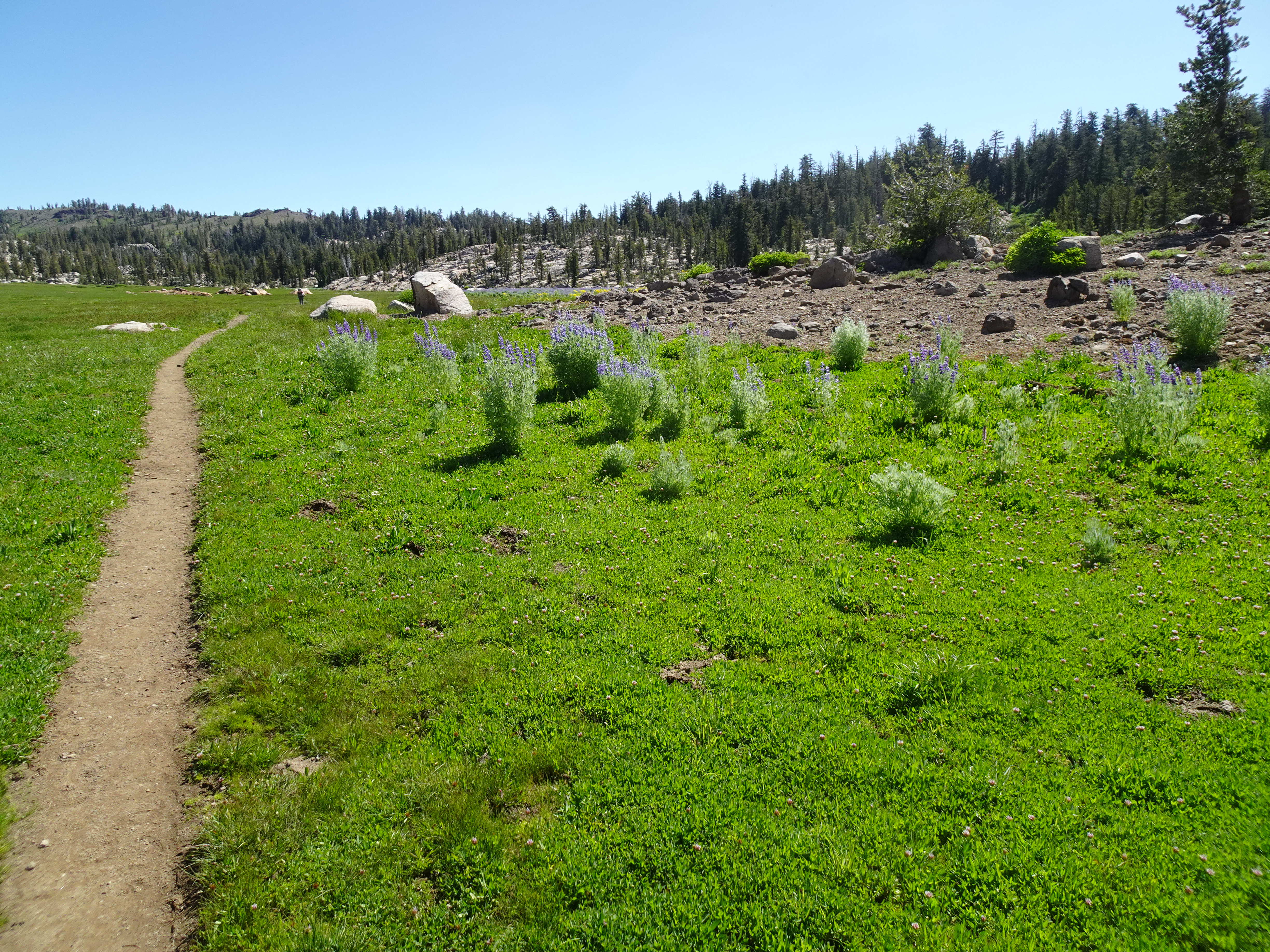
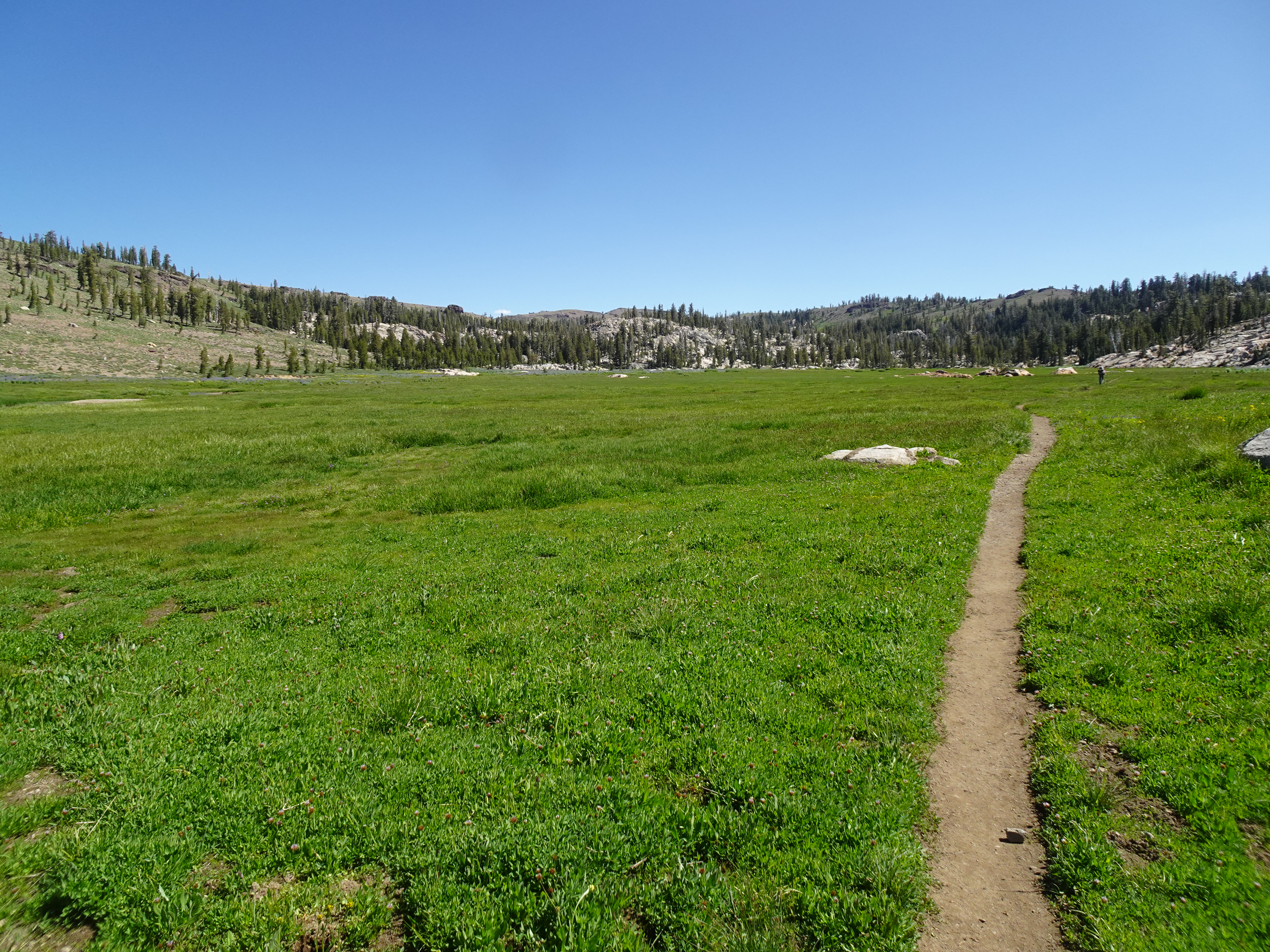
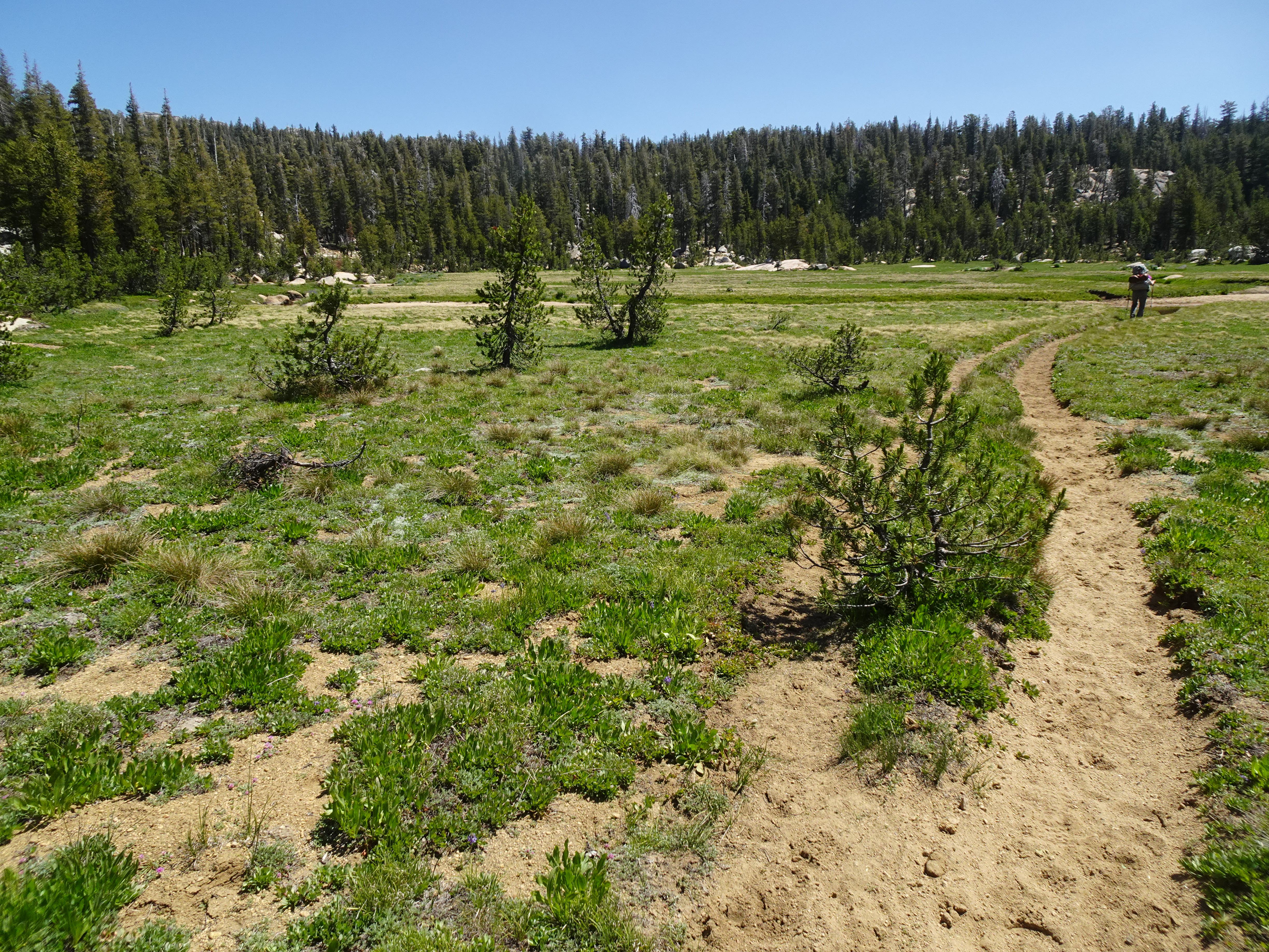
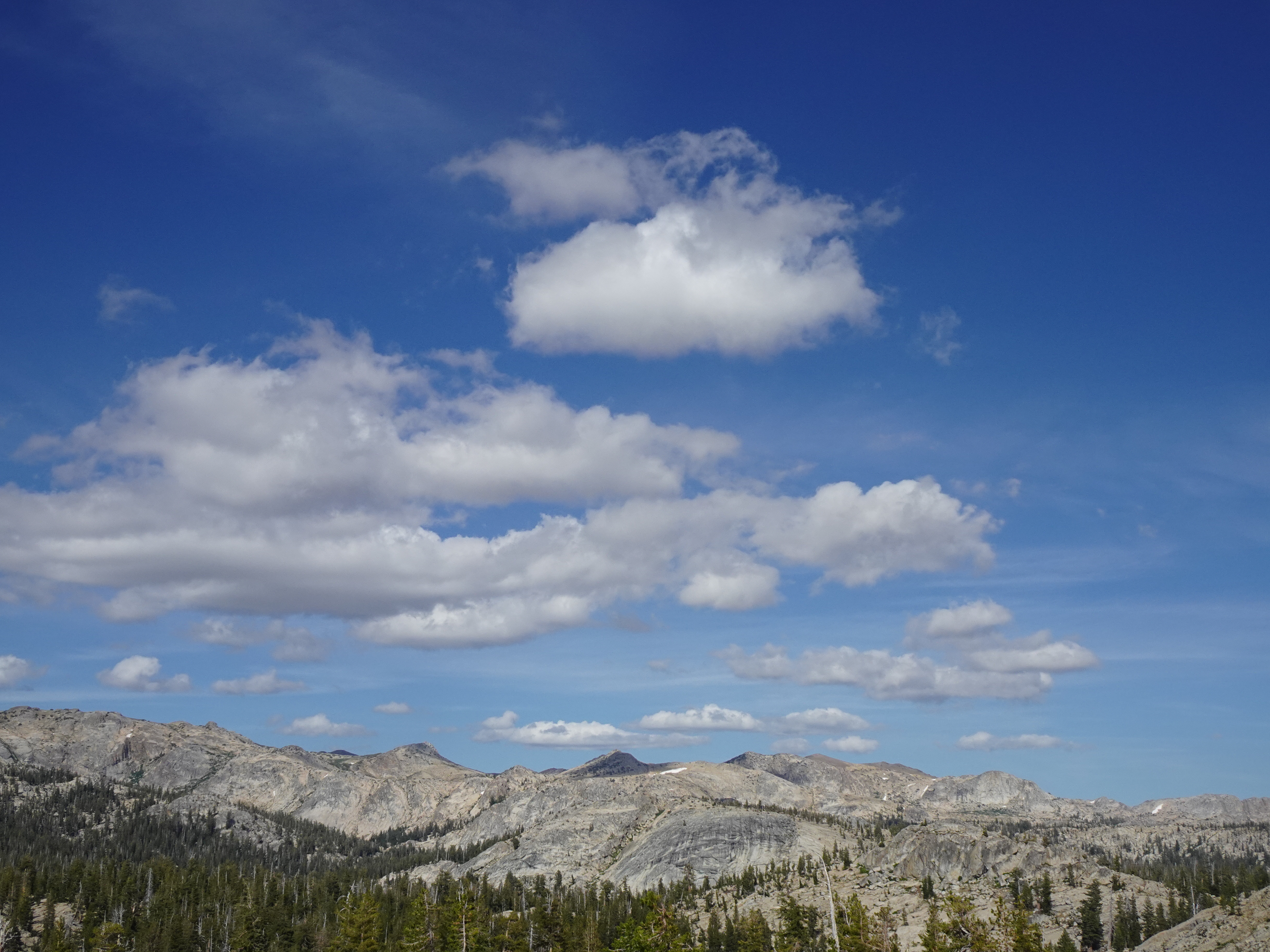
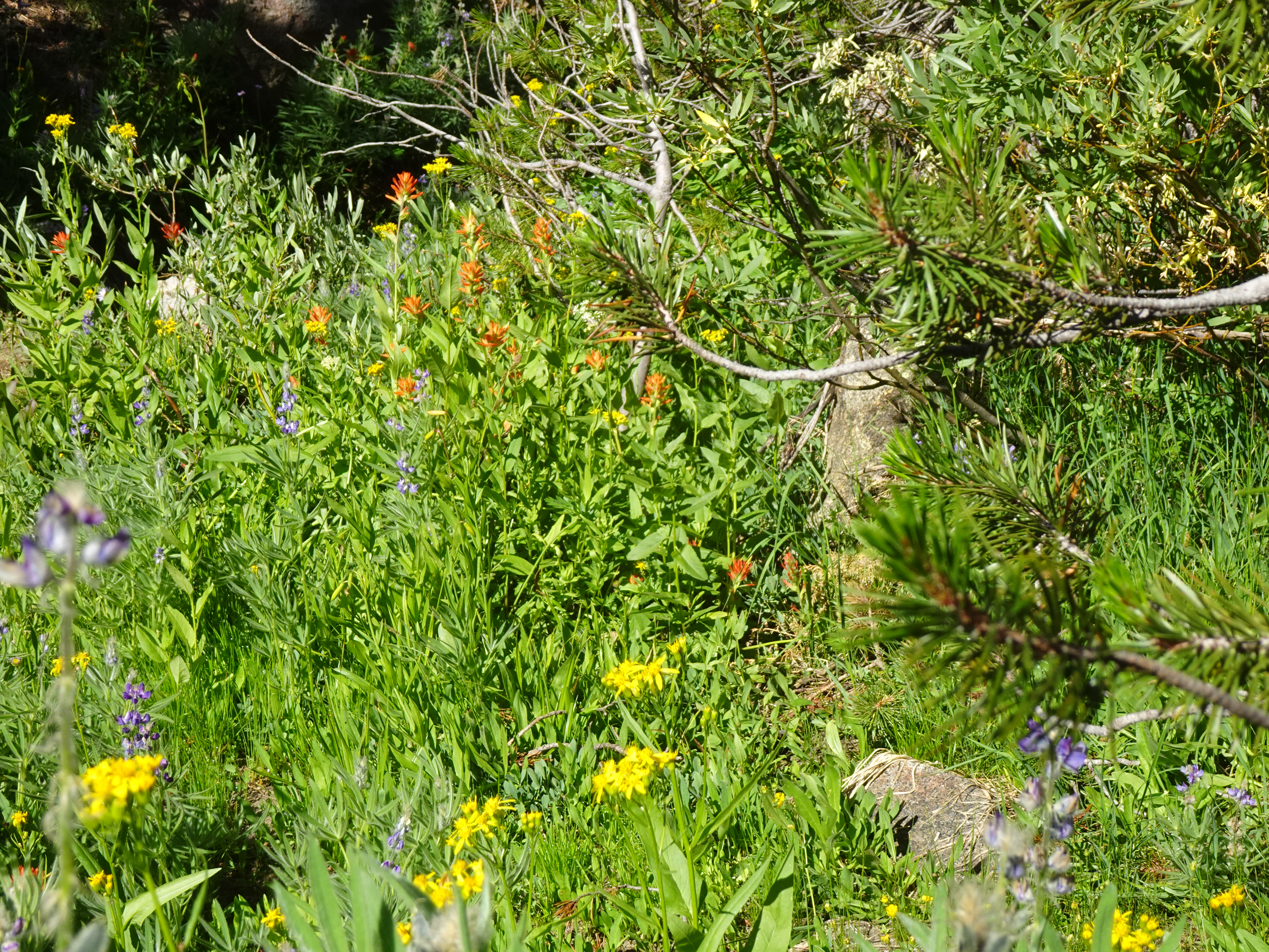
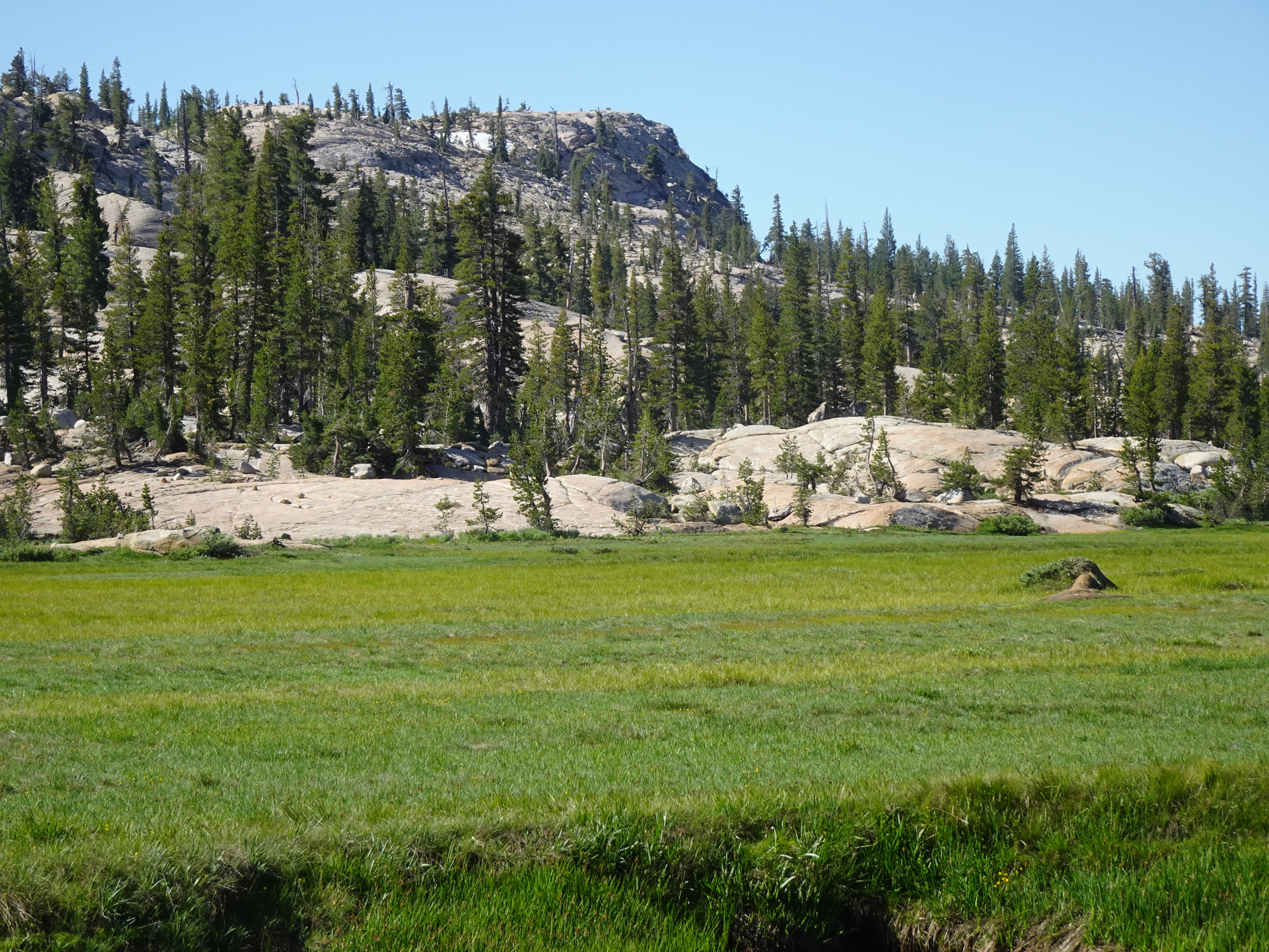
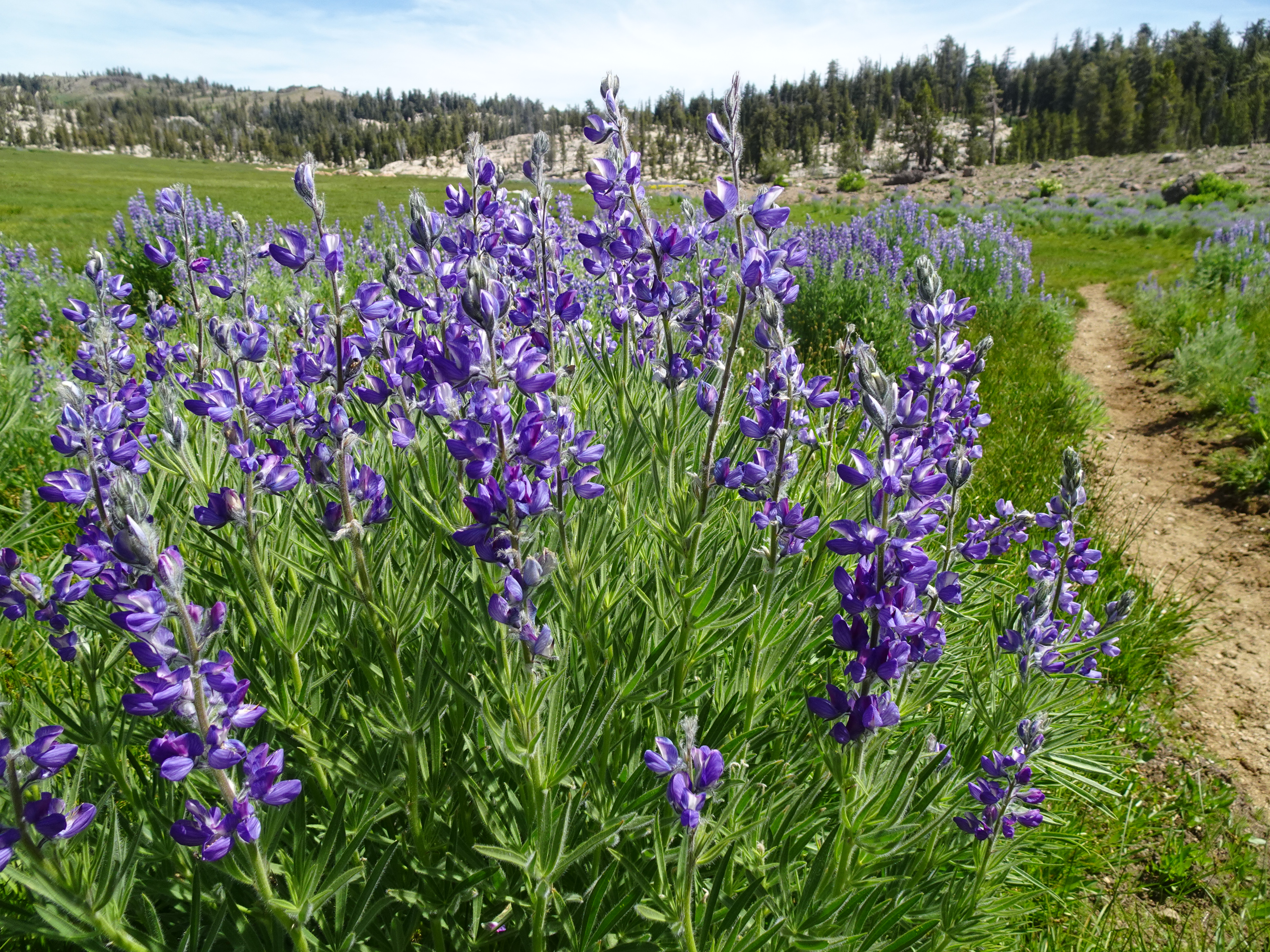
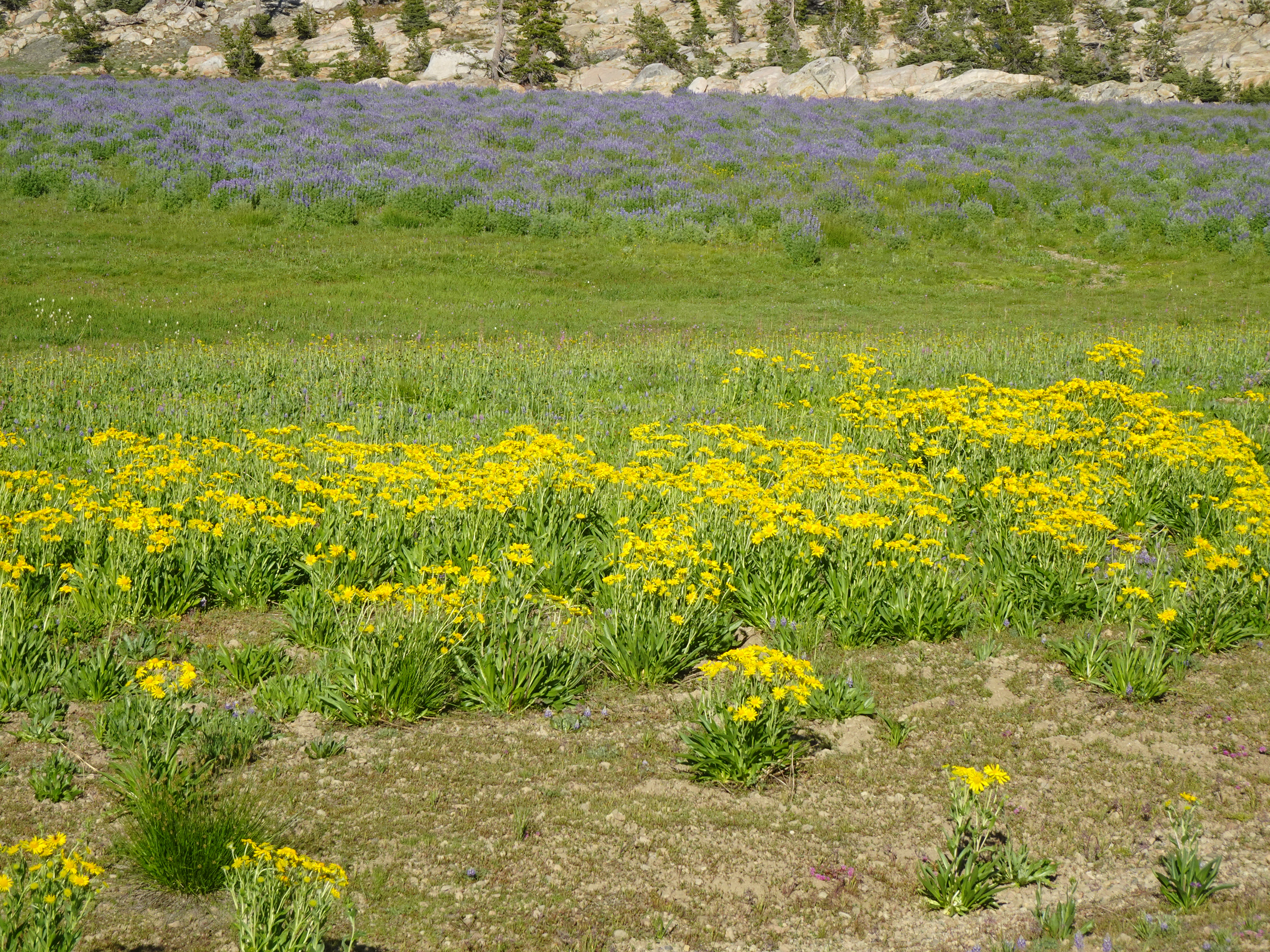
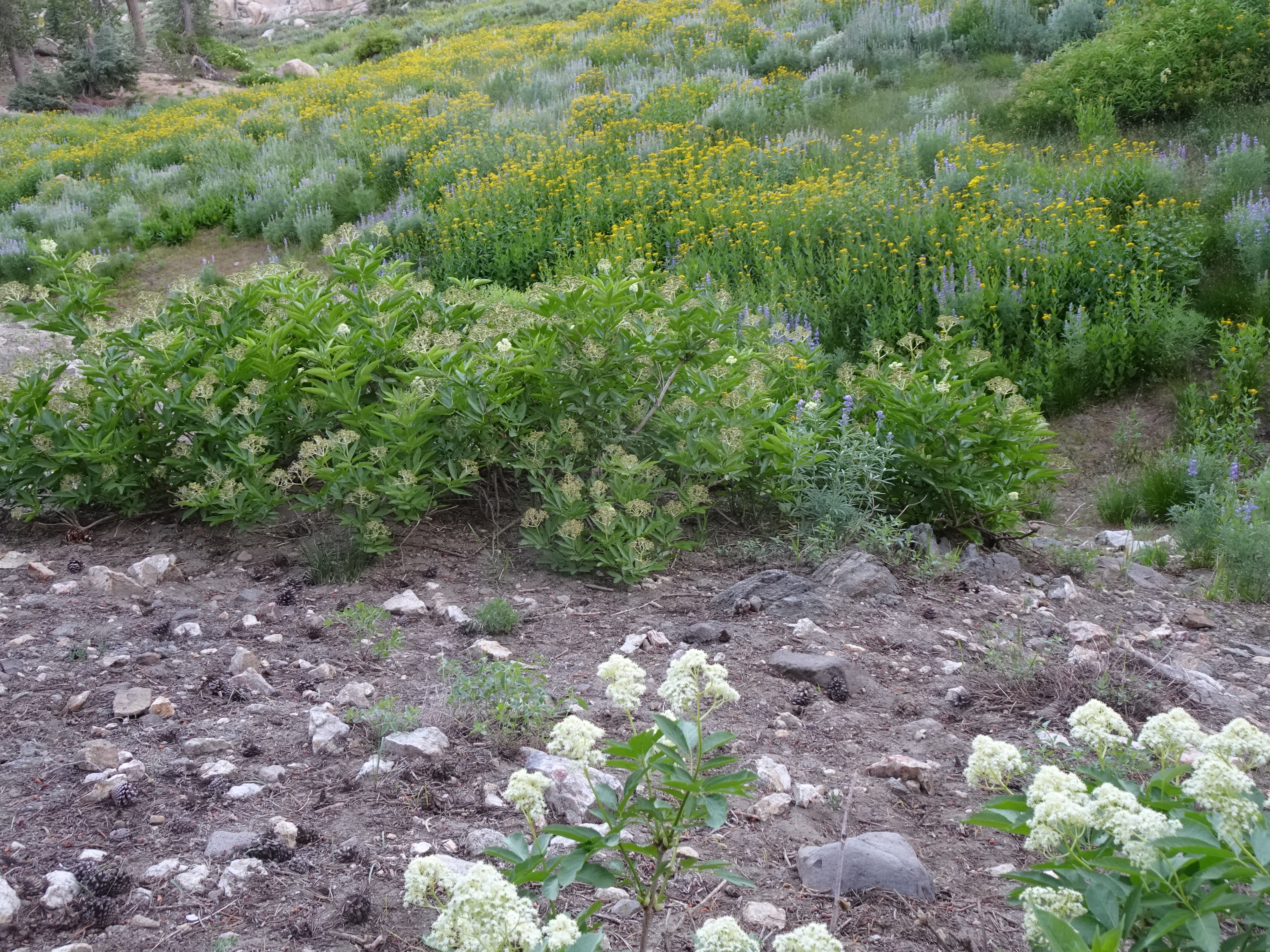
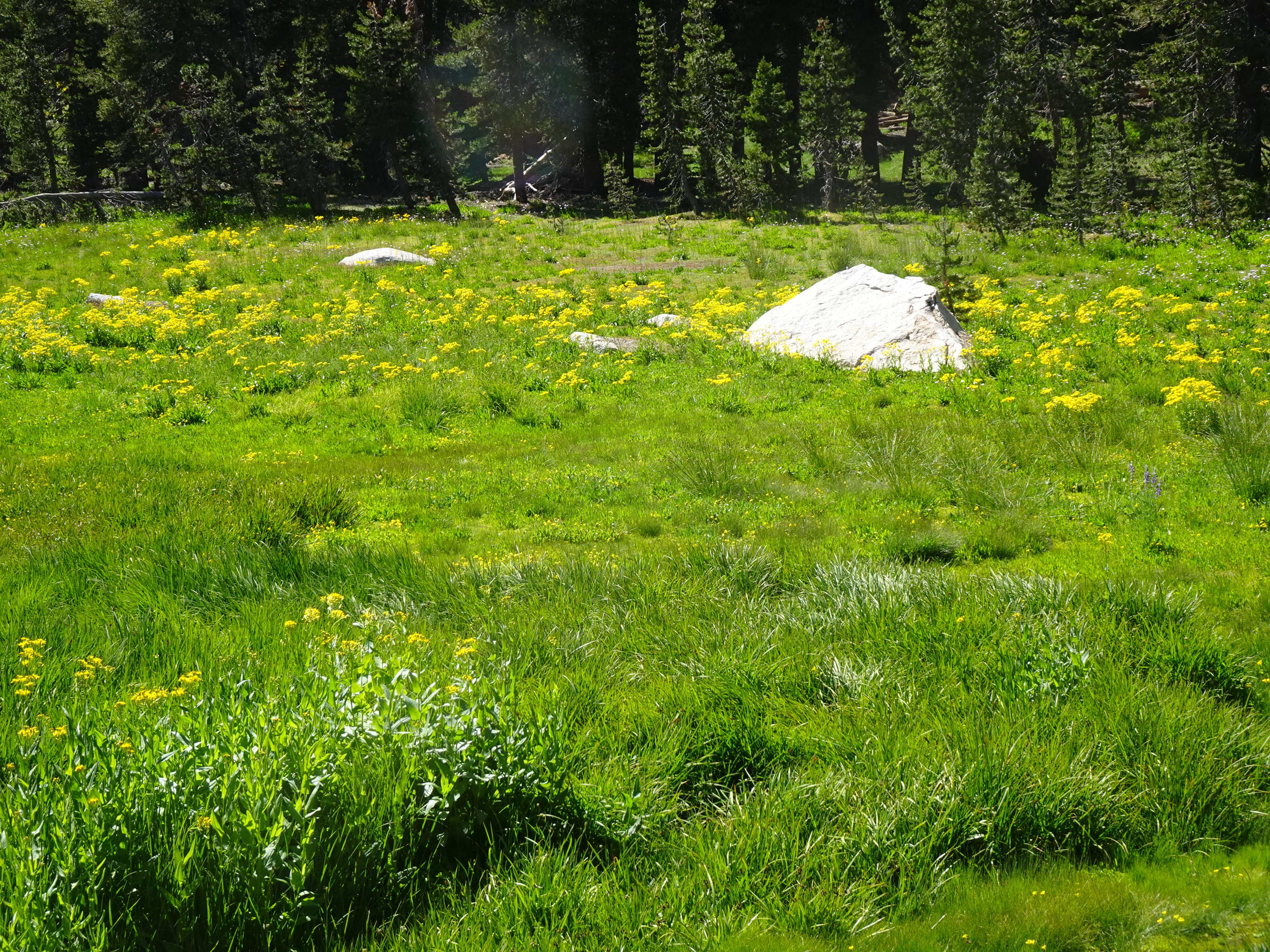
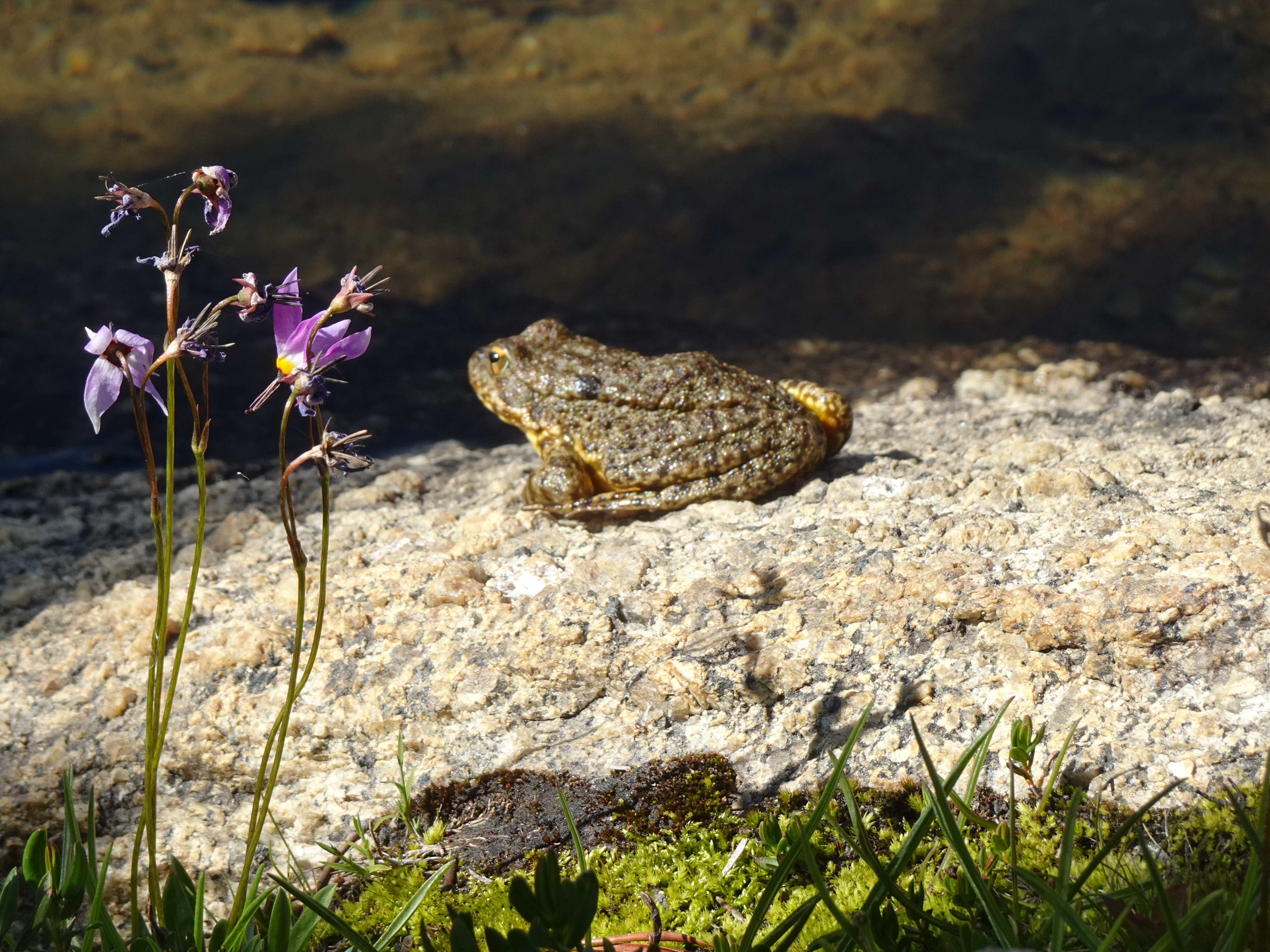
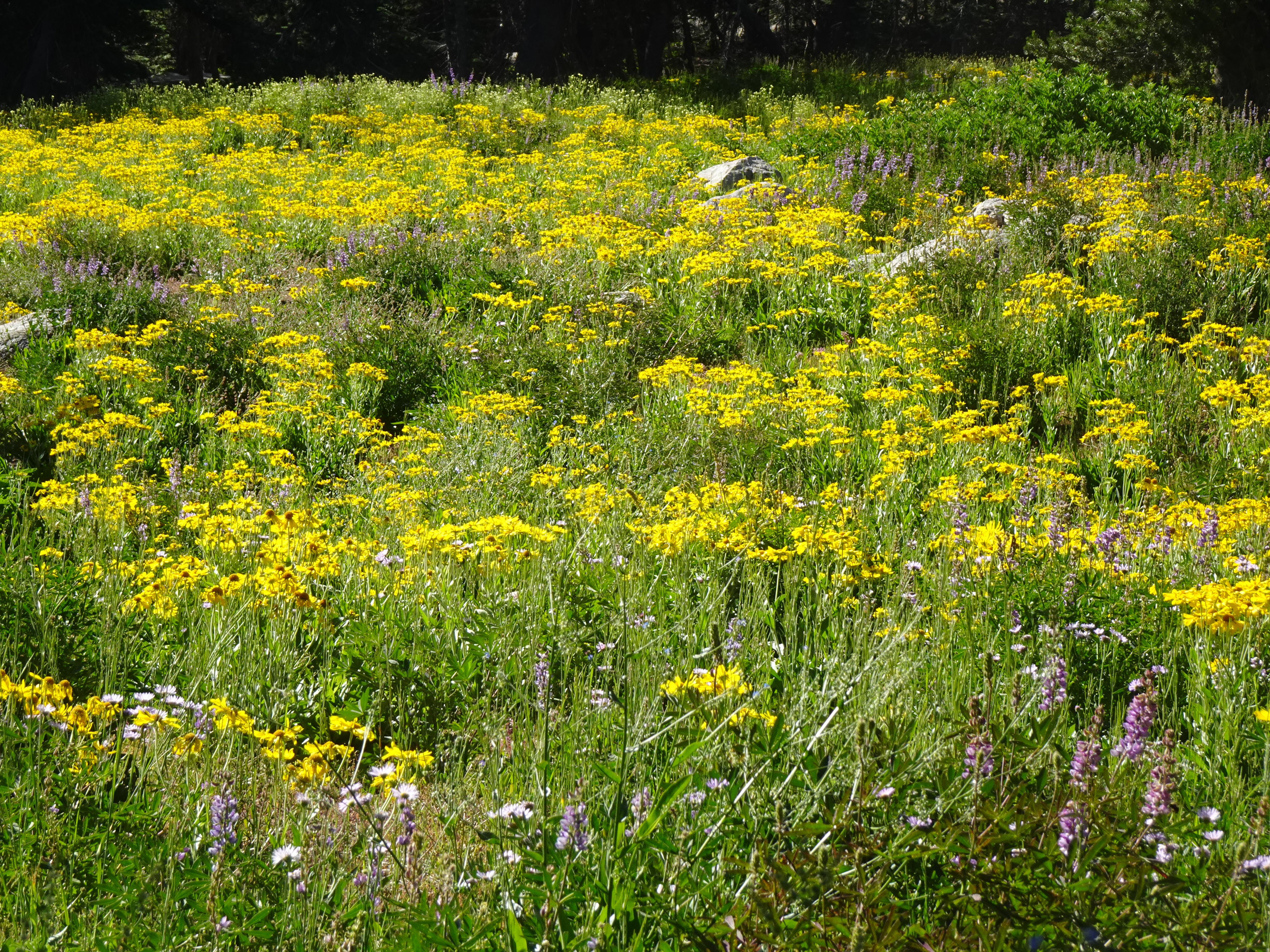
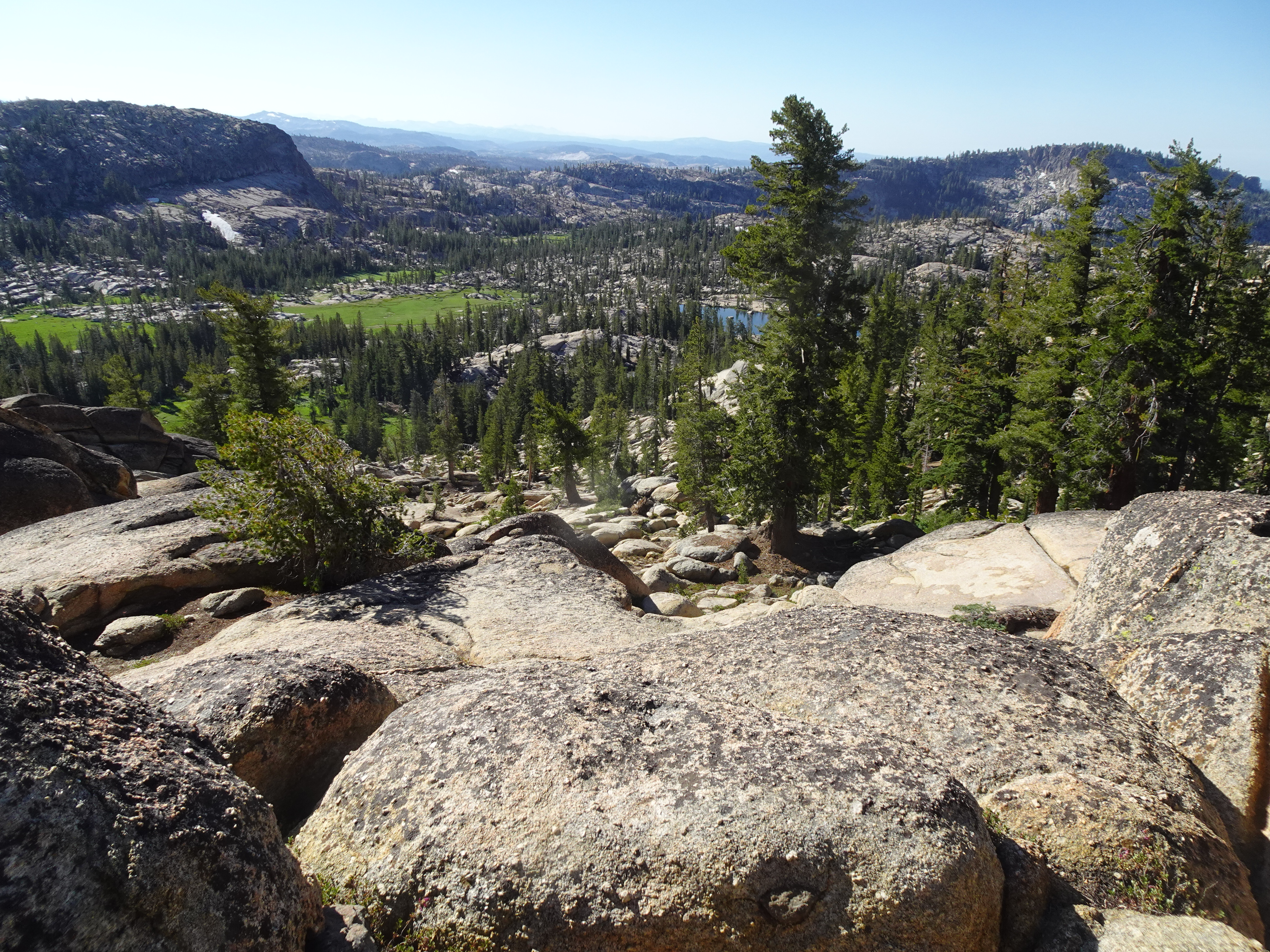
We backpacked from the Gianelli Trailhead to Powell Lake (All Trails says 2.3 miles one way going from elevation 8579' to 8835' net gain of 256' - drag the cursor along the bottom chart to see this). The trailhead and and beginning of the trail are in the Stanislaus National Forest, but not actually in the Emigrant Wilderness. However, we soon entered the wilderness and, as we would find throughout the trip, the views were spectacular, along with so many beautiful flowers and meadows.
 |
 |
 |
 |
|
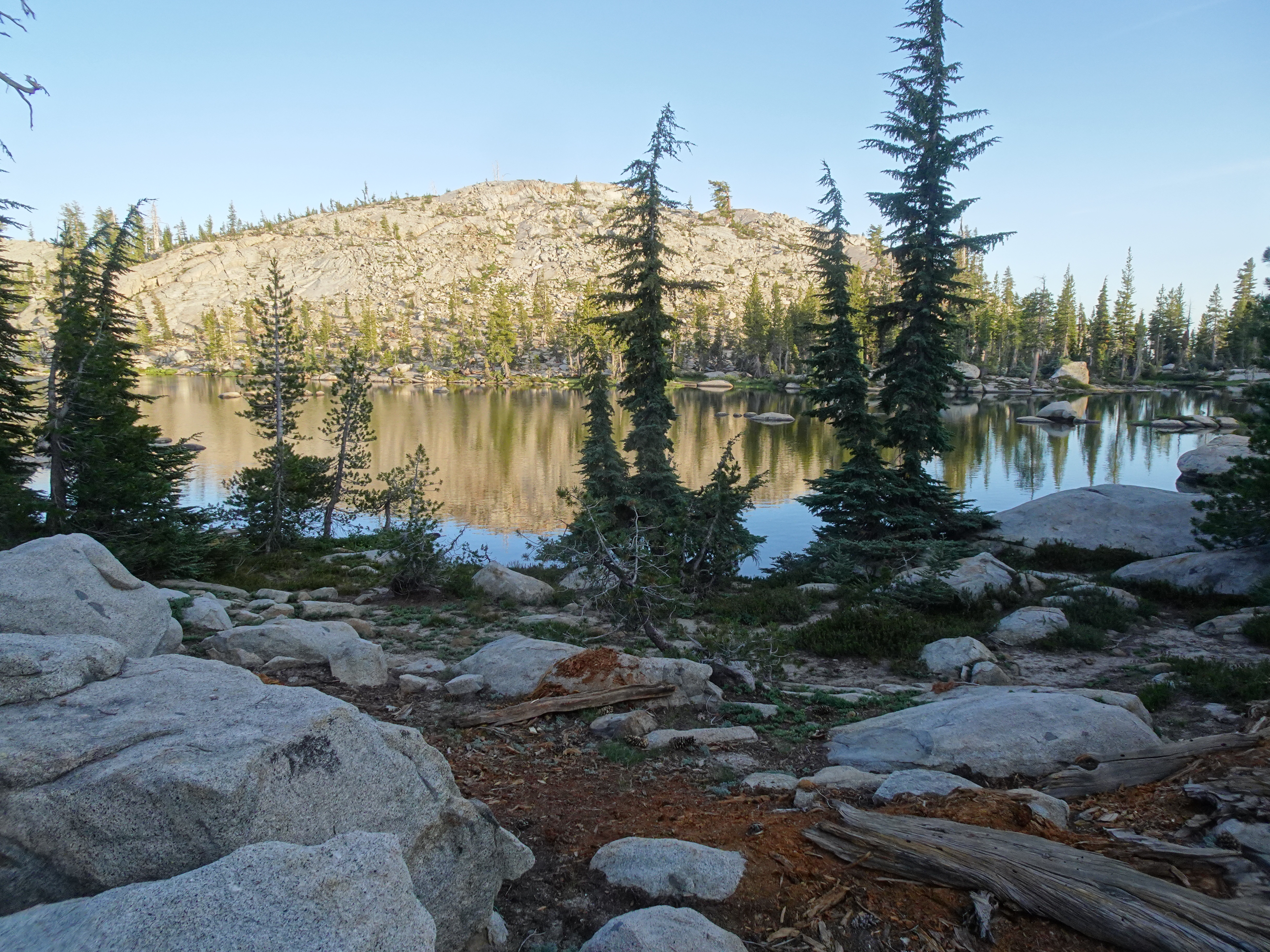
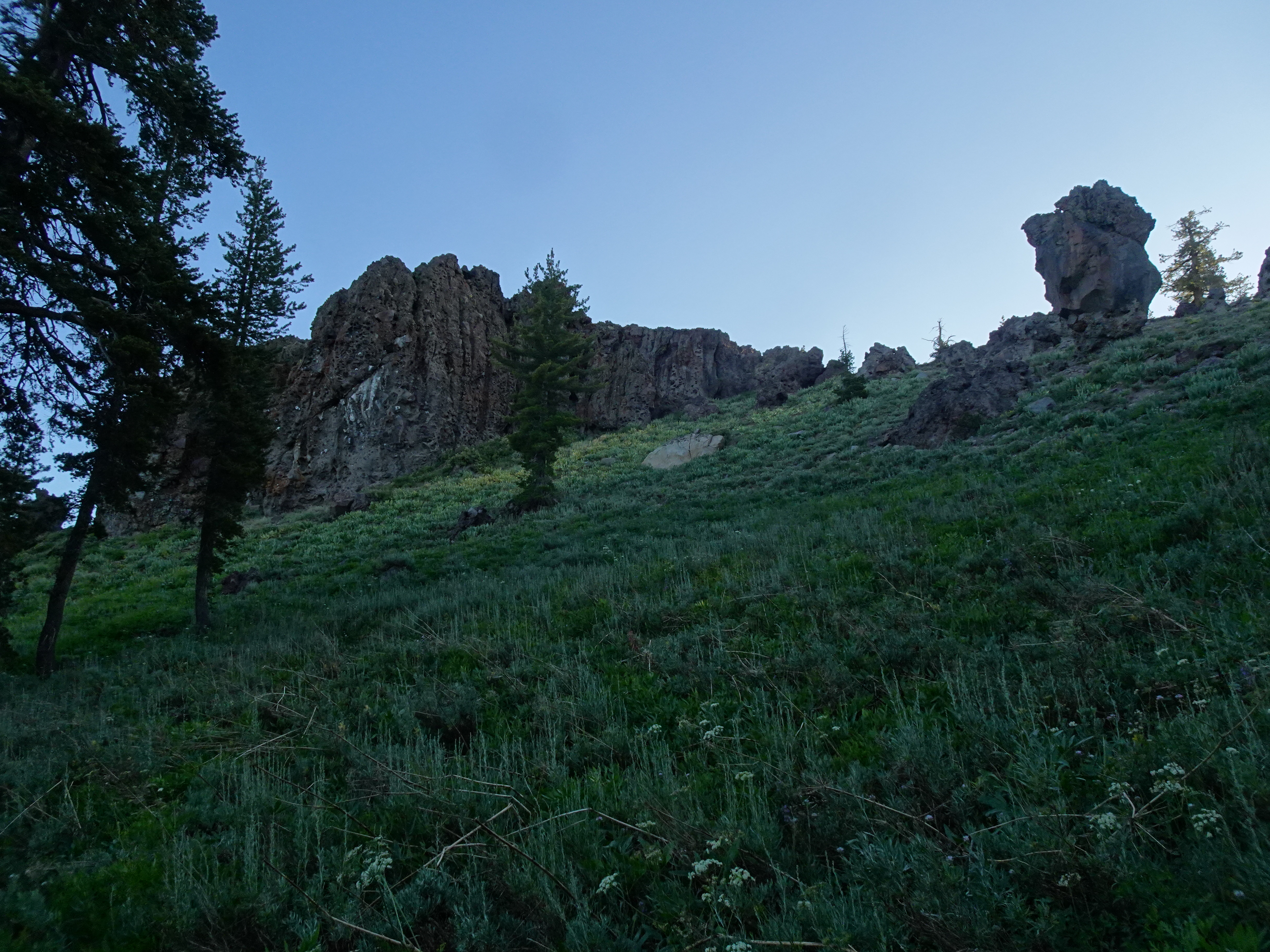
Approaching our destination, we missed the unmarked junction to Powell Lake, so we had to backtrack a bit to get there. We found a nice campsite, set up our tents, heard kids at a nearby campsite and saw other families.
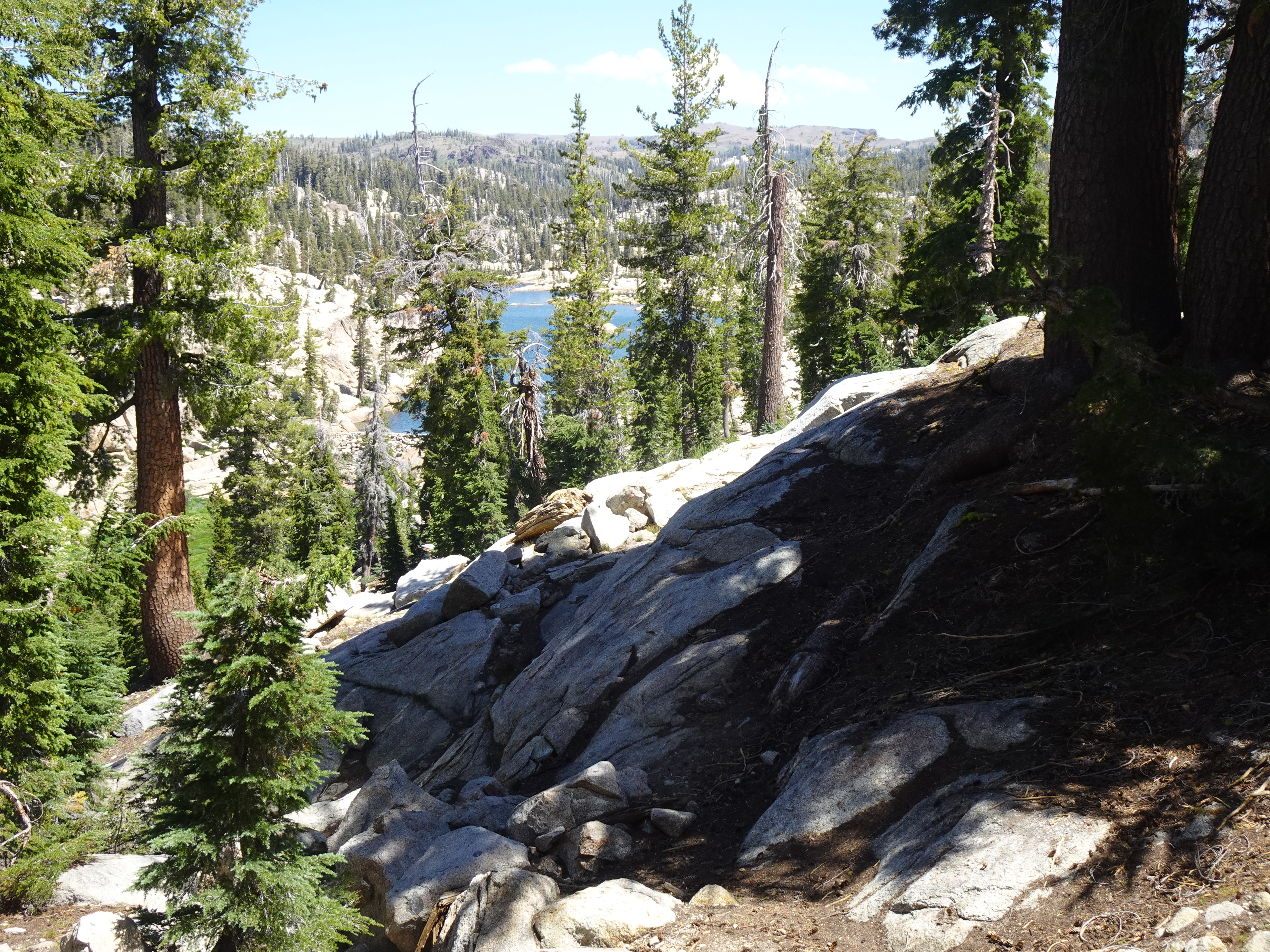
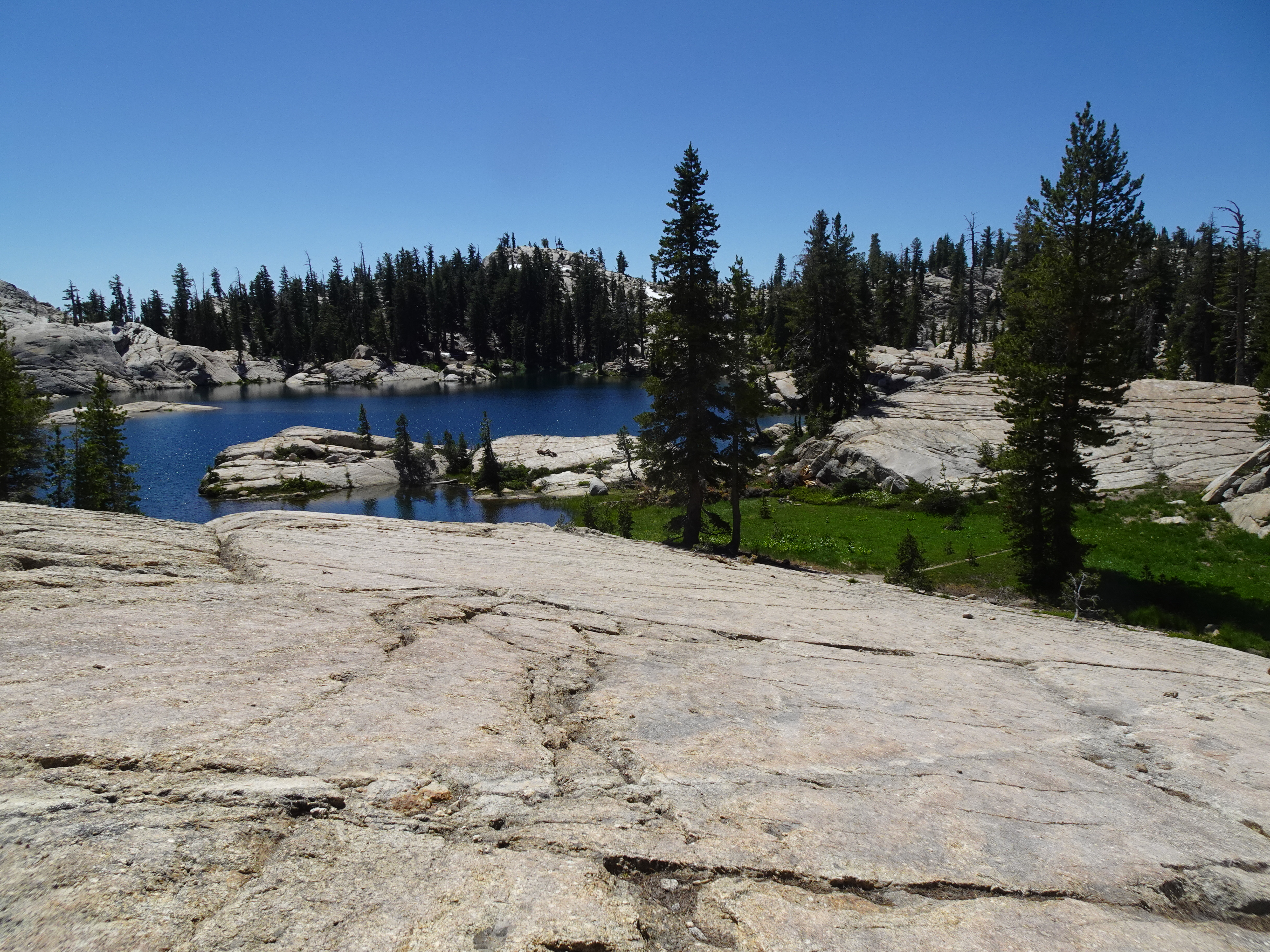
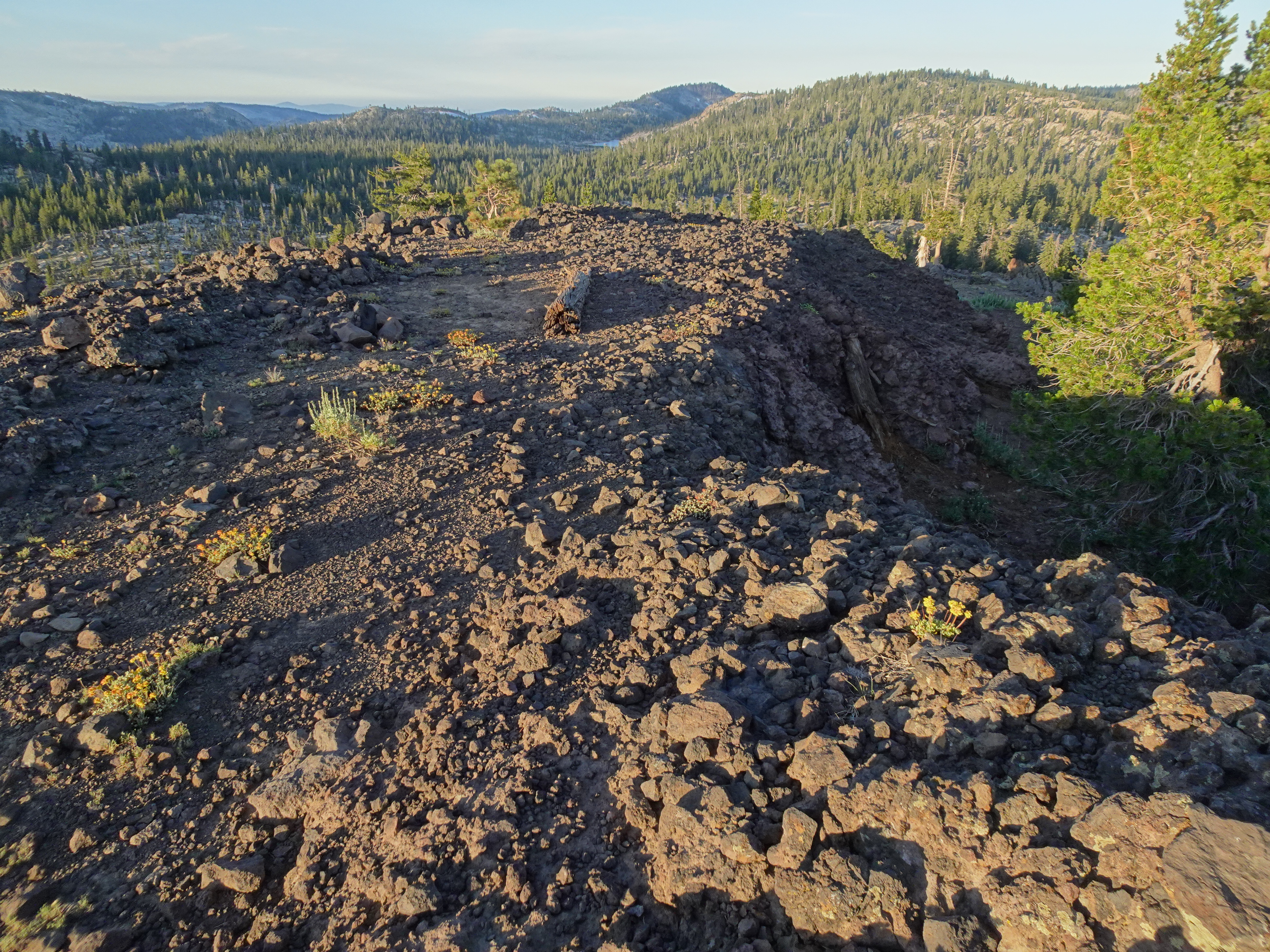
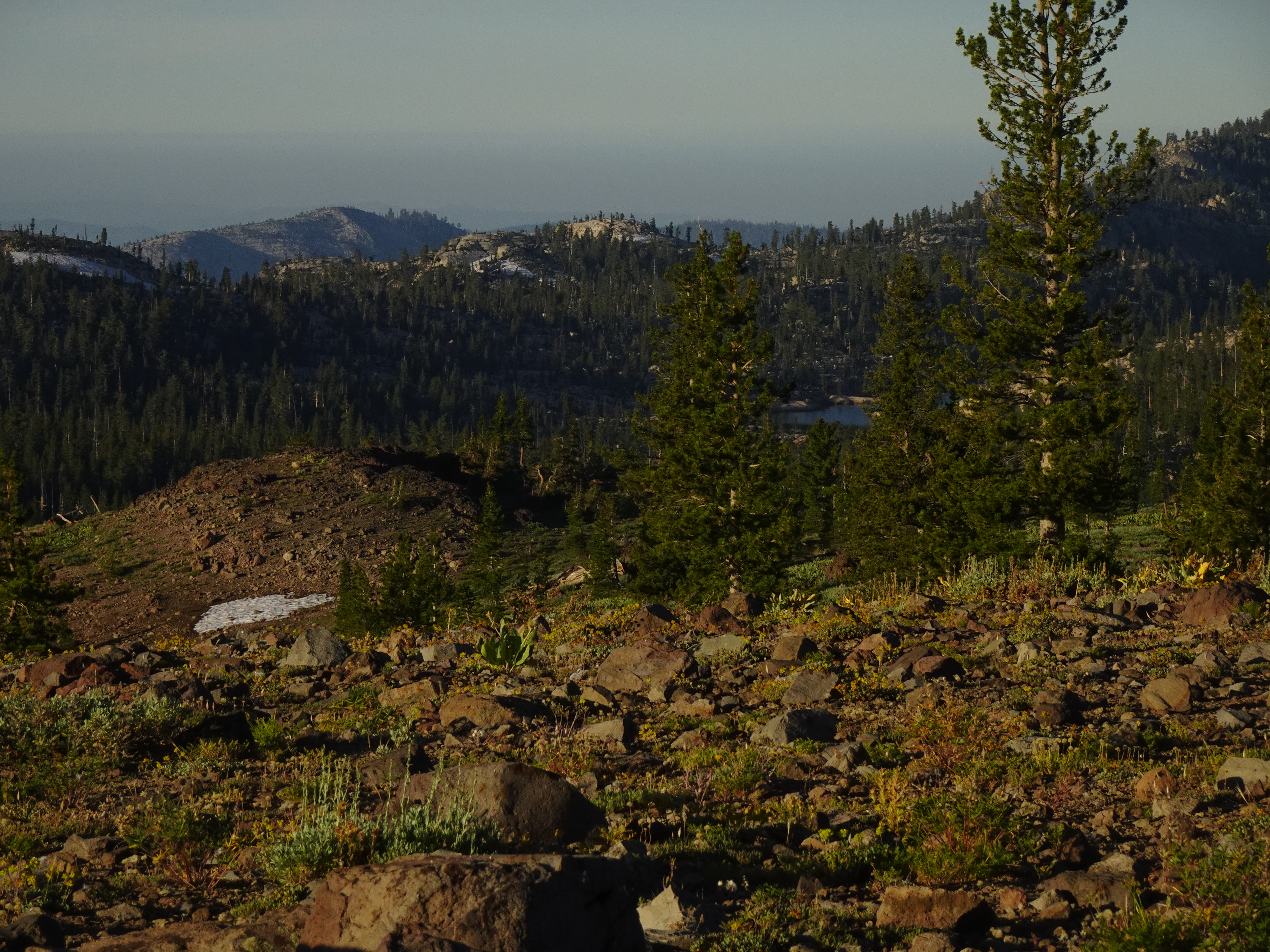
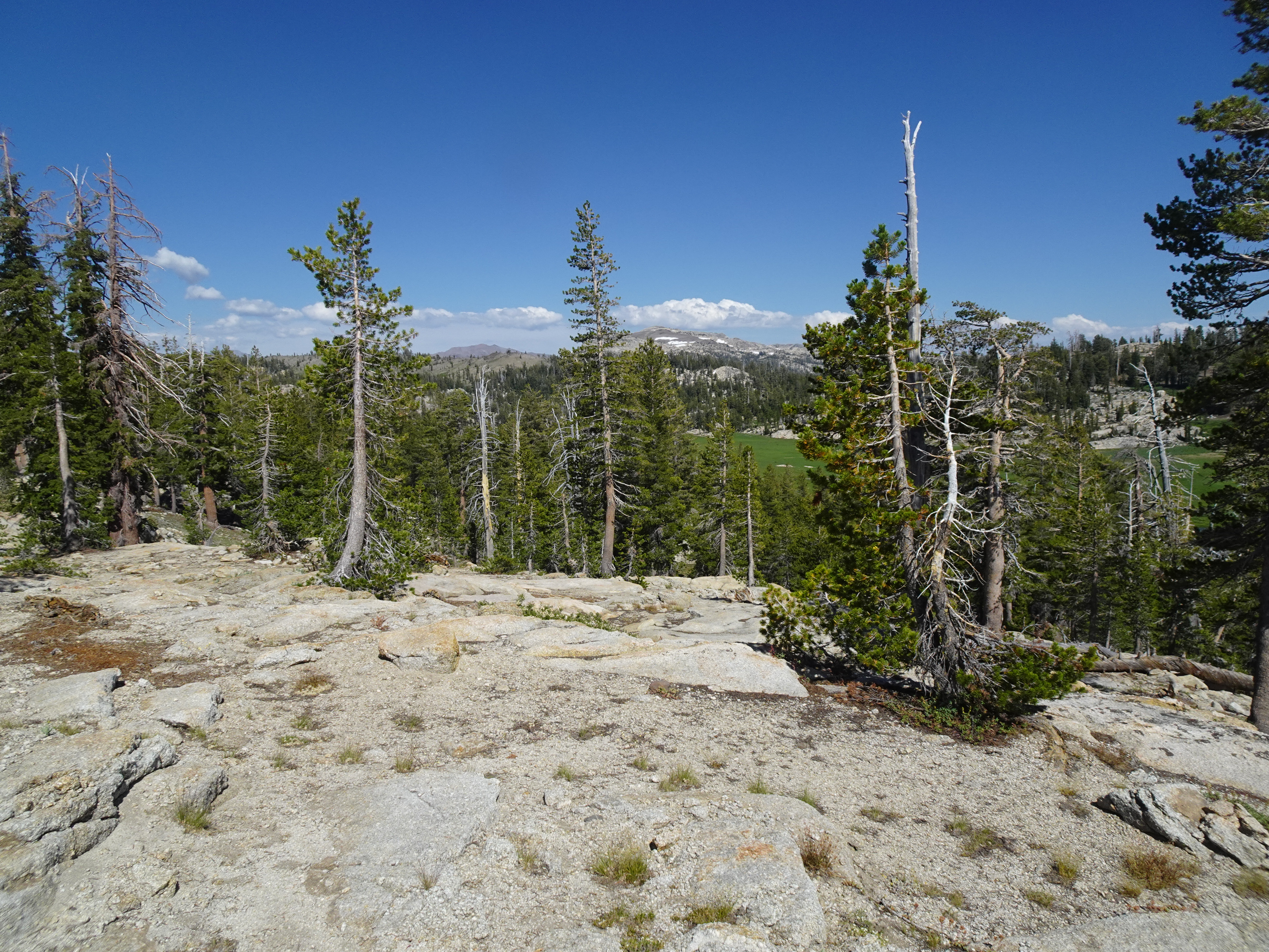
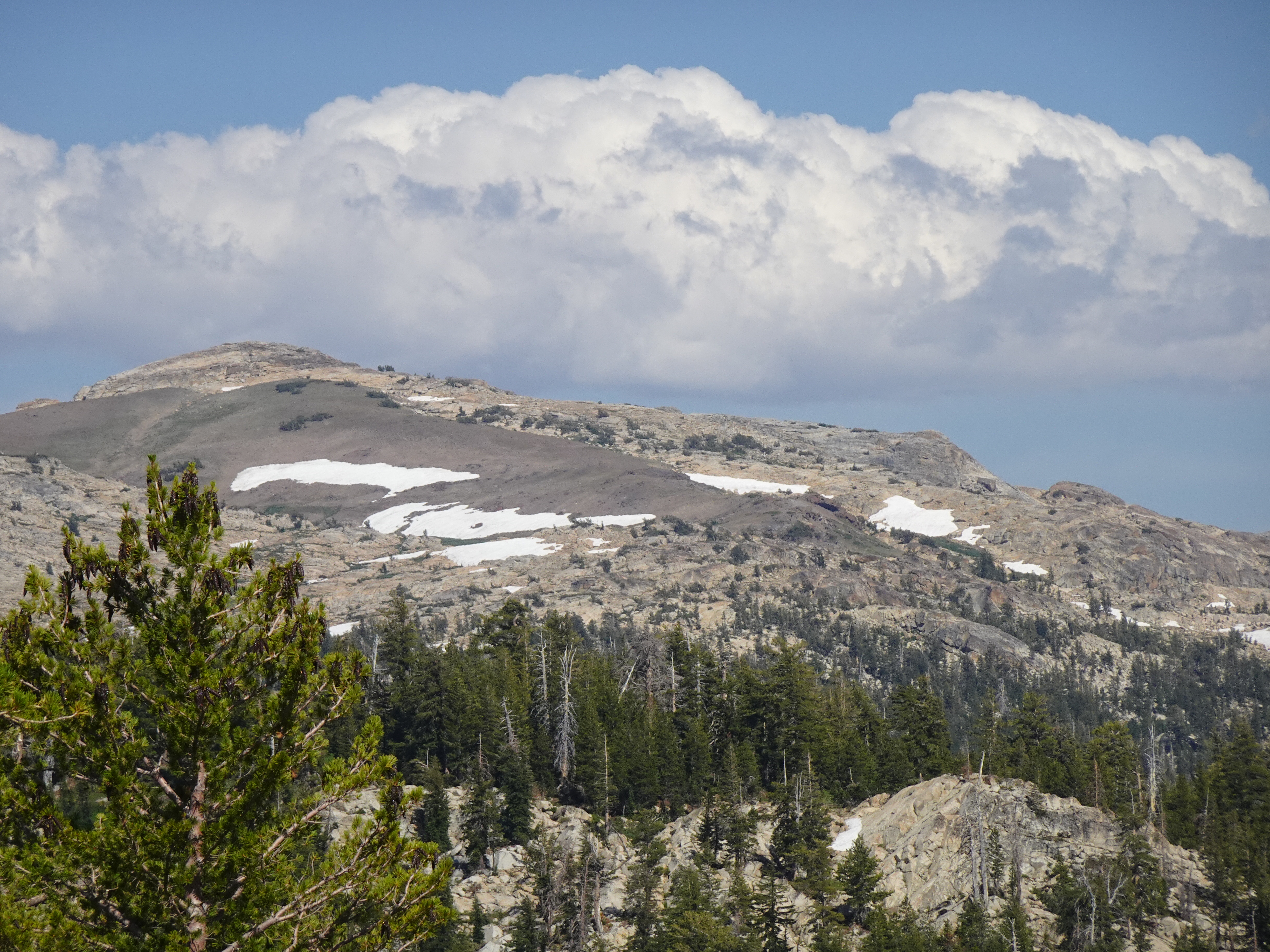
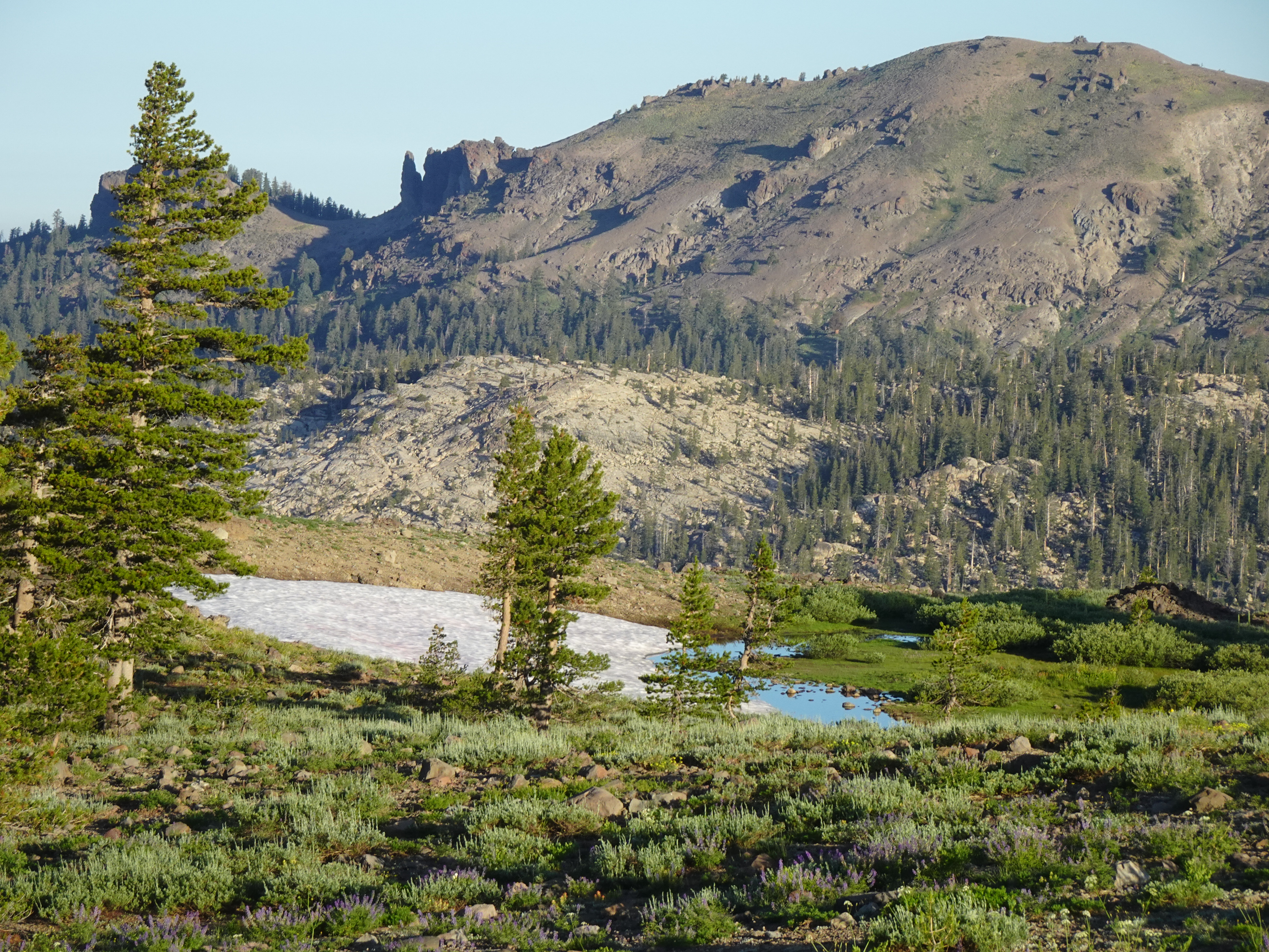
We then hiked up to a beautiful overlook seeing in the distance Castle Rock, Horse and Cow meadows, Ragged Peak.
 |
 |
We could also look down on a campsite near Powell Lake with several kids ("42" said one of the fathers present, we counted 4).
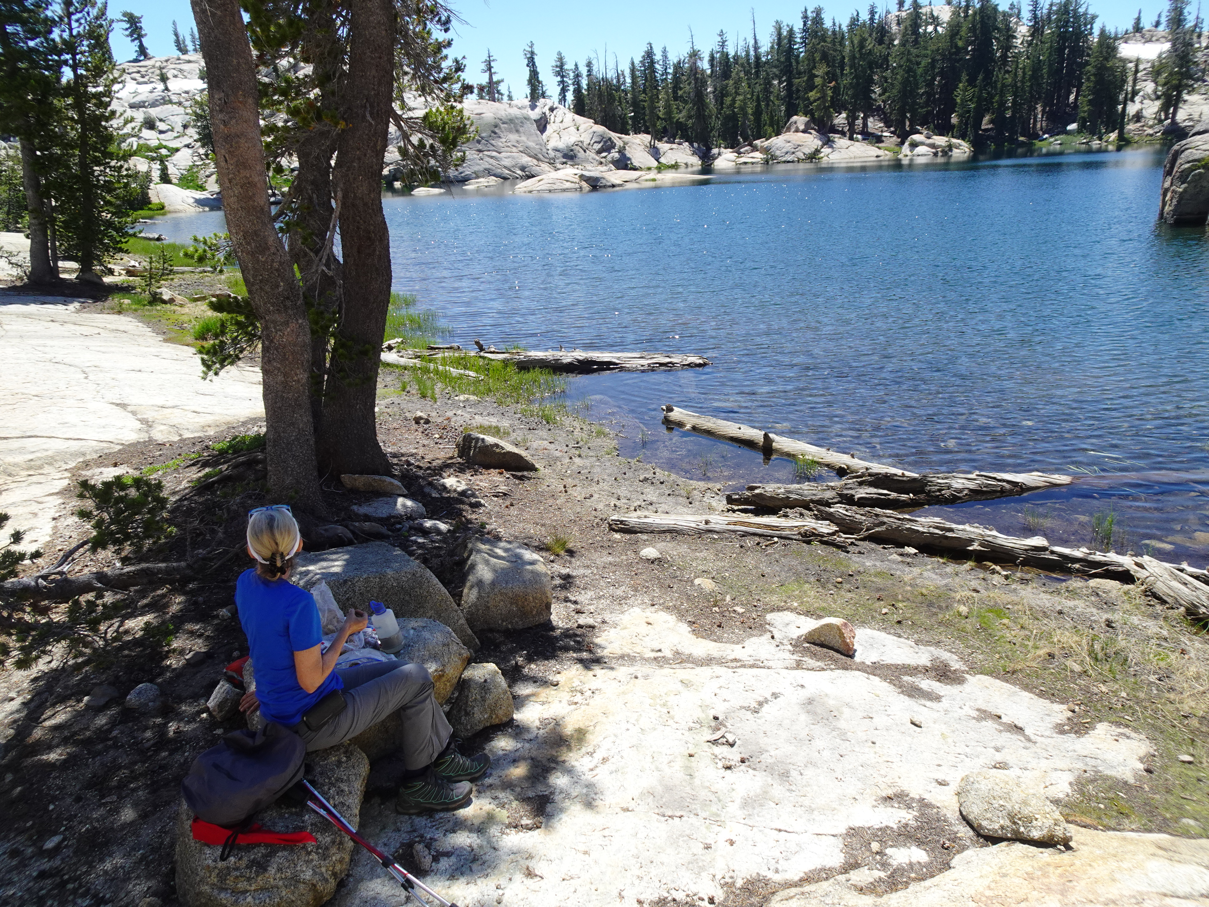
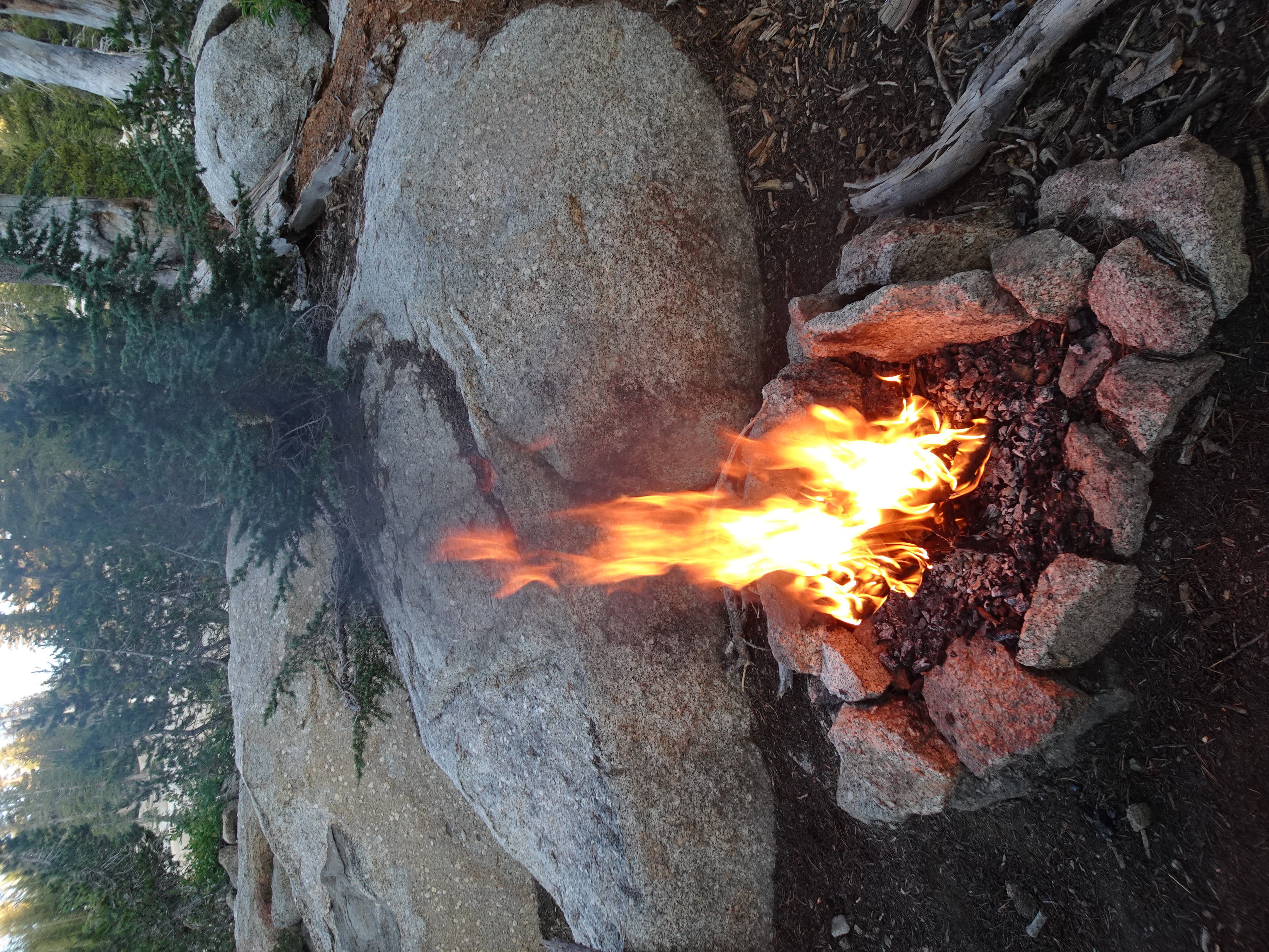
Jennifer prepared dinner (using the new, very large, very lightweight spoon shown below), Bob started a campfire and we had a pleasant evening to a good day. Although we doused the fire with water, in the morning it was still smoldering a bit, so we doused it some more.
 |
 |
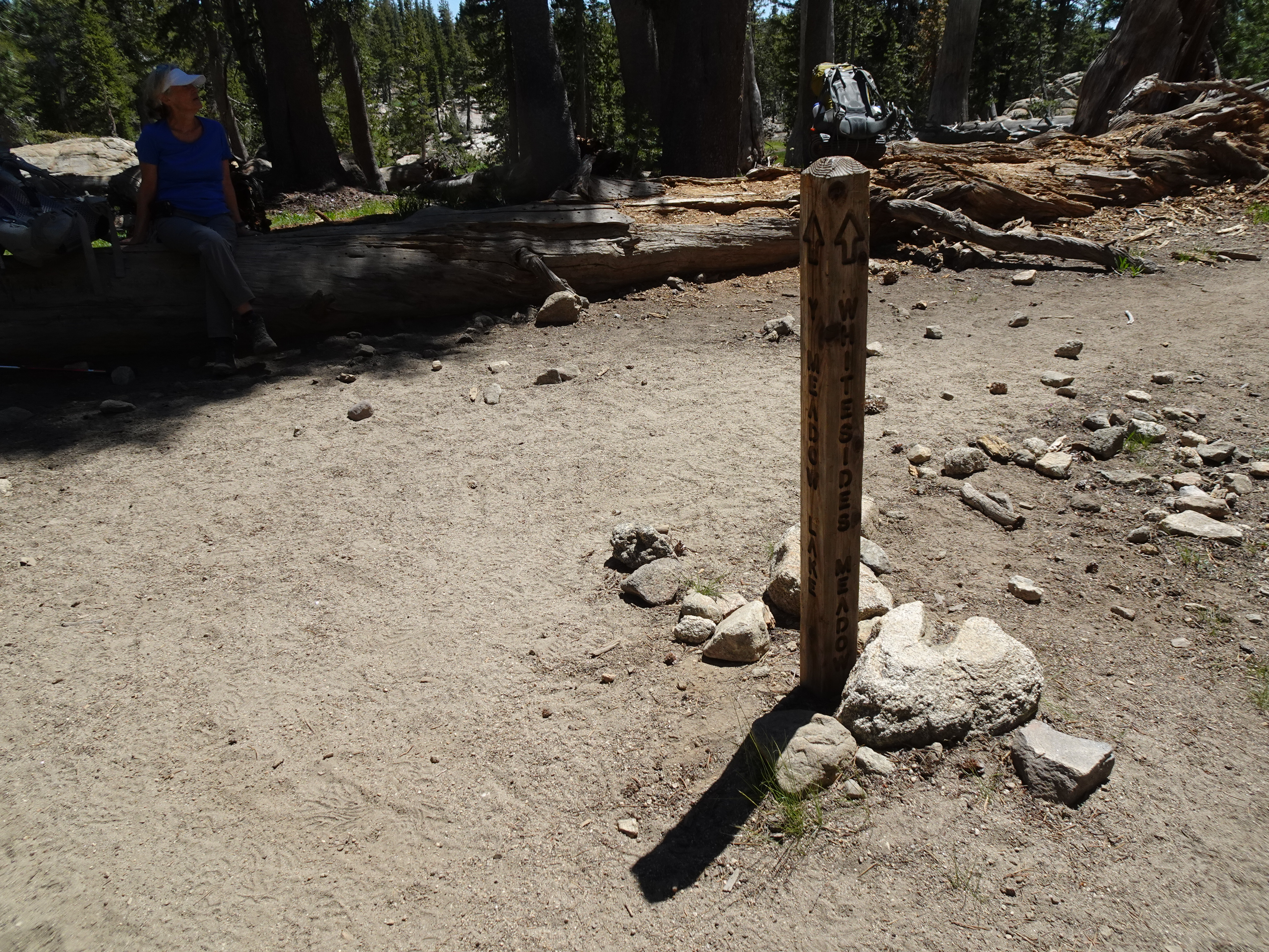
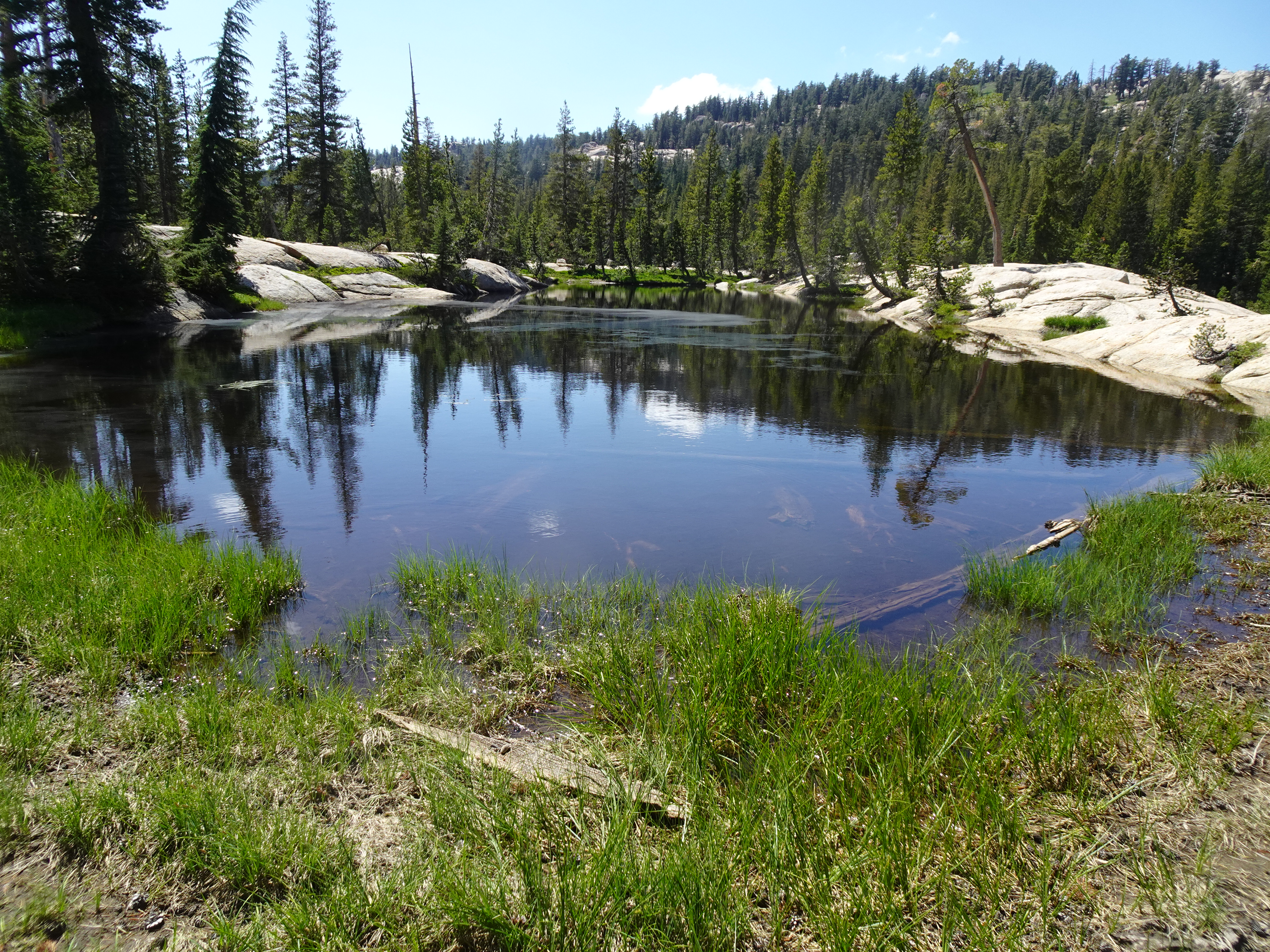
We backpacked from Powell Lake to a campsite along a stream just below Whitesides Meadow.
Videos:
Map of backpack from Powell Lake to near Whitesides Meadow Elevation Profile (Solid yellow line):
 |
Backpack from Powell Lake to near Whitesides Meadow Elevation Profile (understates distance) - Powell Lake to Creek near Whitesides Meadows 4 mi:
 |
Dinner: Tom Yum Tuna (a lot of food)
Diary:
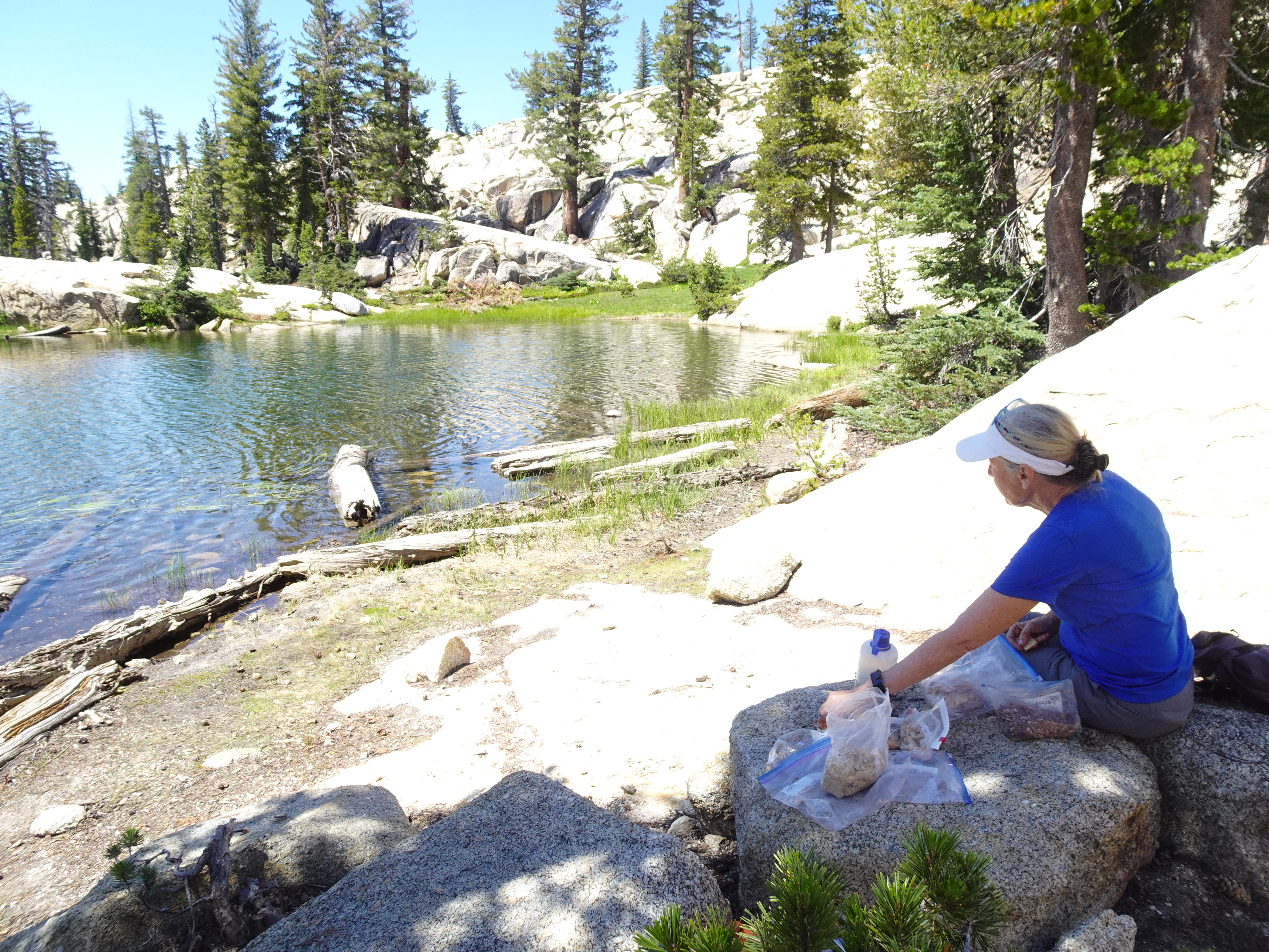
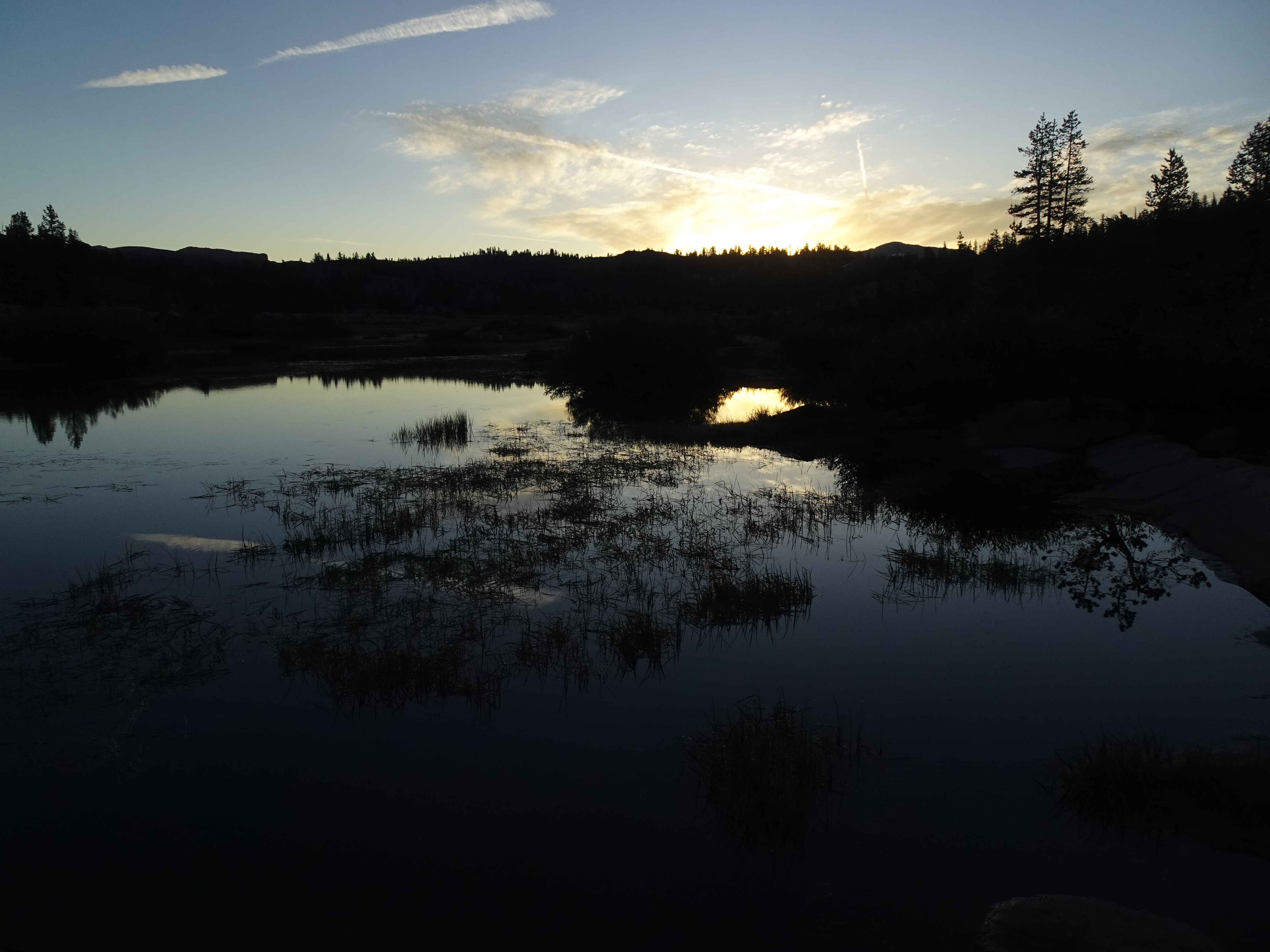
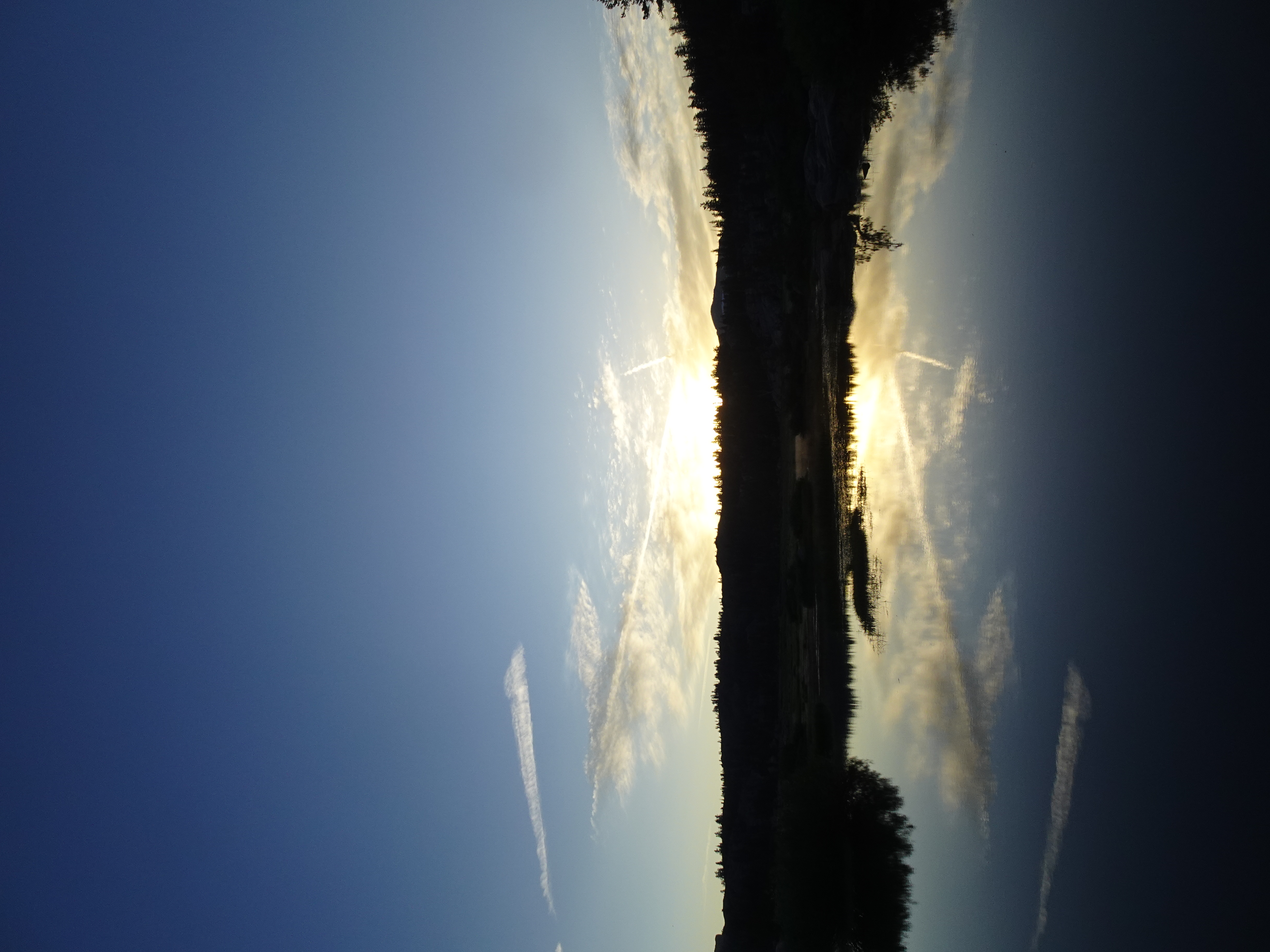
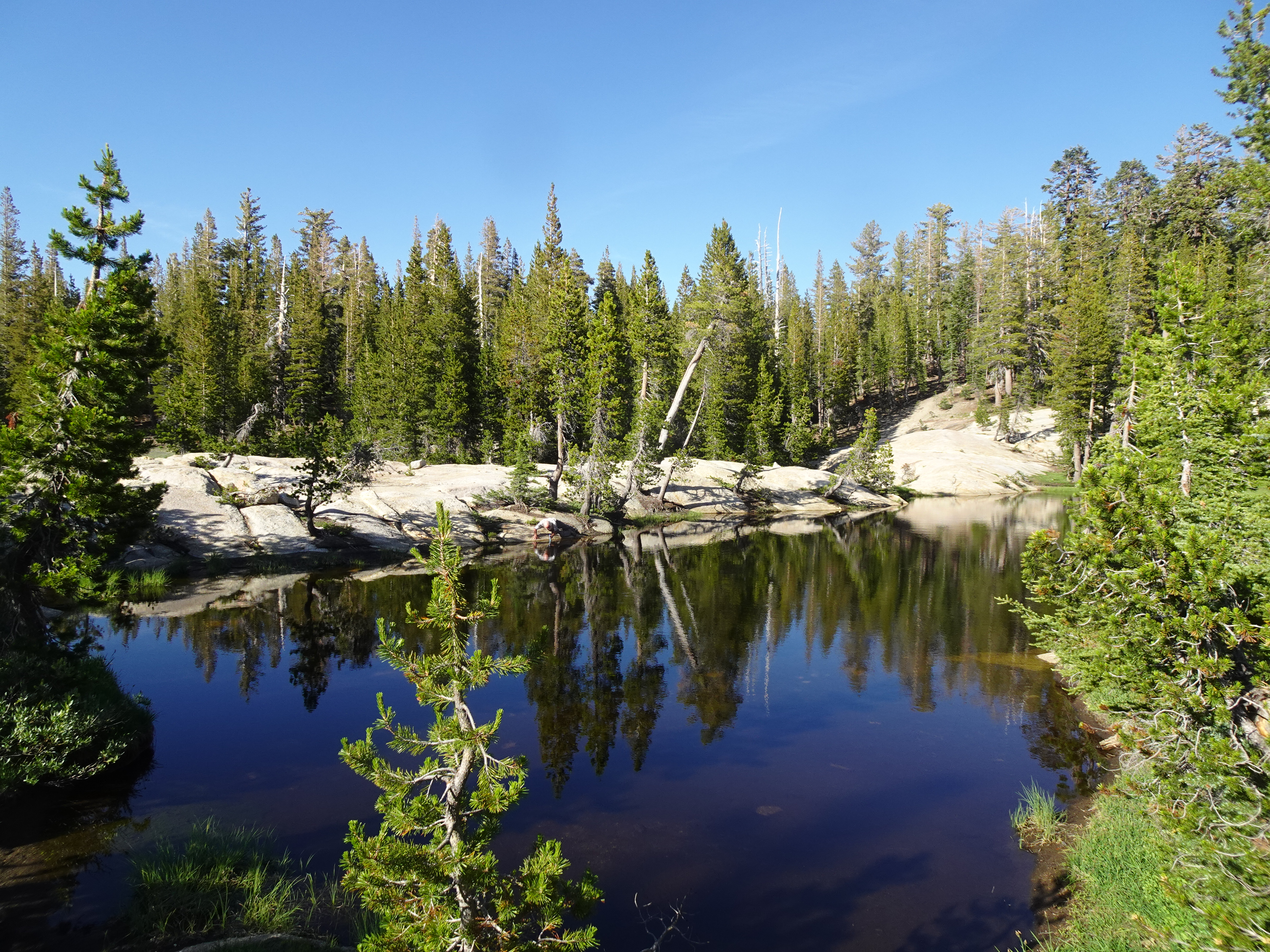
In the morning around 8 am Bob takes a couple of pictures of the lake from diffent angles.
 |
 |
We backpacked from Powell Lake to a campsite along a stream just before Whitesides Meadow.
 |
|
 |
 |
 |
 |
 |
 |
 |
 |
We stepped aside for a mule train at one point, then a few minutes later arrived at the junction to Y Meadows Lake where we would be turning left away from the lake. We rested there and talked with a guy from Massachusetts, who recommended the campsite along the stream just before Whitesides Meadow.
 |
 |
We continued our hike, taking his advice, getting off the path at one point to let more mules carrying supplies to folks at Toe Jam Lake get by. As we hiked, we passed several young people who were backpacking for just a night or two over the weekend. Most of the people we met were from the San Francisco Bay area.
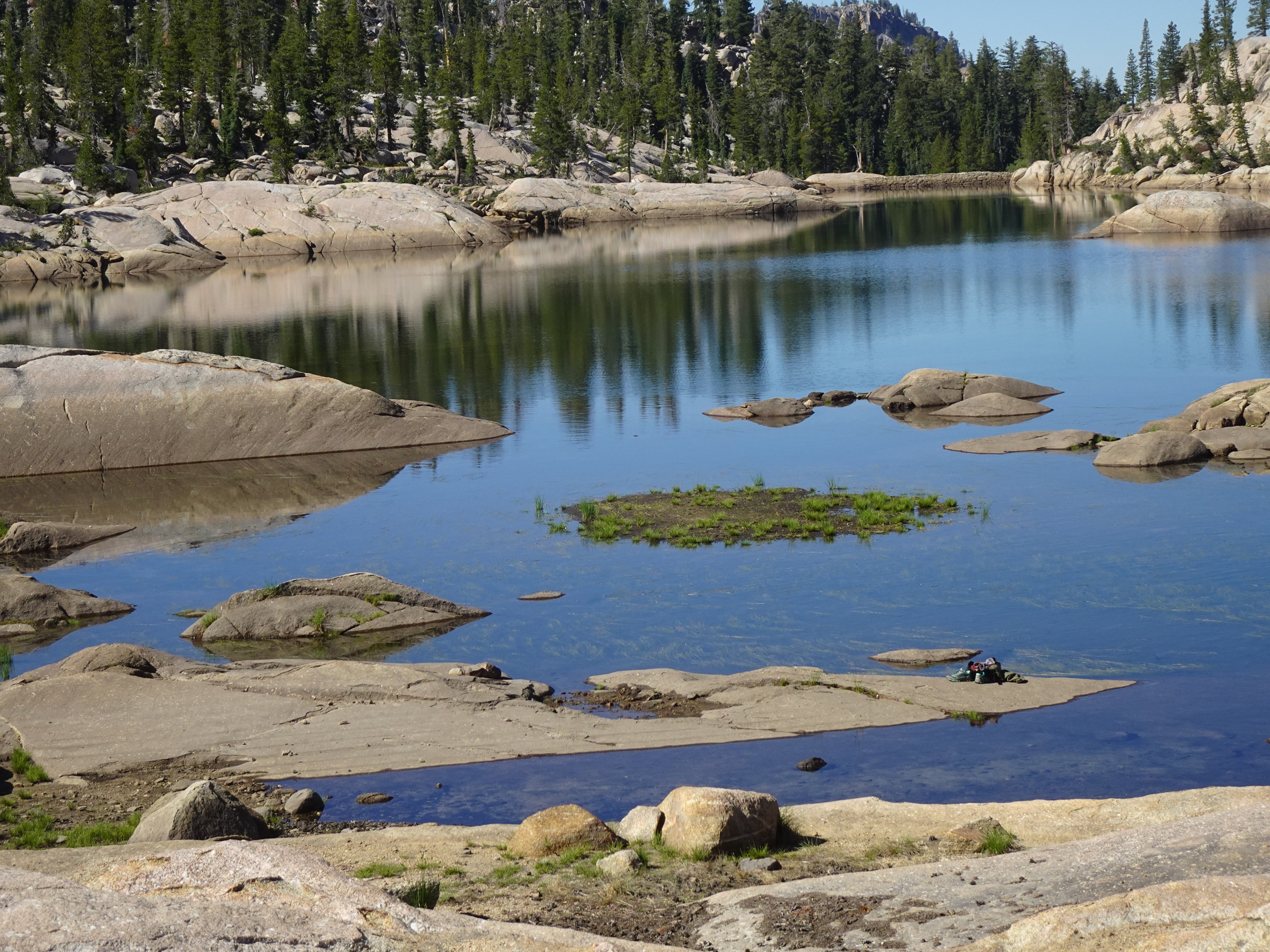
When we arrived at the campsites along the stream just before Whitesides Meadow we met a couple who were waiting for their daughter who worked for the California Conservation Corp (CCC), who maintain the trails we all use in California.
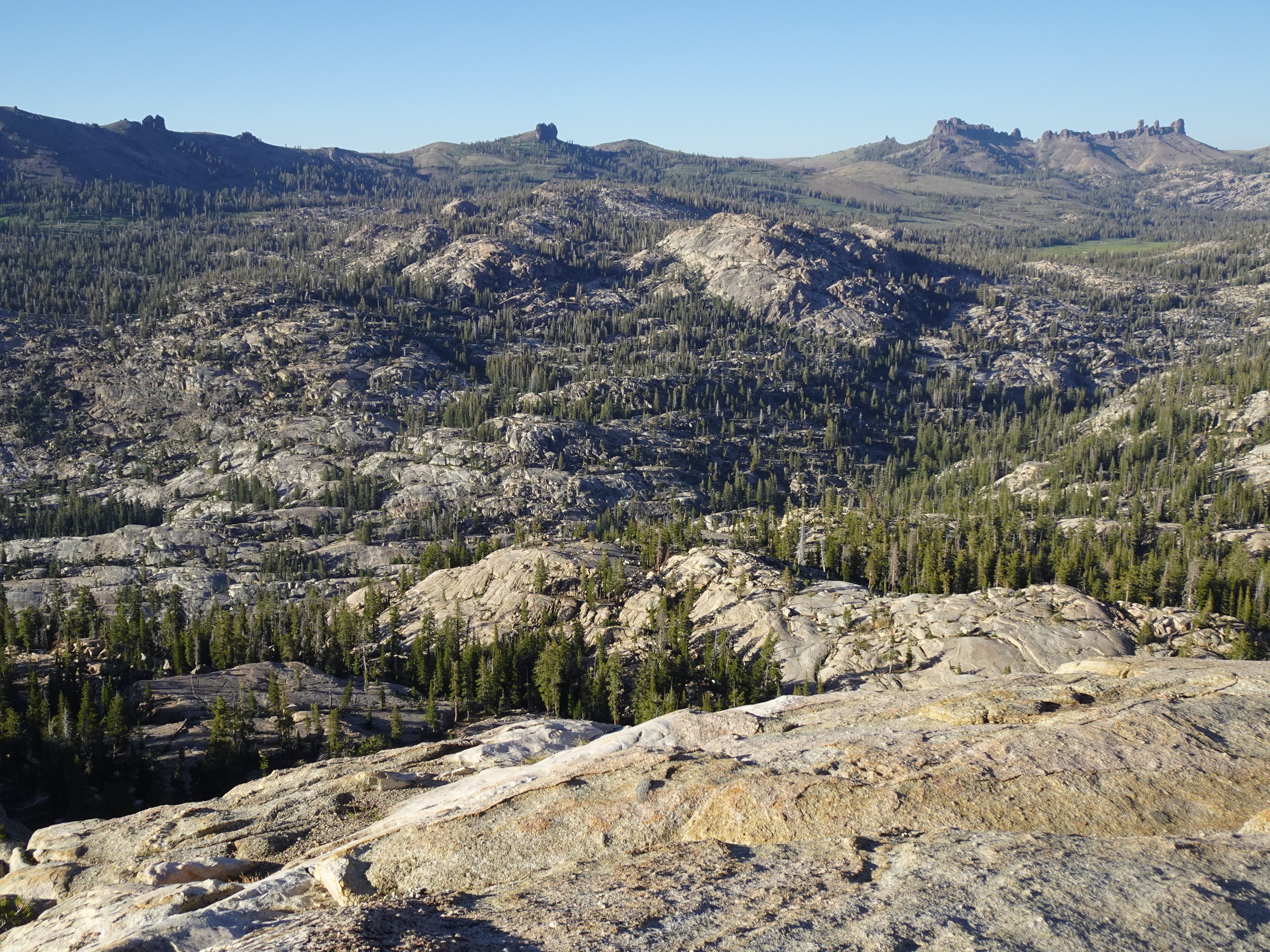
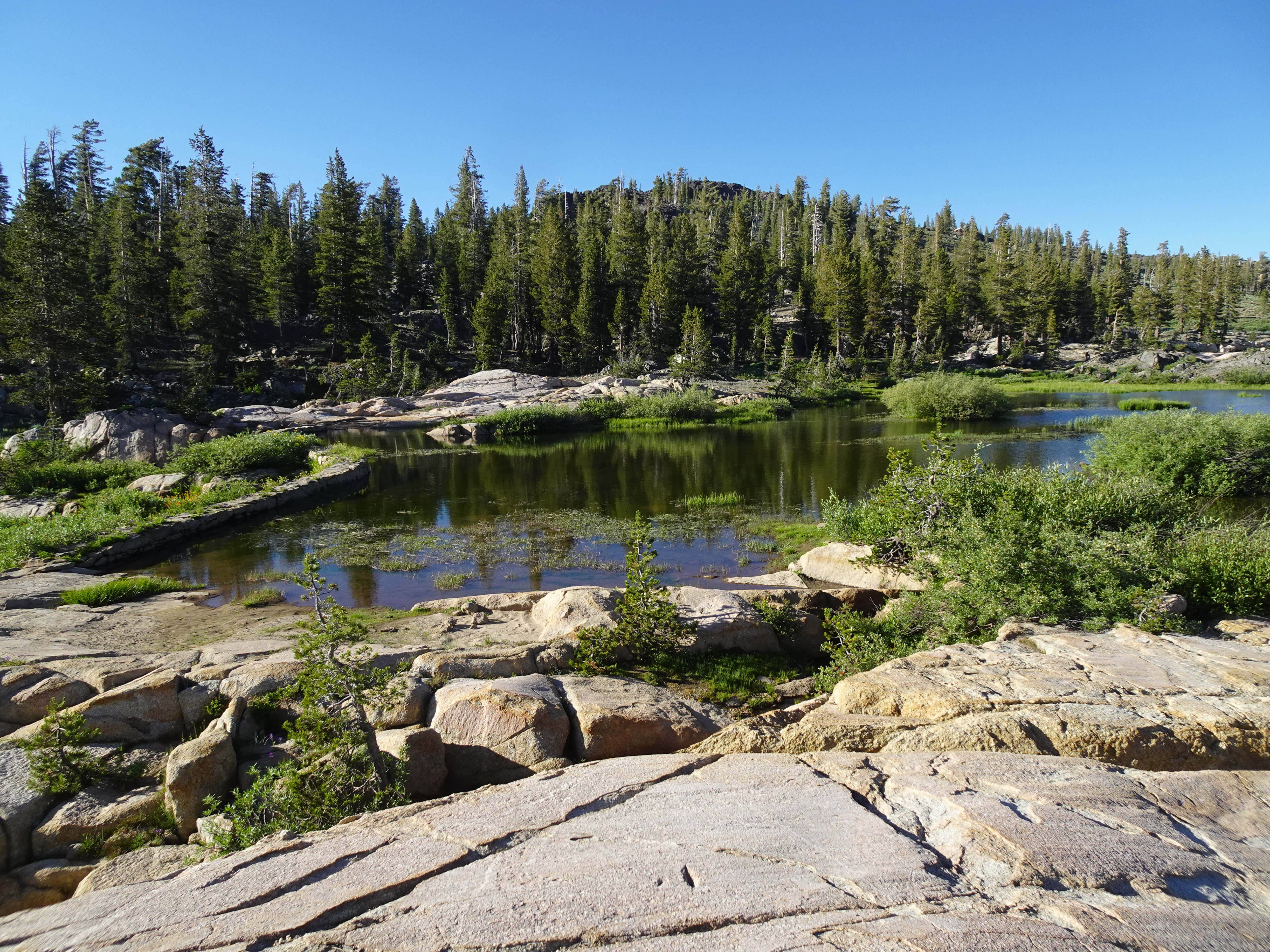
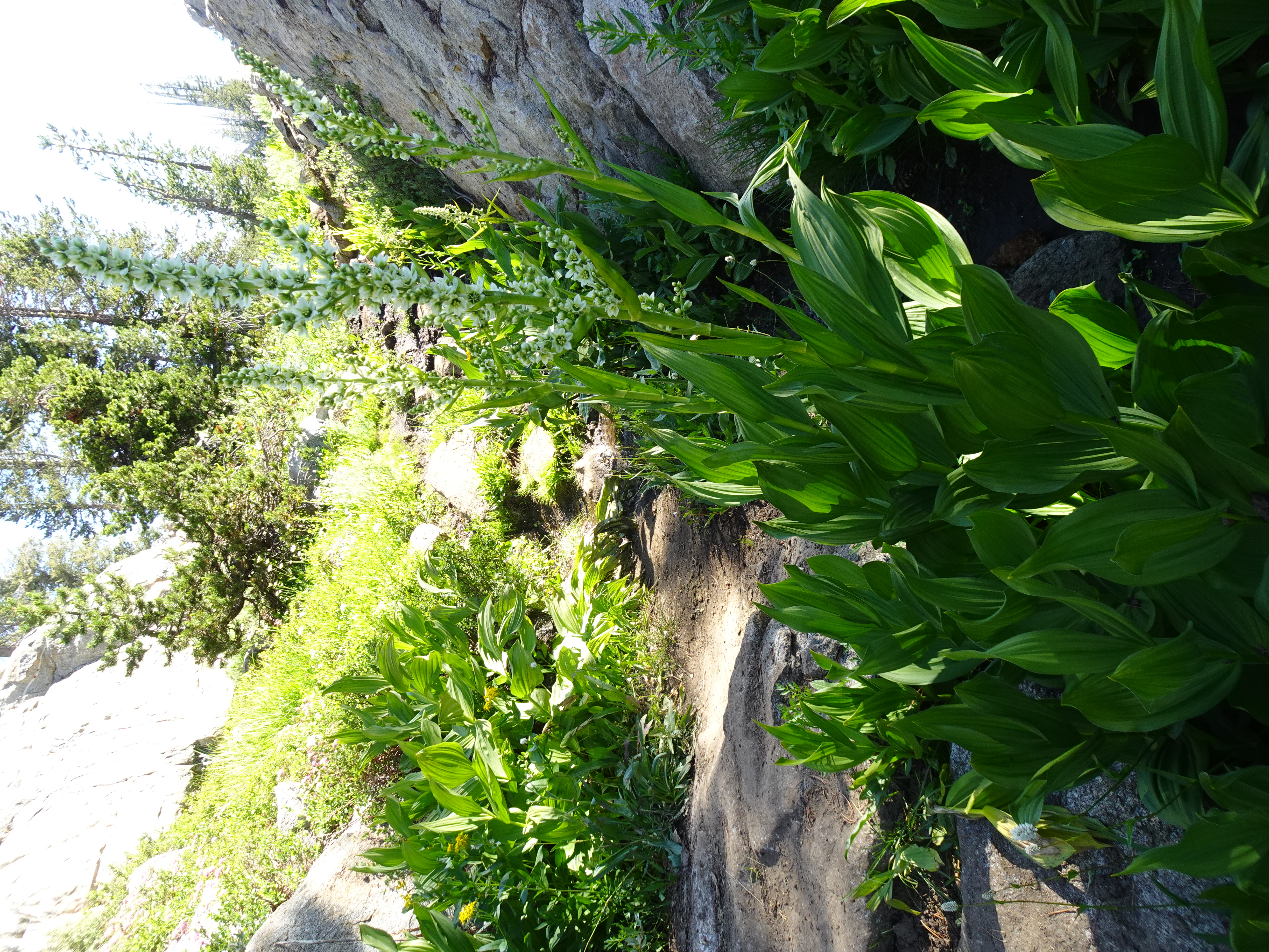
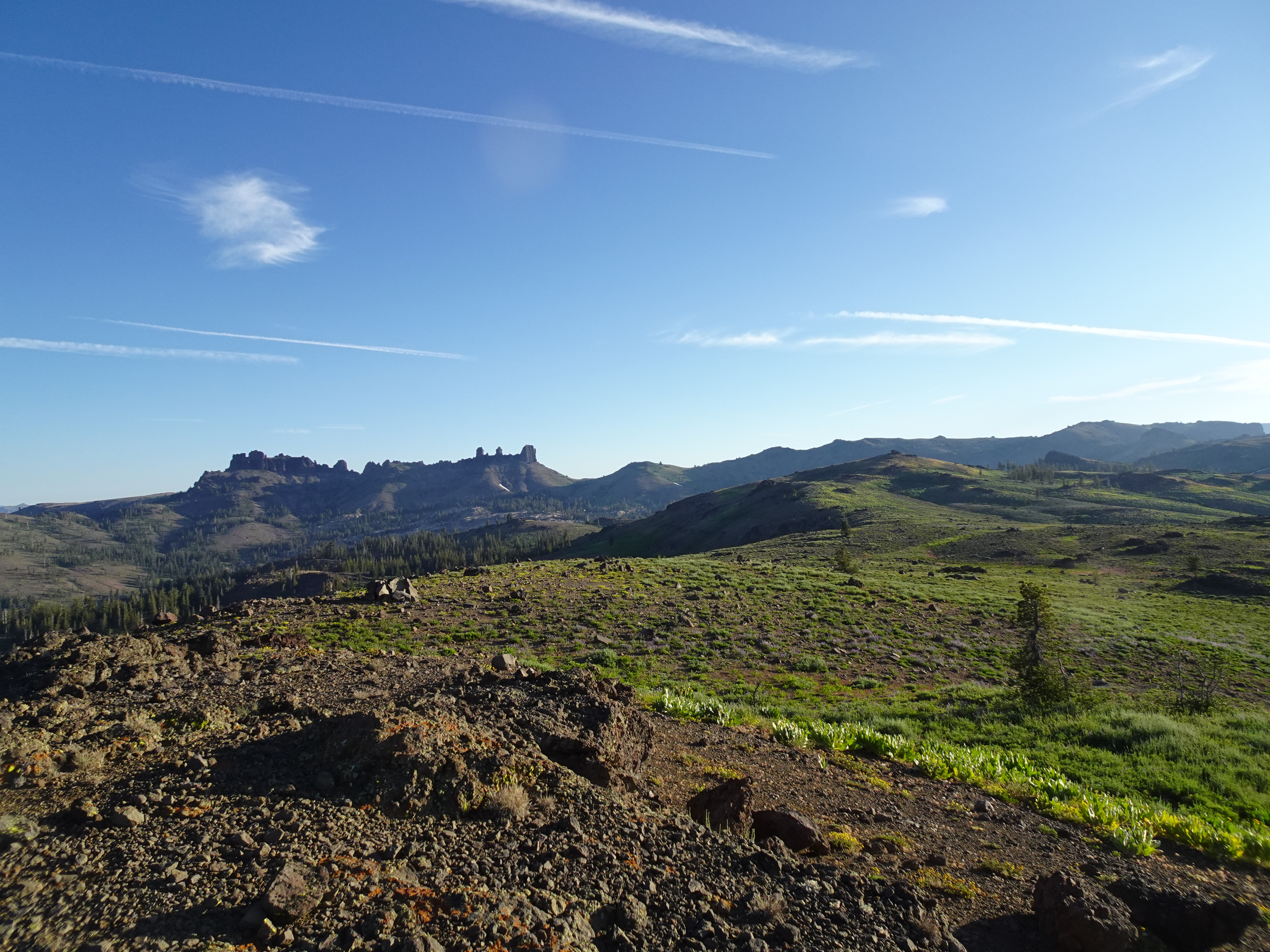
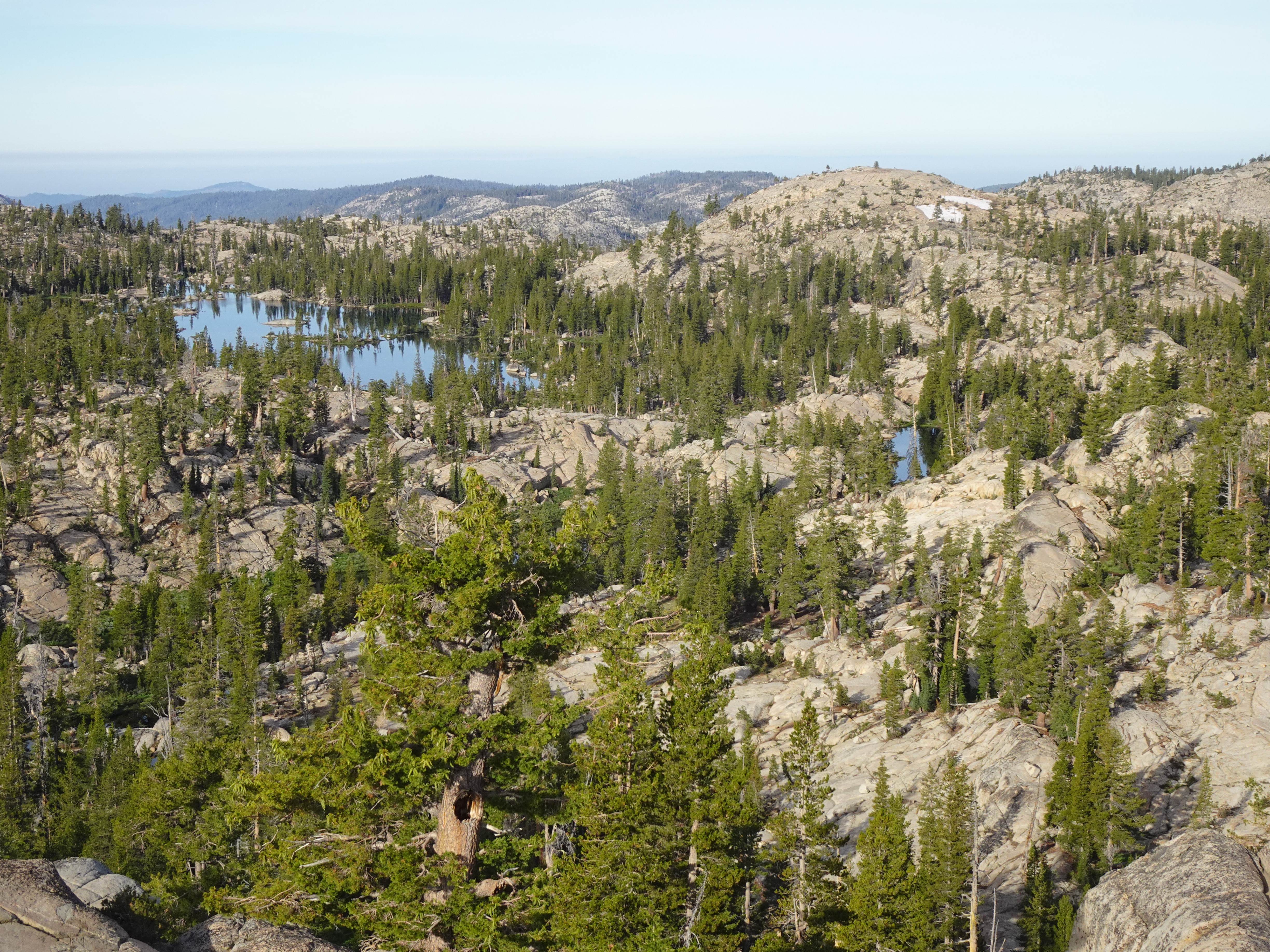
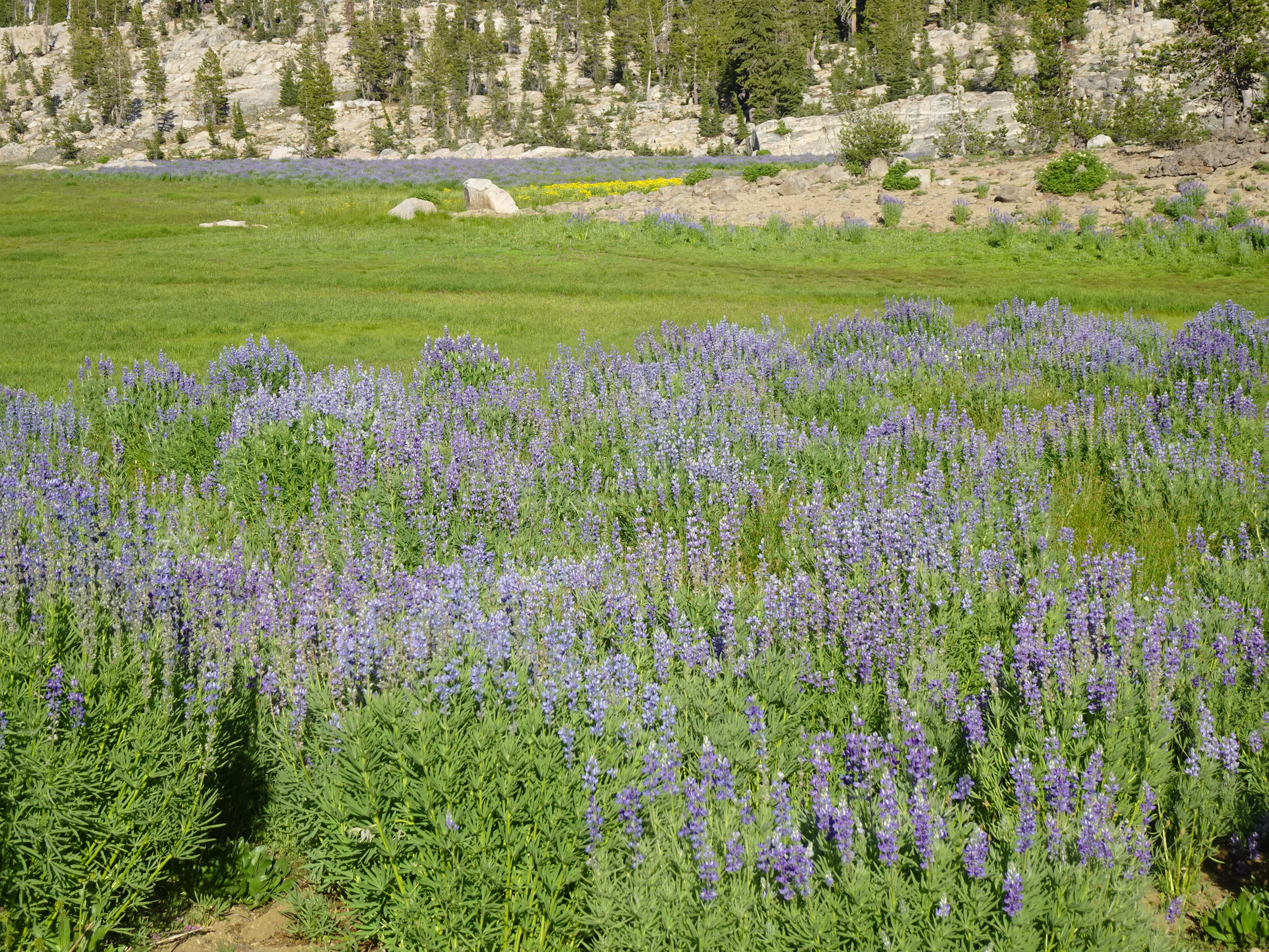
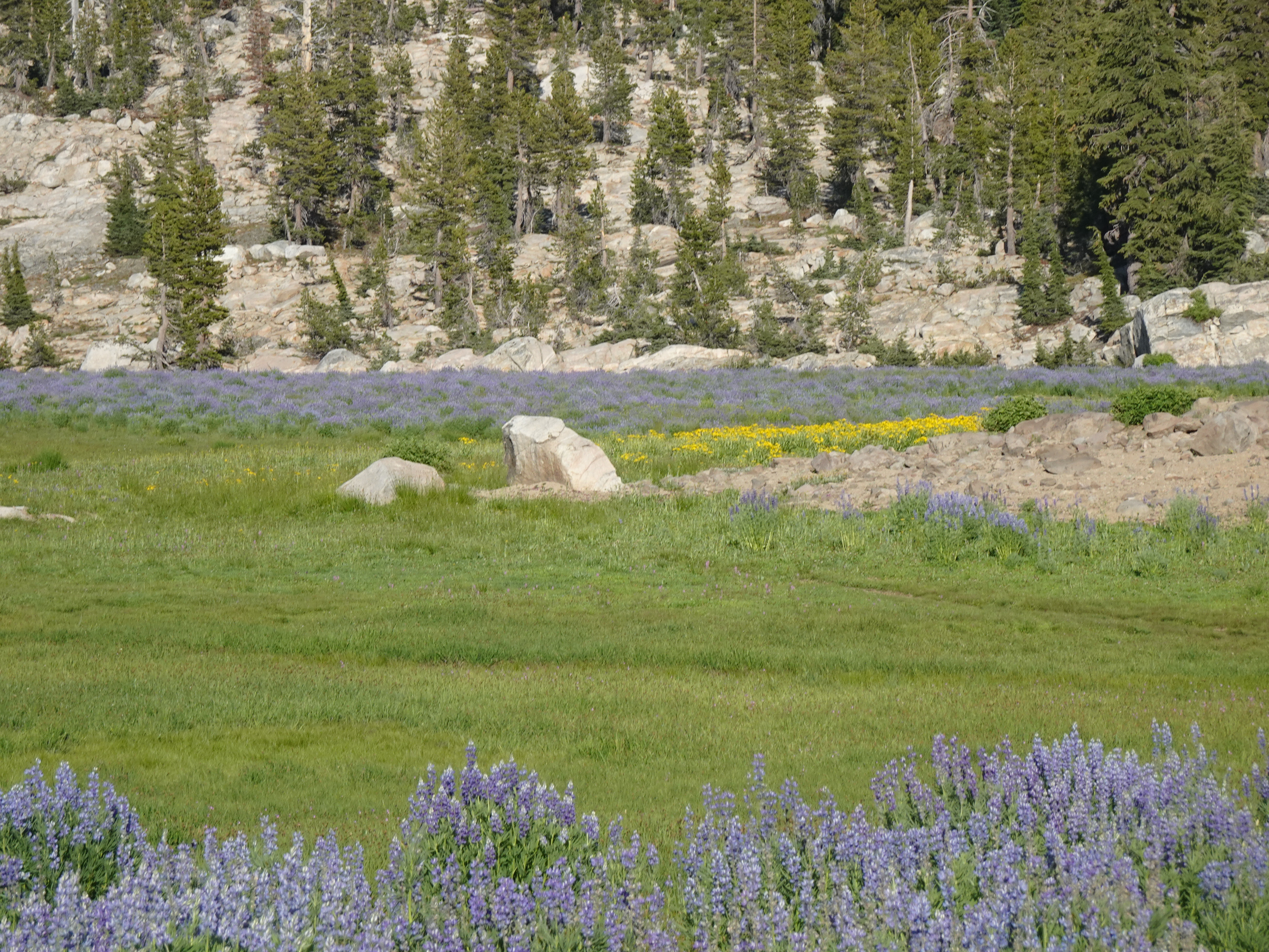
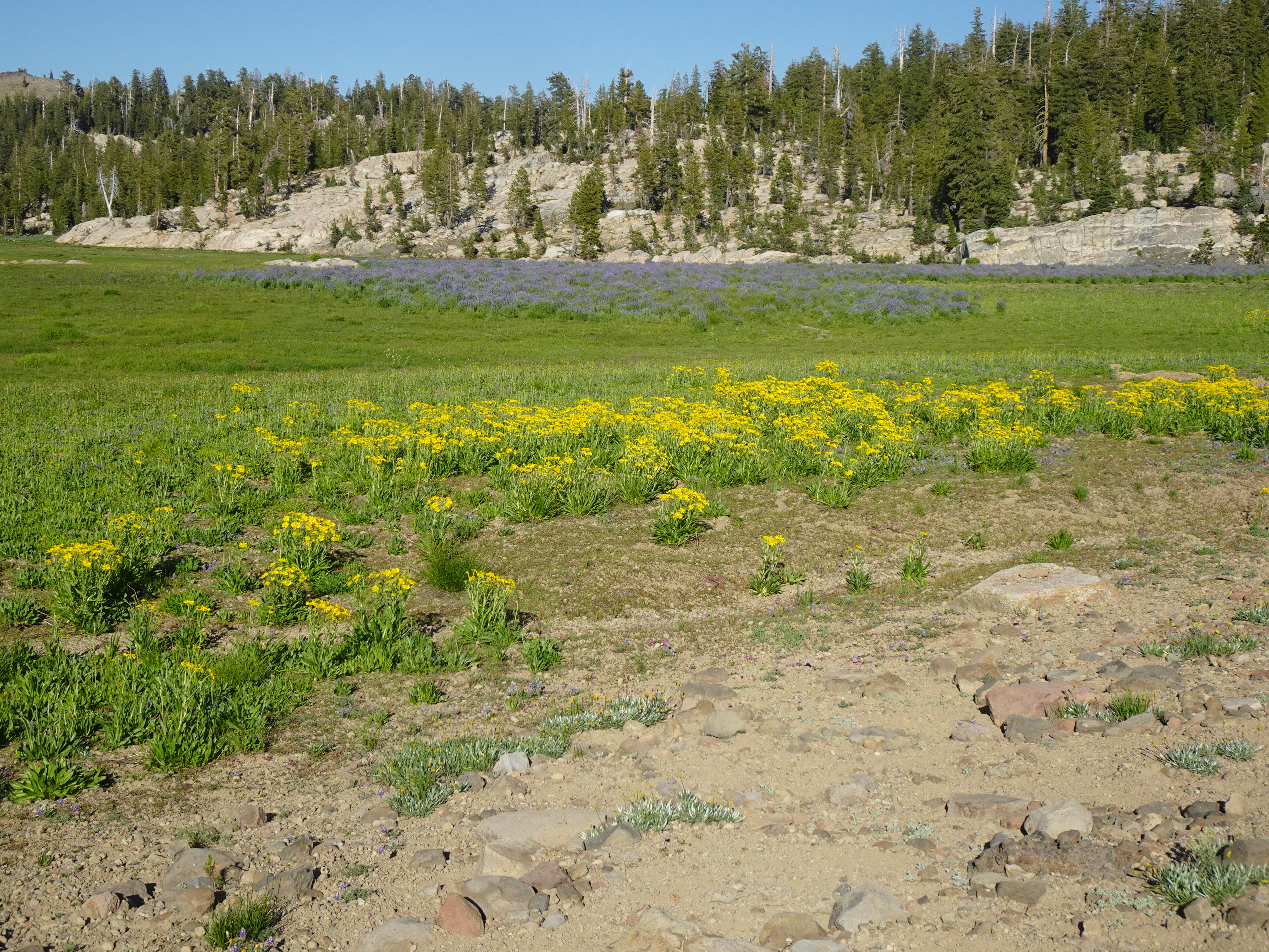
After setting up camp, Bob hikes up to a ridge just behind our campsite which of course has beautiful views both of the Meadow and of a valley on the other side of the ridge. We also walk up to the meadow itself, where a dam allows a reservoir to form and support the meadow.
 |
 |
 |
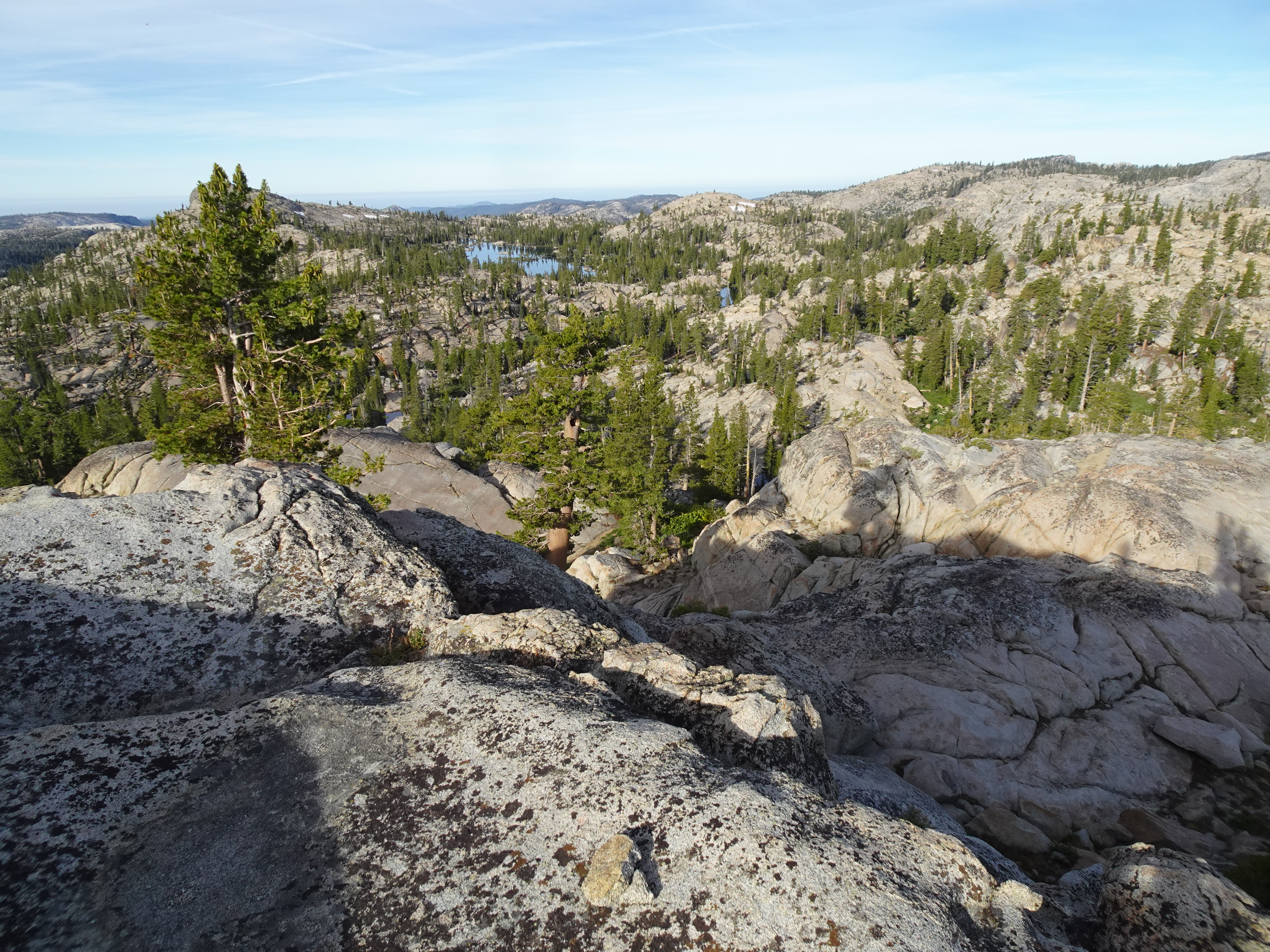
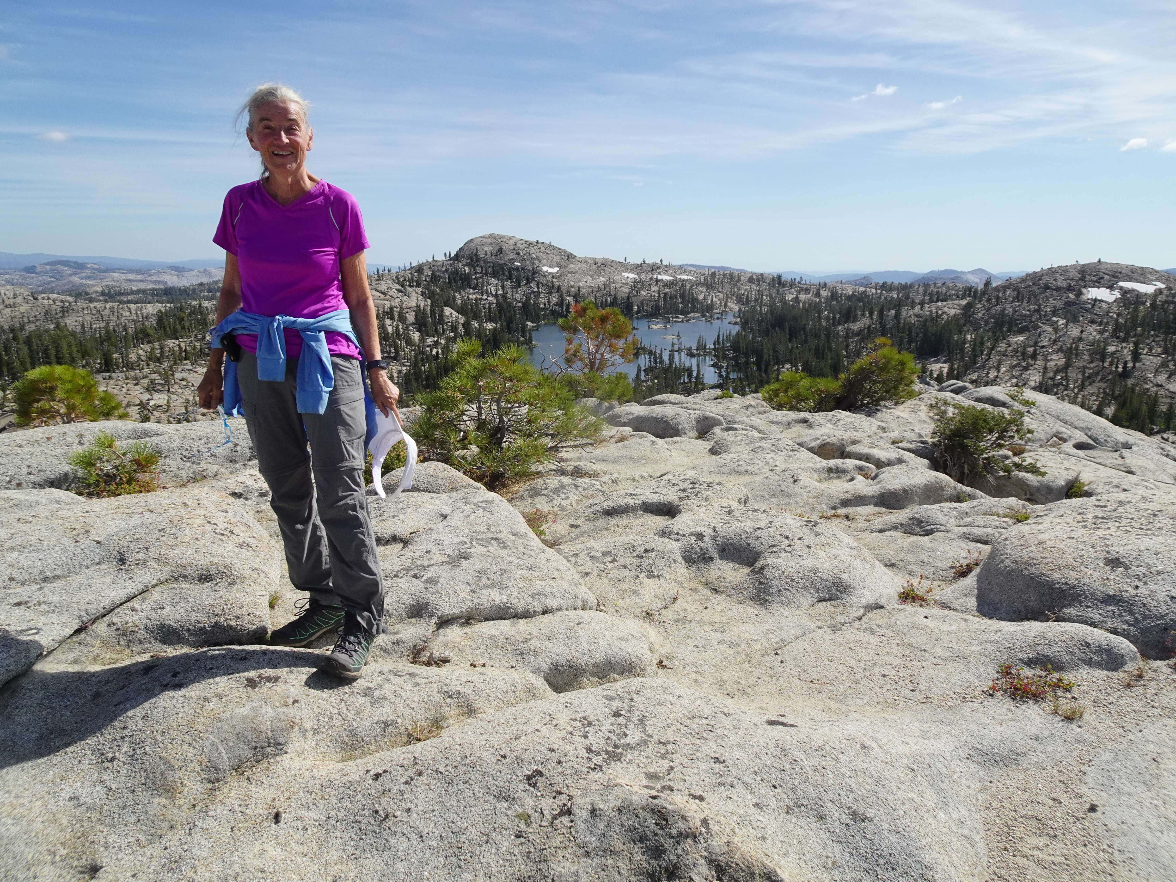
After Bob took and early morning hike to the ridge behind our camp, getting the photo below of Whitesides Meadow, we day hiked to Granite Lake and back, spending time at Y Meadow Lake watching 2 couples swimming with two dogs.
 |
Videos:
Map of day hike to Granite Lake and back (red dotted line):
 |
Day Hike Elevation Profile (understates distance):
 |
Dinner: Lasagna and kale.
Diary:
In the morning, Bob again hiked up to the ridge behind our campsite, then returned. After breakfast, around 9 AM, we began day hiking down to Y Meadows Lake on the way to Granite Lake.
 |
|
 |
 |
 |
Once there, we sat for about a half hour watching two couples with their two dogs swimming in Y Lake. One of the dogs clearly enjoyed swimming in the lake, while the other refused to get in much above his ankles.
 |
After watching them for a while, we continued around the lake to its dam, where a stream flowed out.
 |
 |
 |
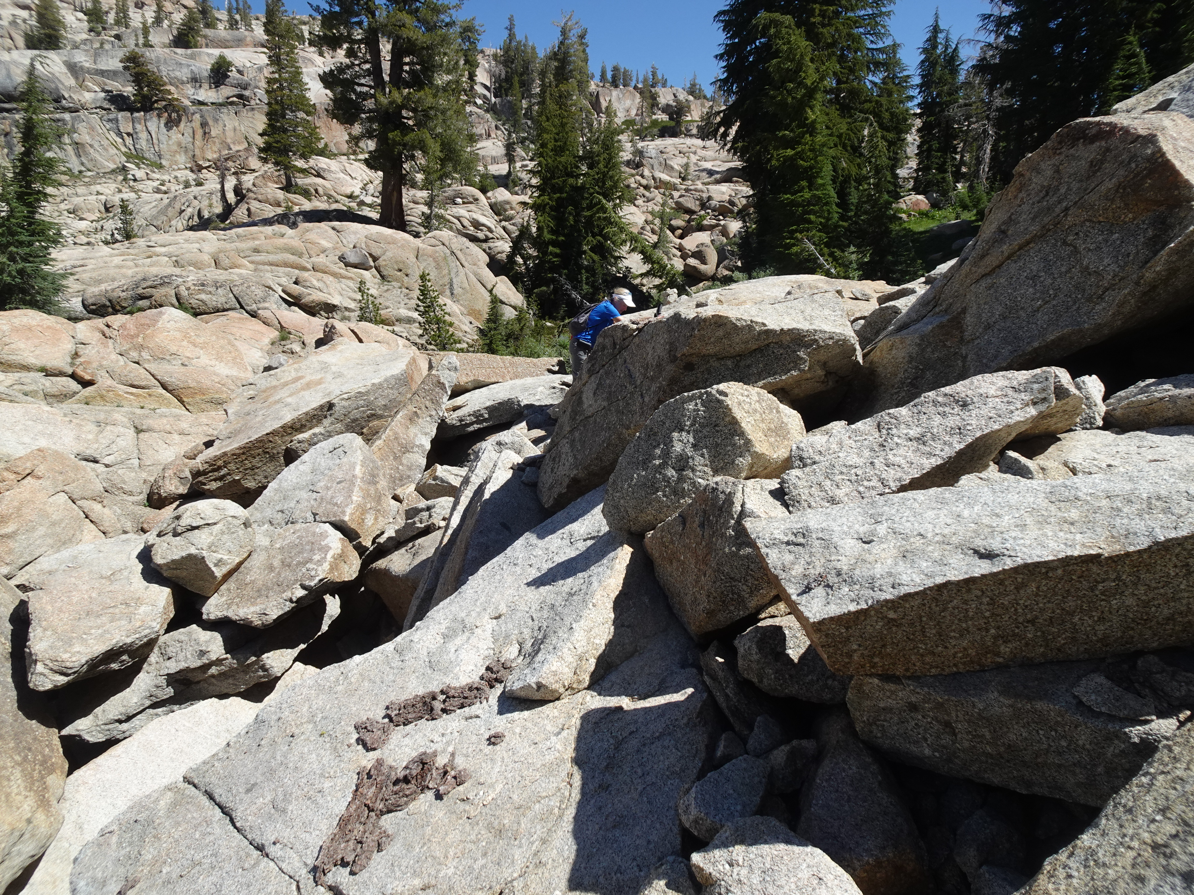
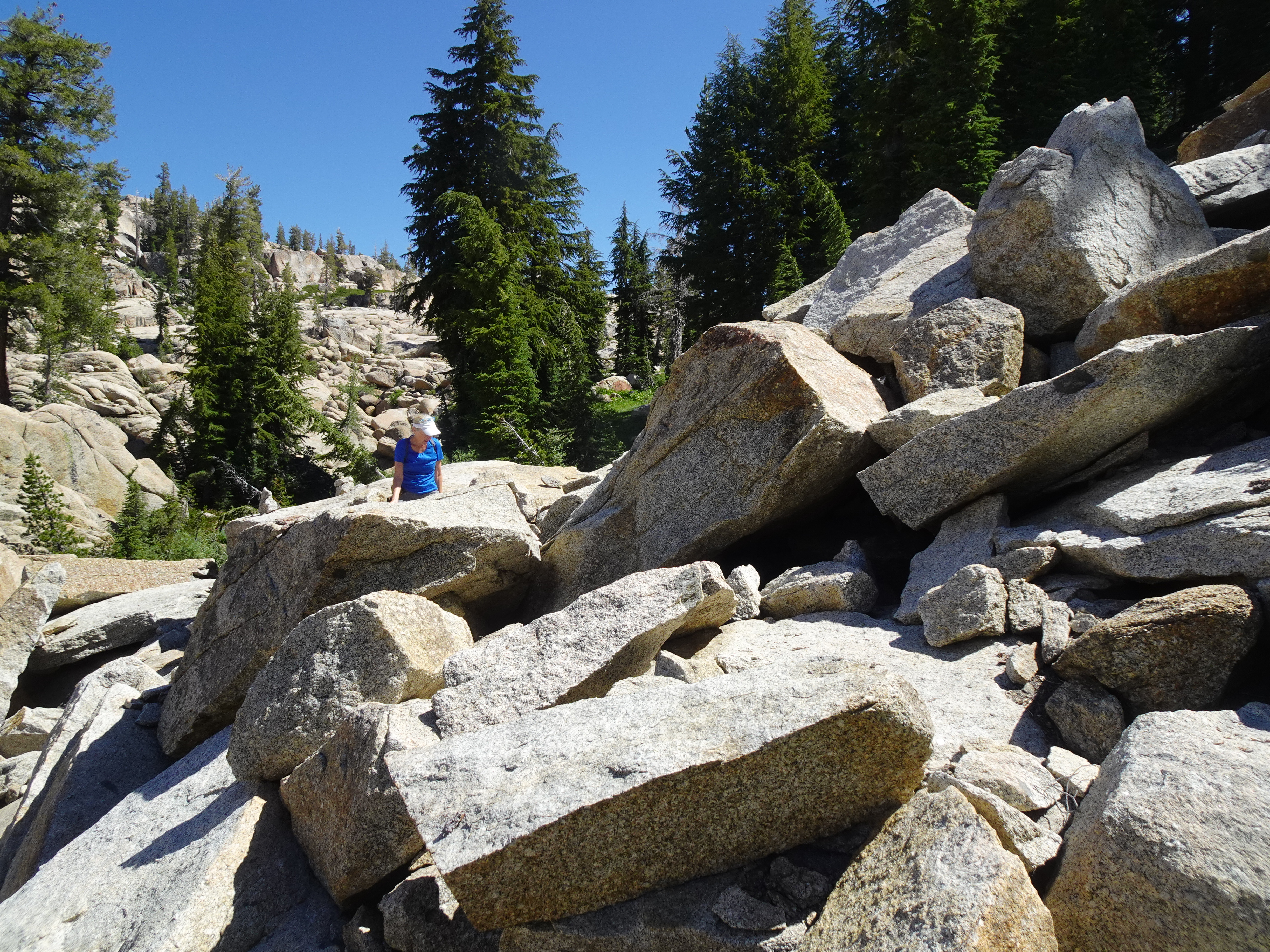
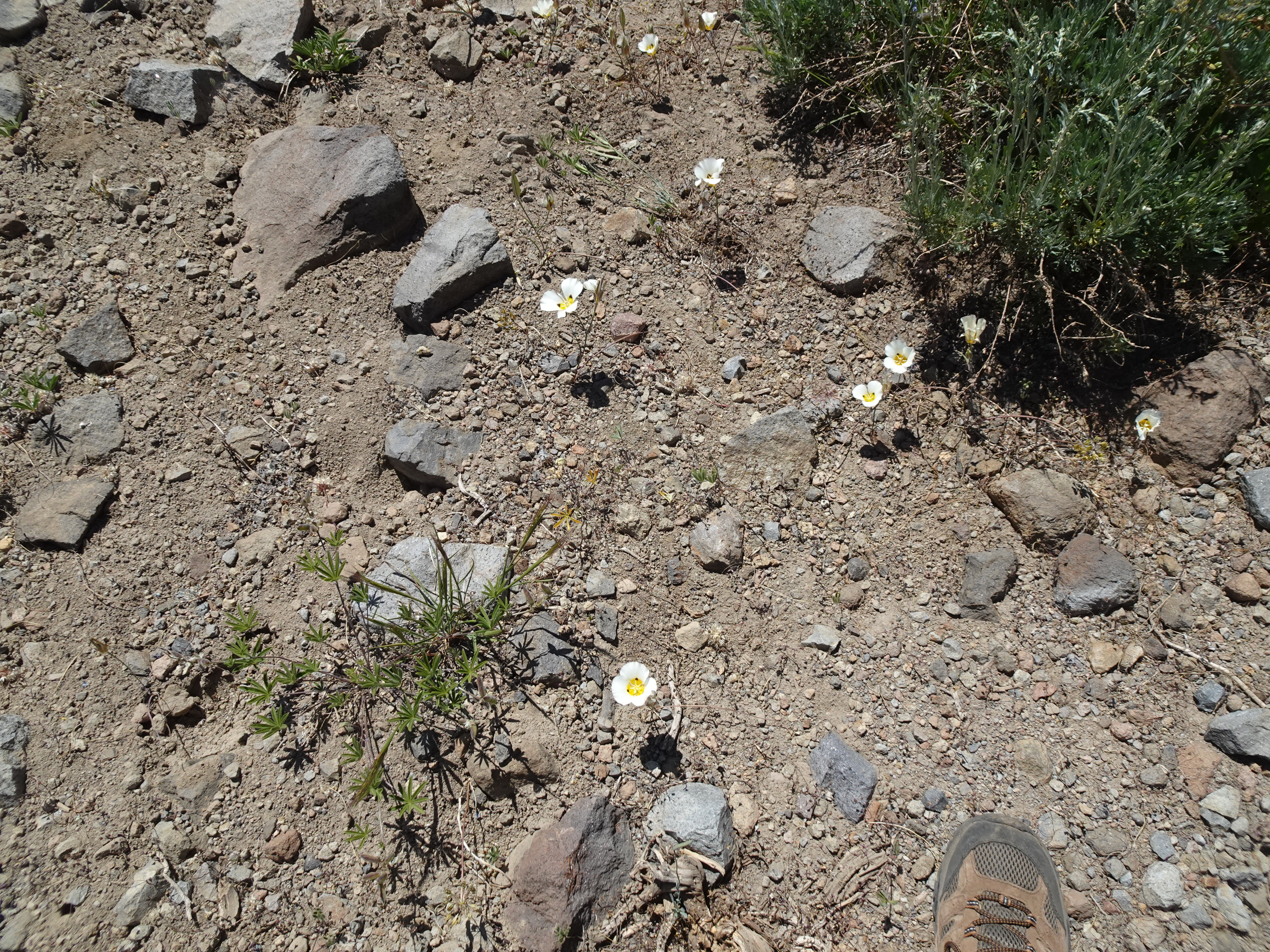
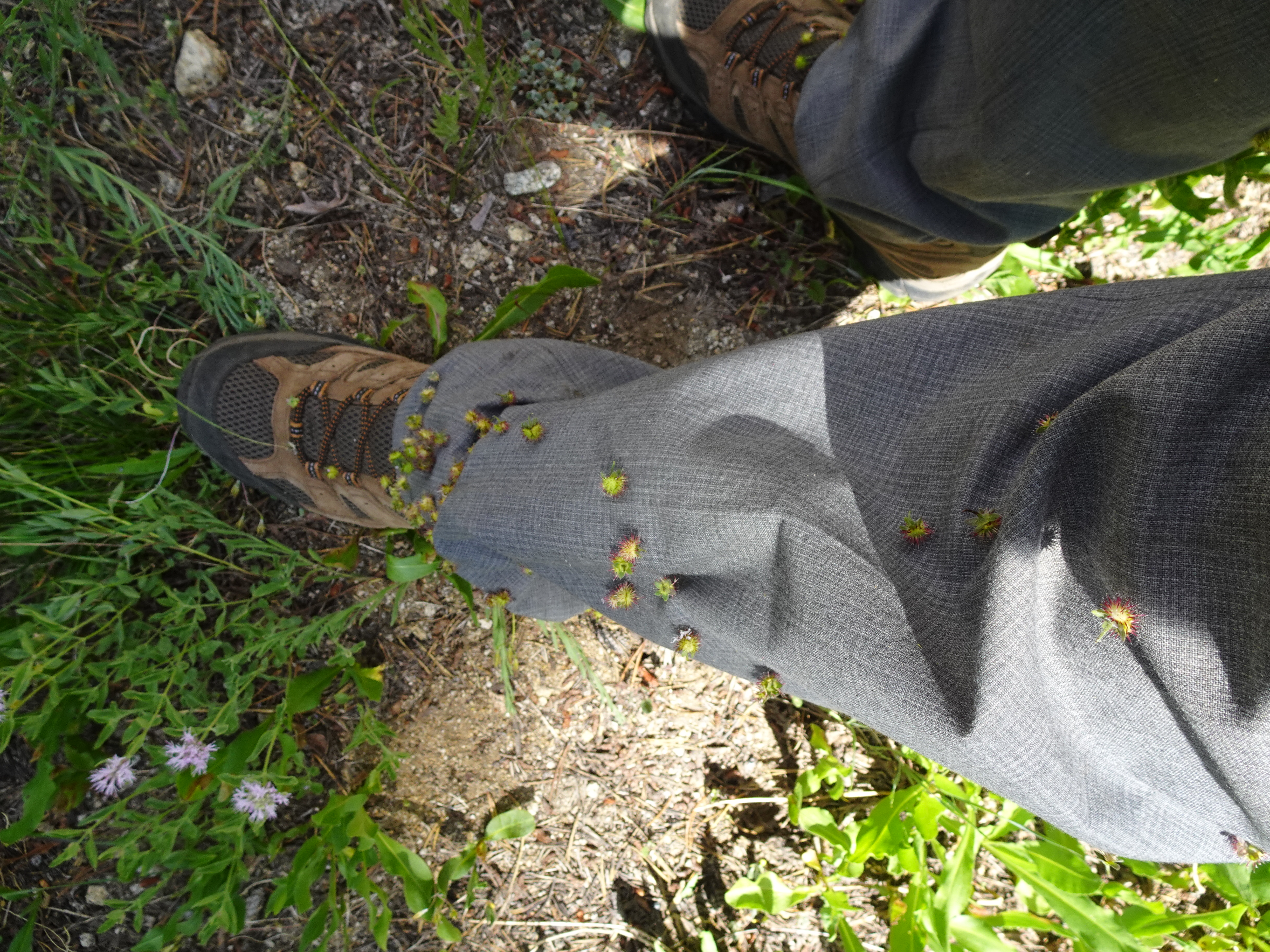
Without checking our GPS or topo maps, we simply assumed the stream flowed into Granite Lake, our destination. Big mistake. The flowers were beautiful, but there was no real trail and we did a lot of boulder clamboring trying to get down.
 |
|
 |
 |
After some time a family of four approached us from above. The father said they had come down because they had heard noise and thought it was a chance to see a bear.
The family had come from Granite Lake which was not fed by the stream we were following. The father described the route up to the top of the ridge we should take to get to Granite Lake. A lot of uphill, given how much downhill we had done following the stream. We followed his directions.
 |
 |
 |
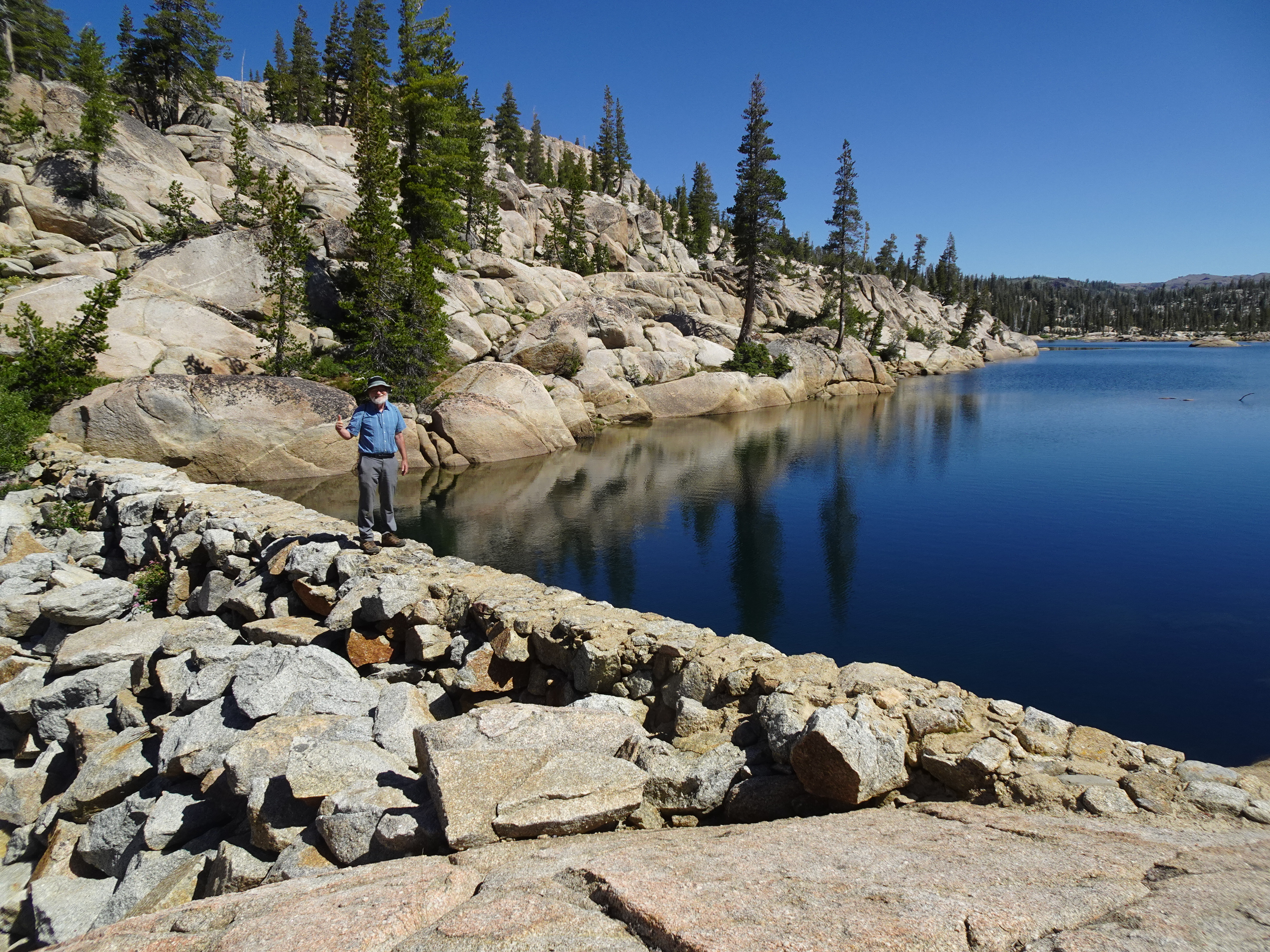
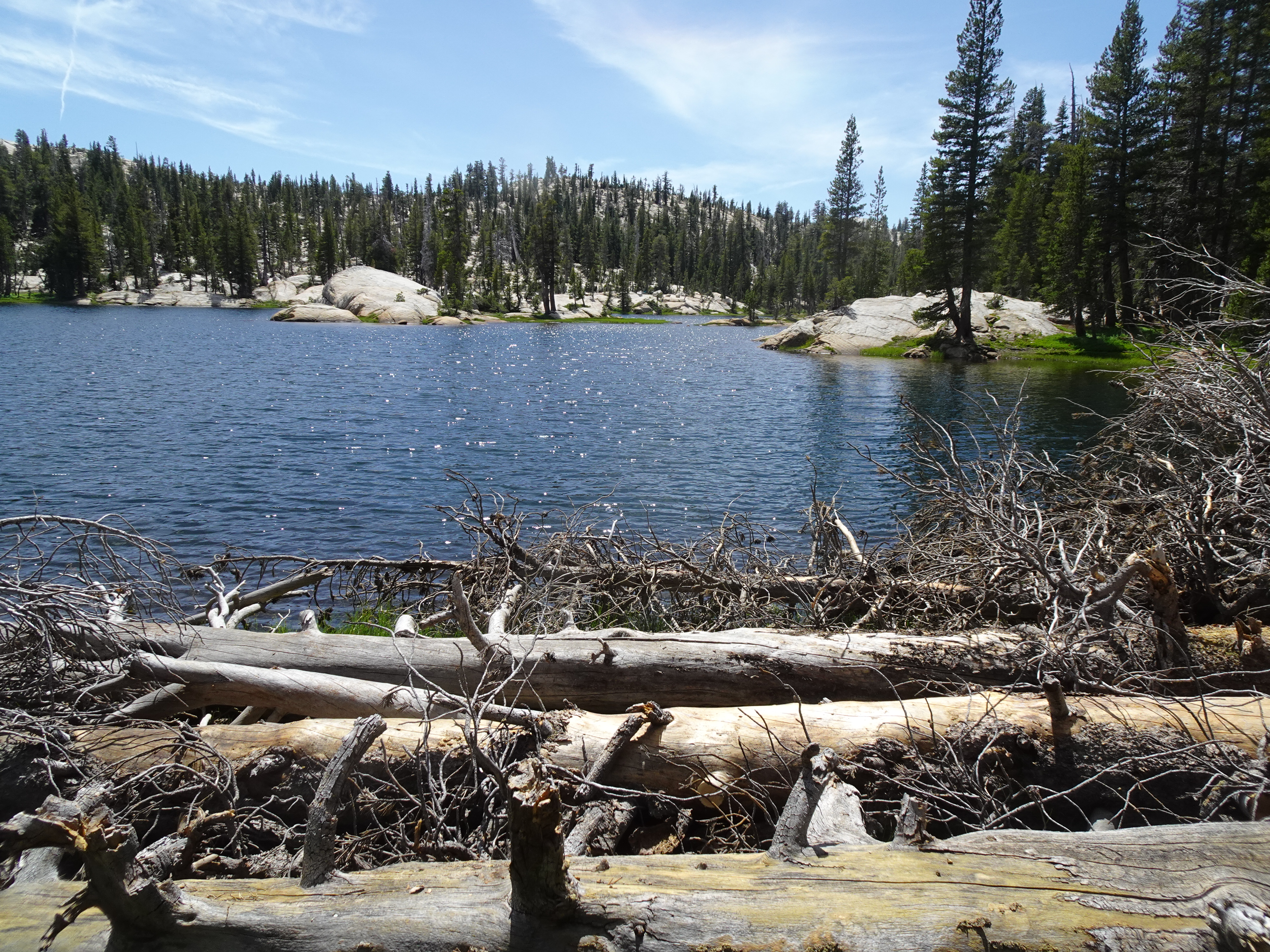
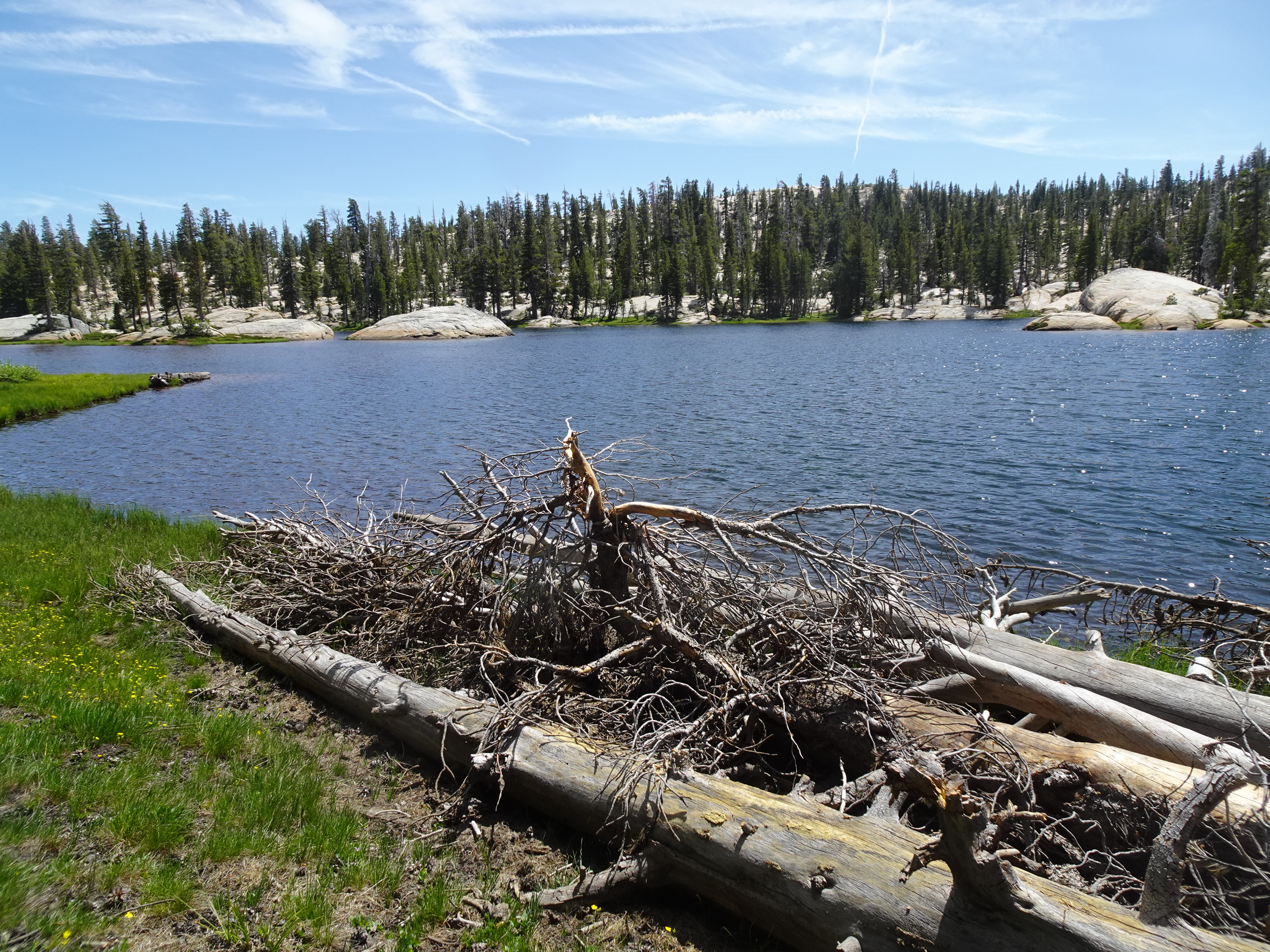
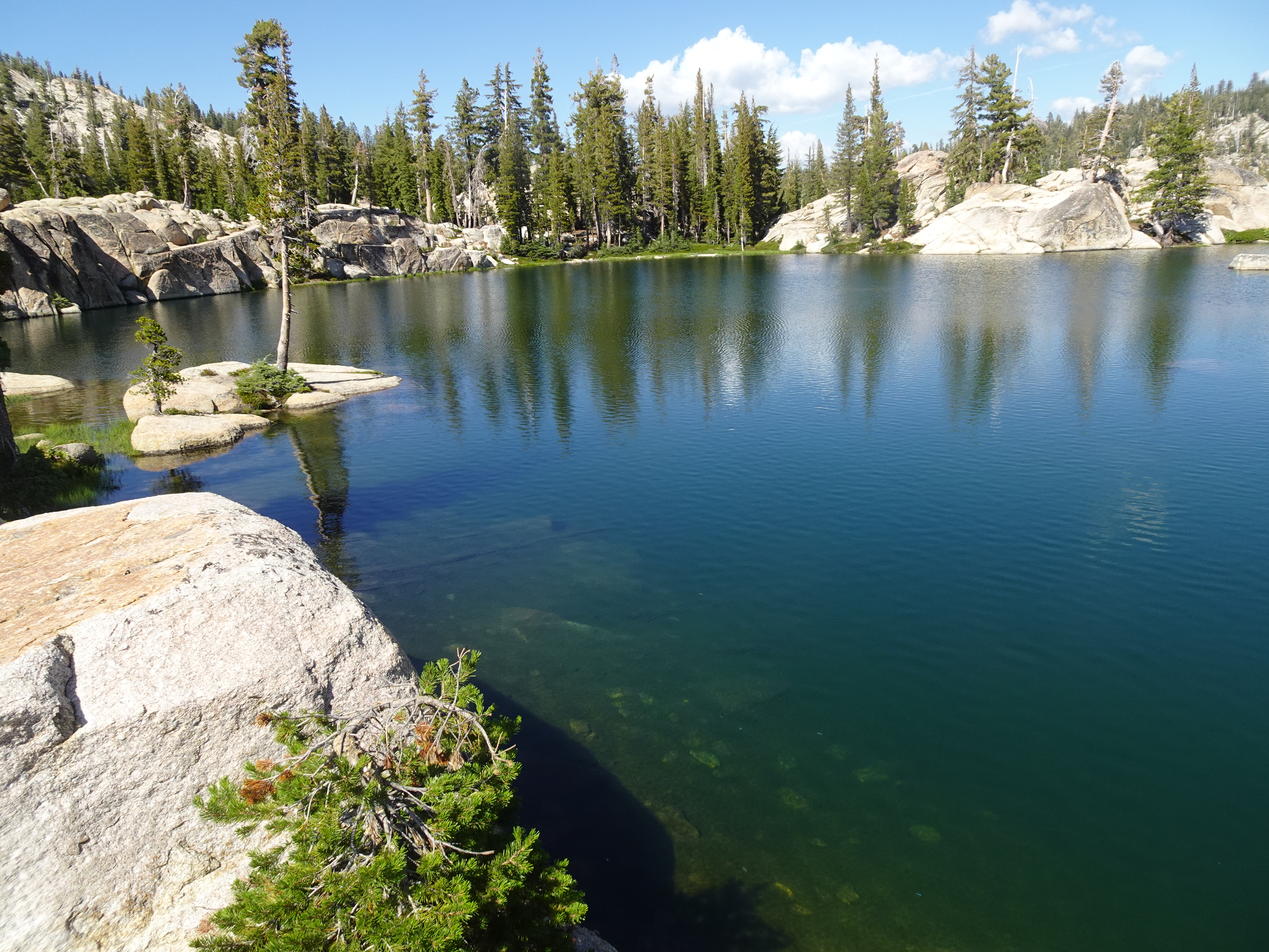
We finally got to Granite Lake which we had to ourselves, with perfect weather.
 |
There we ate lunch.
 |
 |
 |
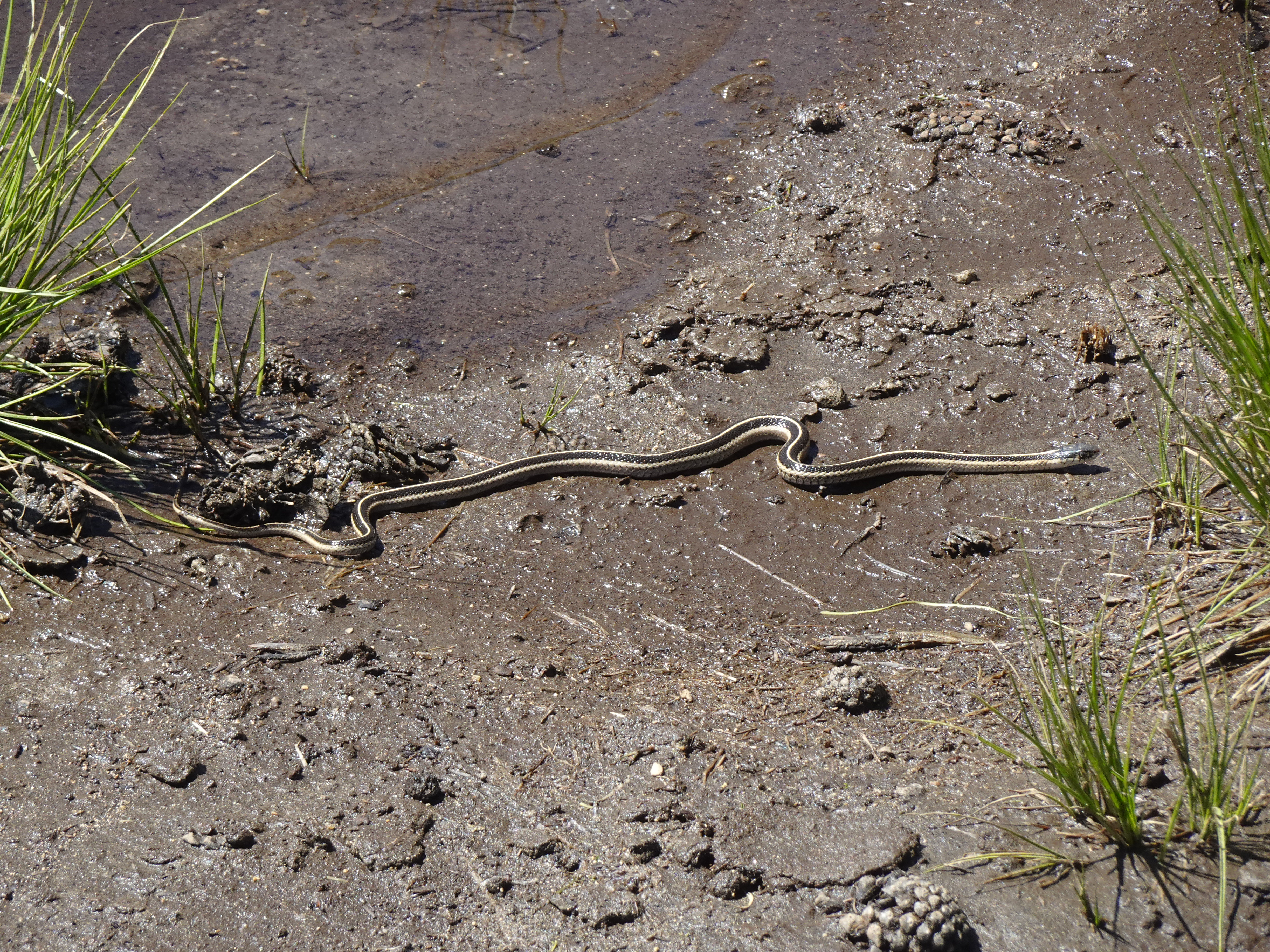
After lunch we followed mule trails as best we could to get back to northern end of Y Lake (took about an hour), where we met a couple of guys who had found a garter snake, so of course Bob had to stop and get a photo.
 |
Another 15 to 20 minutes got us to the trail junction and another 15 minutes to our campsite. We met 2 couples from Forestville who were about our age and who set up camp near us. One of the couples bathed nude in the stream next to our campsite.
Day hike on ridge above Whitesides Meadows to rock on far hill.
 |
 |
 |
Videos:
Map of day hike along ridge above Whitesides Meadow (yellow dotted line):
 |
Elevation Profile (this is a rough guess, 4 - 5 miles round-trip seems about right):
 |
Dinner: Macaroni and cheese; salmon; broccoli
Diary:
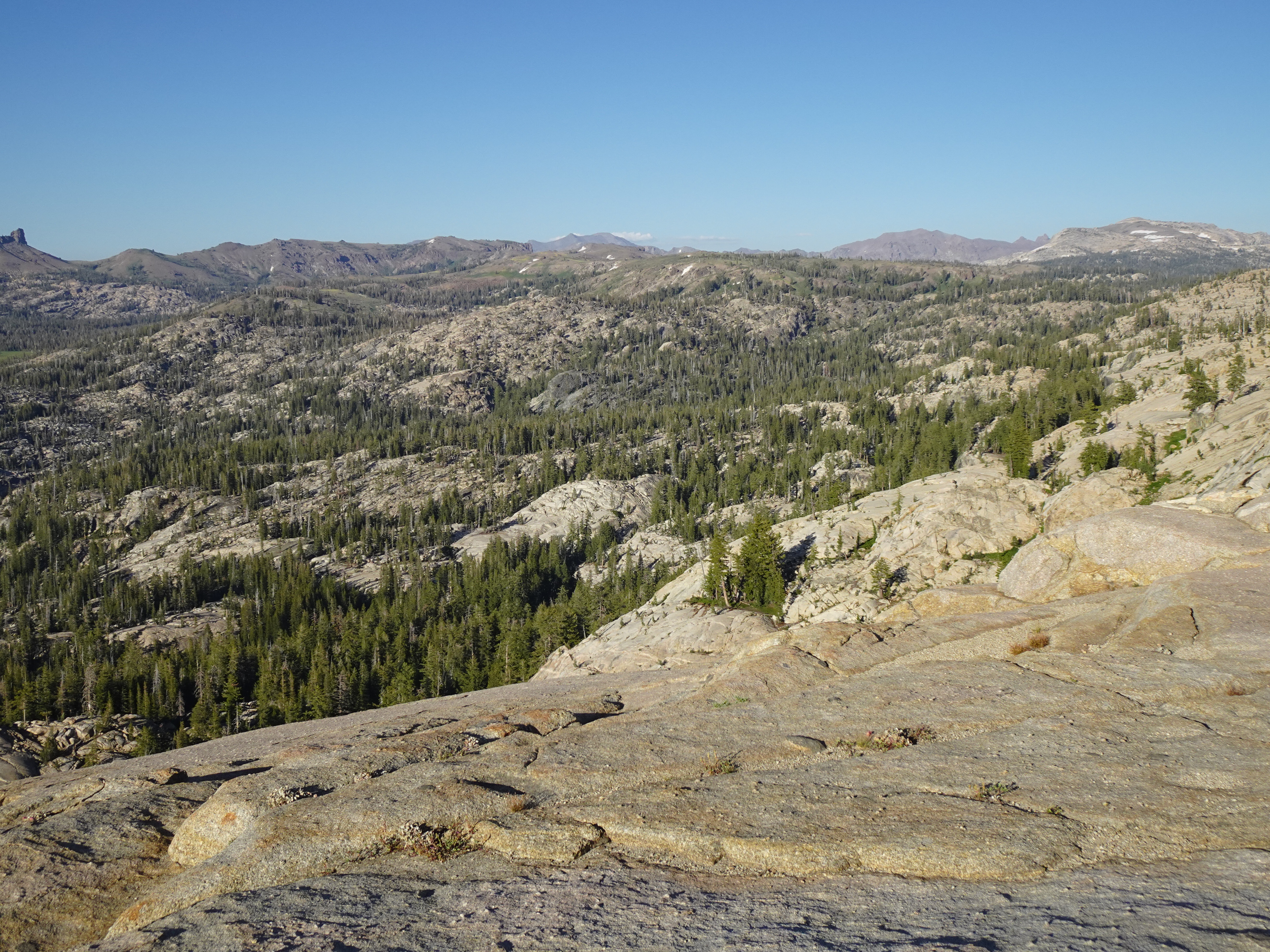
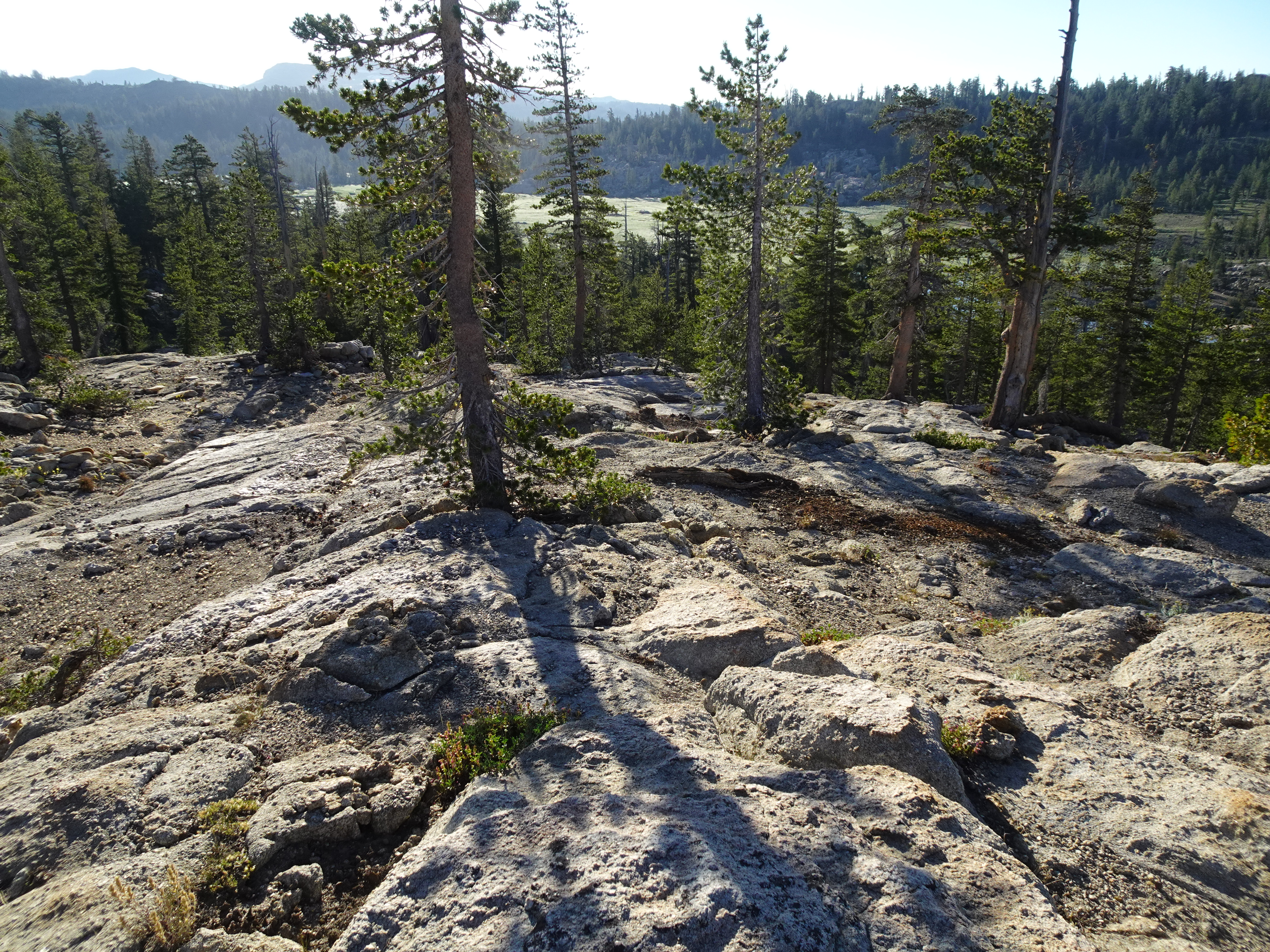
Bob starts hiking as the sun is rising over the Whitesides Meadow reservoir at 6:20 AM up to ridge above Whitesides Meadow, which is beautiful and goes further than Bob can finish quickly.
 |
 |
 |
 |
 |
 |
 |
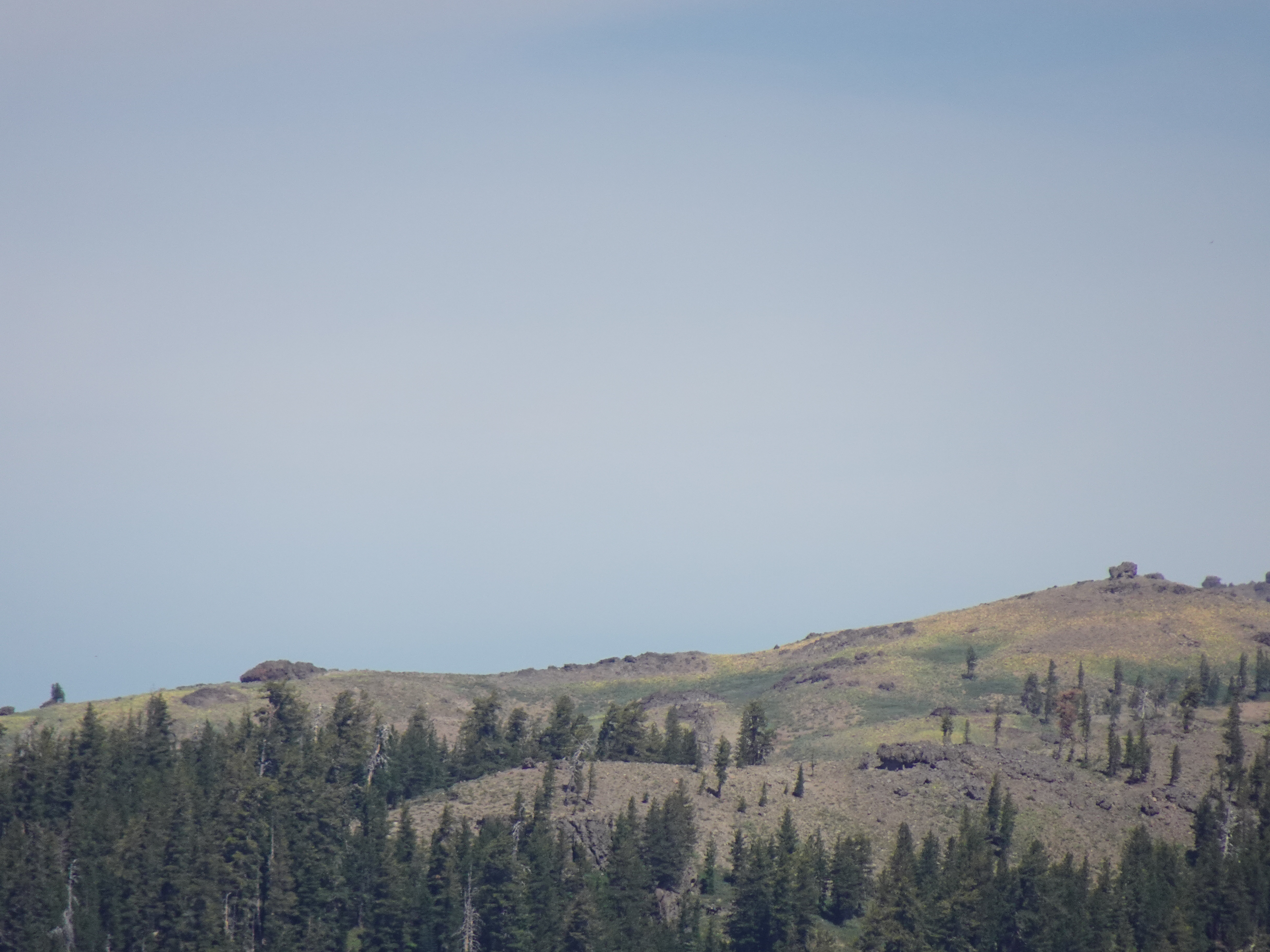
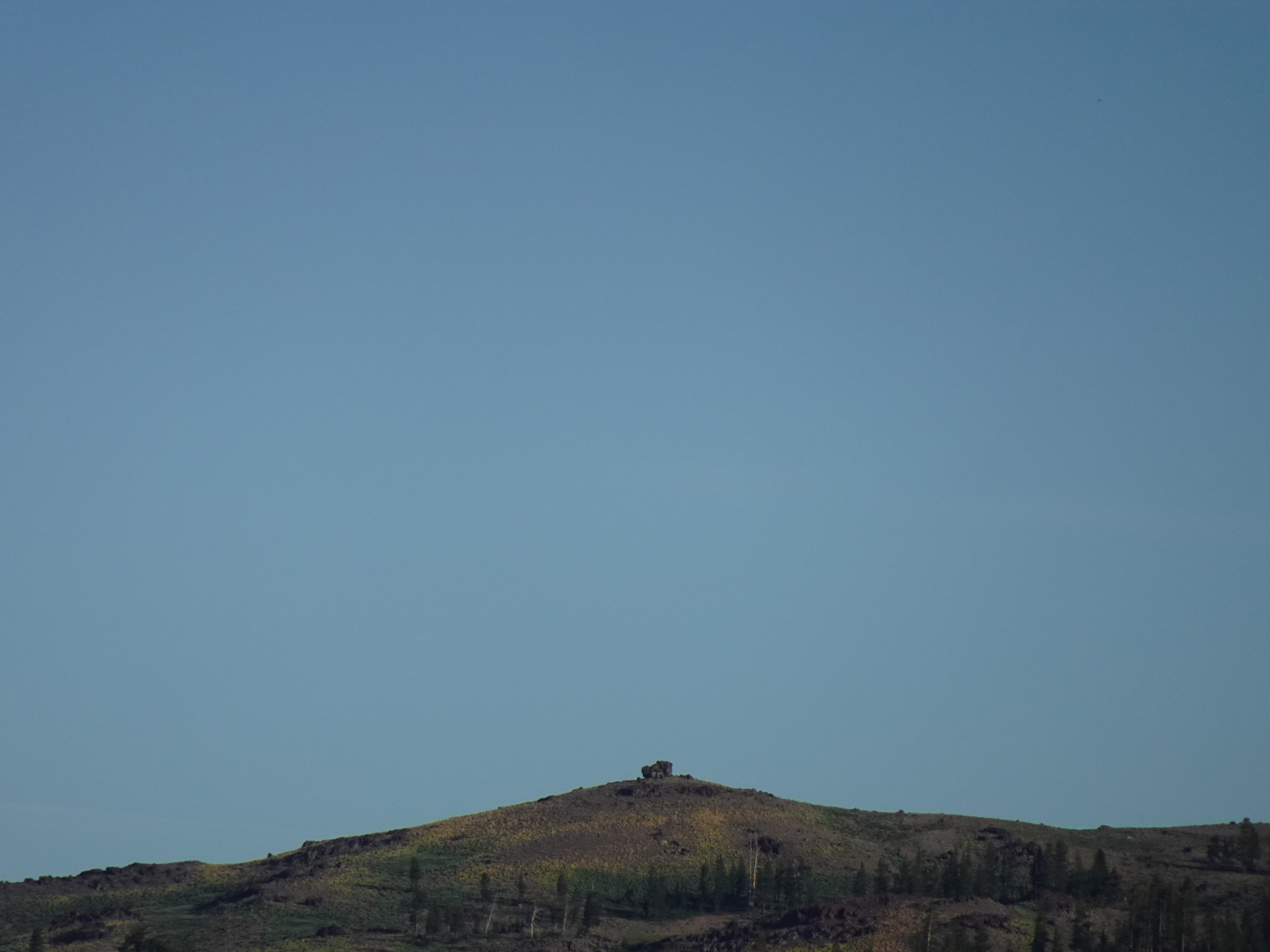
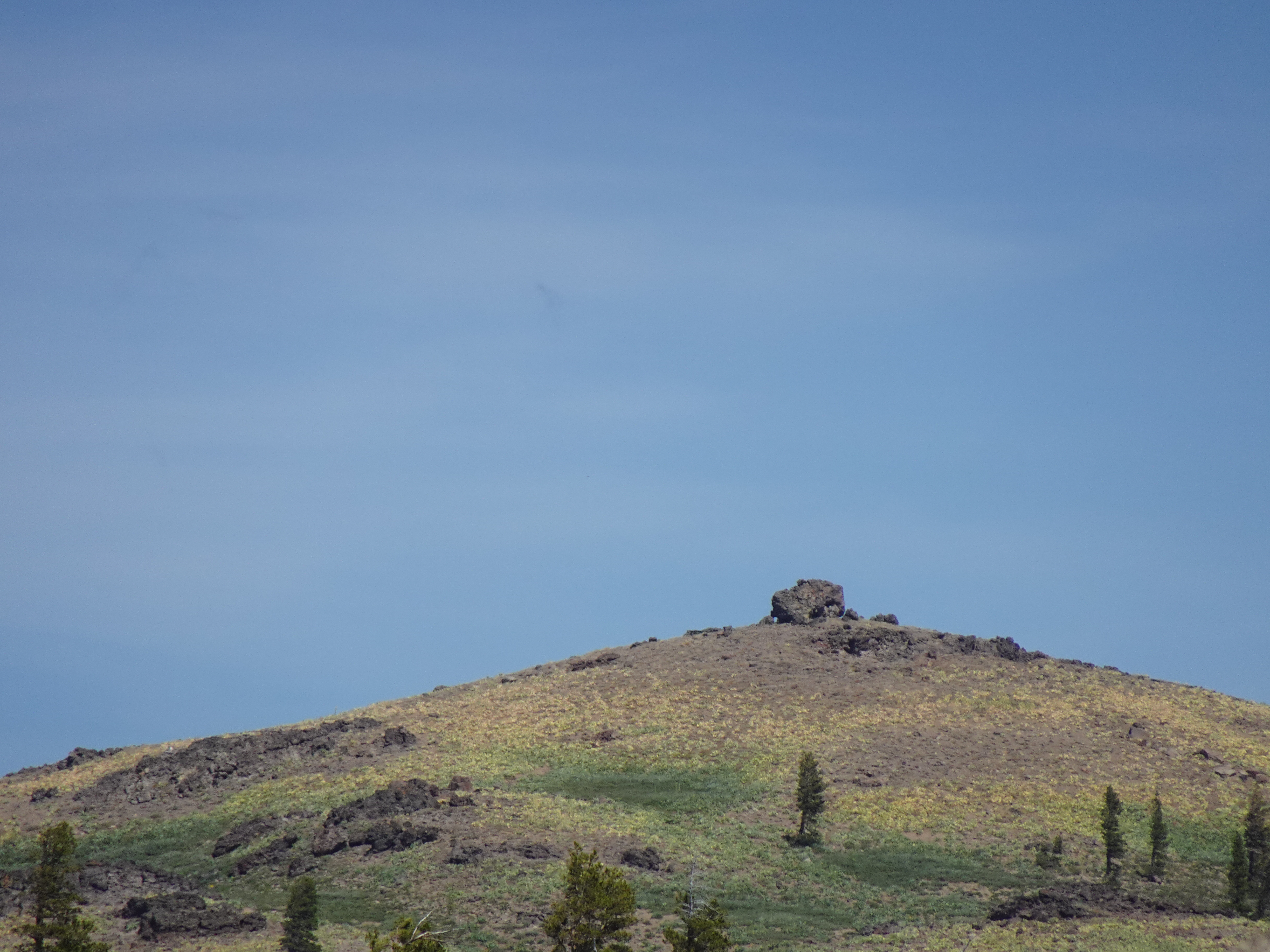
In particular, Bob sees a hill with a rock on it in the far distance that we would like to visit but does not have the time to do so.
 |
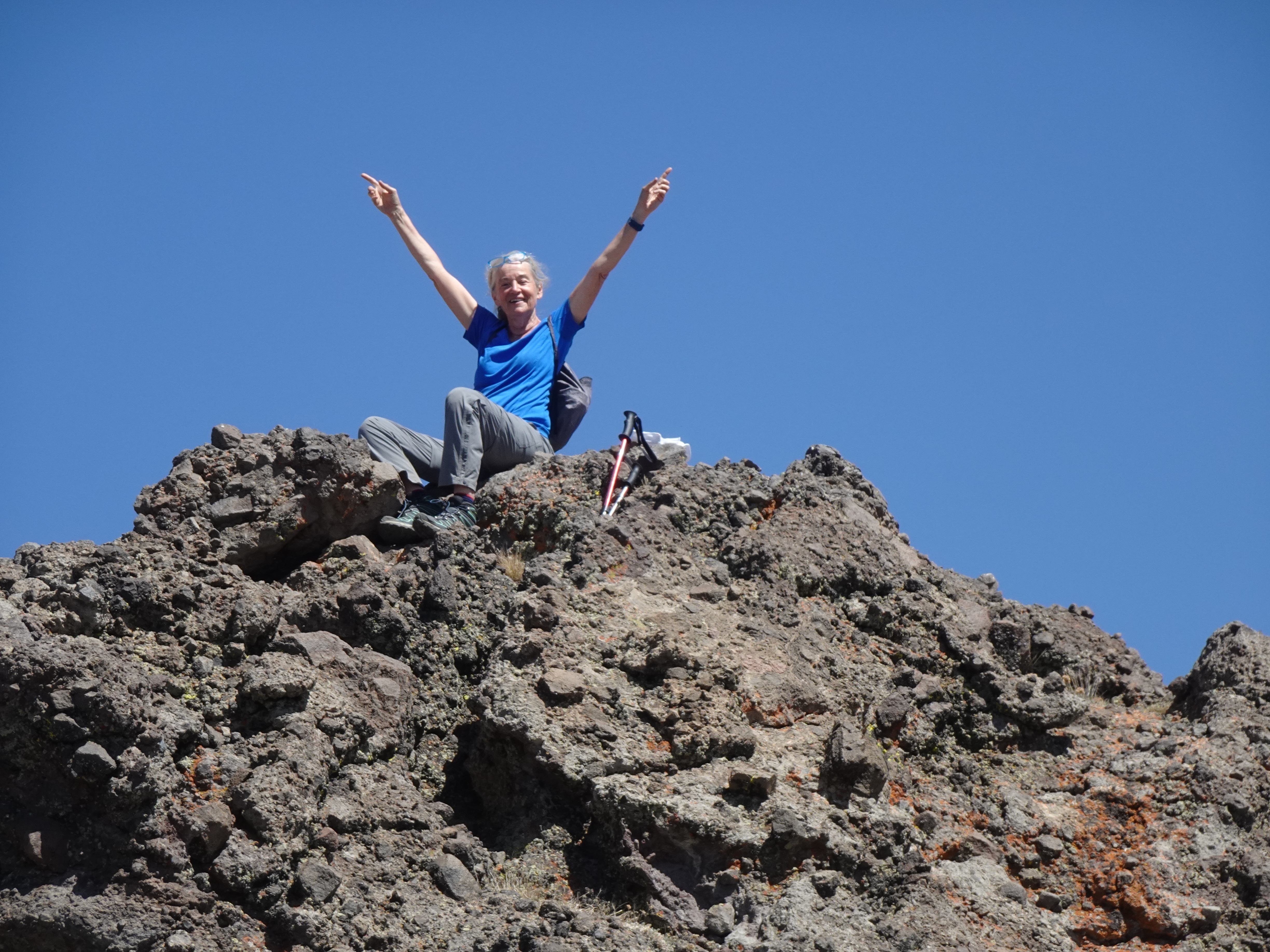
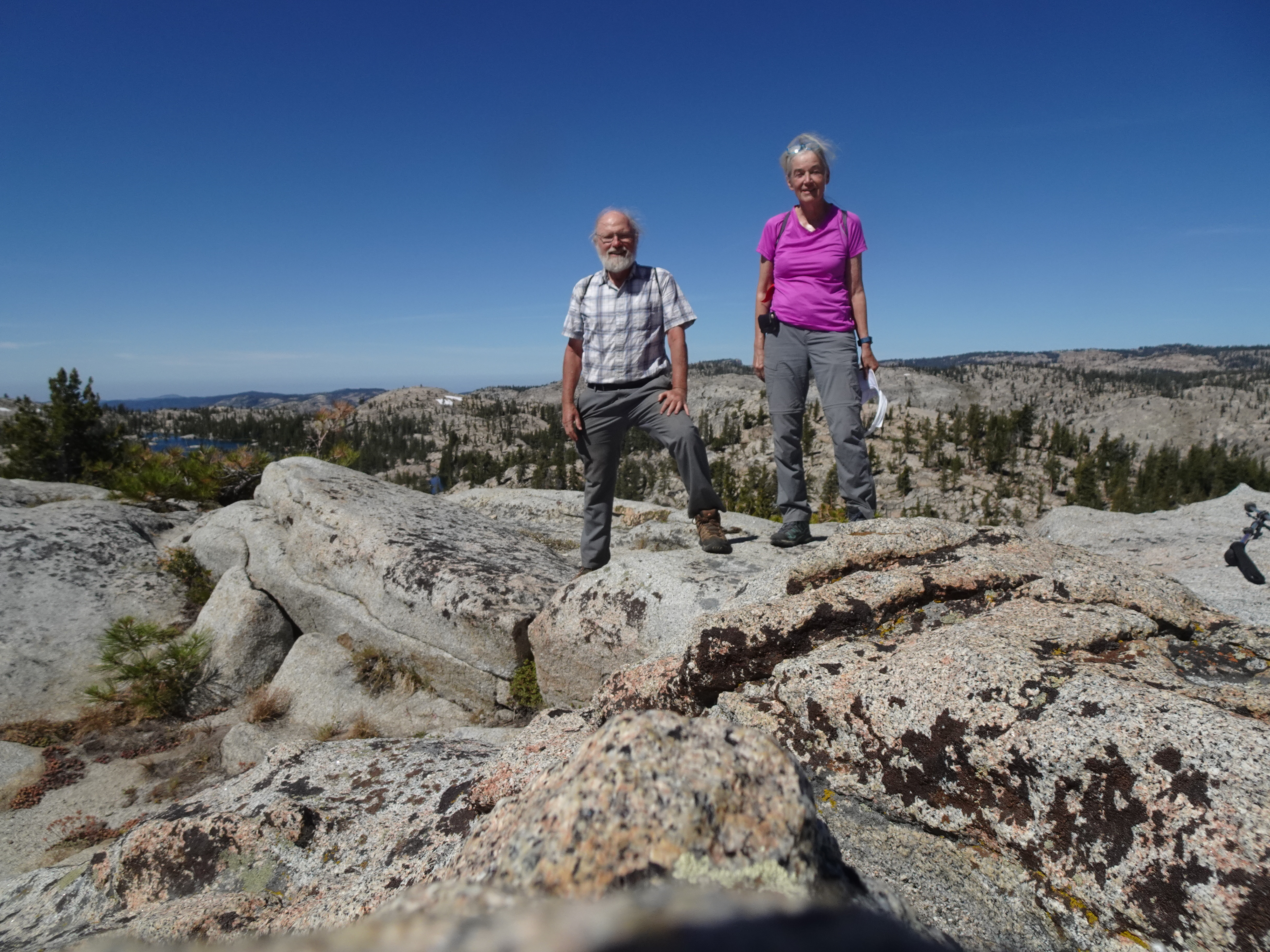
So when Bob returns he suggests to Jennifer, who agrees, that we stay an extra night so she and Bob can day hike to final hill on ridge which has the impressive rock at the top. And so they do. Before leaving and after talking with our 4 nearby camping neighbors, we discover they intend to leave immediately for the Wire Lakes and to stay there the rest of the week, so we will be seeing them again.
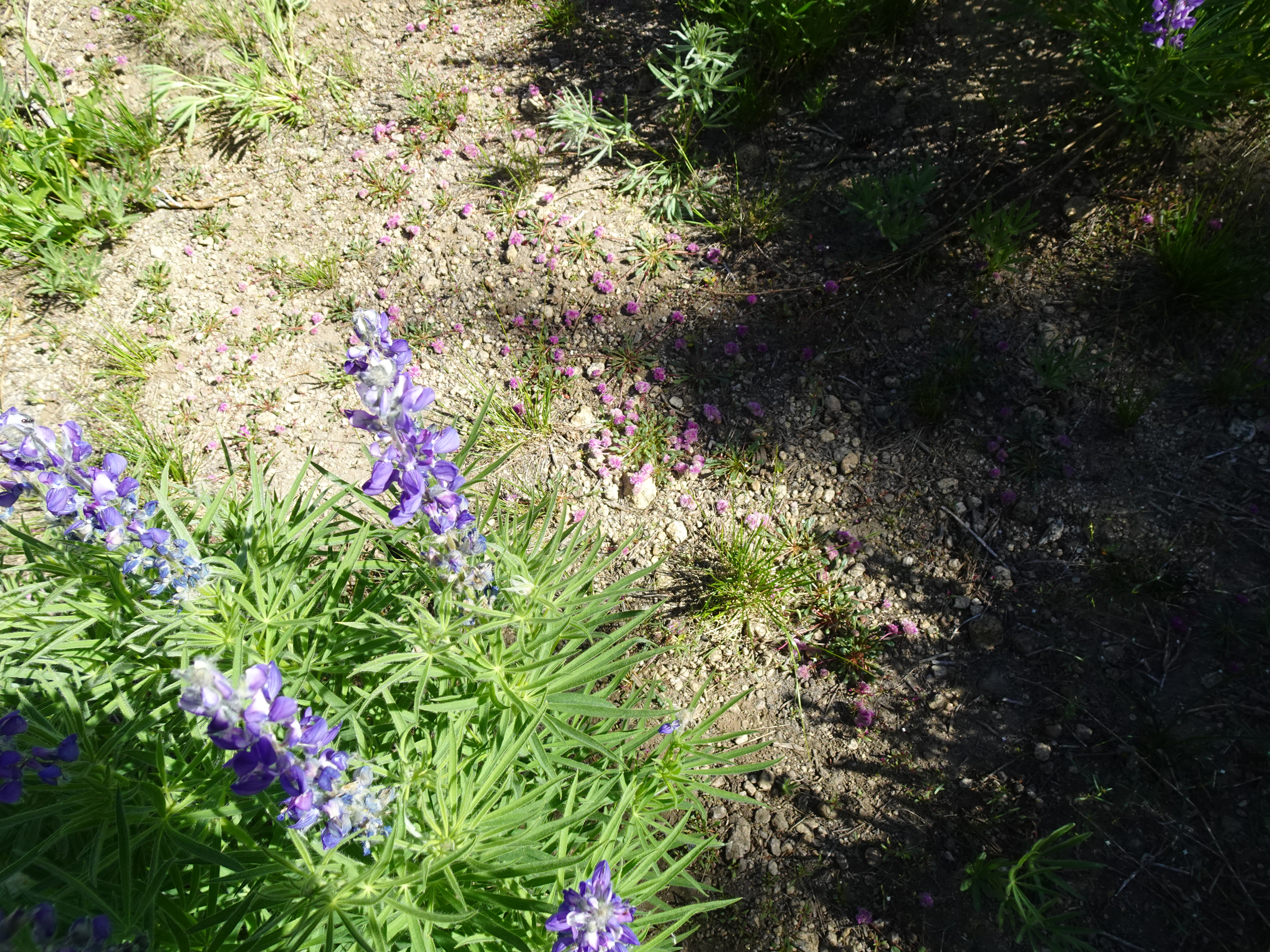
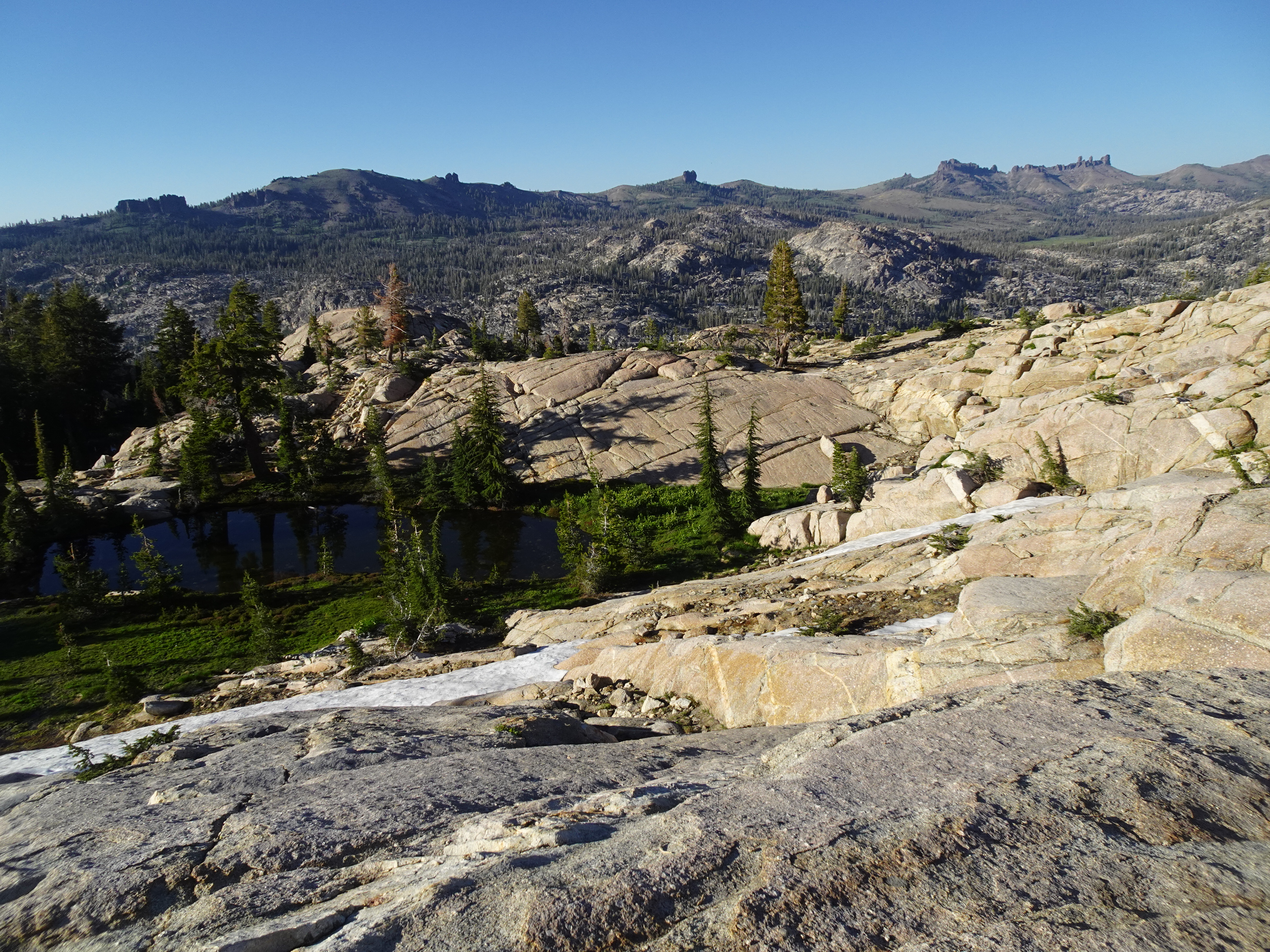
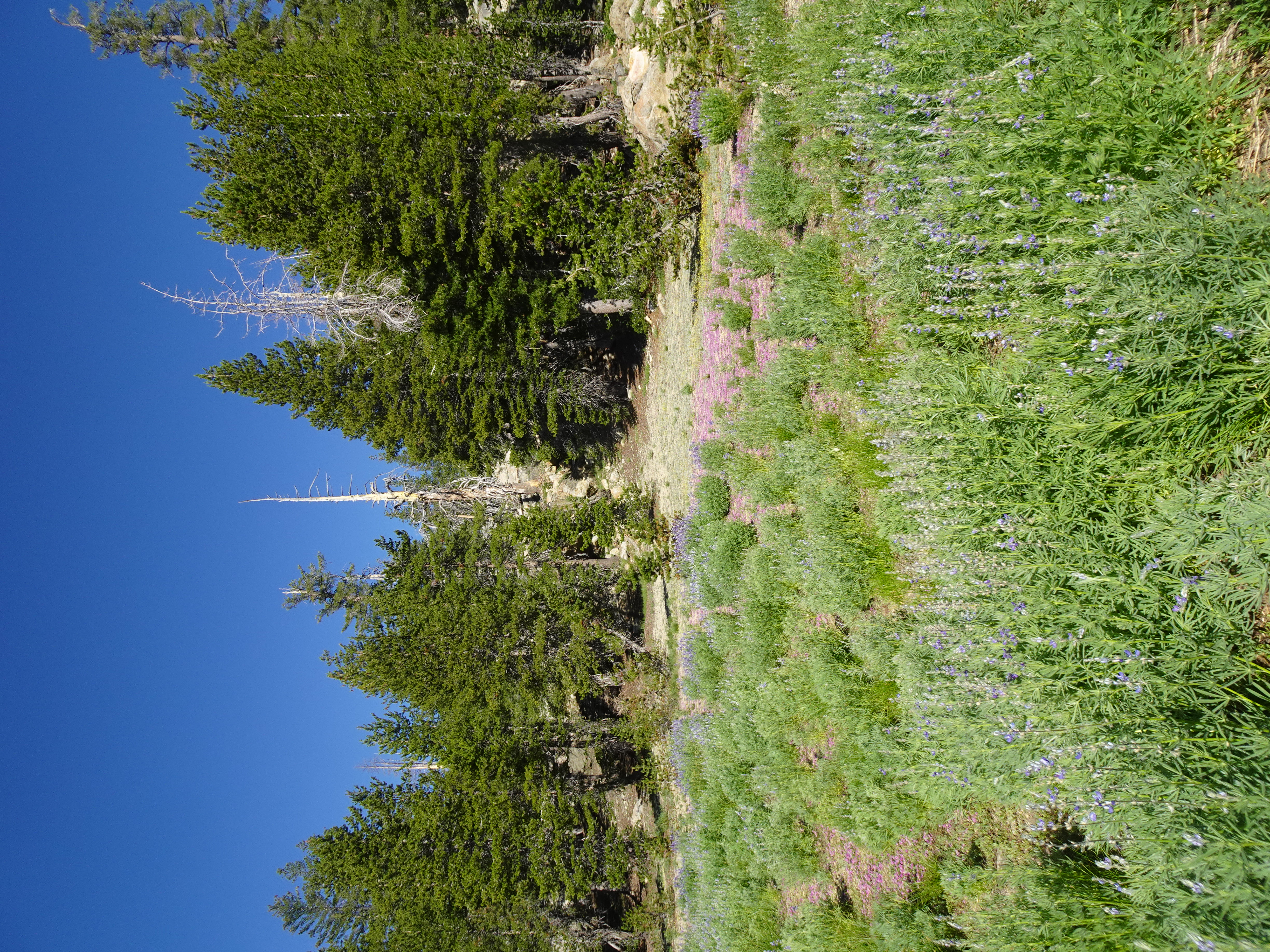
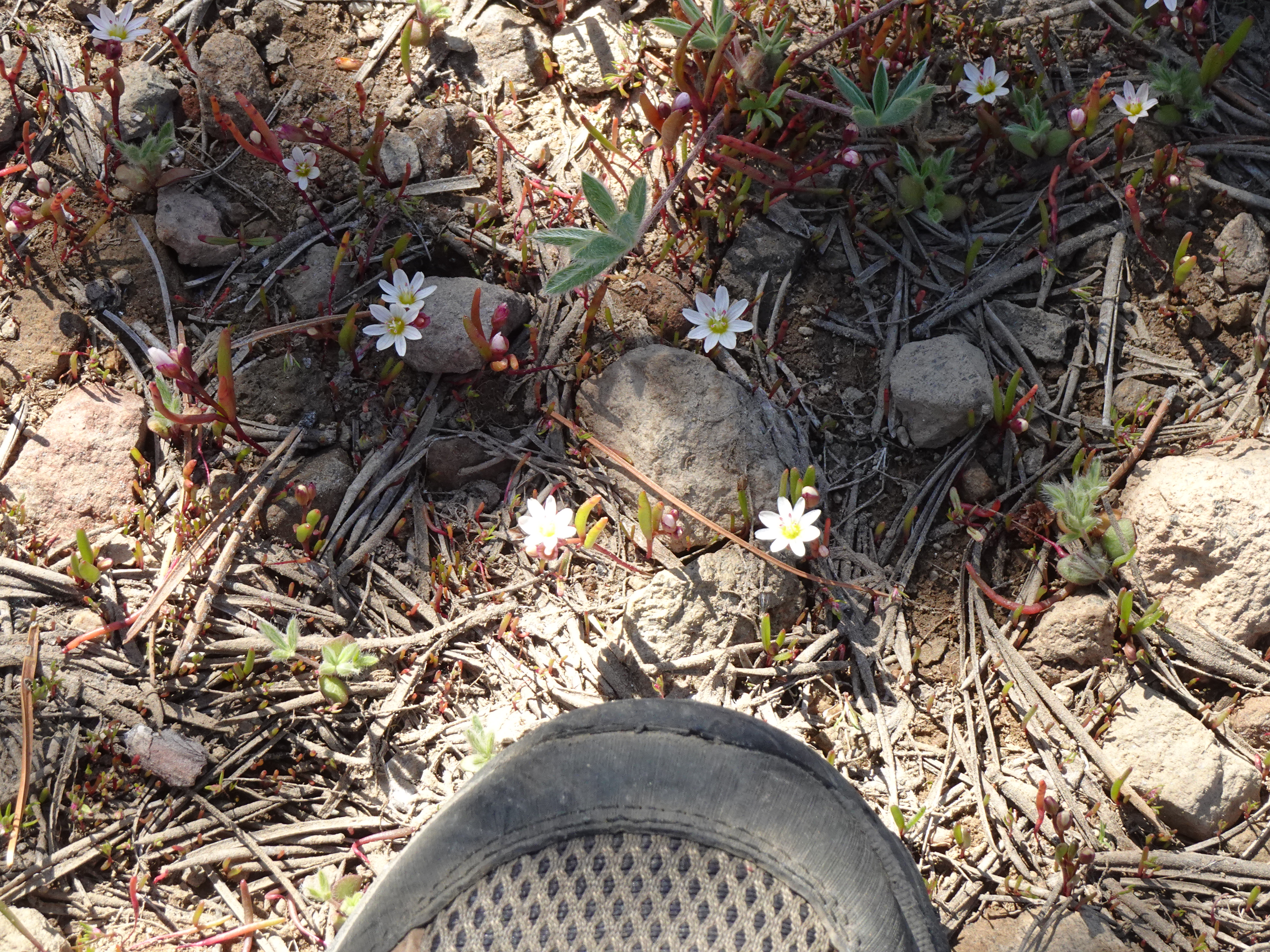
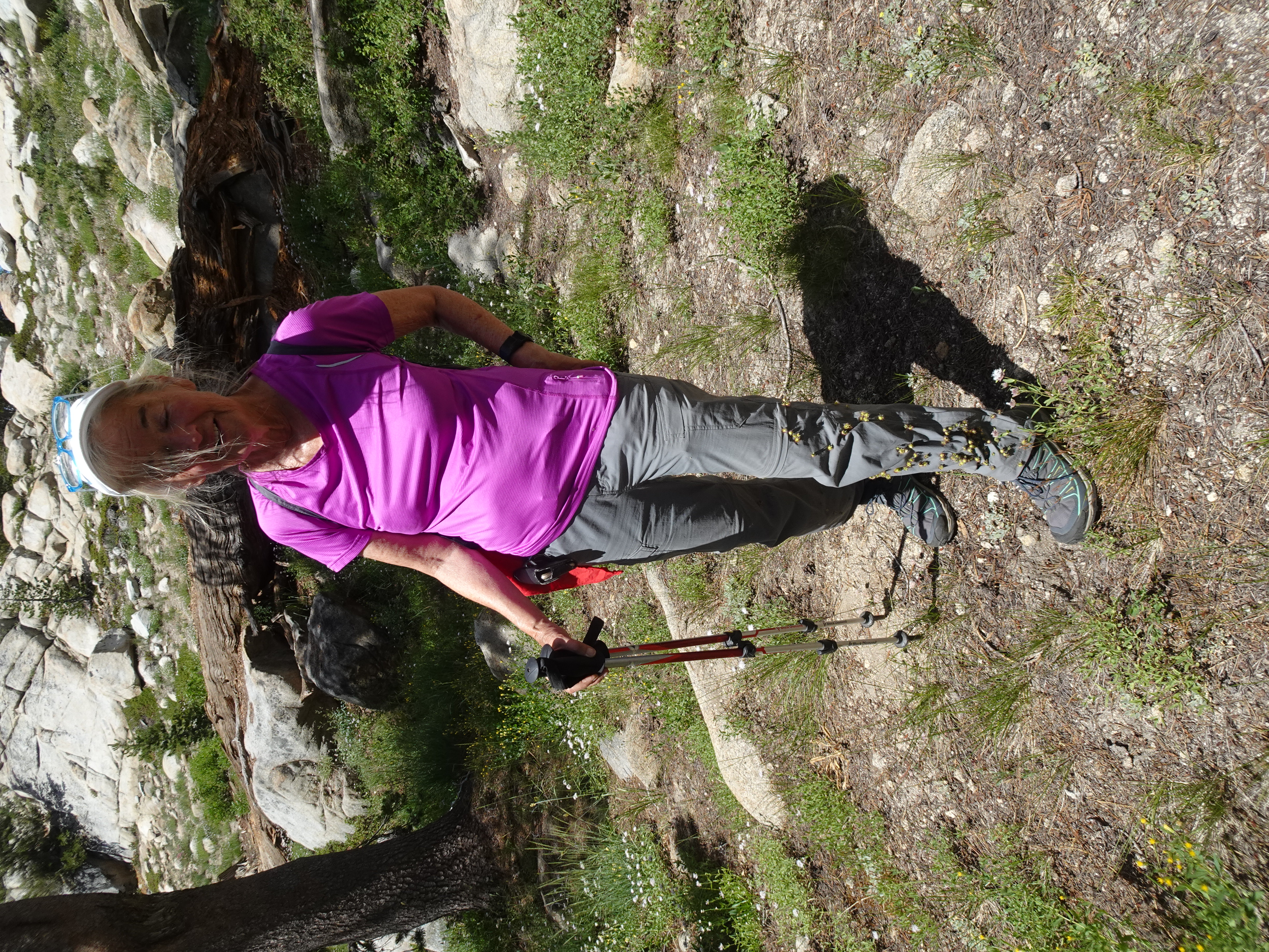
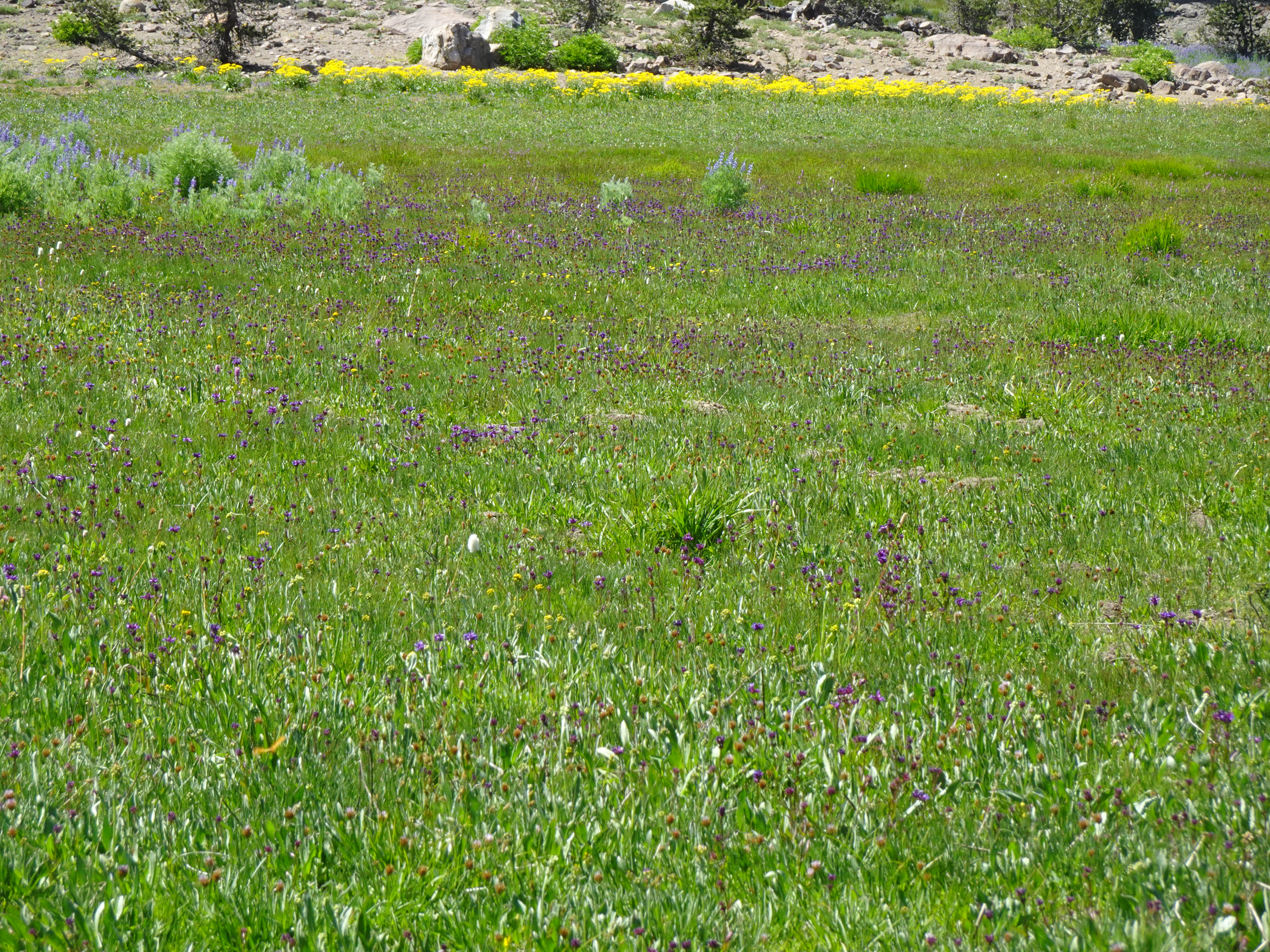
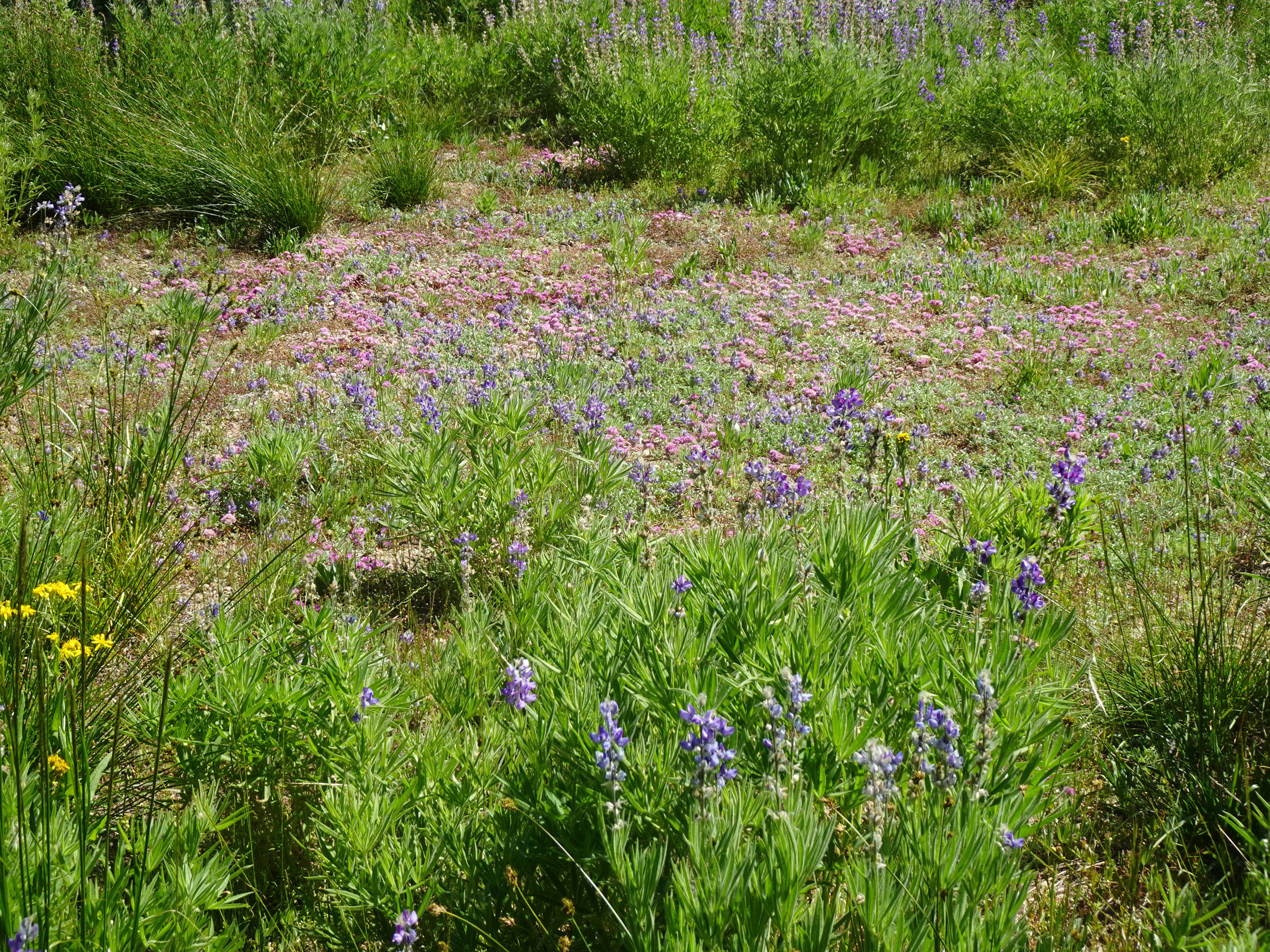
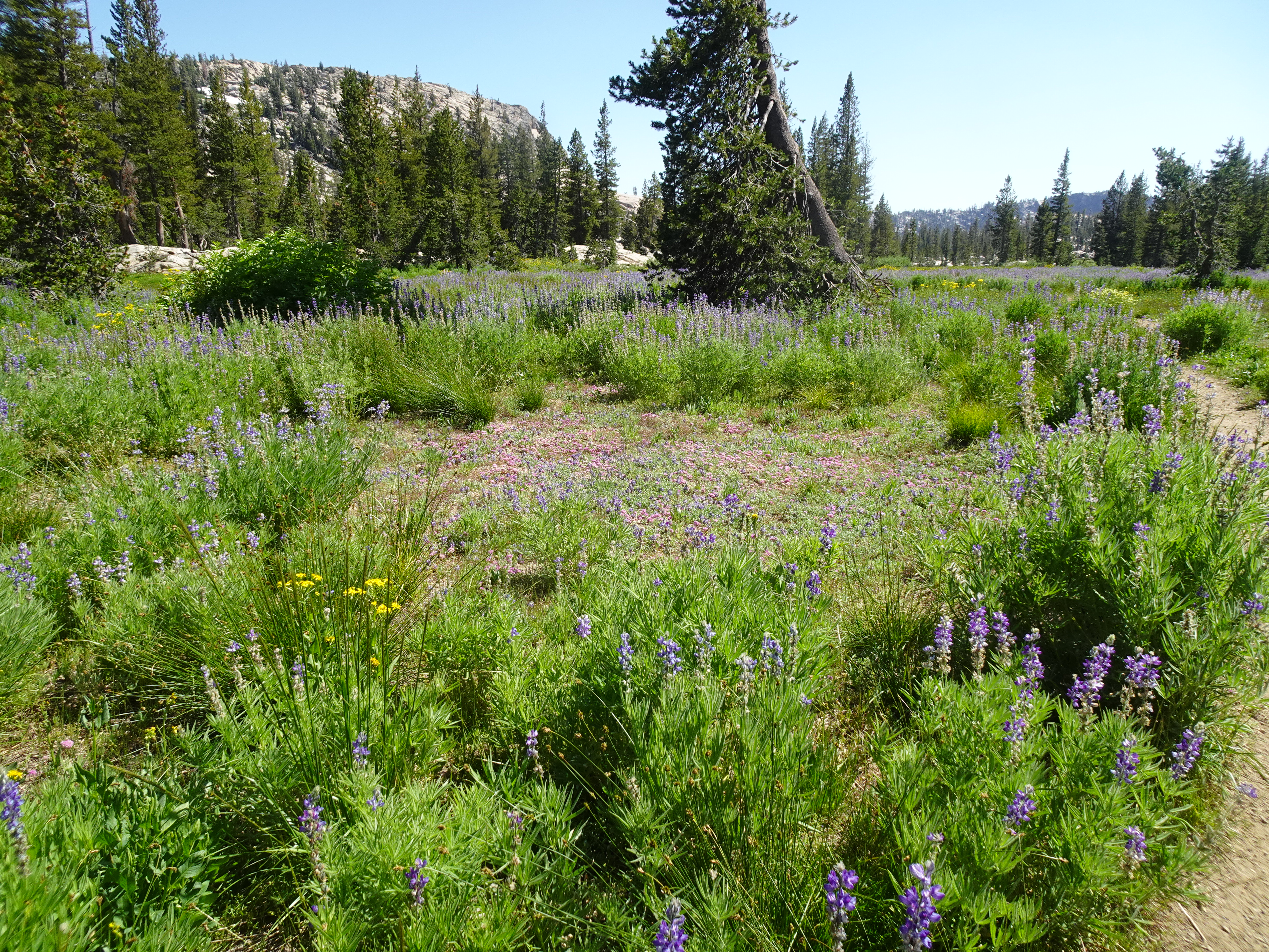
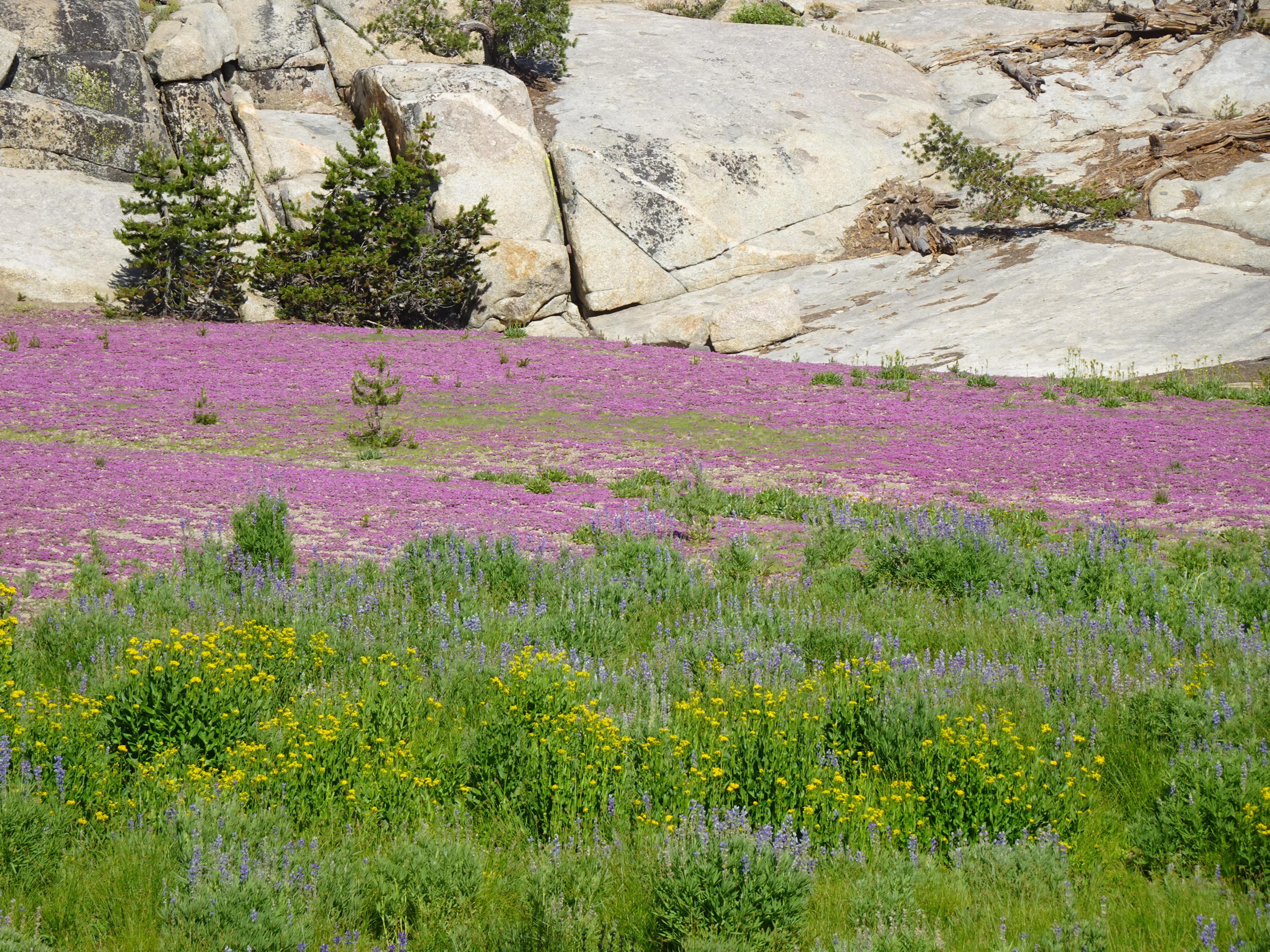
Up on the ridge there are spectacular wildflowers of all types. Apparently it is springtime at these higher altitudes even though it is August. There are many large patches of snow and a pond that is almost entirely snow covered. We saw no people at all during this 4 - 5 mile hike.
 |
 |
 |
 |
 |
 |
 |
 |
In the distance we see a lake that is most probably Y Meadow Lake. We reach the last hill with the impressive rock, then return to camp after covering 4 to 5 miles, including much down and up hill.
Once back in camp, Jennifer dons bathing suit and rinses off in nearby stream. Bob again goes up ridge behind camp and gets cell coverage allowing him to communicate by text with family.
|
|
 |
 |
 |
Backpack to Wire Lakes from Whitesides Meadow.
Videos:
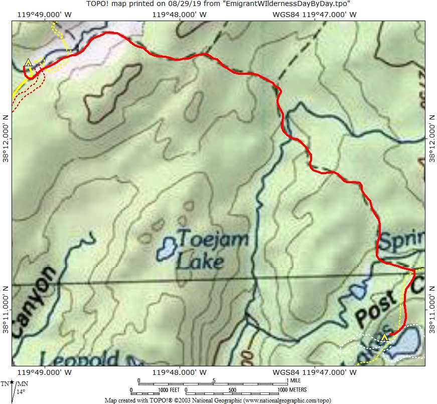
Map from Whitesides Meadow campsite to Wirelakes (solid red line):
 |
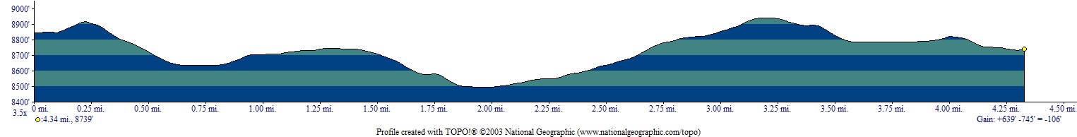
Elevation Profile (understates distance) - Creek near Whitesides Meadows 4 mi to Wire Lake 5.2 mi:
 |
Dinner: Before dinner eat salmon, cheese and crackers; then at dinner eat corn chowder and lentils, along with dried blueberries. (Jennifer confirms our gas cannisters will last through the trip).
Diary:
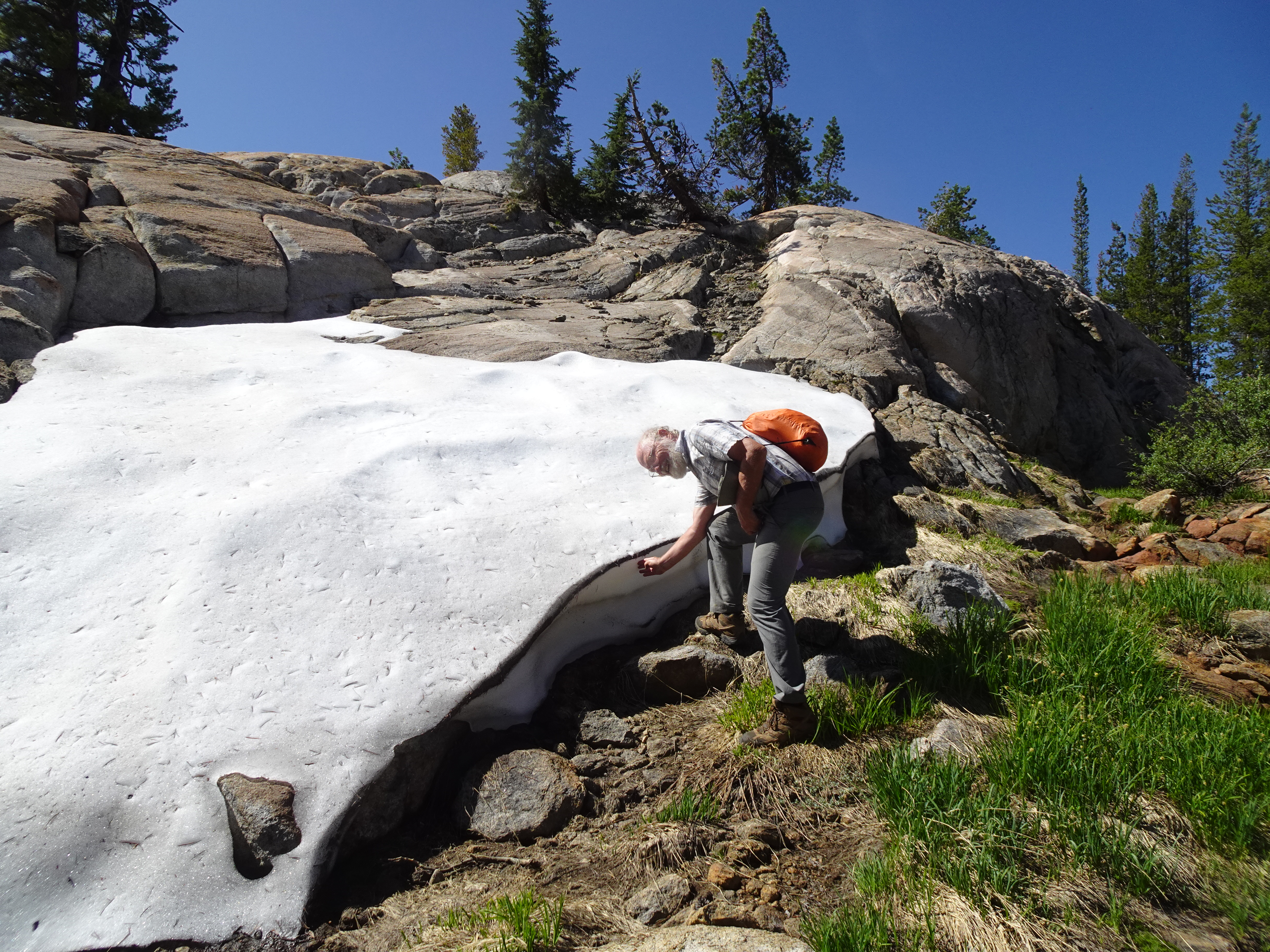
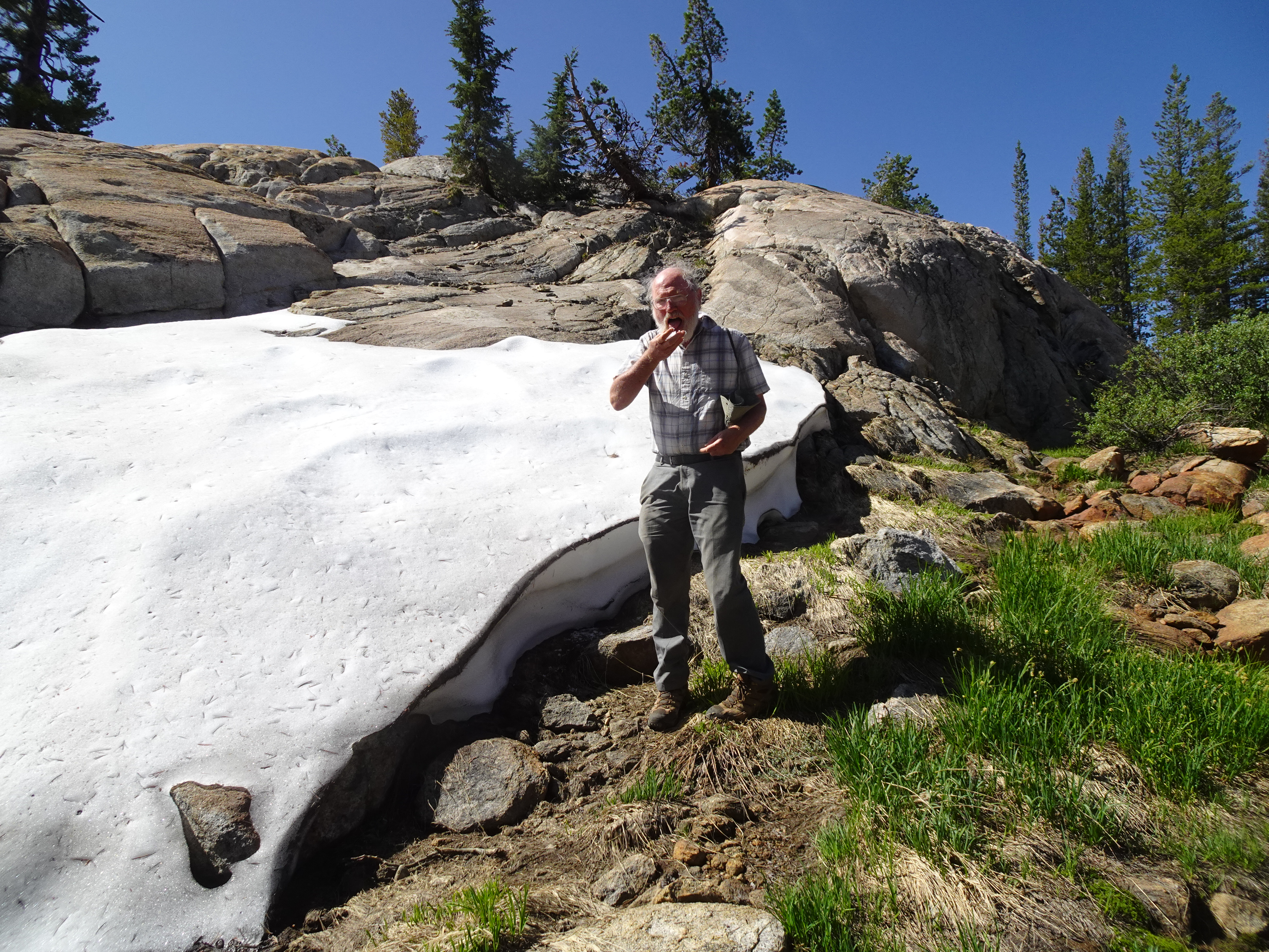
In the morning, inspired by Jennifer rinsing off the creek the evening before, Bob rinses off with washcloth over whole body, but does not actually go into the stream, then changes into clean clothes which are to last the rest of the trip.
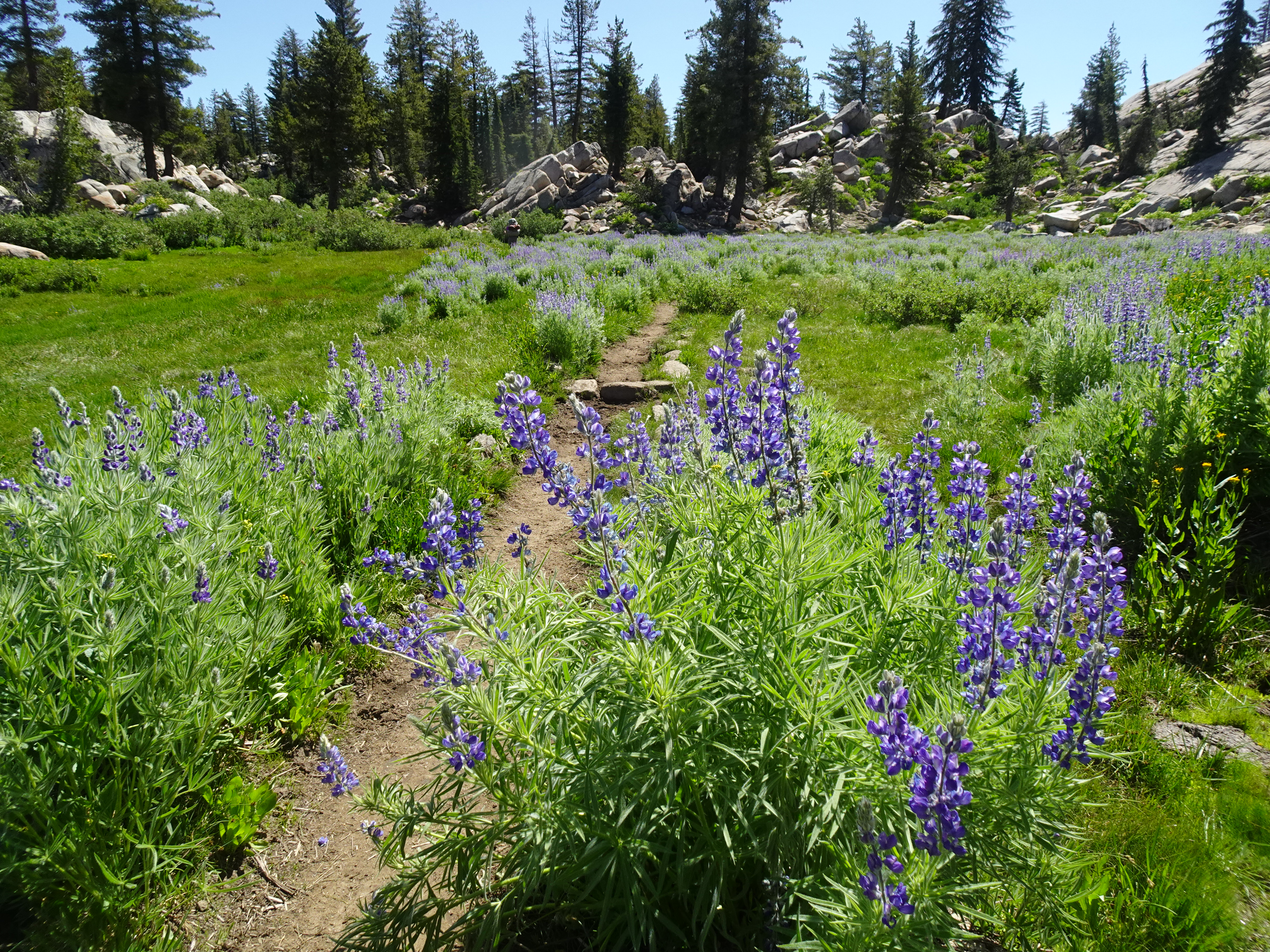
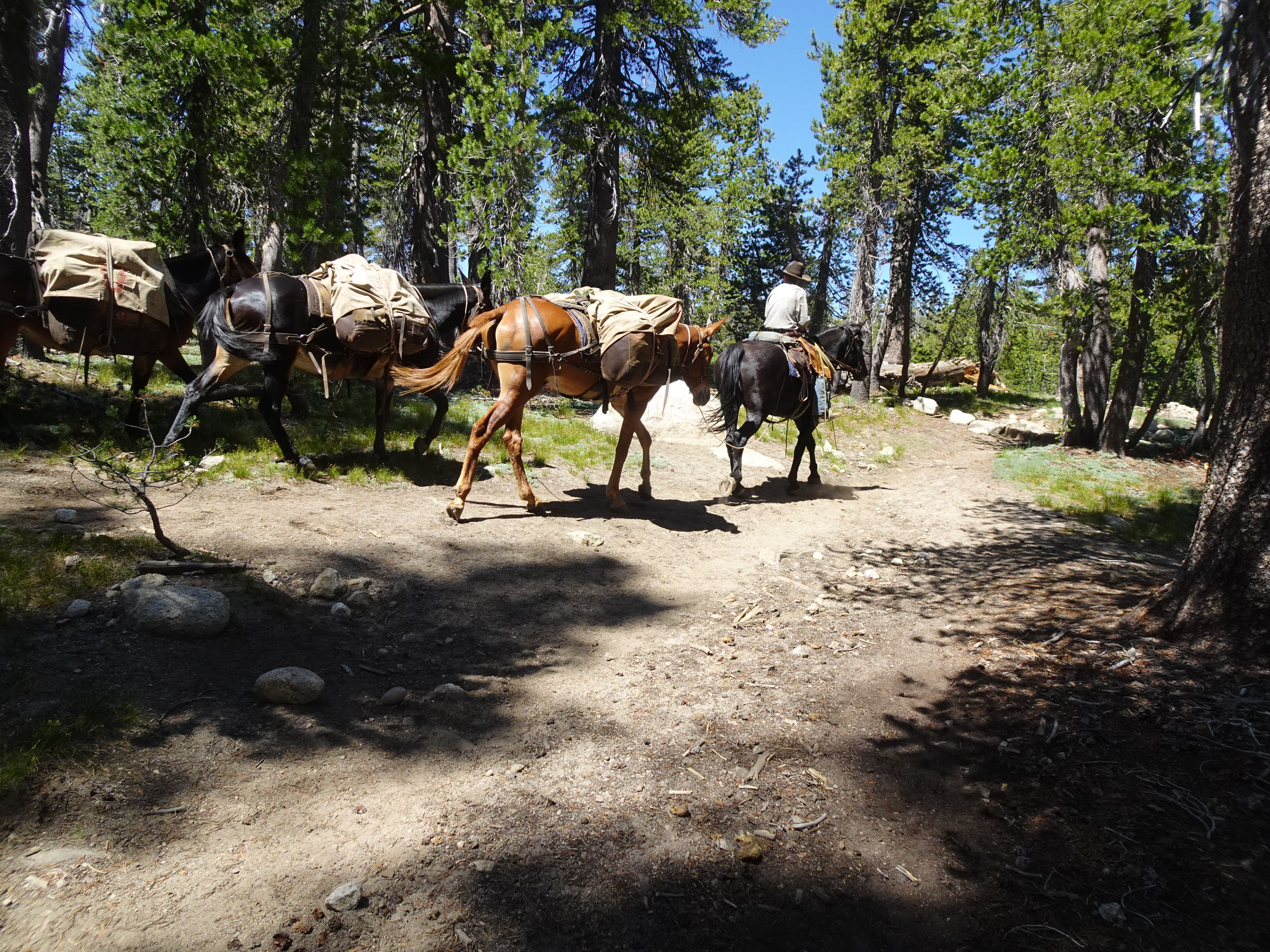
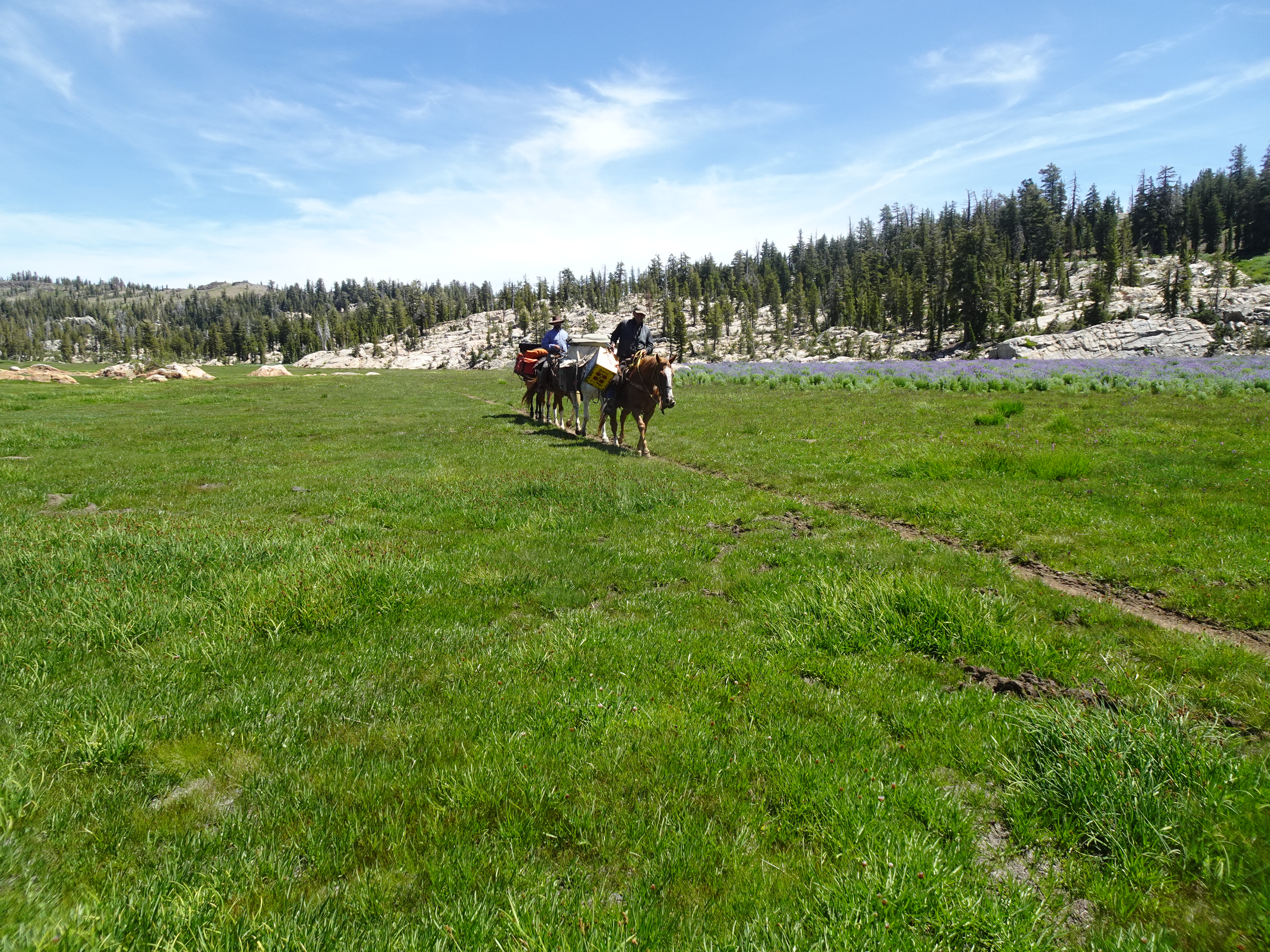
We then backpack to Wire Lakes, through meadows (including one that simply looked like a grass lawn in a beautiful setting), flowers, and passing another mule train.
 |
 |
 |
 |
 |
While crossing Salt Lick Meadow, Jennifer slips and falls and Bob photographs her before she gets up. Fortunately, no injuries.
 |
 |
 |
During the hike we see 3 sets of mule trains, one of which shown above is supplying forest service California Conservation Corp workers who maintain the trails and who are currently camped at Long Lake.
During this hike the mosquitoes are quite bad. As usual, Bob feels them land on his arm and squashes them before they can draw blood. After the trip, Jennifer confirms that it is only a female mosquito which comes for blood and does so before laying her eggs. Fortunately at the campsite mosquitoes are not so bad.
During the hike we get a glimpse of the distinctive rock to which yesterday we had day hiked.
At the first Wire Lake where we camp there are 3 other parties of 4 camping also and we saw one of the people swimming in the lake.
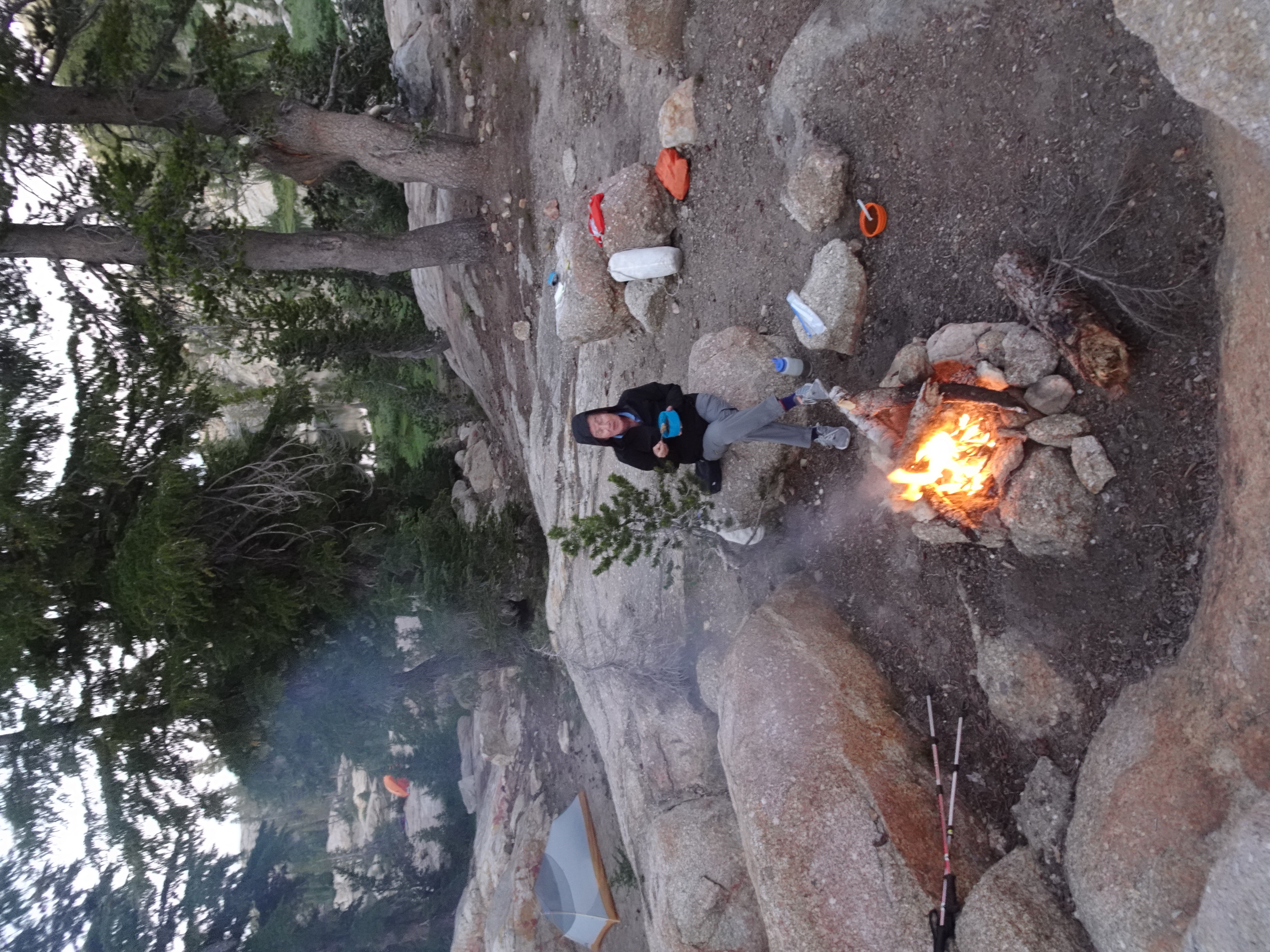
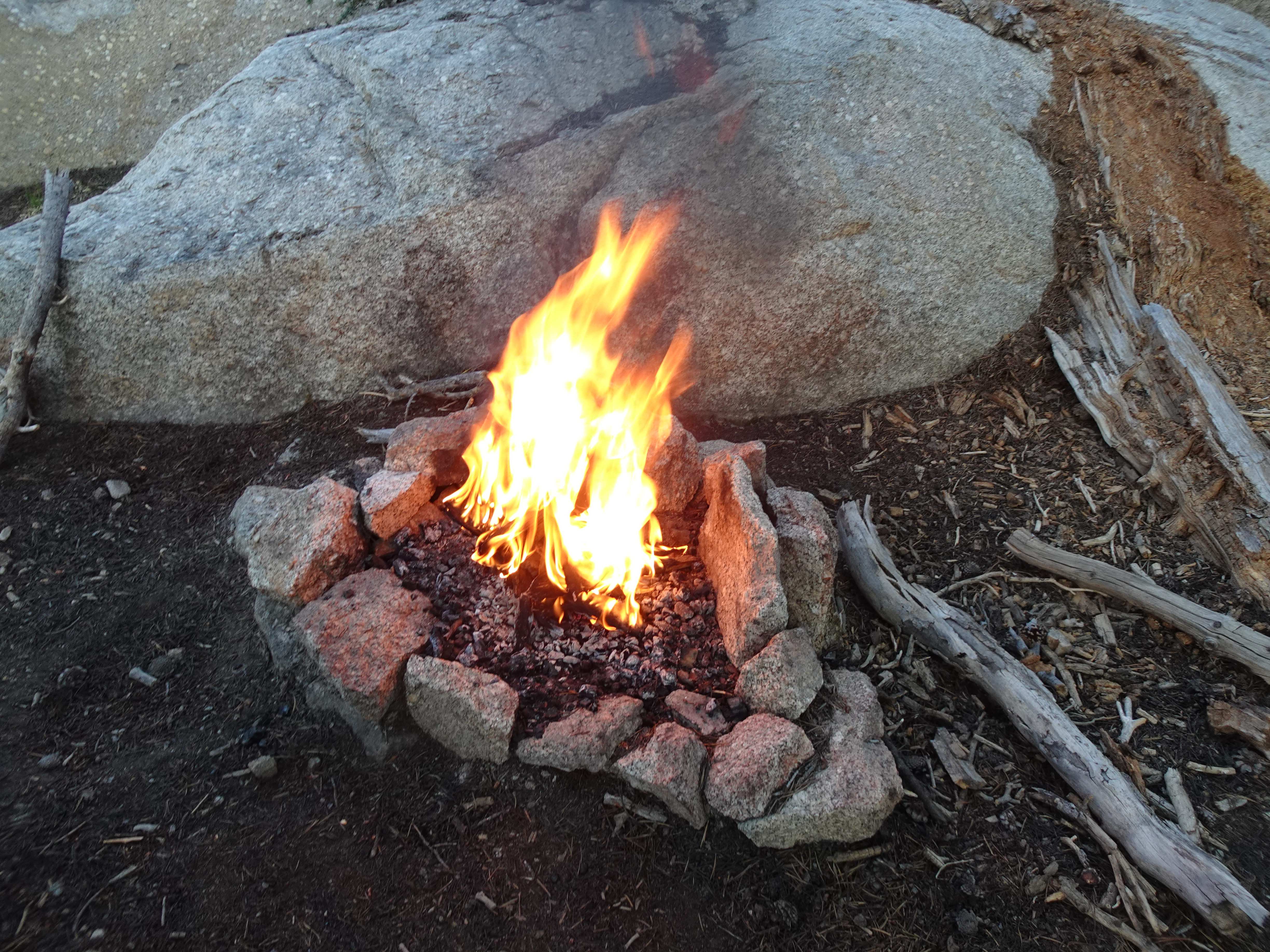
During and after dinner we have a roaring fire.
 |
 |
 |
Day hiked past Wire Lakes cross country to Deer Lake, then back by trail.
 |
Map: Hike to Deer Lake and back (dotted yellow line)
 |
Elevation Profile (understates distance): Day hike to Deer Lake and back
 |
Dinner: Pad Thai (packaged dinner from REI Backpackers Pantry)
Diary:
We day hiked past the next Wire Lake, then cut over towards Deer Lake, going cross country. As we were leaving we spoke with 4 guys camping like us at the first Deer Lake who spoke about some of the difficulties of going cross country. We continued to have perfect weather and the scenery was spectacular. At one point we got a view of the ridge with the hill and rock we had climbed a couple of days ago. And, as always, Bob felt it was important to stay hydrated.
 |
 |
 |
 |
 |
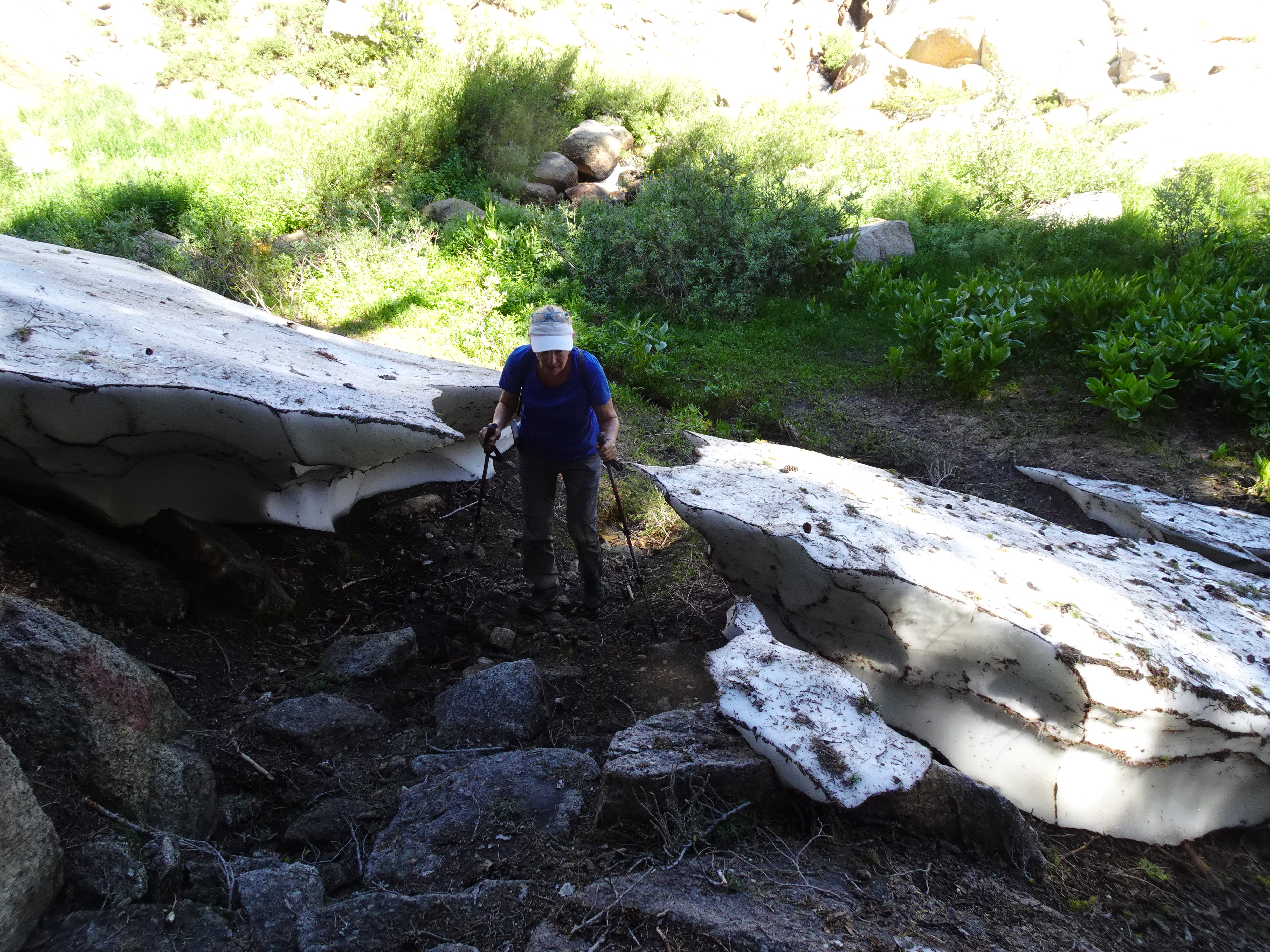
Once we passed the second Wire Lake and headed toward Deer Lake the GPS on Jennifer's phone was critical. Even so we had to backtrack and try different routes past/around boulder hills. Along the way we did get stuck:
 |
 |
 |
Once at Deer Lake we met a guy who was part of a small group of campers, one of whom had a drone he was using to get videos of the backcountry. Apparently there was another guy who was very unhappy about hearing the drone fly around in the wilderness (Bob's opinion is they should be banned). Given that the drone did however have videos/pictures of places we had been, Jennifer asked if they could provide her with them. She gave her email address to them and they agreed.
The guy then showed us a beer can from long ago of which he had found pieces. Based on the type of lid opening he was certain it was decades old.
 |
 |
 |
As we followed the trail around and away from Deer Lake on our way back to Wire Lake, we met 15 of the CCC workers repairing/improving trails (10 men, 5 women)
That night at Wire Lake Bob had his tent up with a rain fly (there was never any rain or threat of it). Looking up while in the tent, Bob first saw flying insects above his tent and crawling on the outside of the tent but below the rain fly. Then a bee of some type came in and began attacking the individual insects when they were landed on the tent. When the bee caught such at insect, it stayed in place and munched on the insect until nothing was left, then flew and tried to capture another insect. Sometimes the insect escaped, sometimes it was caught and eaten.
 |
Videos:
Wire Lake day hike map (dotted white line):
 |
Elevation Profile - hike around Wire Lake and behind campsite:
 |
Dinner: Tiki Masala and broccoli; rice with garbanzo beans with peppers, onions, carrots
Diary:
Bob gets up and leaves for peak across the lake at 7:10 AM, arrives at peak at 8 AM, and looks across lake for Jennifer, hoping to get his picture taken, but does not see her, so starts back at 8:15. Around 8:15 Jennifer comes to lakeside near camp, looks up, sees Bob on peak and goes back to get camera, but Bob has left by time she gets back. Timing is all! Bob returns to camp.
 |
 |
 |
 |
 |
After breakfast Bob and Jennifer go back up to peak and over to another nearby peak and eat lunch without salmon, then hike back to camp.
 |
 |
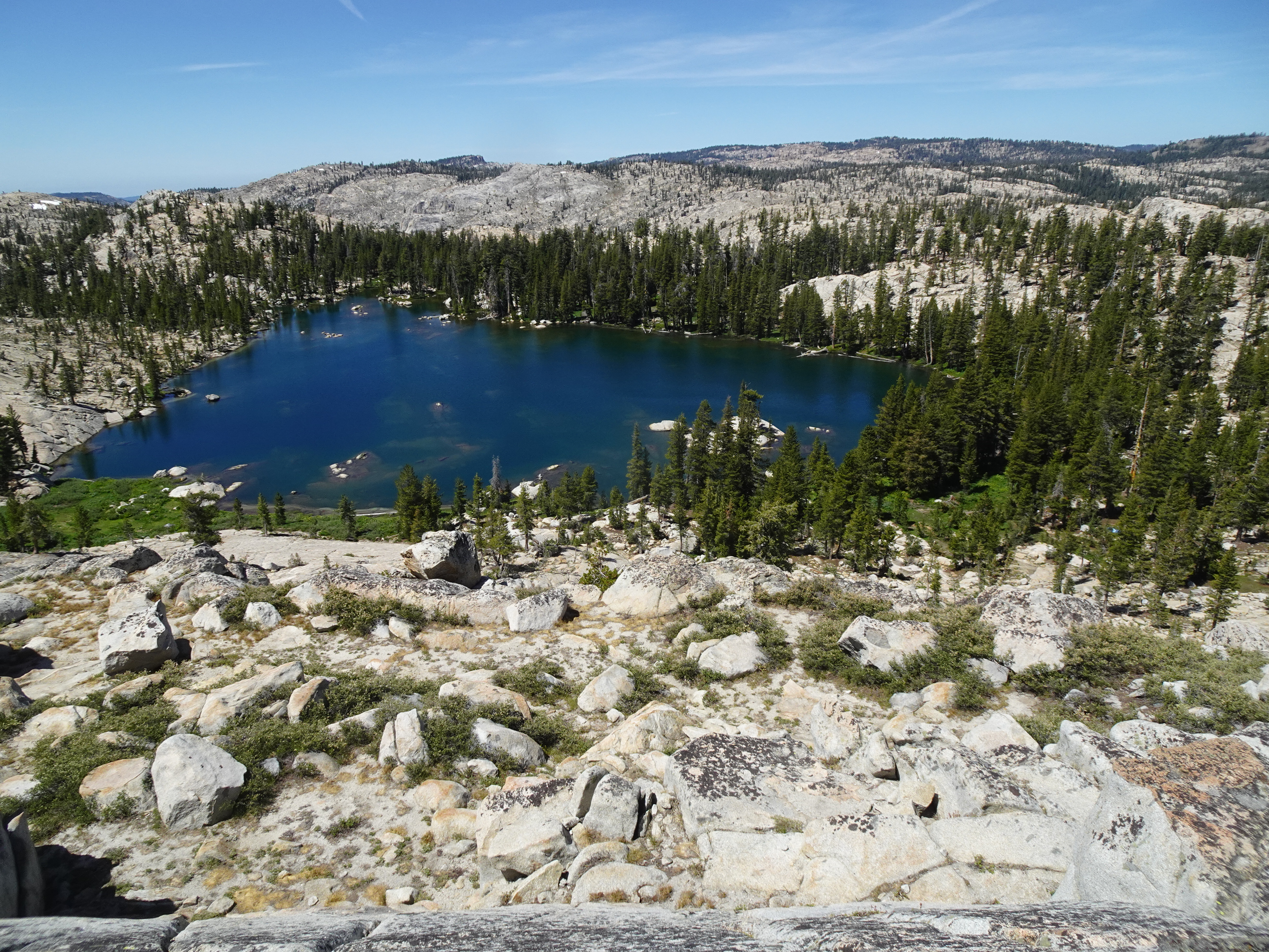 |
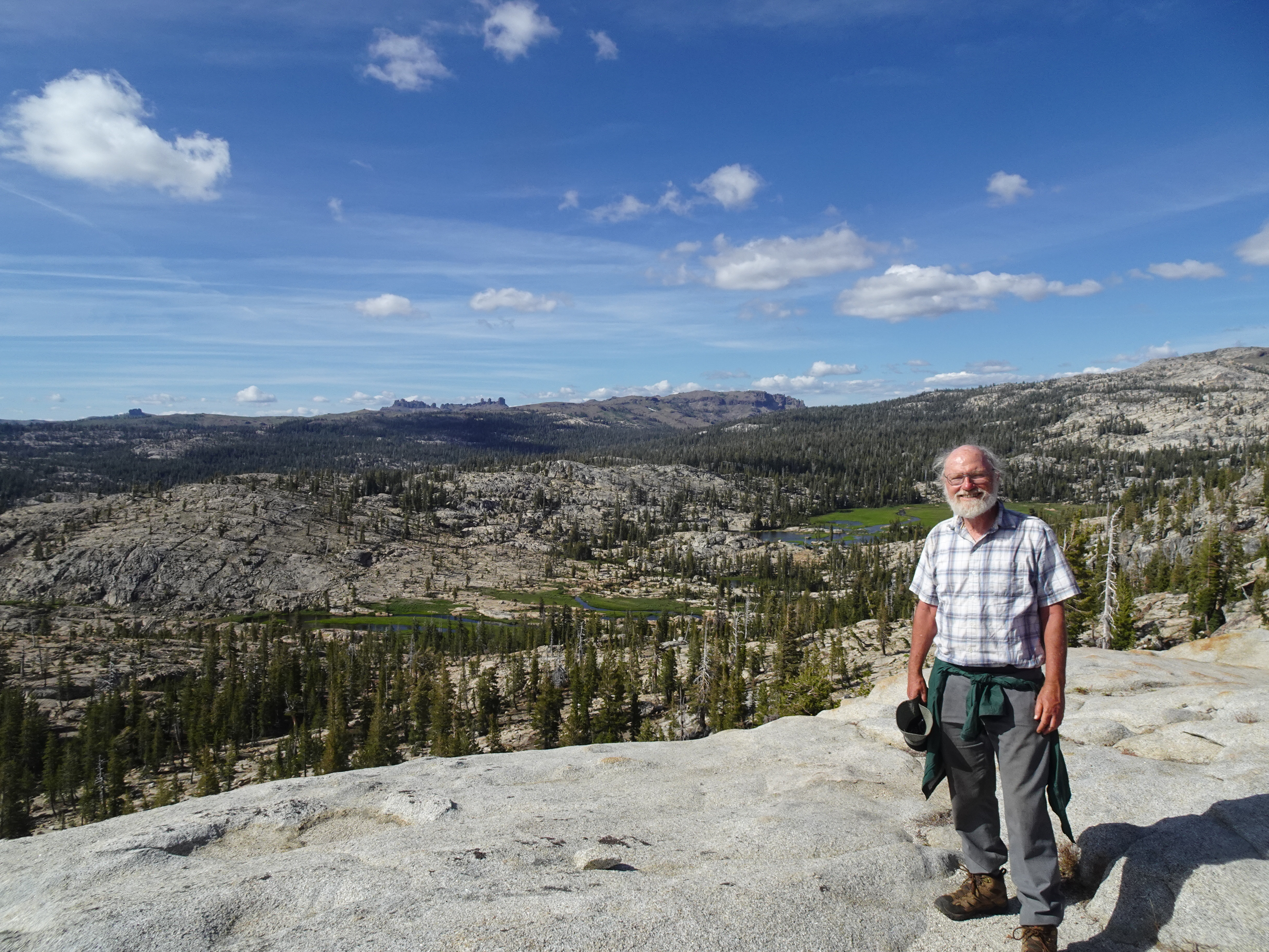
After resting - and eating salmon - Bob and Jennifer hike up to 2 peaks behind the campsite. The first peak is about 9,000'. Since lake is at 8,857', this is about a 150' climb. From that peak we see Spring Creek Meadow and lower Wire Lake, along with Deer Lake. We also view Castle Rock 6 miles away (as crow flies), along with Whitesides meadow, tomorrow's goal 4 miles away.
 |
 |
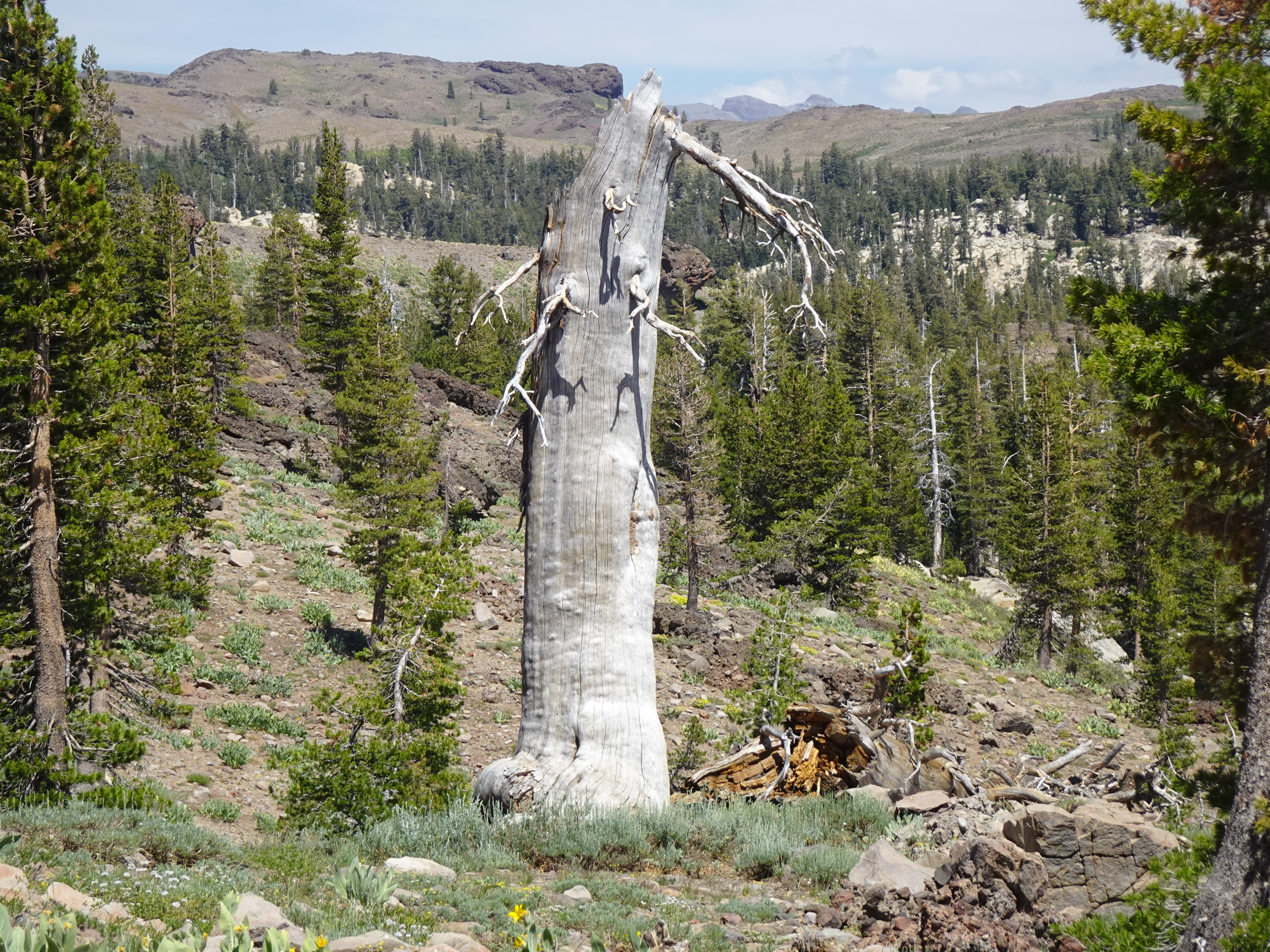
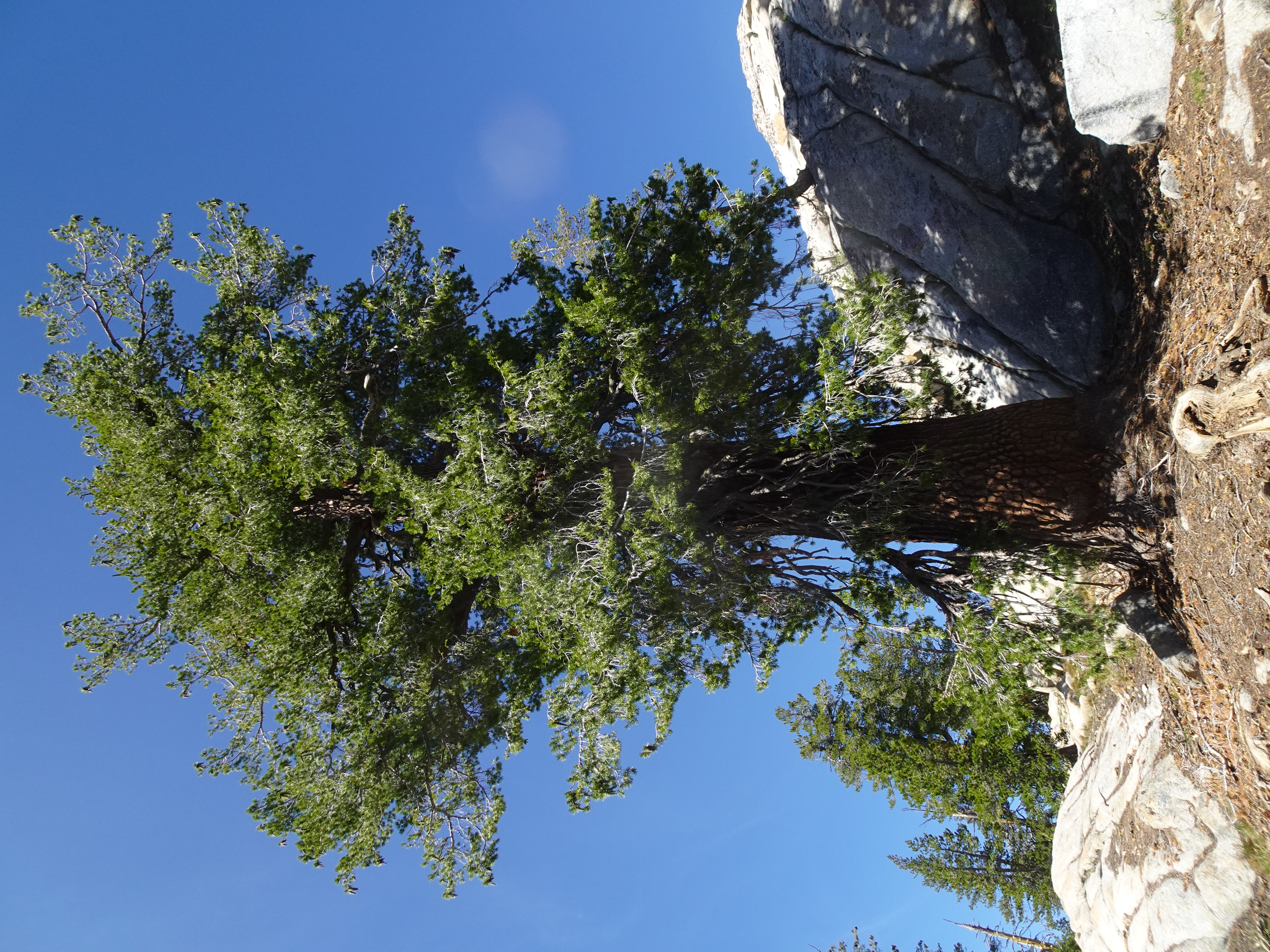
As we see through much of the trip, The redwood trees are magnificent and beautiful, but sadly, many appear to be damaged or dying.
 |
 |
Backpack from Wire Lake to Whitesides Meadow.
 |
Map from Wire Lakes to Whitesides Meadow campsite (Solid red line):
 |
Dinner: Egg plant parmesan with broccoli and kale (Bob eats all of unreconstituted kale as side dish before dinner).
Elevation Profile (understates distance) - Wire Lake to Creek near Whitesides Meadows 5.2 mi:
 |
Diary:
At 8:30 AM we begin our backpack to return to our campsite next to the stream near Whitesides Meadow. While hiking back we first meet son, then his mother, who are on the way to Long Lake where his father is a "sponsor" of the CCC crew there. The meadows of flowers continue to be so beautiful. We also meet two deer hunters returning from failed hunt on 2 horses with 2 mules. Bow hunting season had just opened in the Emigrant Wilderness the last week.
 |
 |
 |
 |
 |
 |
 |
 |
 |
 |
 |
 |
 |
We arrive at our Whitesides Meadow campsite at 12 noon. Whitesides Meadow seemed even more spectacular with wild flowers than it had several days ago. After a lunch of salmon, cheese, crackers and a little bit of dried fruit, we set up tents.
We hike up to a nearby ridge, but alas neither of us get cell service to inform families we have now started back and all is well.
Backpack from Whitesides Meadow to "unknown", small lake near junction to Chewing Gum Lake, then day hike to Chewing Gum Lake and back.
 |
Videos:
Map from Whitesides Meadow campsite to "unknown" lake (Solid white line) and day hike to Chewing Gum Lake (dotted blue line):
 |
Elevation Profile (understates distance) - Creek near Whitesides Meadows 4 mi to Pond at Chewing Gum Lake trail intersection - 2.3 mi:
 |
Elevation Profile: Day hike from "unknown" lake to Chewing Gum Lake and back
 |
Dinner: Beans, rice, cheese, salsa, and spinach
Diary:
Bob gets up at 6 AM and at 6:15 AM starts hiking to ridge, then hill about 2 miles away.
 |
 |
 |
 |
 |
 |
He returns to camp around 8:15 AM. At 9:20 AM we begin backpacking to our new campsite at a little unknown, unnamed lake near the trail junction to Chewing Gum Lake. Today was the day for meeting many people, dozens at least, chatting with many of them. However, we have the small lake to ourselves and it is quite pleasant. While backpacking we climbed up nearby ridge and Jennifer got very good cell service.
 |
 |
 |
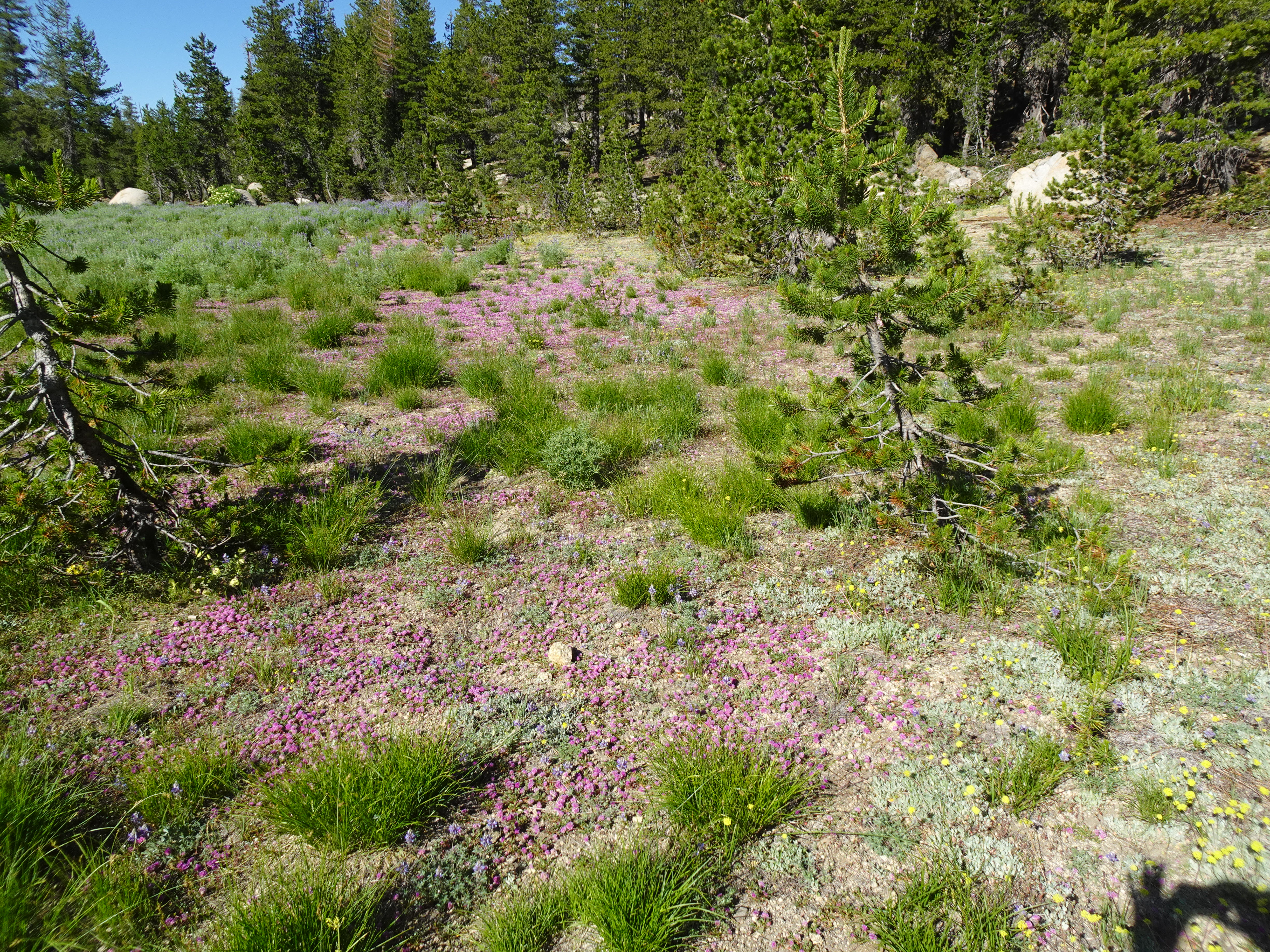
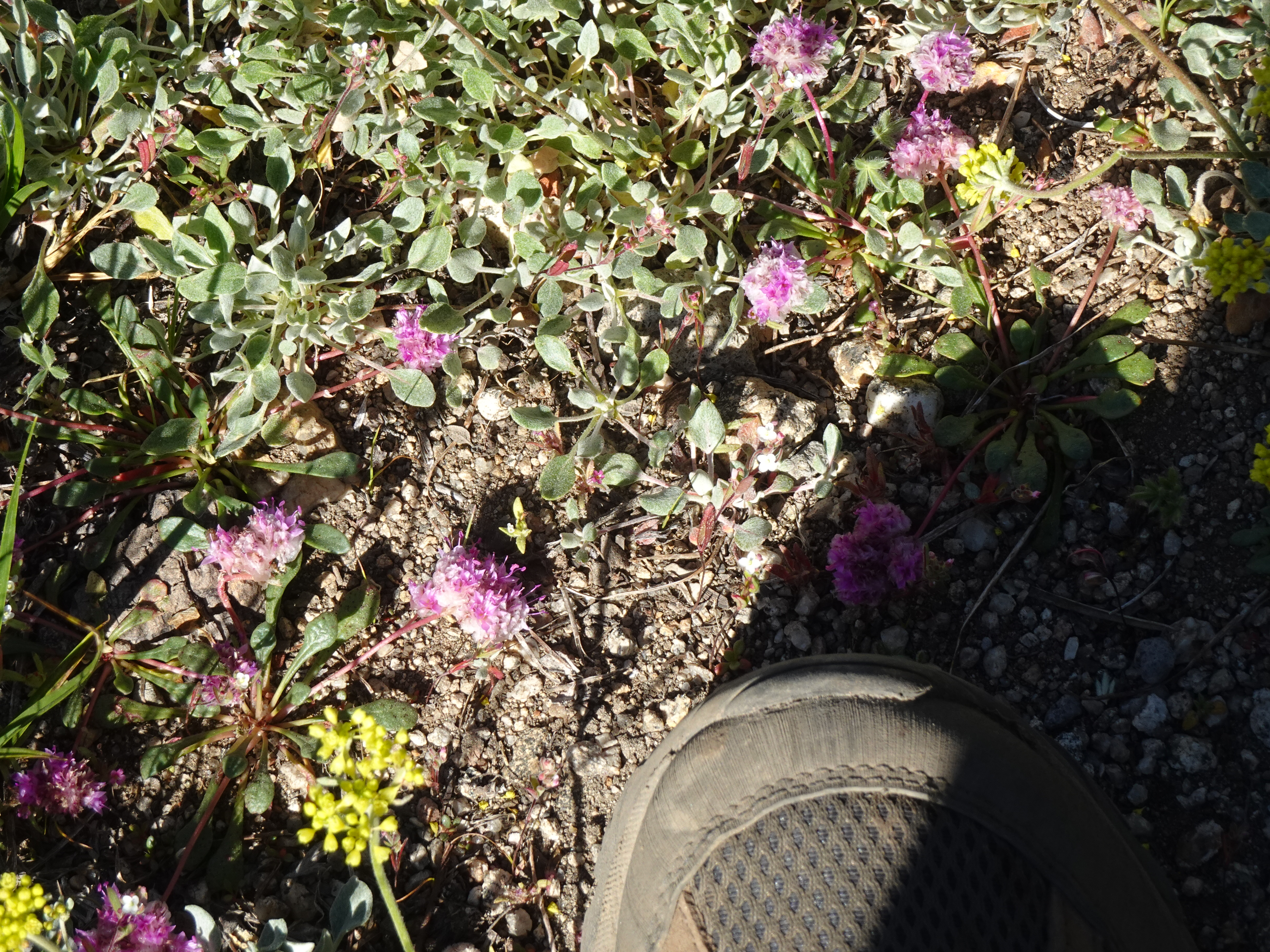
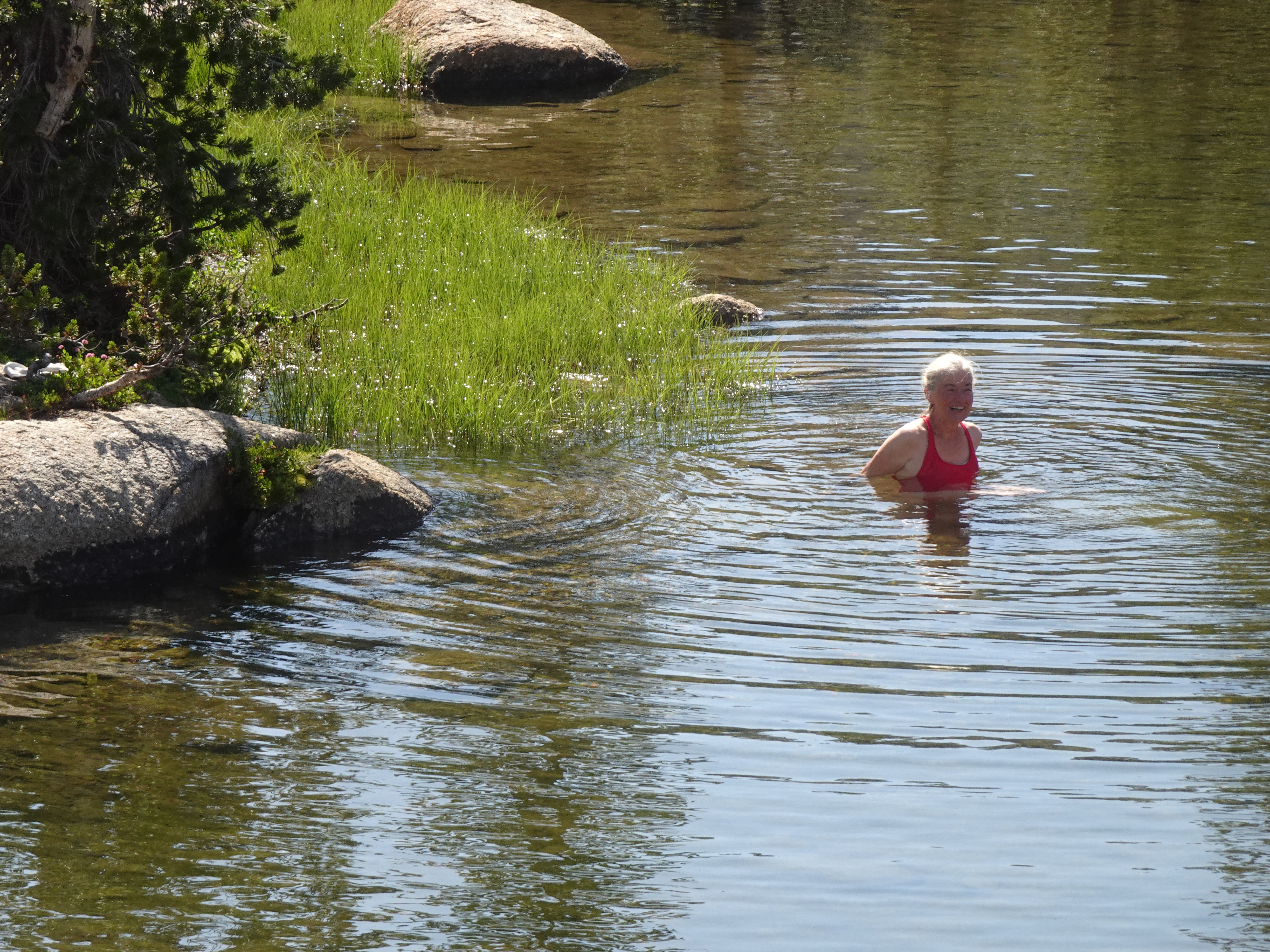
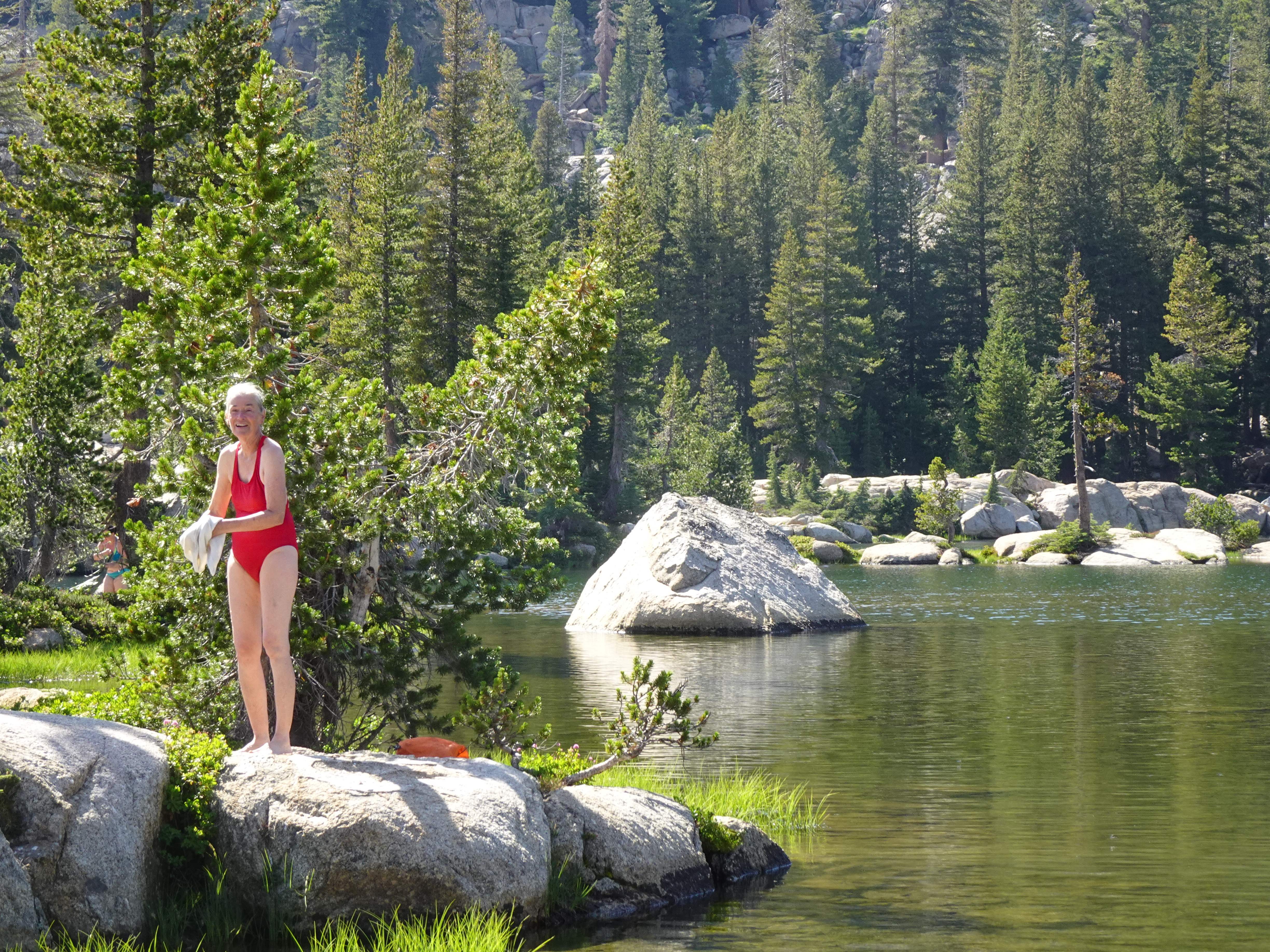
After setting up camp, we hiked down to Chewing Gum Lake where Jennifer went swimming. The meadows were covered with flowers and were beautiful, including one meadow that solid pink. Lots of people were camped at Chewing Gum Lake.
 |
 |
 |
 |
 |
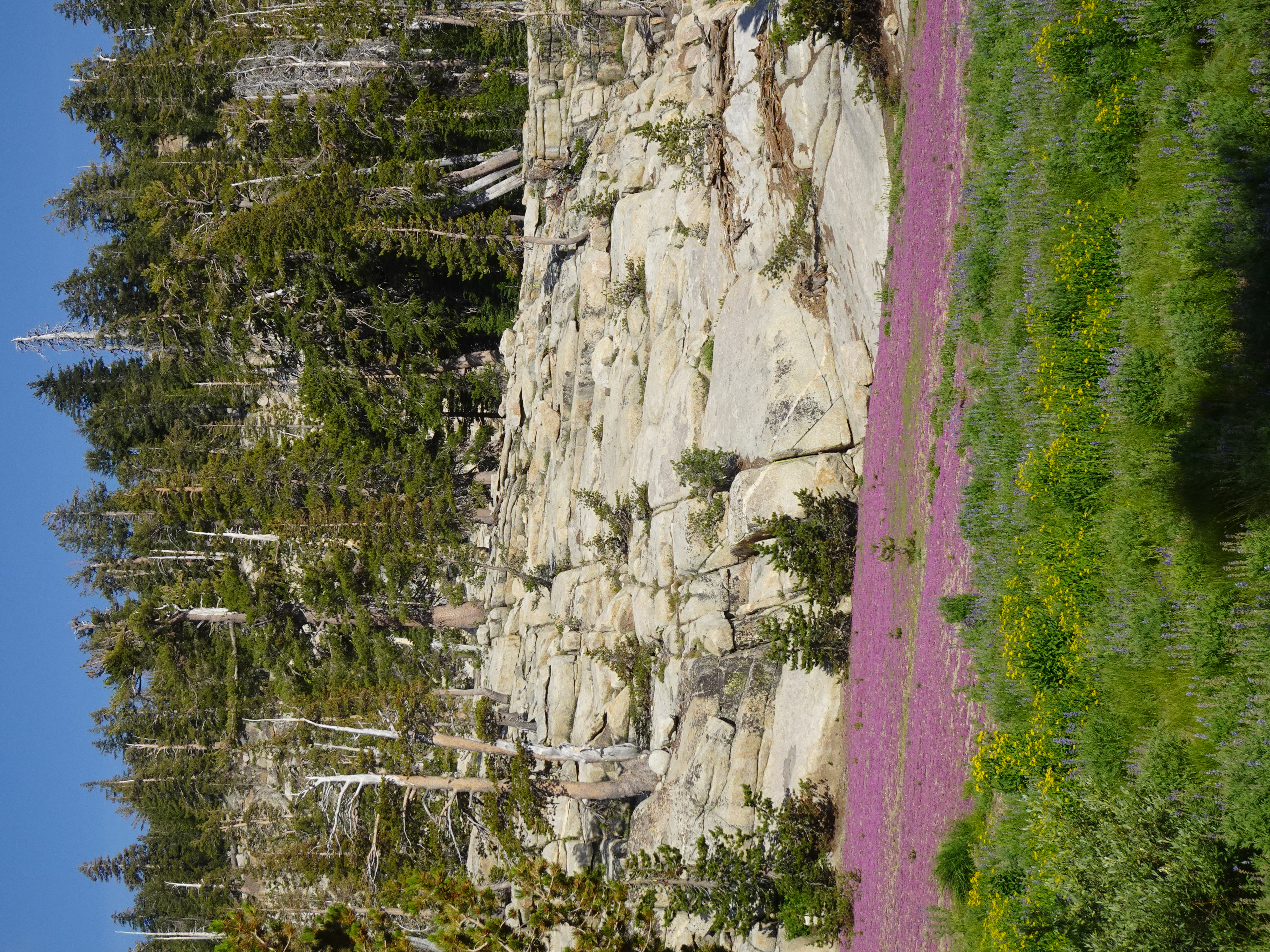 |
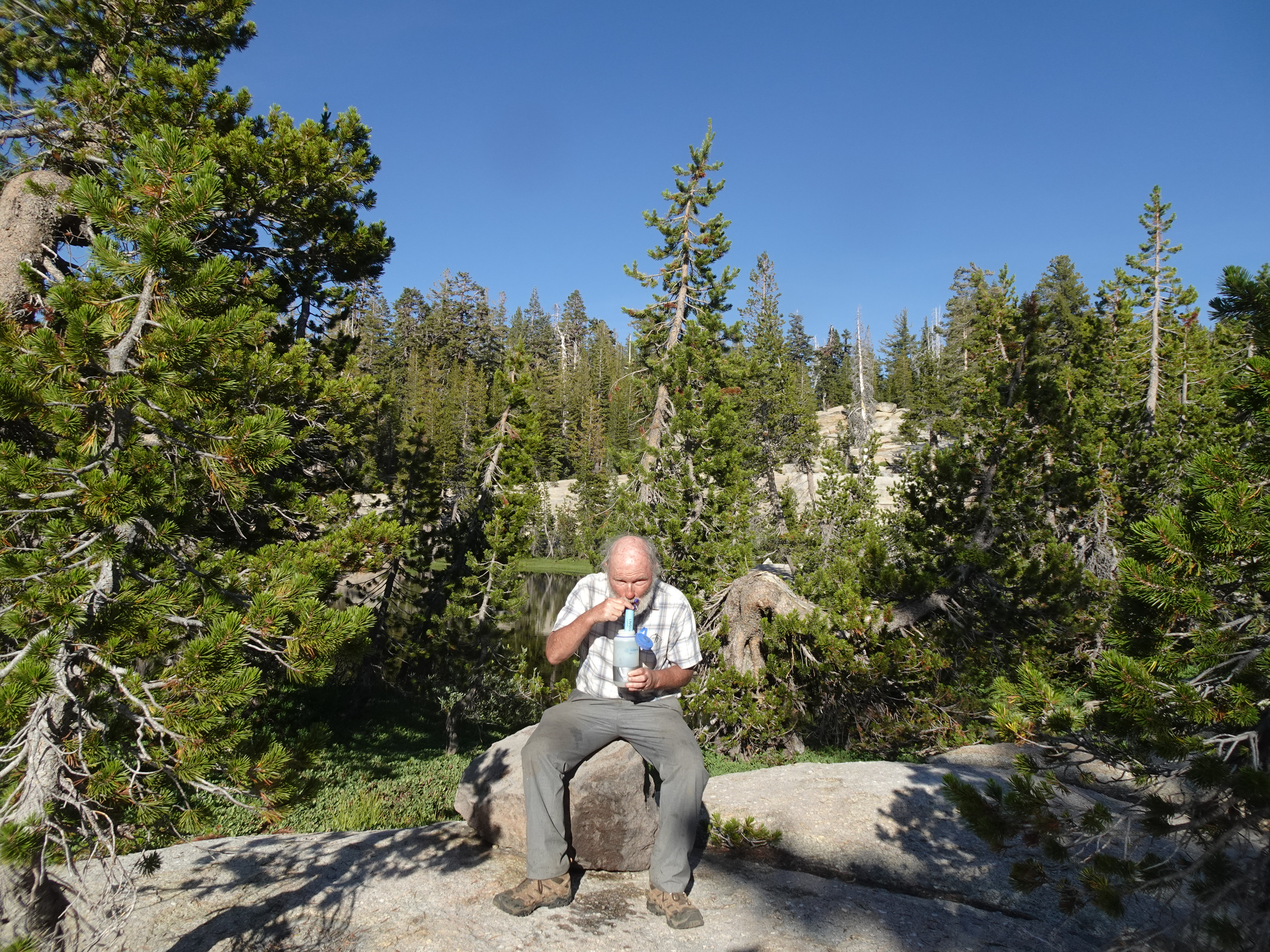
We returned to our own campsite and there tried out a new water purifier Bob's son David had provided. It is very lightweight and one simply sucks water from a lake or bottle up through a tube and the water is completely purified of bacteria, fungus, etc. This is a great backup to the usual Steripen water purifier. Jennifer took pictures of Bob using the device.
 |
 |
 |
 |
We finish our trip by backpacking from the lake with no name to the car at the Gianelli trailhead.
 |
Map: Backpack from Unknown Lake to Gianelli trailhead (dark blue solid line)
 |
Elevation Profile (understates distance) - Pond at Chewing Gum Lake trail intersection to trailhead 3.6 mi:
 |
Dinner:
Diary:
Our last day of backpacking went smoothly and well.
 |
 |
 |
 |
 |
They then went ahead to the parking lot, opened their car door, and it began honking loudly. I almost said something about that. I thought what a stupid car design. Then I got to my car, put the key in the door and opened it, and my car started honking loudly. That surprised me - it is a relatively new car for me. I guess you are supposed to using the electronic key to open it. What a stupid design! However, the ride back went smoothly, with a stop at Subway for Bob to eat a sandwich (Jennifer walked to a nearby restaurant and brought back something she liked).
What a wonderful backpacking trip!
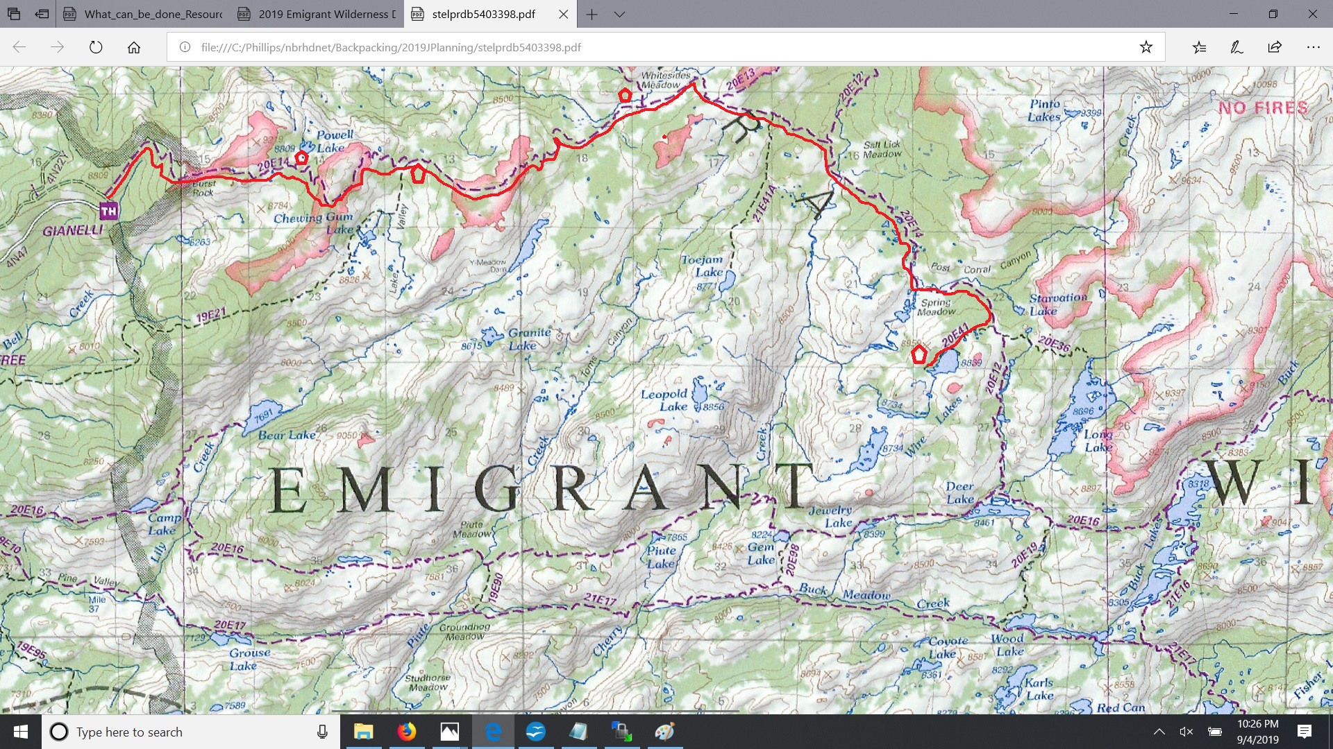
The map below is an image from the Forest Service Emigrant Wilderness map available in its entirety here. The red line on the image below is our backpacking route with our campsites shown as red pentagons. Refer to day-by-day notes above for day hikes.
Propane
Used 1 large canister (8 oz) and part of 1 small canister (3.5 oz) for nine days. Used 1.25 oz for first four days and about .75 oz/day for the next five days. We were able to use less because (1) later meals required less cooking time and (2) we heated water via the sun and soaked dehydrated food for longer. For future should assume 1.25 oz/ day. A typical day included heating water for coffee/breakfast in the morning and for dinner at night.
Food comments
Never again
Food Chart

Photos and narrative were contributed by both of us: Jennifer and Bob
Here are all of the backpacking trips Jennifer and Bob have taken
Other Websites
By Bob:
Bob Phillips [phillips bob 27 at yahoo dot com - no spaces]
Santa Rosa, CA
August, 2012