For any of the following Favorite photos, click on the image to bring up the full resolution version. Day by day photos and narrative follow these.
These two videos show, first, how Bob reacted to swimming in Emerald Lake and, second, how Reenie reacted: Bob's Reaction and Reenie's Reaction
|
 |
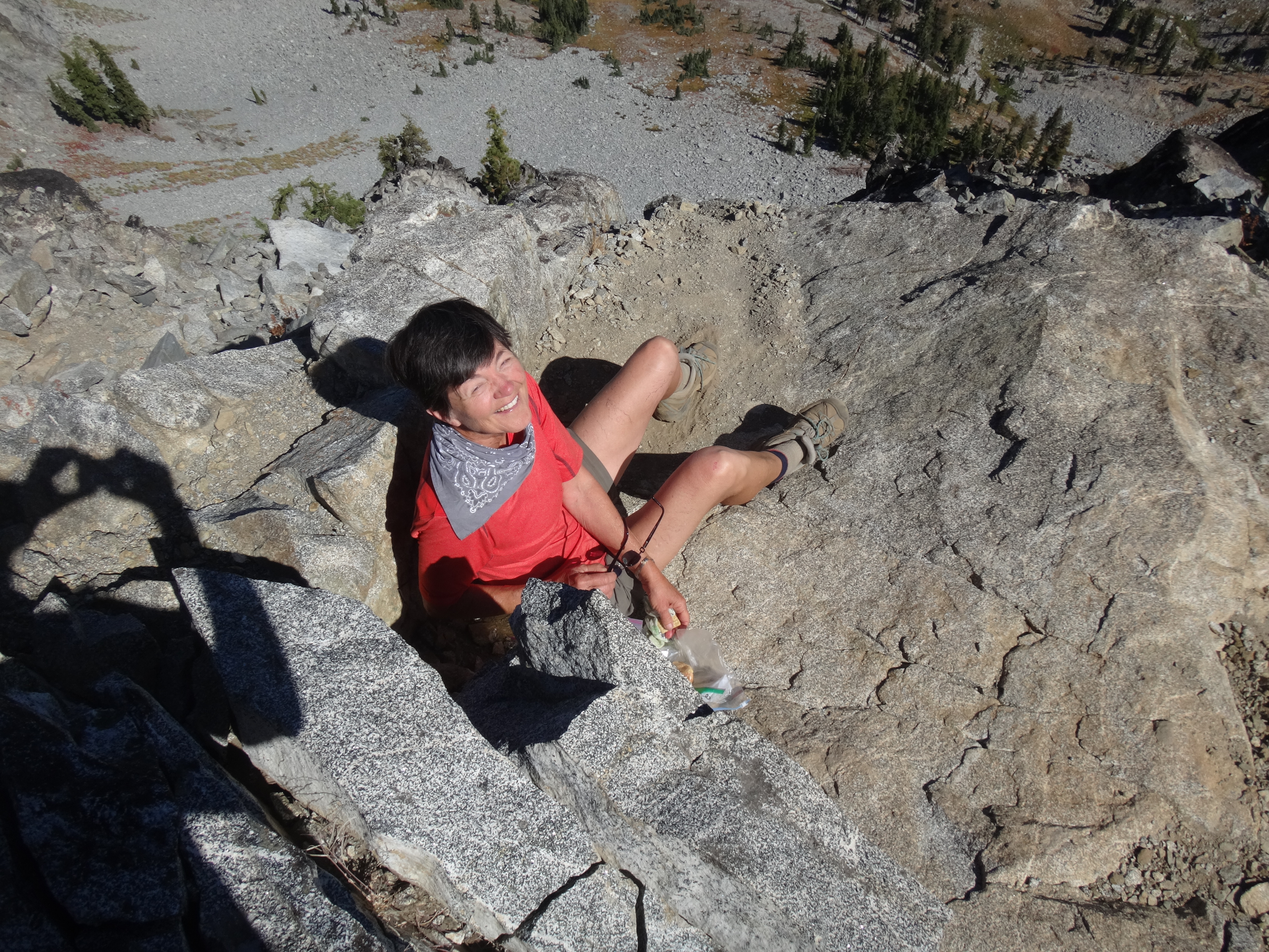
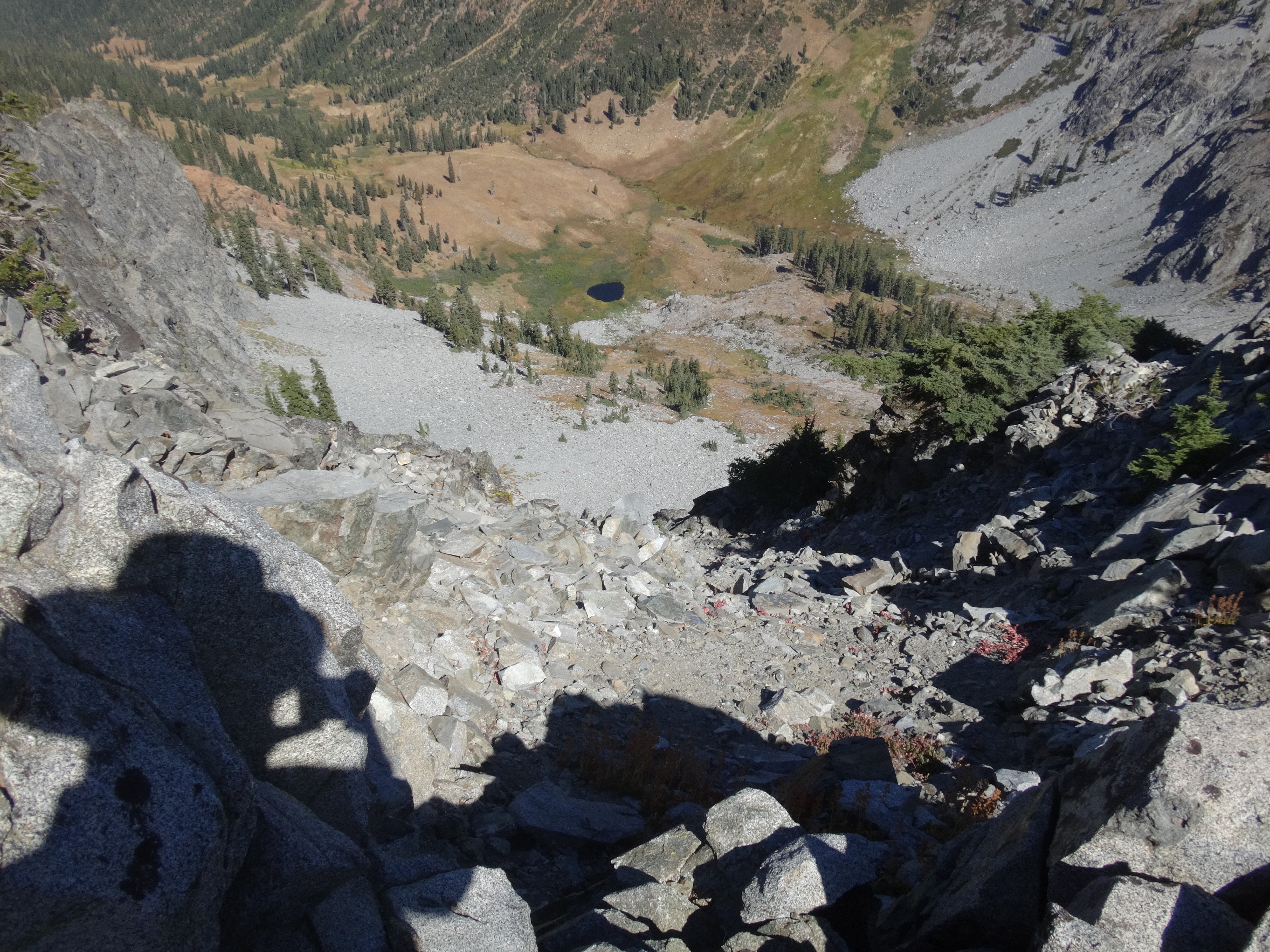
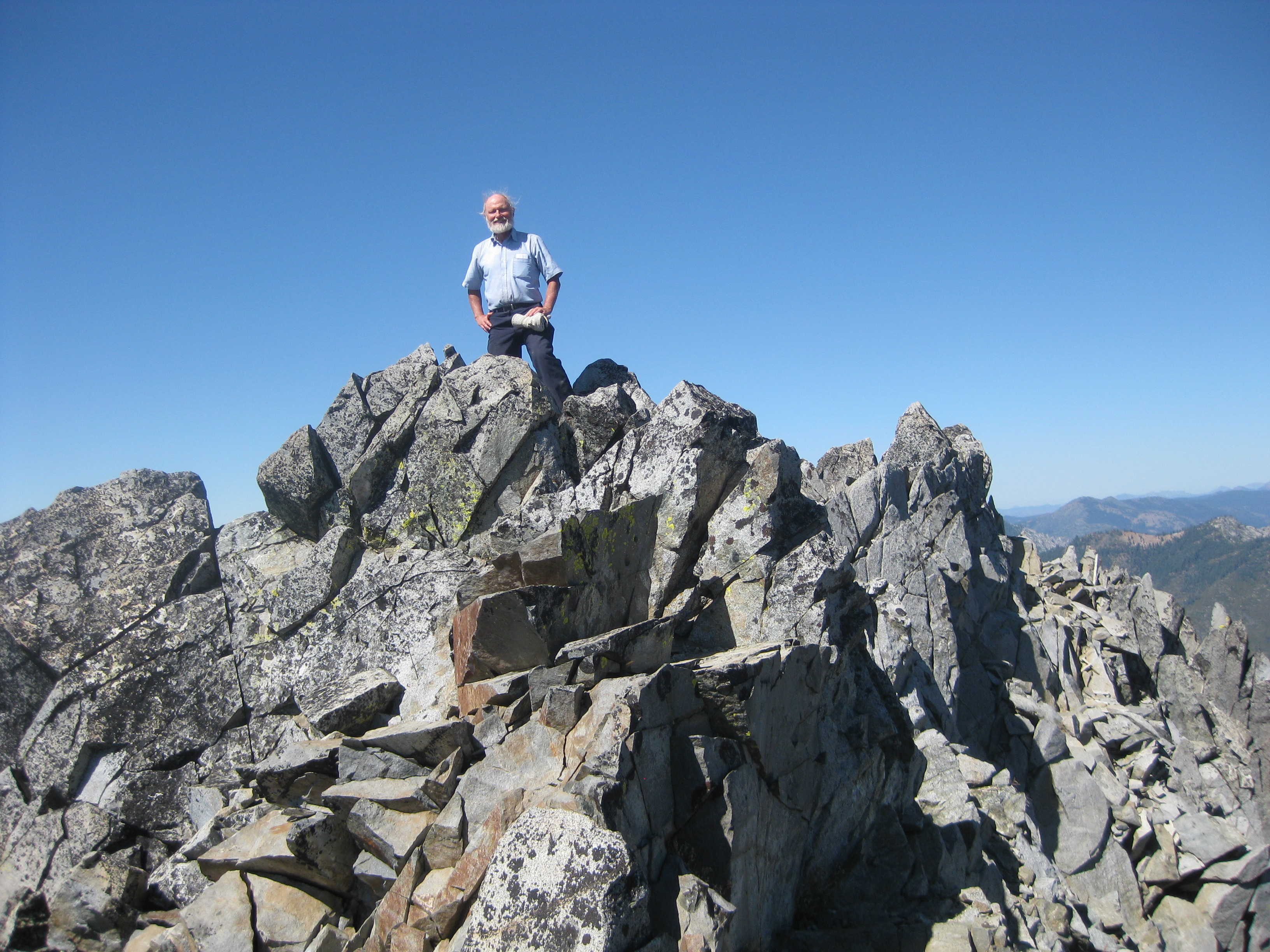
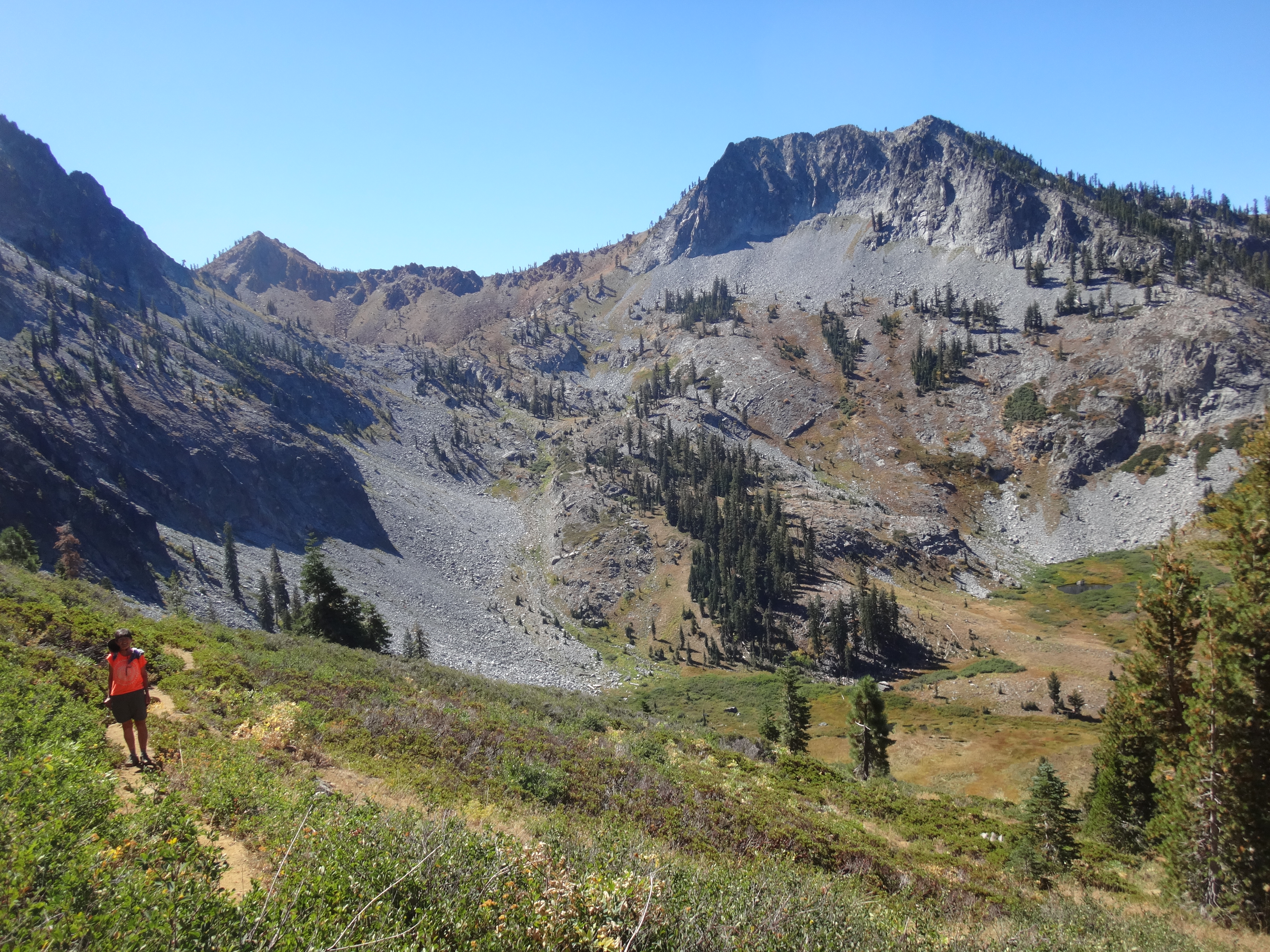
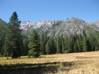
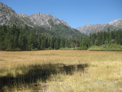
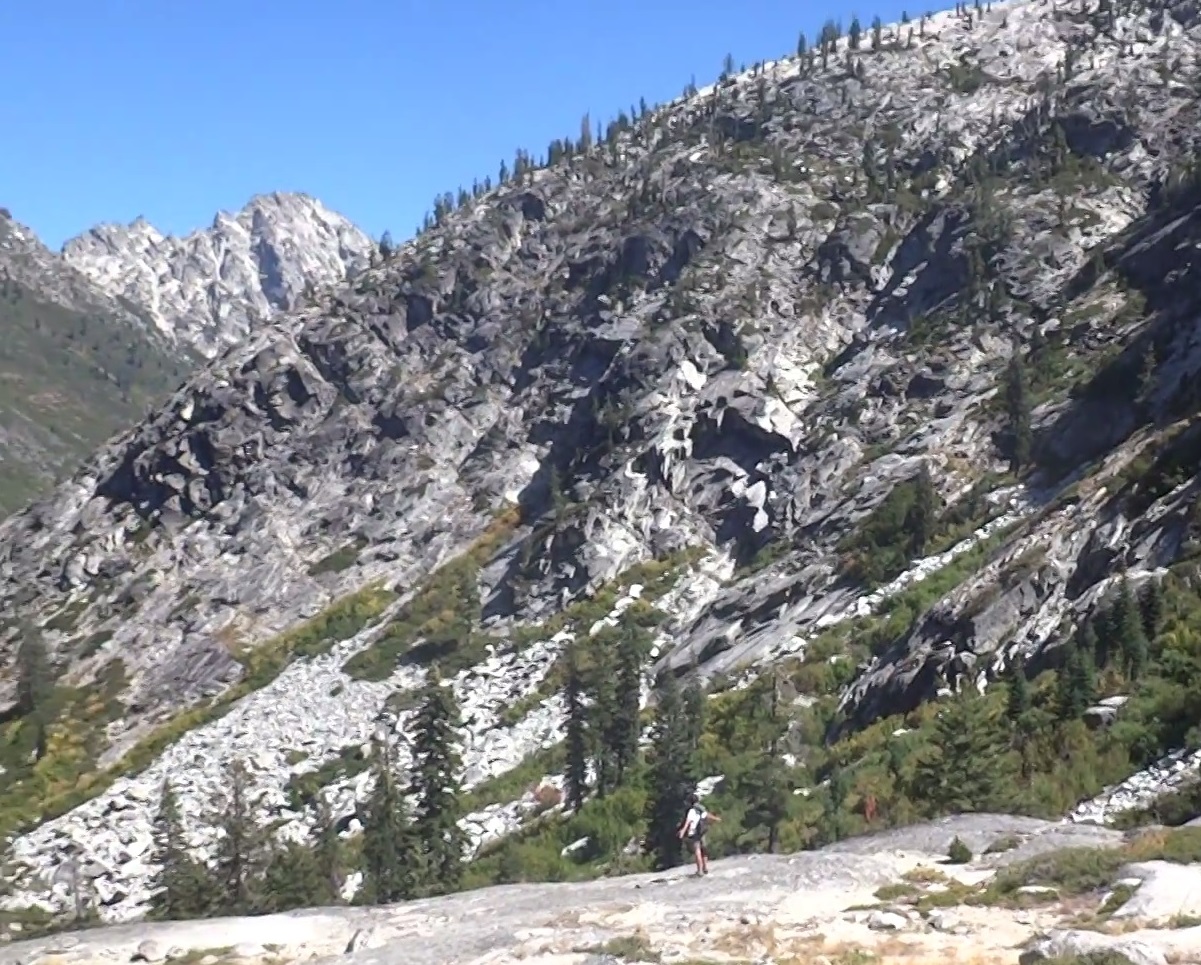
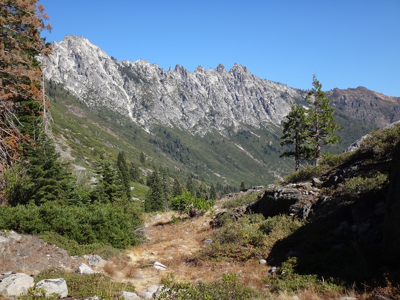
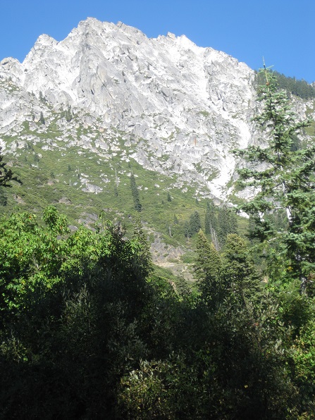
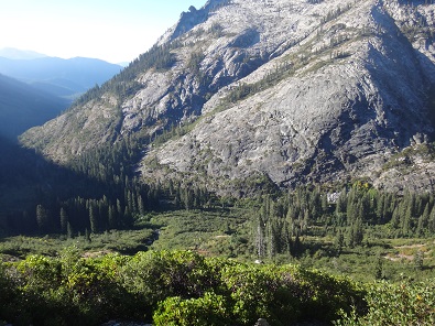
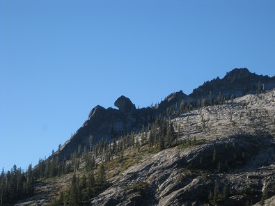
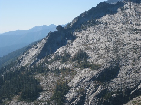
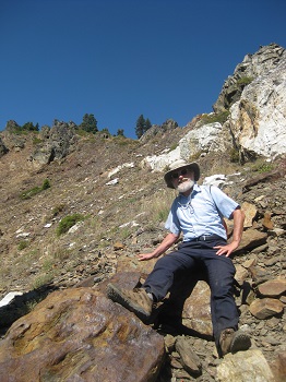
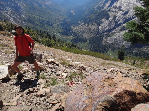
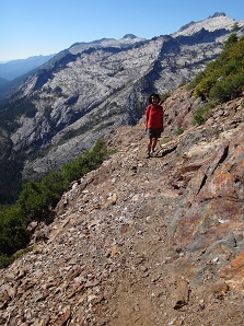
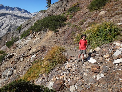
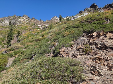
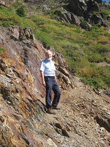
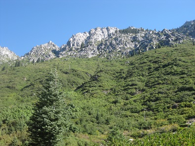
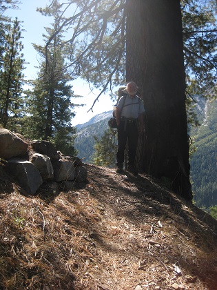
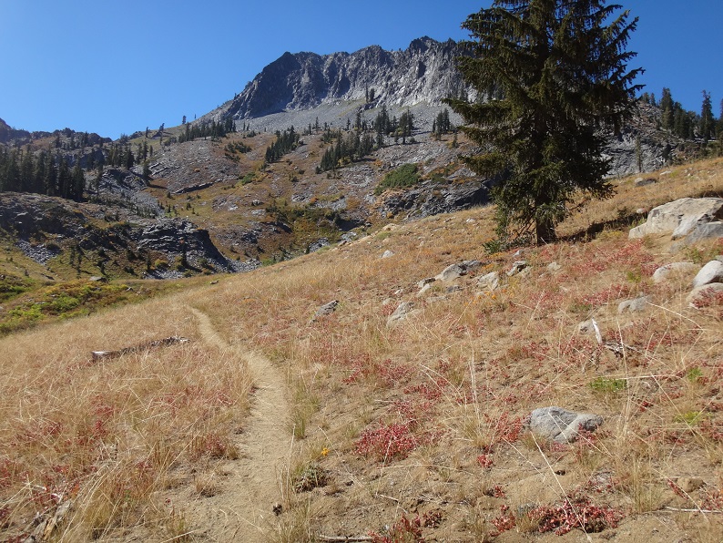
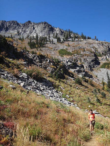
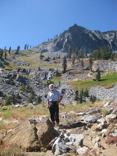
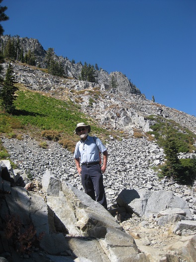
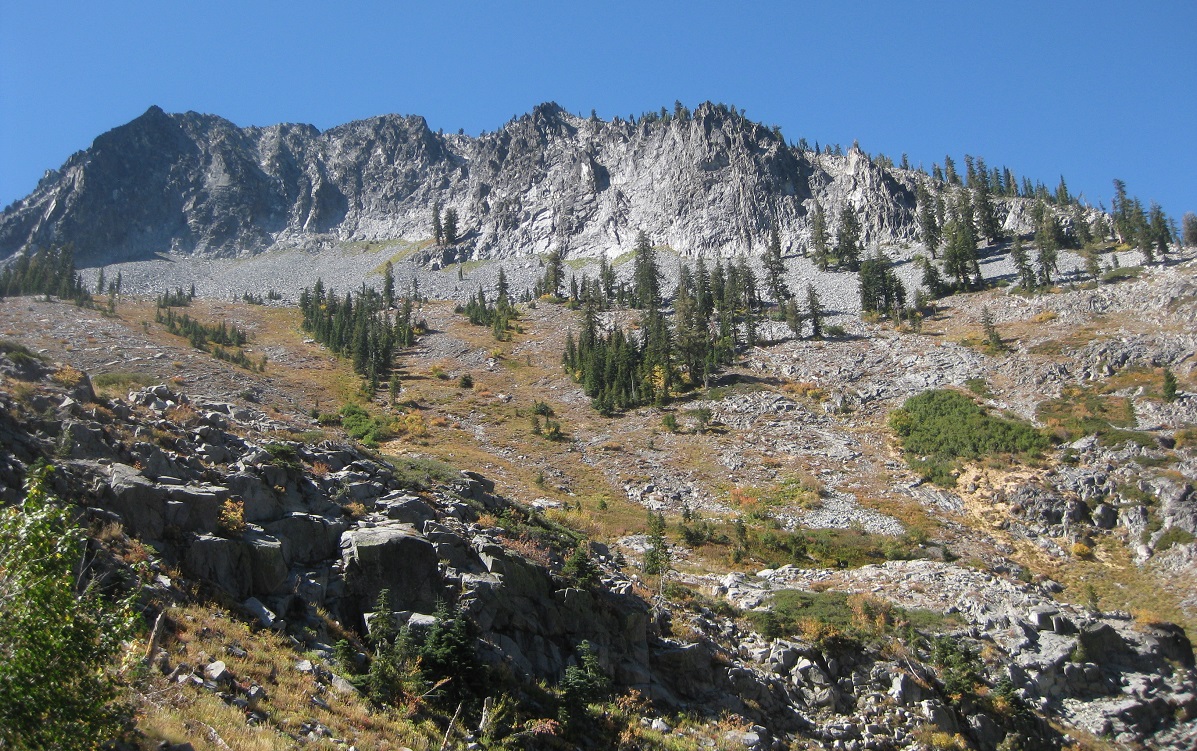
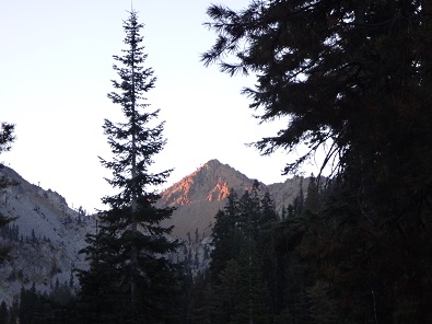
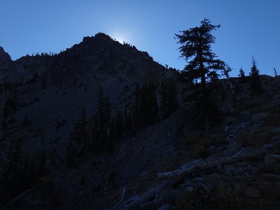
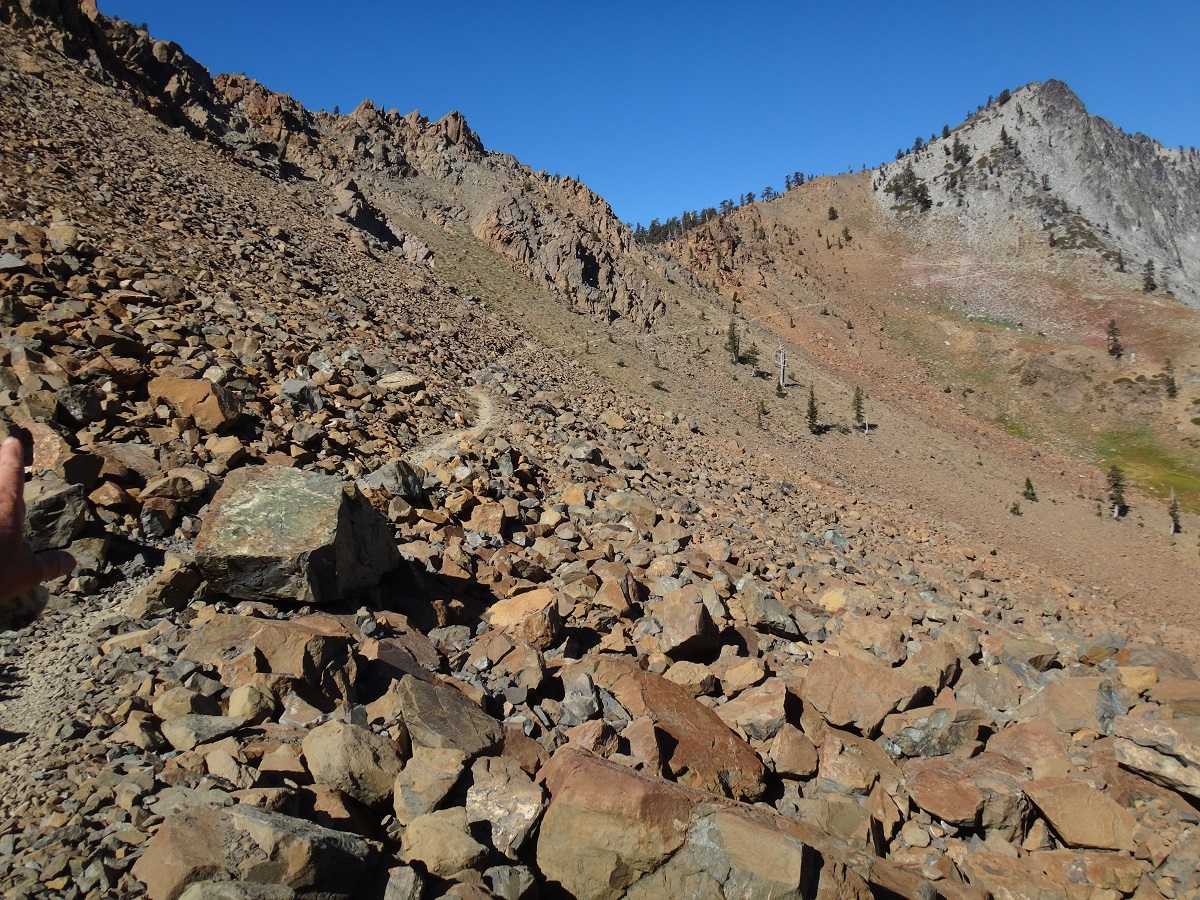
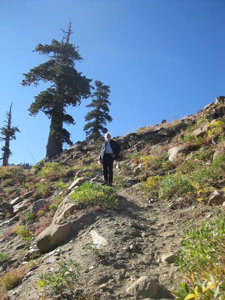
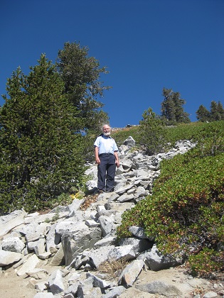
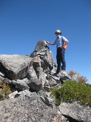
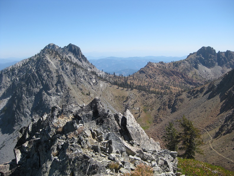
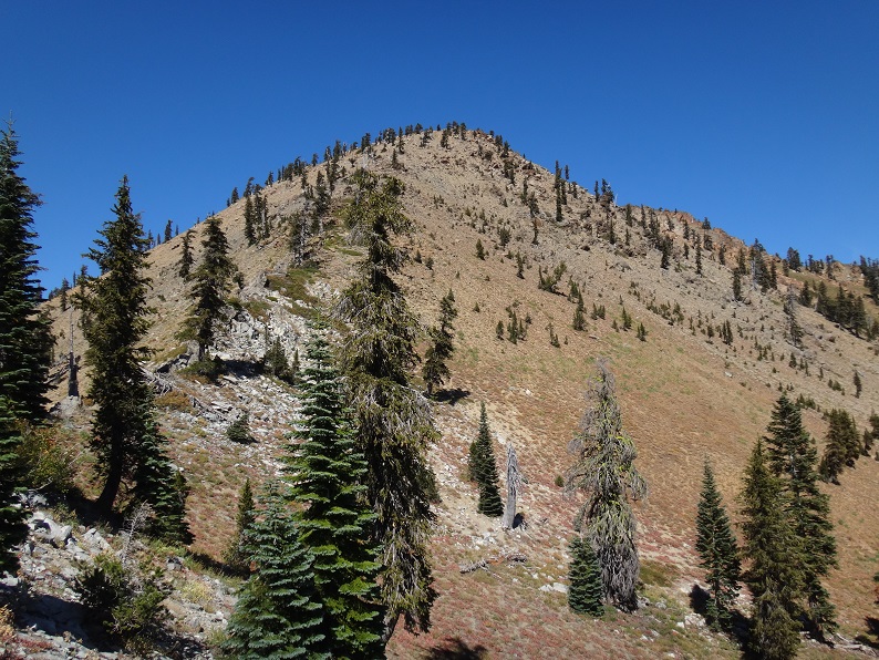
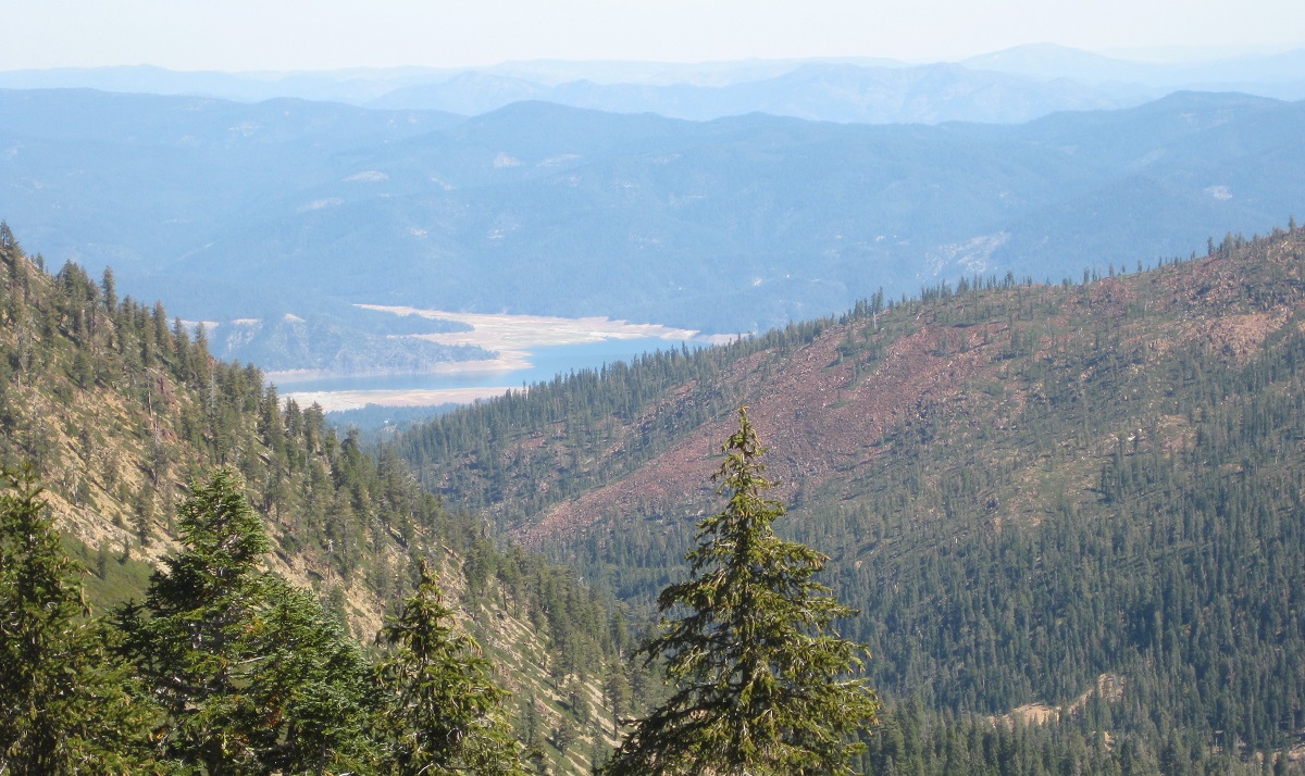
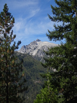
The first 5 photos below were all taken at the top of Siligo Peak. The photo below those five, taken while going up the Granite Lake trail the next day, shows Siligo Peak from a much different angle, and points to the place the first 5 photos were taken.
 |
 |
 |
 |
 |
 |
Video suggestion: All videos shown below are very short and HD (1080p). I find best YouTube settings (for all but the few with Bob, Reenie, or animals) are HD (1080p), slow motion (0.25 or 0.50), and full screen. Actually, watching Bob and Reenie in slo mo can be amusing.
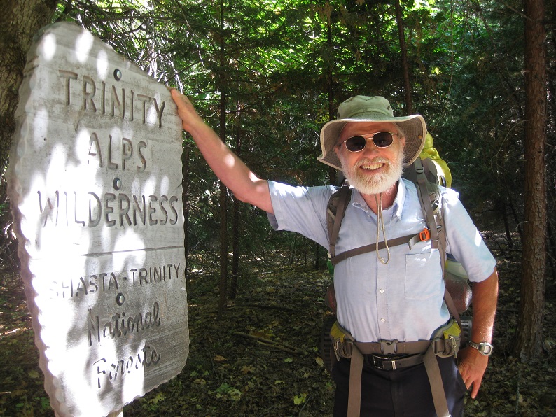
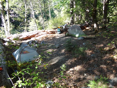
Drove to Trinity Alps and set up tents at Bridge Camp, right near Stuart Fork trailhead. No backpacking required.
Dinner: Subway all-veggie sandwiches.
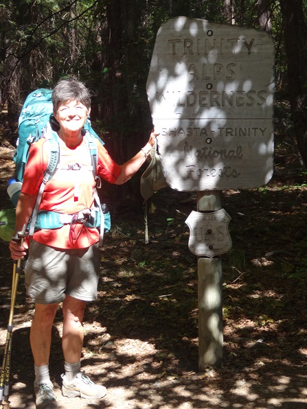
Reenie and Bob are on the road by 7 AM, and do not get lost even once all the way to the trailhead - major accomplishment! In Redding we pick up our wilderness permit (sadly, no fires are allowed), after already having obtained our stove permits on-line. We also stop for all veggie sandwiches at Subway.
As we are leaving Redding, we pick up a hitchhiking couple, he from Mexico, she from Italy. They had been with a larger group in Canada, but had split up to hitchhike down to California.
We let the hitchhikers off in Weaverville (we would later find, at the end of the trip after getting home, that one of them had left a bag in the car trunk), and drove to the Trinity Alps Road turnoff. Bob, who wanted a picture, simply stopped in the middle of the highway. We decided this was not the best of ideas, so pulled off the highway for more intersection photos (click on second photo for full beauty of the intersection!).
 |
 |
 |
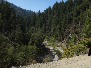 |
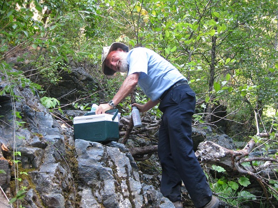
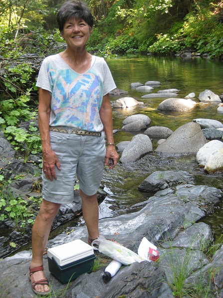
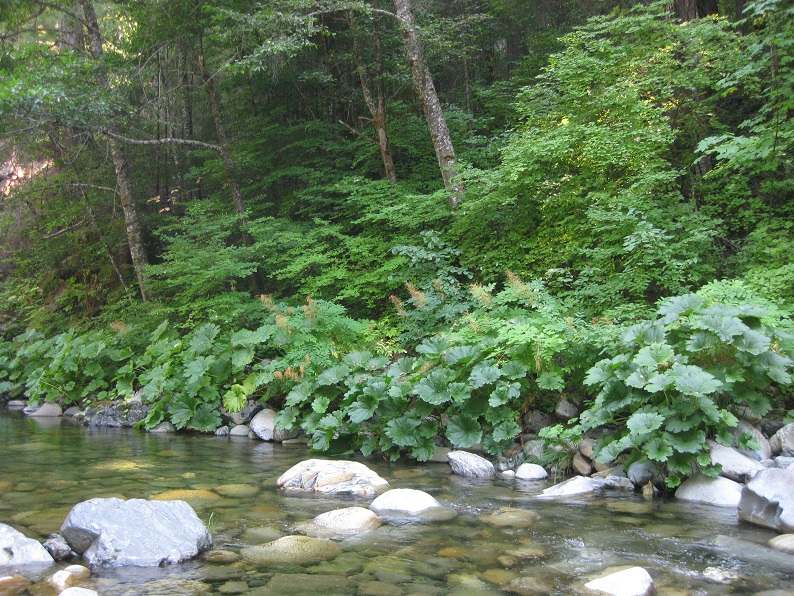
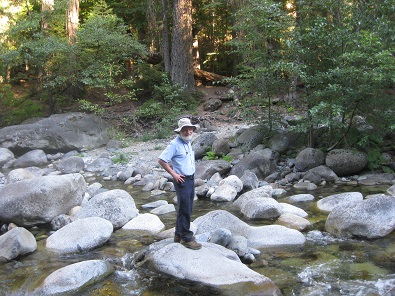
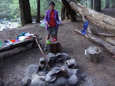
We drove on to the Trinity Alps Resort (Reenie's husband had actually stayed there as a college student), then on a dirt road for about a mile to Bridge Camp, where for $10 we were able to set up our tents near the Stuart Fork river, with few other people around, and walked down to the river. The river banks were covered with a very large leaf plant, probably the gunnera plant. The camping ground included a water tap and latrines, so we did not have to purify water using our Steripen.
 |
 |
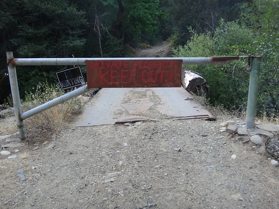
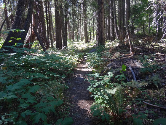
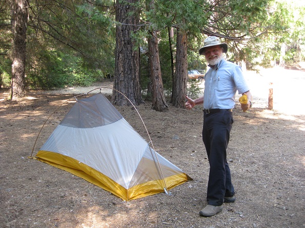
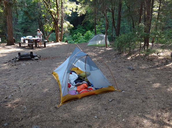
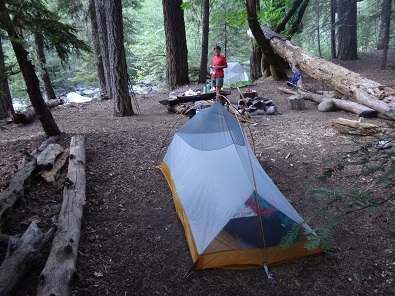
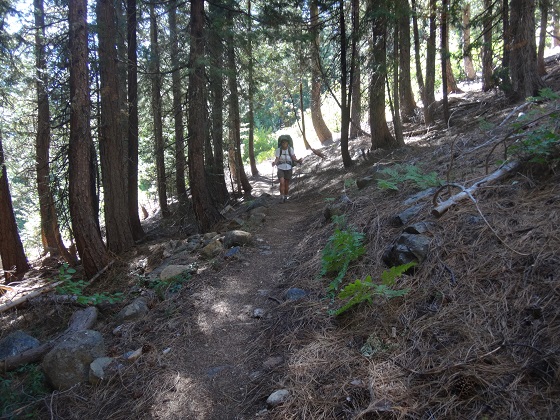
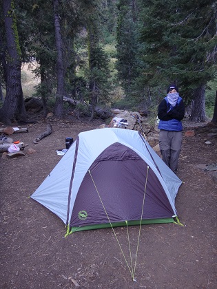
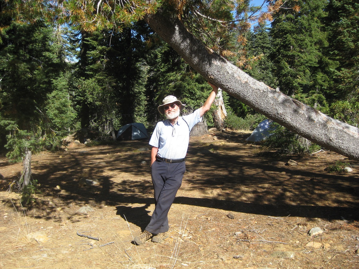
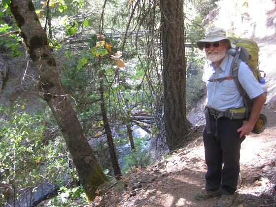
We set up camp, Bob using his new 2 person Big Agnes Fly Creek tent, then we walked up to the trailhead and down the trail a bit to check it out. The first mile of trail is bounded by private property, which was made very, very clear.
 |
 |
|  |
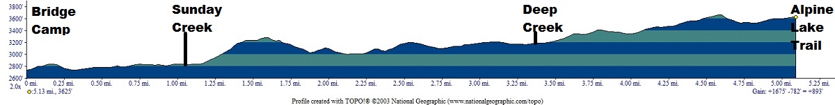
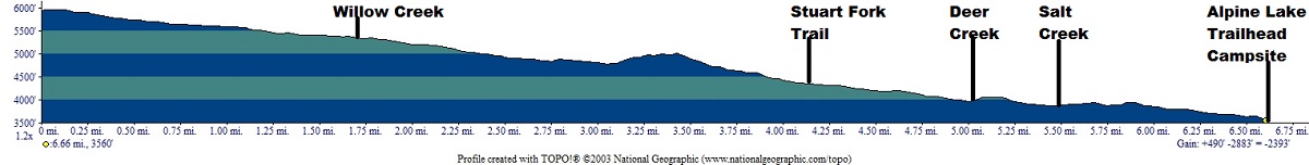
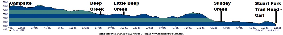
Backpacked 5.1 Miles from Bridge Camp to a camp at the Alpine Lake trailhead junction. (Net gain ~900'; total uphill 1,675', not that anyone is counting)
Elevation Profile:
 |
Dinner: Jaipur Vegetables from Trader Joe's with added re-hydrated vegetables, pineapple, apples, tomatoes on noodles, topped with peanuts. Really, really good.
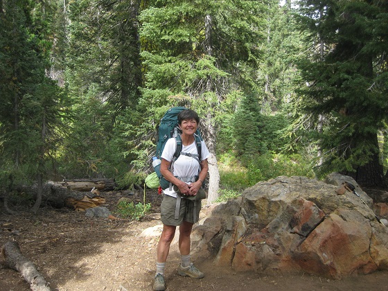
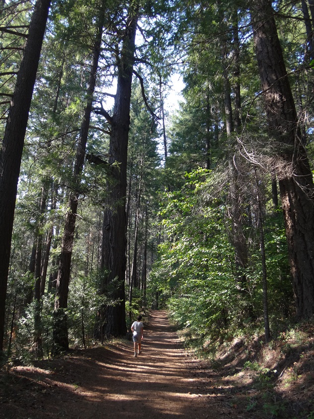
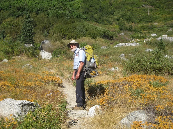
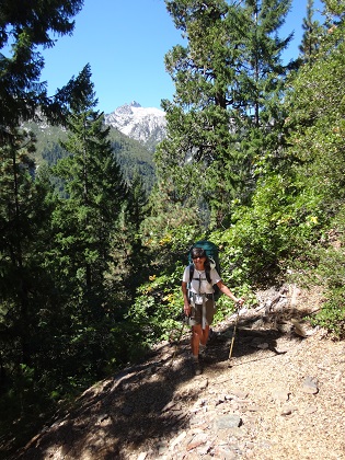
After breakfast we moved the car out of camp up to the closest parking space to the trailhead, adjusted the backpacks some and started up the Stuart Fork trail.
 |
 |
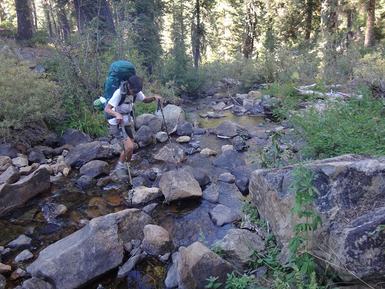
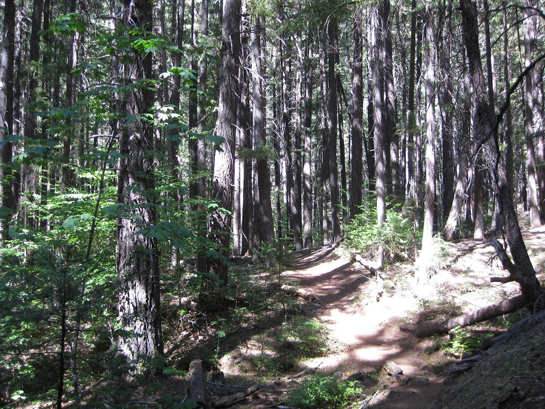
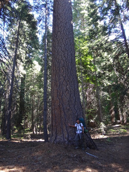
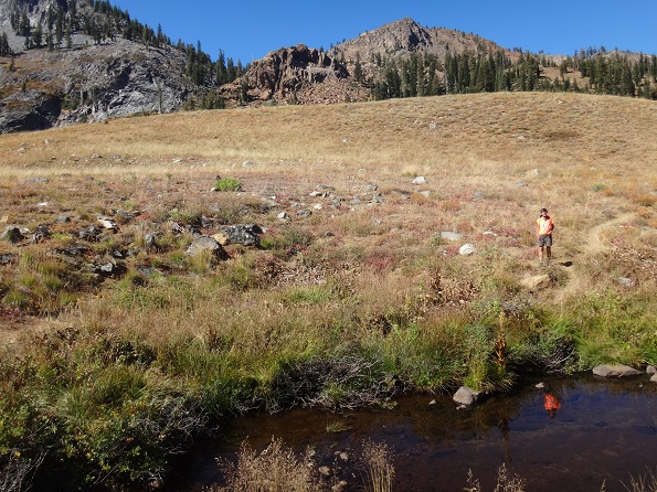
It was a perfectly clear day that warmed up by noon, but we were in forest and it got noticeably cooler as we crossed streams feeding the Stuart Fork. Such streams come down from canyons, so almost invariably there is an uphill, then downhill, then uphill as one passes the stream and its canyon.
 |
 |
We met two lady dayhikers on their way out who talked to us about various subjects including "Forest Bathing" which may be taught in Santa Rosa and is a meditative experience based on being in the woods.
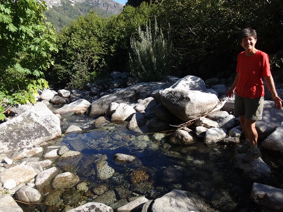
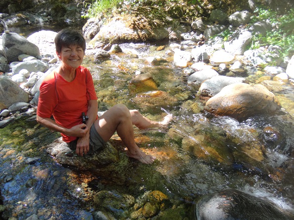
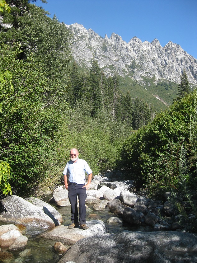
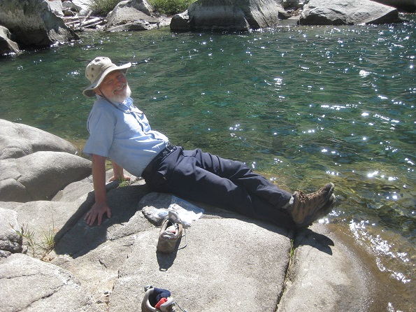
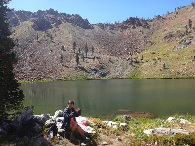
We had a very nice lunch time at Deep Creek, where Reenie put her feet in the cold, clear waters of the stream.
 |
 |
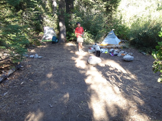
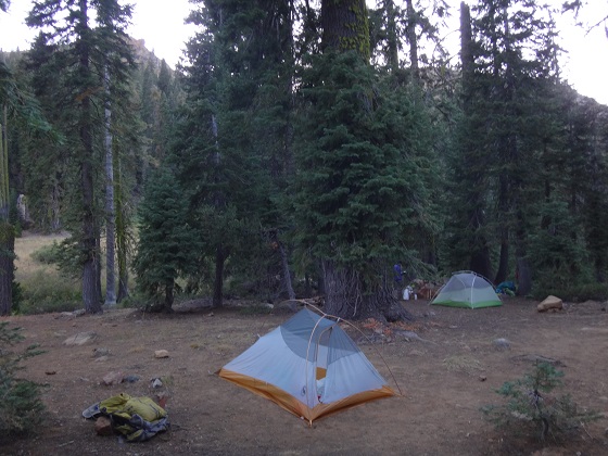
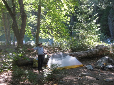
Then we met a couple who were hiking out and who gave us an incredibly good piece of advice by telling us about a wonderful campsite, not shown on maps, which can be found right at the Caribou Trail junction, but down next to the Stuart Fork. We would spend 3 nights there after this night at the Alpine Lake trailhead. The camp at the Alpine Lake trailhead was itself quite nice, no other people, the sound of Stuart Fork audible all night since it was right next to the camp.
 |
 |
 |
We even thought about spending the next day going up to Alpine Lake and in fact hiked a bit up the trail, but then decided not to do that and instead continue on our way up to Portuguese Camp and Sapphire Lake.
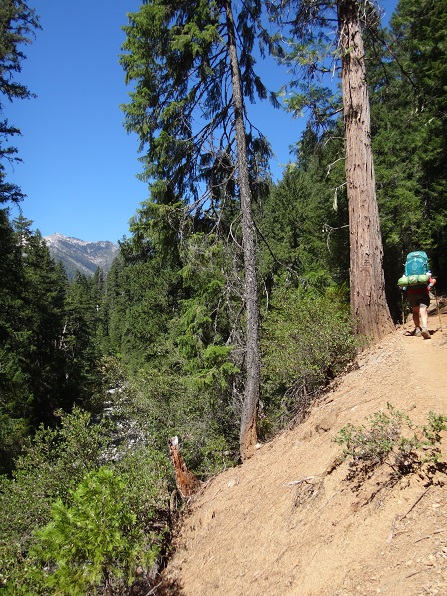
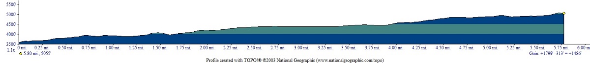
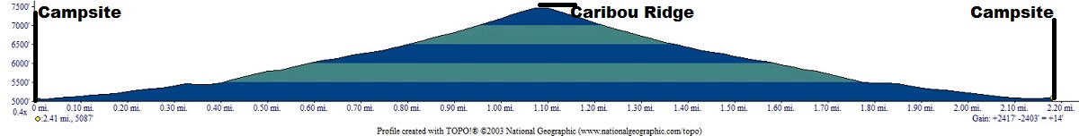
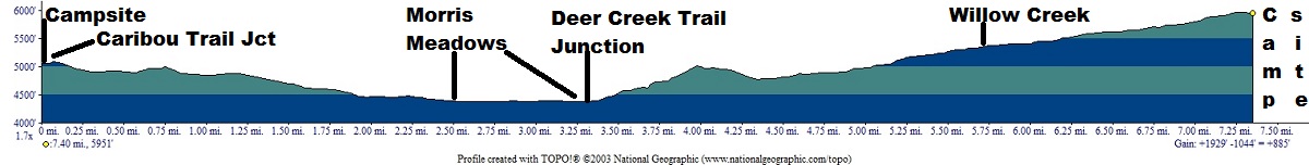
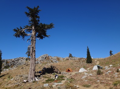
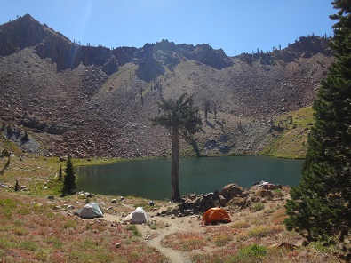
Backpacked about 7 miles up the Stuart Fork trail - including some steep inclines - to a campsite next to the Caribou Scramble trail junction which had been recommended by someone we met 2 days earlier. (net gain 1486': total uphill 1,799')
Elevation Profile (understates distance):
 |
Dinner: Potato soup with added spinach, mushrooms, squash and all of which re-hydrated beautifully.
Today's videos:
We awoke to having bats flying over our tents and were on the trail by 9 AM. We met two women with a dog who were leaving and gave us copies of pages from their hiking book of the Trinity Alps. They told us everyone had cleared out of the area to which we were going. This was confirmed by the last guy we met, who had been even further up the trail to Emerald Lake and said no one remained. In fact, we did not see anyone until we were leaving the camp 3 days later.
We passed Deer Creek and then the junction for Deer Creek trail, which we would be taking later in the trip.
 |
 |
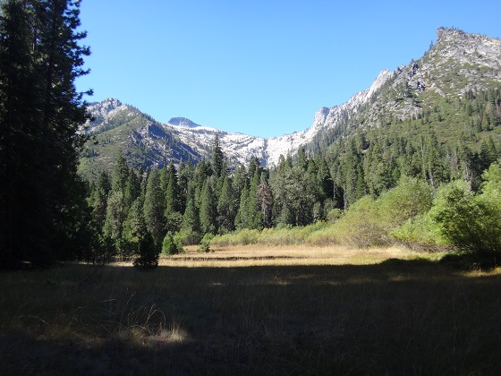
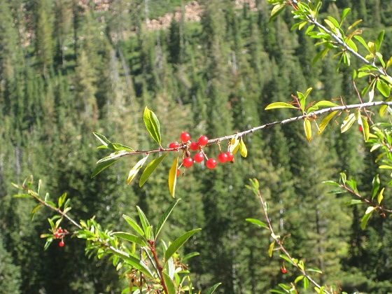
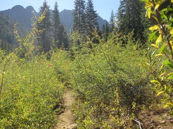
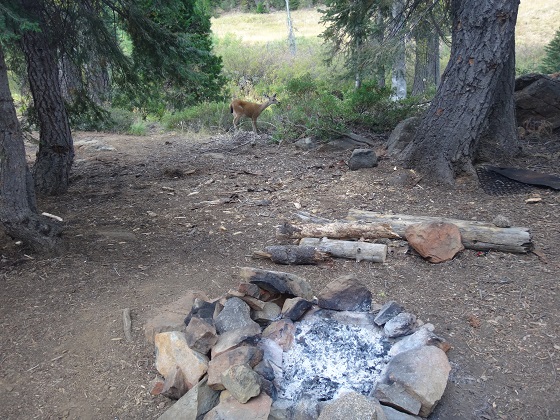
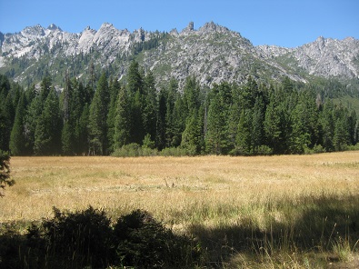
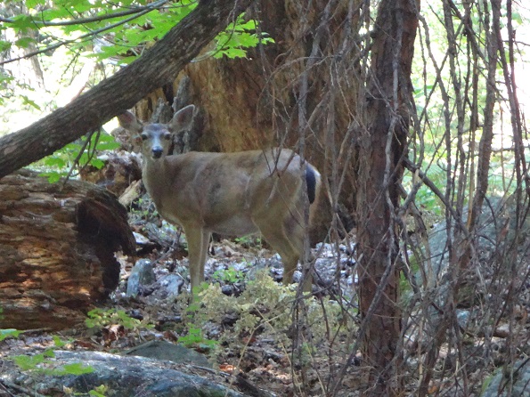
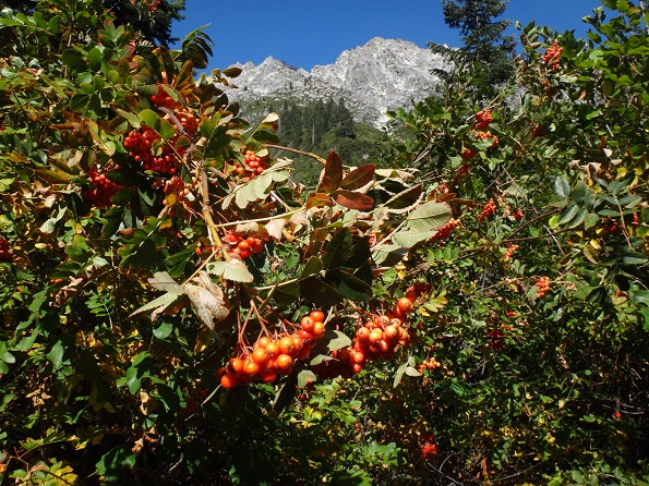
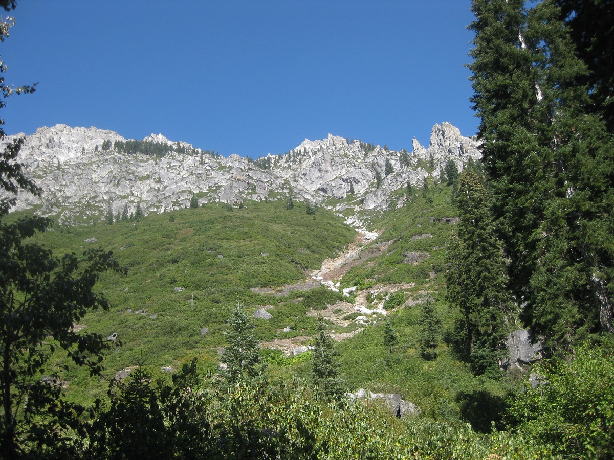
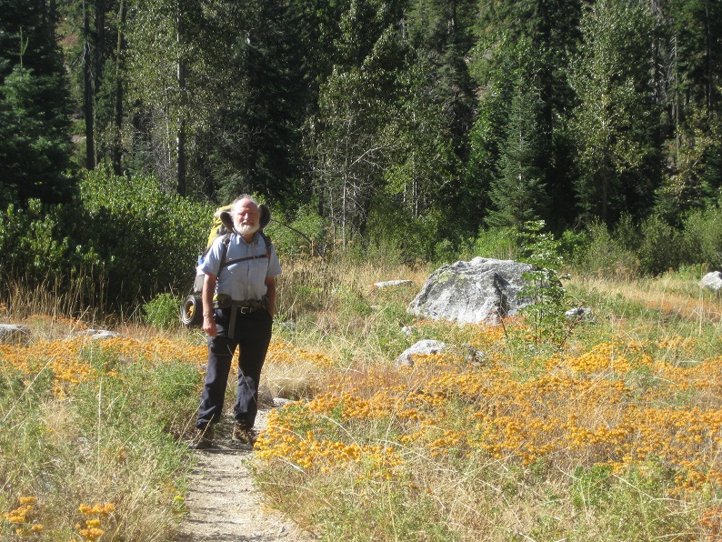
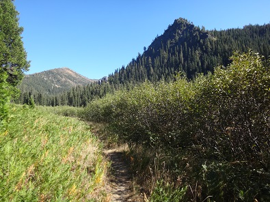
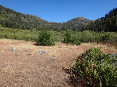
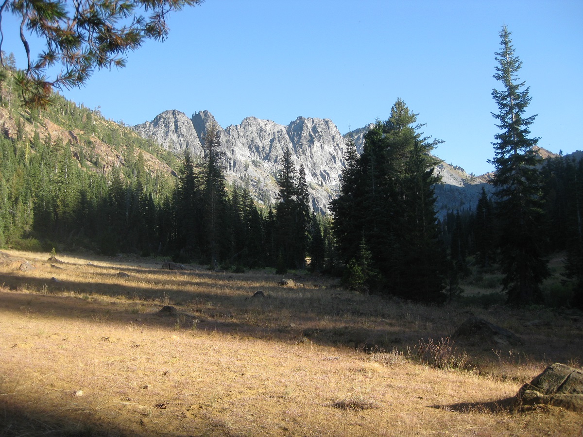
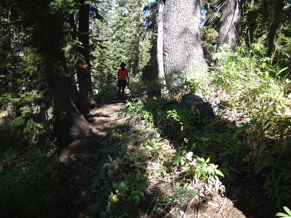
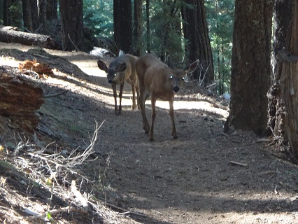
After Deer Creek Trail junction, we hiked through Morris Meadows. Shortly after, a deer posed for us and we saw a grove of berry bearing bushes. The views of the surrounding peaks became more and more outstanding.
 |
 |
 |
 |
 |
 |
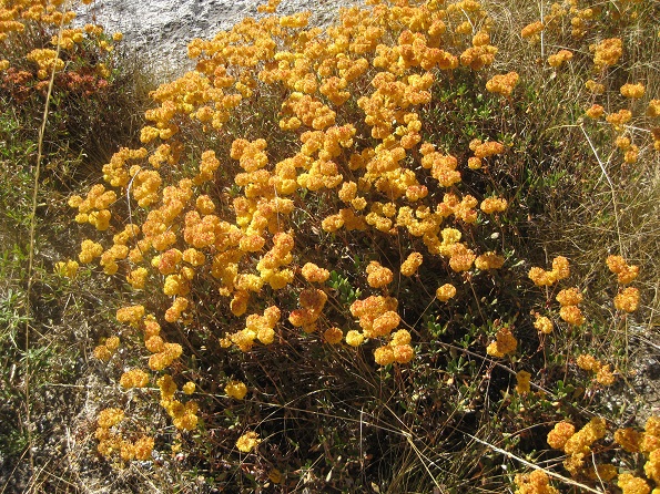
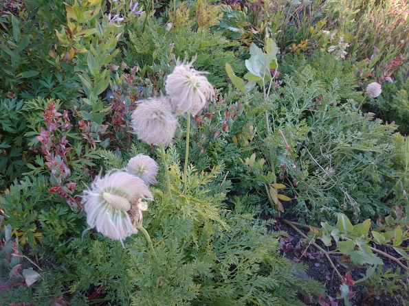
We continued to see plants of all colors. Below is a field of California buckwheat.
 |
 |
 |
The campsite near the Caribou trailhead that had been recommended to us was wonderful - nestled in a canyon with ridges all around us, mostly surrounded by trees, next to the Stuart Fork with no one nearby. The Stuart Fork looked inviting enough that we got into our swimsuits and put our feet in, but it was freezing cold. We also rinsed off clothes (a first for Bob).
 |
|
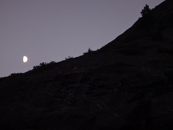
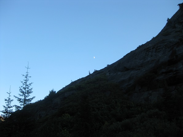
There was a beautiful sunset, then the moon rose and went up along the ridge line above our campsite. Magical.
 |
 |
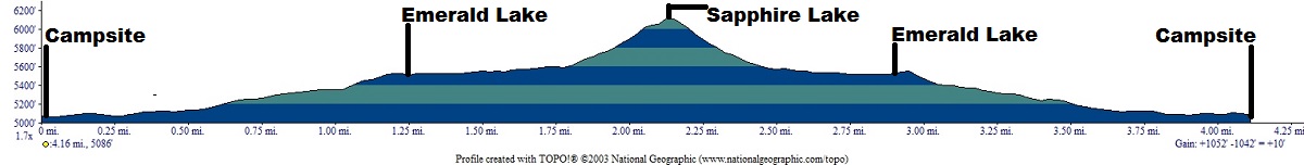
Day hiked about 4.5 miles up to and back from Emerald and Saphire Lakes and swam in Emerald Lake. (net gain 0': Total uphill: 1,052') Elevation Profile (understates distance):
 |
Dinner: Spanish rice with roasted red bell peppers, tomatoes, black beans, and onions.
Today's videos:
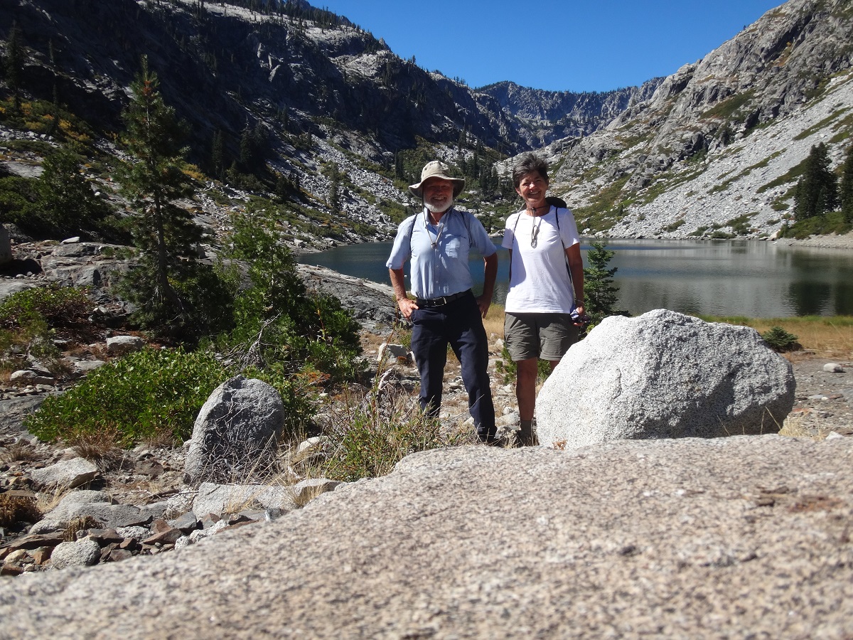 |
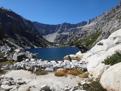
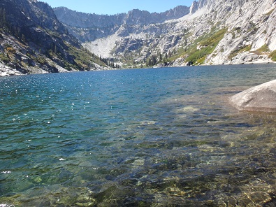
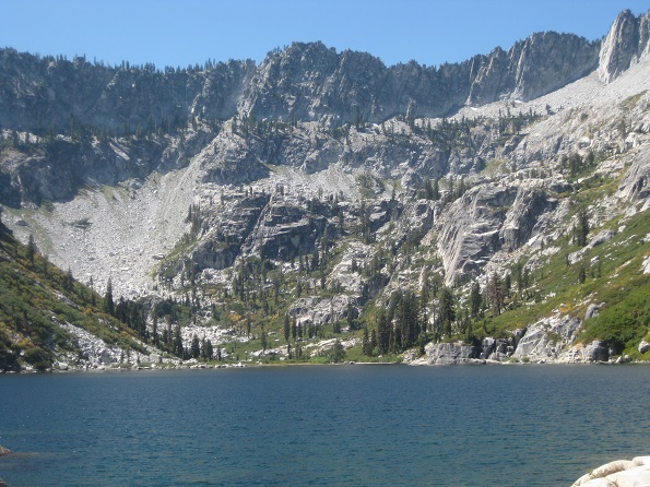
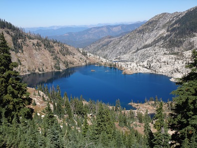
Today we day hiked from our camp up to Emerald, then Sapphire, lake.
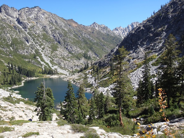 Emerald Lake |
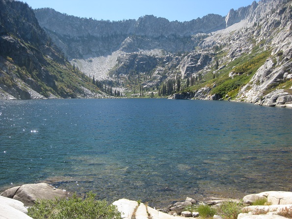 Sapphire Lake |
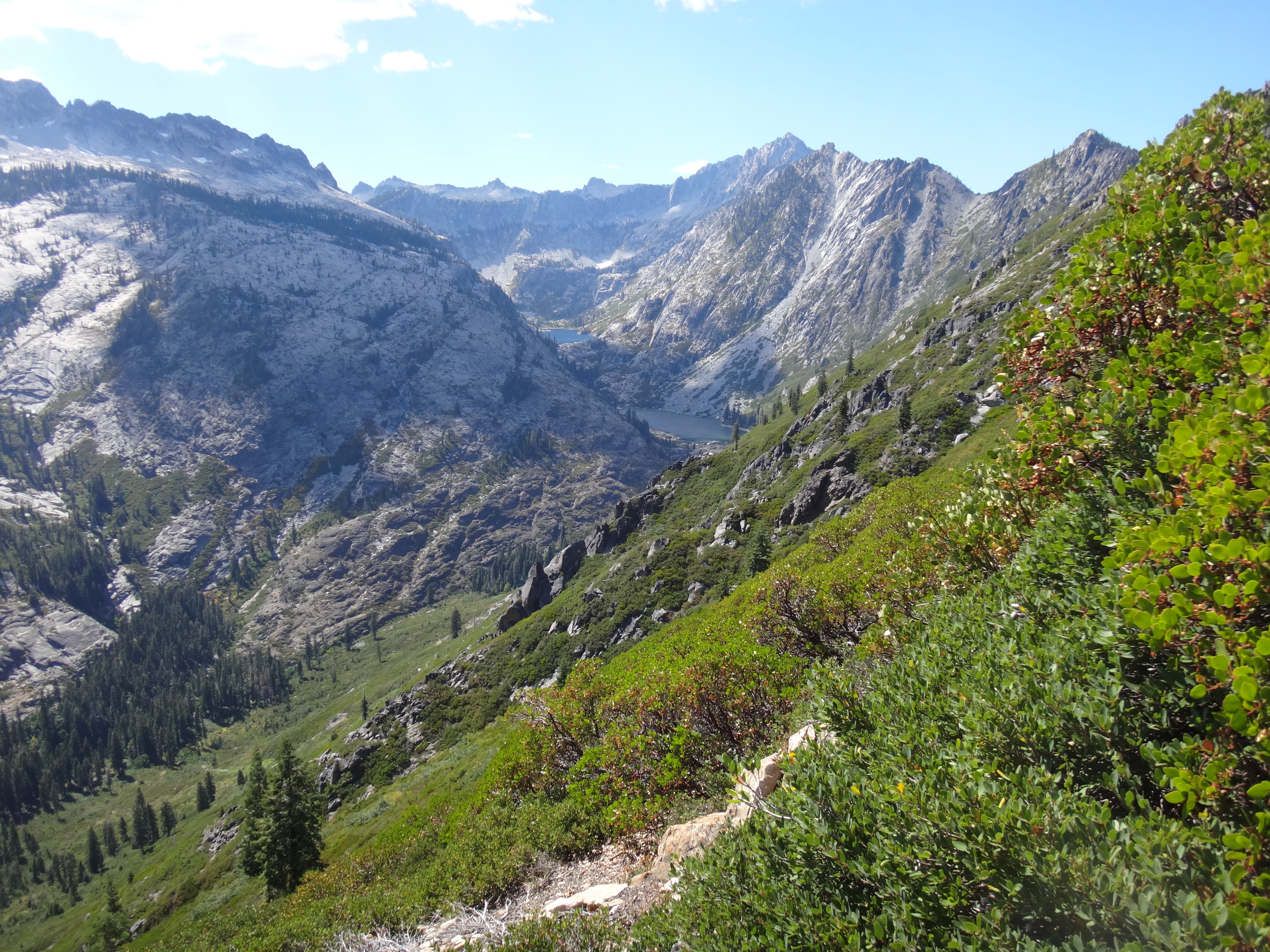
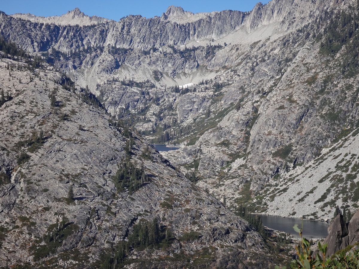
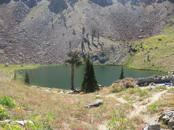
At Sapphire Lake there was an option to continue off-trail up to Mirror Lake. However, as we looked at how we would first have to get around one or the other side of Sapphire Lake, both of which looked very difficult, and then would have to clamber up scree and over granite to get to Mirror Lake, we decided not to do it. So we simply had a nice picnic lunch at Sapphire. The ambiance was terrific. Here are 5 photos of Sapphire Lake. Note that in the first of the photos you can see the remnants of a dam built in the late 1890's when the mining company needed more water for its operations.
 |
 |
 |
 |
 |
 |
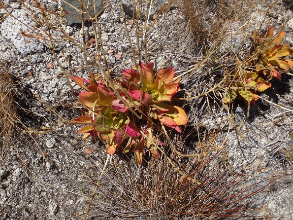
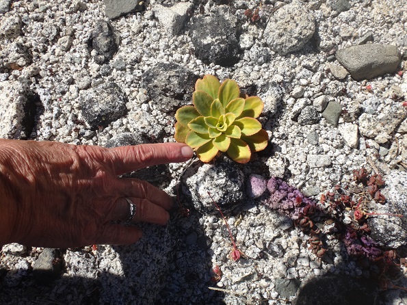
We hiked back down to Emerald Lake, seeing what we believe were succulents as we went.
 |
 |
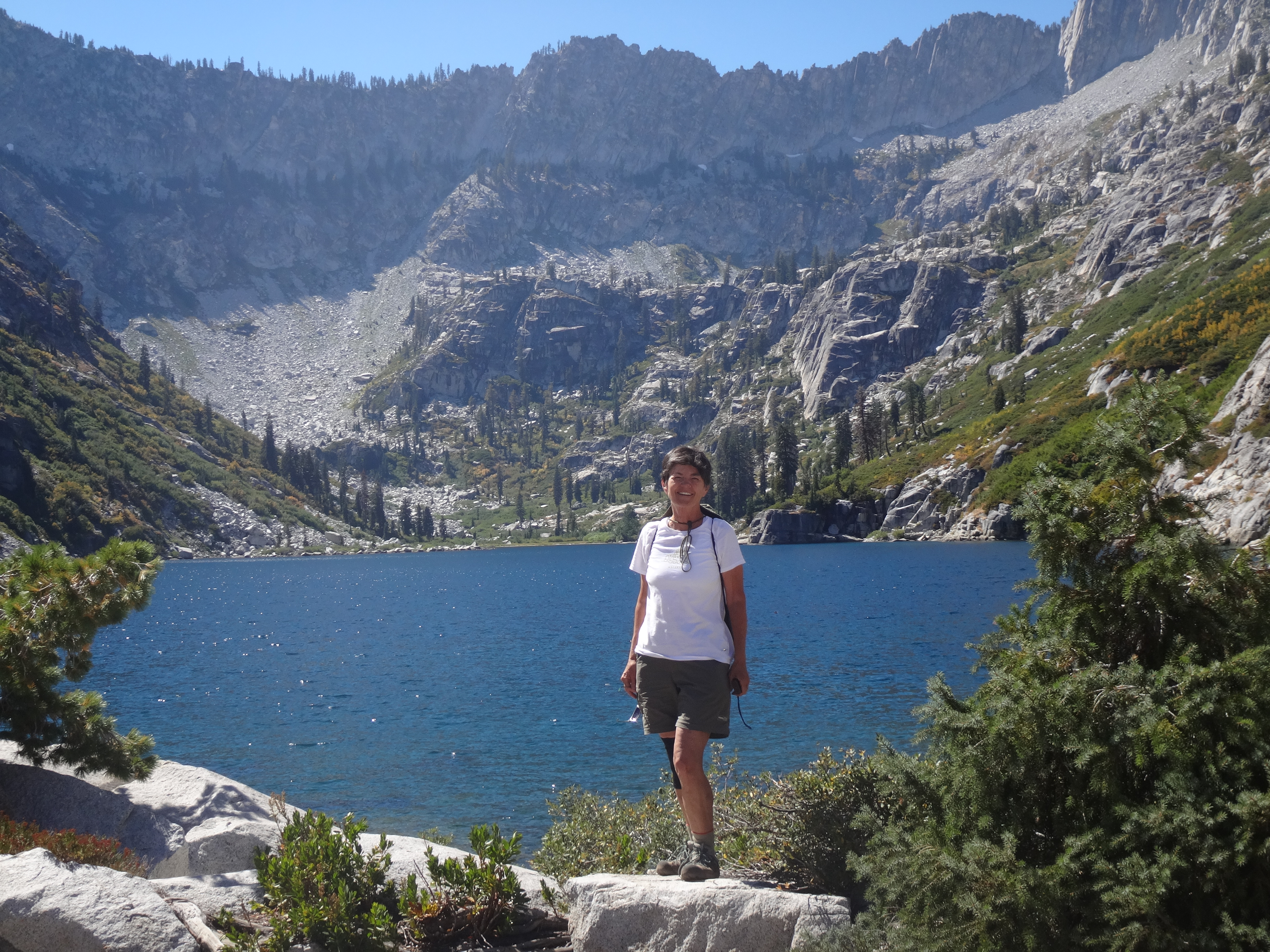
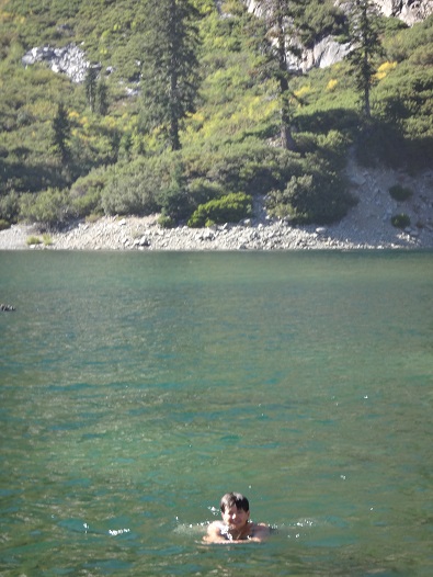
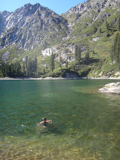
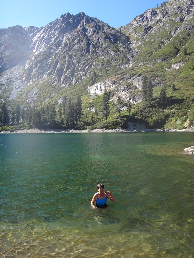
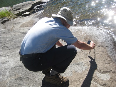
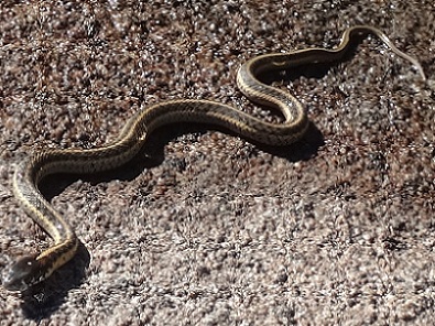
At Emerald Lake we went for a swim. Well, Reenie went for quite a long swim, while Bob found the water freezing cold and in the end swam but a short distance. While we were at Emerald Lake we saw a small garter snake on the same rock we were using. As we were hiking back to camp we saw a larger one.
 |
 |
 |
 |
 |
 |
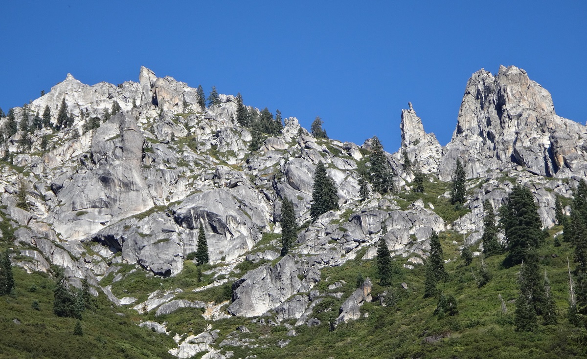
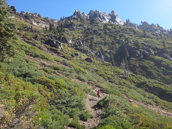
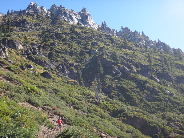
The hike itself was spectacular both going and coming back with views of Sawtooth and other ridges and granite cliffs. It was, however, steep enough and hot enough when we were going up to be uncomfortable at times. Fortunately, some of the hike was through forest. Here are a couple of photos as we returned.
 |
 |
Day hiked up "Caribou Scramble" trail to ridge above Caribou Lake and back, about 4 miles roundtrip. (net gain 0': Total uphill 2,400') Elevation Profile (understates distance):
 |
Dinner: Fetuccini Alfredo with spinach, tomatoes and mushrooms. Parmesan cheese added. Also had salmon, cheddar cheese and Triscuits.
Today's videos:
We day hiked up the 2,400' "Caribou Scramble", which one guy we met described as "brutal". Actually, the backstory here is that we had not intended to do this and had run into another couple of hikers previously who said they had done it about 15 years ago and would not try it again. Based on these comments, Reenie concluded that the idea of going up this intense hike was not in the cards. "So glad we are not doing that hike," said Reenie.
But, having a free day after going up to Emerald and Sapphire Lakes the day before, and being right at the Caribou Scramble trail junction, Bob suggested the two of them climb up a little ways, just to get the view. So a compromise agreement was reached that we would hike until 10:30. Since we got a later start than planned, we pushed that to 11 AM. However, as 10:30 approached and the views were already so spectacular and the ridge looked so close, Reenie insisted that we go to the ridge top. Bob gleefully acquiesced to her demands.
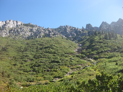
Part way up we got a wonderful view of the sun rising above the ridge. We also saw that what looked like a granite dome with a ridgeline above us at our campsite was, in fact, a small bottom part of a much larger and higher ridgeline that became clear as we climbed upwards.
 |
 |
As we climbed higher and got better and better views, we saw an ape head and a couple of dragons. The meadow dragon, whom the ridge dragon ardently pursued, can be seen below and with careful consideration, the ridge dragon in the pictures that follow.
 |
 |
 |
 |
 |
 |
 |
 |
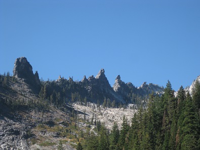
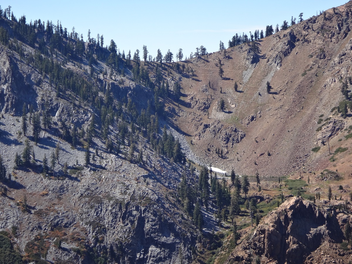
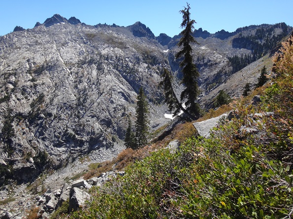
It took us 4.5 hours to get to the ridge top with a view down to Caribou Lake and Lower Caribou Lake, but only 2 hours to get back down. As the photos above and below show, the climb gave us many views of the surrounding peaks. At times the trail was steep enough to almost give Reenie vertigo. The following 6 photos give an idea of just how steep the scramble became:
 |
 |
 |
 |  |  |
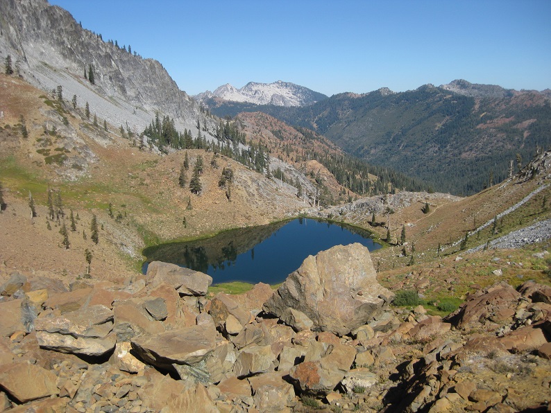
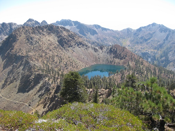
We also got a good view of Emerald Lake, Sapphire Lake, and the snowpack above Mirror Lake:
 |
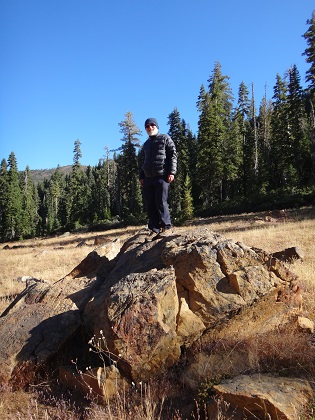
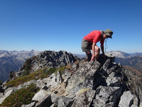
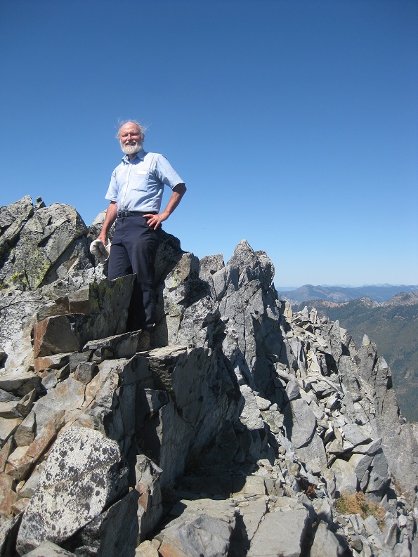
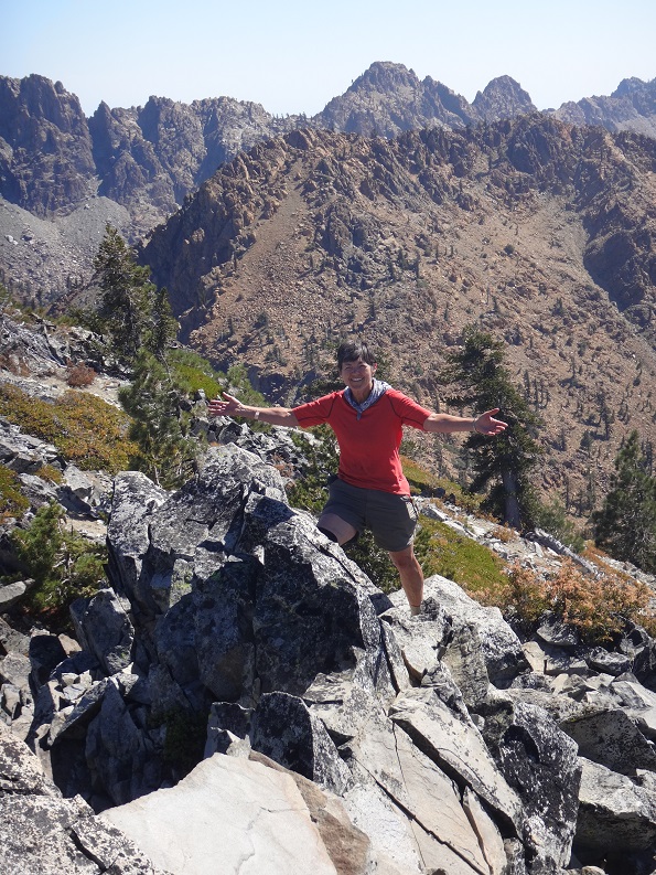
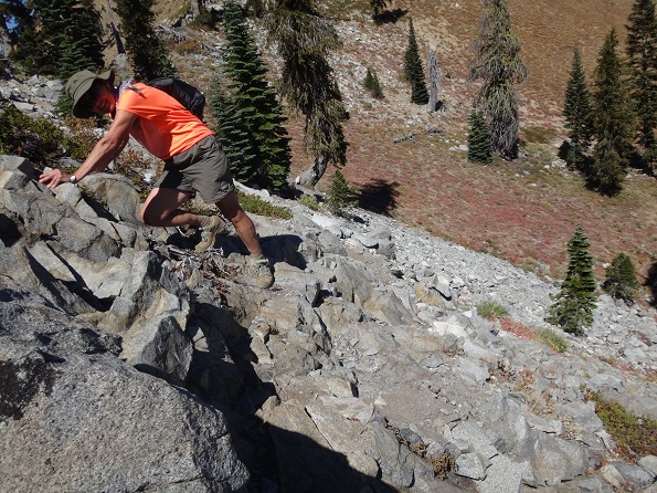
As part of our meaningful and philosophical discussion for the day, we also tried to name every food we could that began with the letter "P", such as "Prawn". When we reached the top we had a Picnic that was very, very pleasant with many wonderful views - including Caribou Lake and Lower Caribou Lake - a nice breeze, and Peanuts and Pumpkin Seeds, among other foods, although no Pralines nor even Pecans. And we clambered around on rocks for fun (click on 3rd photo for alternate, higher resolution version).
 |
 |
 |
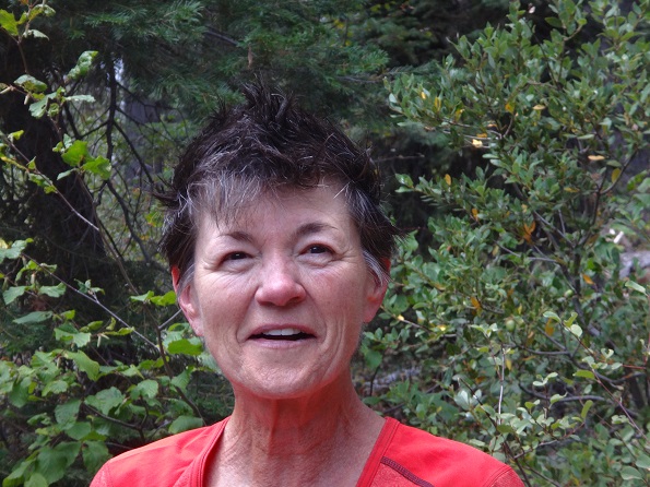
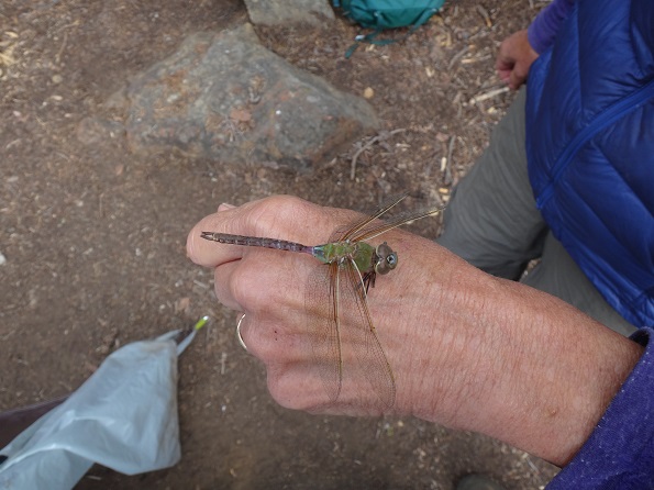
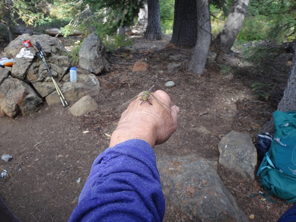
The animals today included many, many lizards and a very, very green insect that boldly displayed itself against the contrasting colors of the rocks. Upon our return to the camp, Reenie washed her hair and displayed a very nice punk hairdo.
 |
 |
Backpacked about 8.5 miles to last campsite near end of Deer Creek Trail (net elevation gain = 885'; total uphill 1,929').
Elevation Profile (understates distance):
 |
Dinner: Madras lentils with pine nut couscous and pineapple.
Today's videos (Two short ones of the same snake in Morris Meadows):
Woke up to the coldest morning yet, ate breakfast, and began our longest backpacking day, going about 8.5 miles to a campsite near the headwaters of Deer Creek. Like every day of this trip, the weather was just about perfect.
As soon as we left camp and got to the main trail, we met 4 people, who from the smell of things were smoking marijuana. We had seen no one else since we left Morris Meadows heading to this campsite 3 days ago.
 |
 |
As we backpacked down the Stuart Fork canyon we took photos of the ridgeline we had hiked up to the day before when we did the Caribou Scramble.
 |
 |
 |
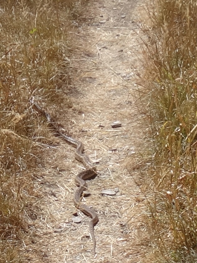
After hiking through woods, we crossed Morris Meadows where we found a 3 to 4 ft long snake, which quickly left the trail as we approached. We took the videos shown above, along with photos.
|  |
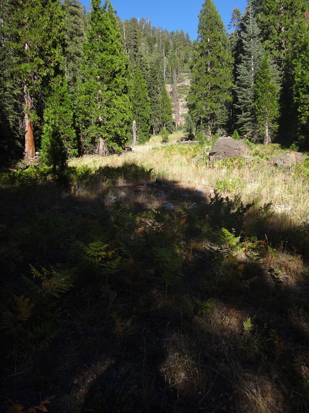
When we started on the Deer Creek Trail we immediately began a steep climb up the ridge separating Stuart Fork and Deer Creek. We then had a pleasant walk through the forest which was downhill for a while, then gradually climbed until we reached our campsite.
 |
 |
 |
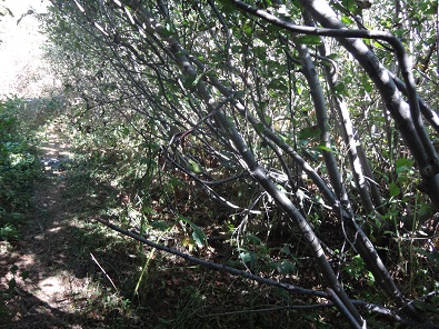
The trail varied quite a bit as it went from forest, to meadow, to tightly winding through bushy plants. If we had not had our legs protected at that point, there would be quite a bit of scratching. Bob always wore long pants, while Reenie could zip and unzip leggings on.
 |
 |
 |
At first we completely missed the campsite, crossed over Deer Creek for the third time, realized we were starting to head up and away from Deer Creek, so turned back. As we crossed back over Deer Creek we saw a path running to the left. Reenie looked down the path and saw it led to a campsite - the last campsite before the climb to Deer Lake.
 |
|
We had covered more ground than originally planned, meaning we would be able to stay at this campsite for 4 nights instead of 3 and have 3 day hikes without having to take down the tents.
And, once again, it was a very nice campsite right next Deer Creek. We found a nice bandanna, a clip, an ax, and a pad of some sort which had been left by previous campers.
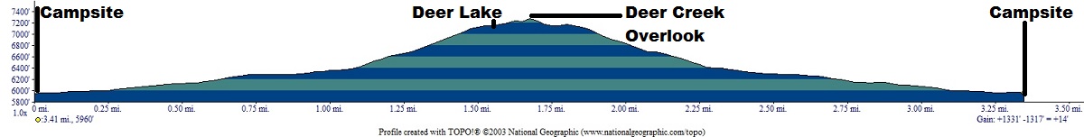
Dayhiked about 4 - 5 miles to Deer Lake and back (net elevation gain 0': Total uphill 1,330').
Elevation Profile (understates distance):
 |
Dinner: Basil Pesto Linguini with broccoli, mushrooms, and Armenian cucumber.
Today's videos:
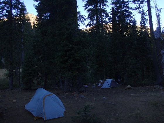
We woke up to the coldest morning of the trip. Because the weather had been so perfect, neither of us had put up rainflies on our tents. However, rainflies not only keep out rain, they help the tents retain warmth. So we began the day by putting up rainflies on our tents. The one downside is that you can no longer see the moon and stars when you are lying in the tent at night.
 |
 |
 |
 |
 |
This was the day we would hike up to Deer Lake in order to check out what the climb the following day would be like to Siligo Peak.
 |
 |
 |
|
 |
 |
 |
 |
 |
 |
On the way up the trail we saw a red tailed hawk take off from a tree far above us. He was lit perfectly by the sun. A beautiful sight.
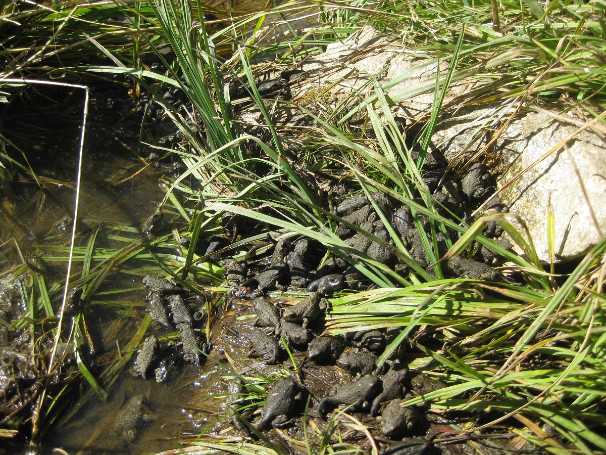
There were a few surprises for us when we reached Deer Lake. Actually, Bob was surprised that it was even where it was. He had completely misinterpreted the topo map and expected it to be quite a bit further on the other side of a ridge. Reenie predicted exactly where it would be and was right.
So Bob changed subjects: "Look at all the tadpoles and frogs!" Yes, the small outlet from the now-found Deer Lake was filled with tadpoles and pollywogs. And the muddy little path on the other side was filled with small frogs. More than either of us had ever seen before.
 |
The next surprise was finding a filled campsite, currently empty, which we learned was for 4 guys who were there for over a week.
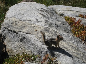
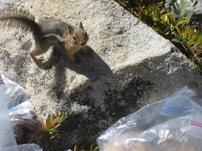
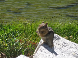
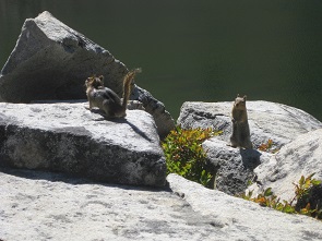
We picnicked on a rock next to the lake and laughed as we saw chipmunks thoroughly checking out the campsite nearby - going over the backpacks, under and around the tents. It was great fun and not so much of a surprise when the chipmunks decided we and in particular our picnic needed to be checked out. Feeding wild animals is forbidden, but Bob went to UC Berkeley and hence is allowed to ignore such rules. The chipmunks got peanuts, pumpkin seeds and cashews, in return for posing for photos and videos.
 |
 |
 |
 |
While we were picnicking we had a perfect view of the path we would be following the next day as it cut across and switchbacked up the high dirt and rock ridge across the lake from us, before going over the pass which would lead down to Summit Lake or up to Siligo Peak.
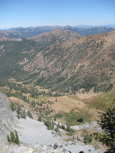
We then climbed up through the campsite to a ridge looking down on Deer Creek canyon, where we were camped. Although we could not make out our campsite, we saw the nearby meadows and also the beautiful ridges and peaks of the canyon.
 |
 |
 |
 |
 |
Coming back down through the campsite we saw that there were 5 bear canisters next to one tent. We also saw leaning against a tree something about 3 feet long and wondered whether it was for holding fishing poles or, as Reenie guessed and was right, a solar array. Reenie reached over to touch it and we got another surprise: a guy whom we had not seen yelled at us from across the lake where he was fishing. We could not understand what he said, but the tone was obvious. We left the campsite and began our return down to our Deer Creek campsite.
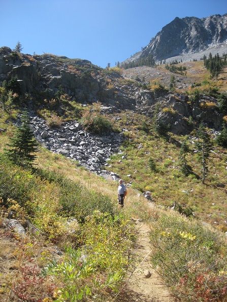
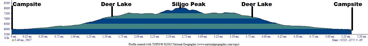
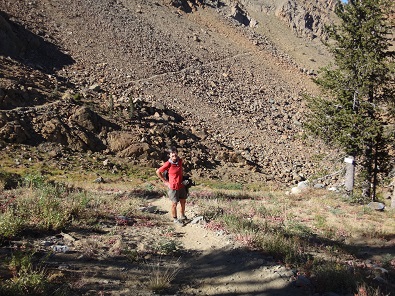
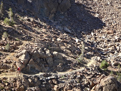
Day hiked 7 to 8 miles to top of Siligo Peak and back. (net elevation gain 0': Total uphill ~2,550').
. Elevation Profile (understates distance):
 |
Dinner: Smoked salmon and butter garlic pasta with "Cheese appetizers".
Today's videos:
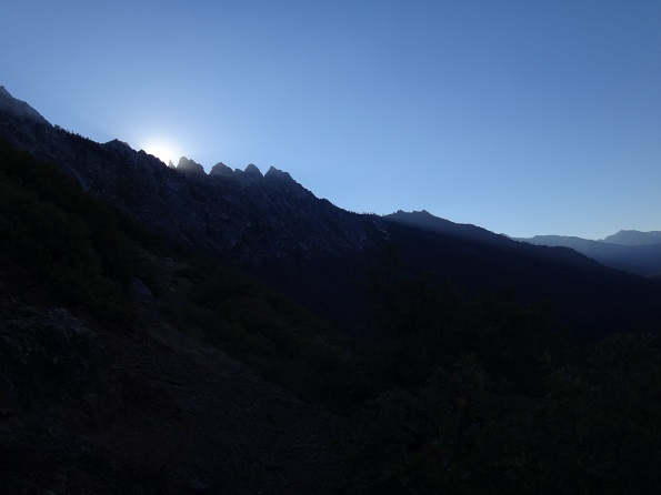
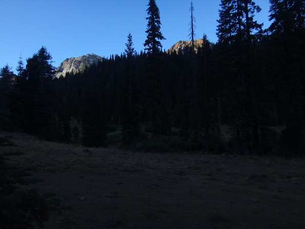
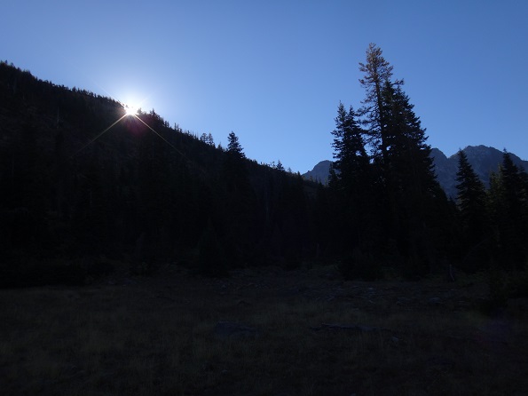
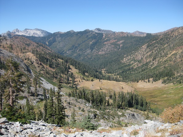
Woke up to yet another beautiful day, early enough to catch the first sunlight on nearby peaks, for Reenie to enjoy her cup of coffee. Left camp at 8 AM, destination Siligo Peak. As we hiked up the canyon we got to see the sun rise above the ridgeline.
 |
 |
 |
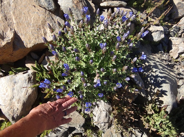
As we hiked along the flowers added color. The picture on the left is of cotton grass.
 |
 |
They had horses/mules pack in their supplies as far as the ridge above Deer Lake and then they themselves had packed the gear down to their campsite. Supplies included an extra bear cannister filled with fresh vegetables, hence the reason we saw 5 bear cannisters. As they spoke, Reenie kept looking at Bob and nodding her head, clearly stating she thought using mules was a really, really great idea.
They gave us matches when we asked, which was a very good thing because we were running low.
We climbed up the trail as it circled behind and above Deer Lake to the pass above Summit Lake. It was almost a straight line, no switchbacks, for most of the way across the side of the ridge. Near the end it would get steeper with a few switchbacks as we turned back and up to the pass to Summit Lake.
 |
 |
 |
 |
The next two photos were taken as we approached the pass to Summit Lake, taking a final look at Deer Lake before heading to the Siligo Peak summit. We were surprised that Deer Lake was actually not visible from the summit, being blocked by the intervening ridge.
 |
 |
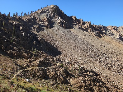
Once through the pass, we headed up use paths to Siligo Peak, of which there were many criss-crossing each other.
 |
 |
 |
 |
 |
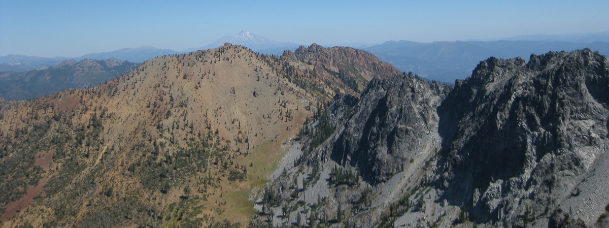
The views were stunning, including a view of Mt. Shasta in the far distance.
 |
Both of us got vertigo at various points. As Bob reached the top he stuck his head over a rock and looked straight down a vertical cliff for hundreds and hundreds of feet. From the summit ridge we could see both Round Lake, which we had passed as we climbed up the Deer Creek canyon, and our path above Deer Lake, though we no longer could see Deer Lake because of the ridge.
 |
 |
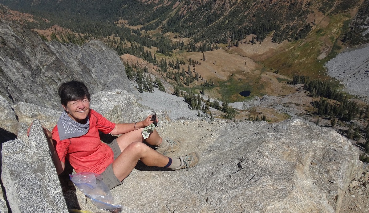
We found a nice spot about 3 feet back from the vertical cliff and had a picnic lunch. Reenie sat safely and firmly in a spot which, if she moved forward a yard, dropped hundreds of feet. Bob sat a bit further back and had a fearful adrenaline rush when Reenie moved her feet. Reenie assured him she was safe. Once again Reenie is proven correct.
 |
We were never positive we had reached the absolute highest point, but we were nearly there if not there. We clambered along the sheer rock ledge to get to the highest point we could and posed on the edge. Since we did not have a drone, we could not get photos of both us and the dropoff.
 |
 |
Neither phone had reception, though we had read there probably would be reception when we saw Mt. Shasta. Actually, Reenie's phone gave 1 bar of reception. 5 attempts at sending very short texts all failed. The phone would show "95%" complete, then "Message not sent."
As we descended and were hiking back near Deer Creek 4 large, quail-like birds suddenly scattered and flew a short distance. They did not look like the California quail, so we were not sure what type of bird they were.
We finished our hike for the day, having climbed up Siligo Peak as we originally planned and looked back from camp to the peaks we would get much closer to tomorrow.
 |
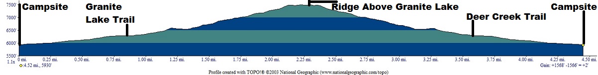
Day hiked 5 to 6 miles up to Granite Lake pass, which is near top of 7 Up Peak. (elevation change = ~1,600').
Elevation Profile (understates distance):
 |
Special Breakfast on Bob's Birthday: Rehydrated strawberries and peaches; dehydrated bananas; oatmeal.
Dinner: Couscous curry with carrots, mushrooms, red bell pepper, raisins and coconut with onions.
Today's video:
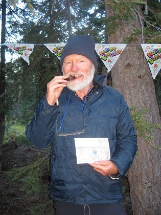
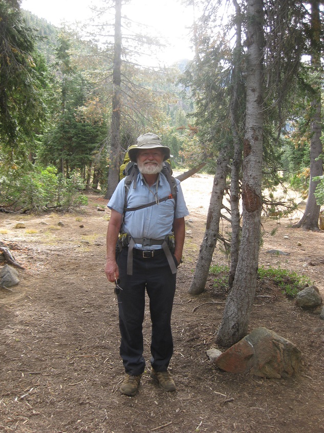
Bob awoke, got out of tent, and saw that Reenie had hung Happy Birthday flags between trees. Then Reenie sang Happy Birthday (a version Bob had not heard before) and presented him with a chocolate bar and card from Adele. Bob had previously discovered another chocolate bar Reenie had brought him, and promptly ate it, as he did Adele's chocolate bar this morning. In fairness, Bob did provide one bite of the bar to Reenie. Bob was blown away by all of this. (Note all these photos were taken in the morning, but there was a big difference in temperature between 9 AM and 11 AM).
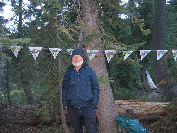 |
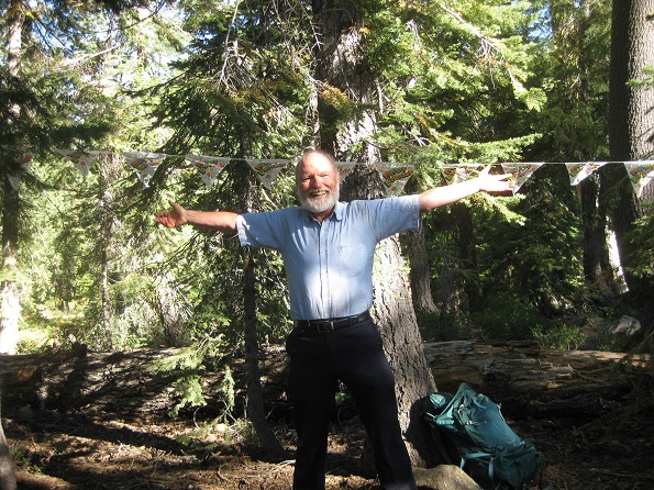 |
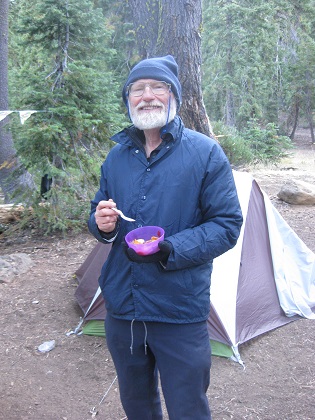
Reenie also made rehydrated strawberries and other fruit, along with oatmeal, so it was a very satisfying breakfast, given particularly that it started with chocolate.
 |
 |
 |
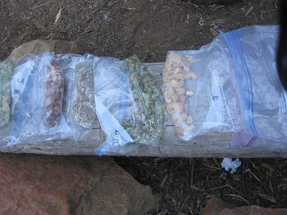
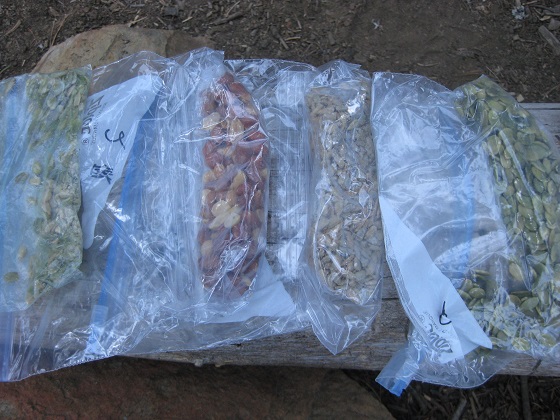
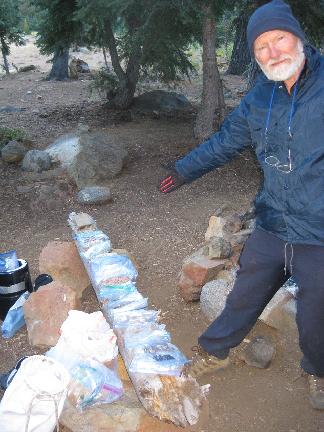
To make sure the breakfast was fully and completely satisfying, we also laid out all the non-dinner food remaining, noting that we were well into the second half of the trip, so there was plenty to eat.
 |
|
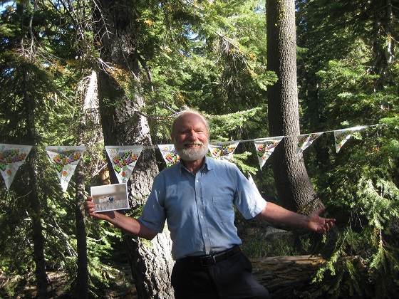
After all this attention, Bob was completely at ease and happy.
 |
We left for a day hike at 10:30 to climb up to the Granite Lake pass which is just below 7 Up Peak. The trail started out as the earlier dayhikes following Deer Creek through meadows, but then crossed Deer Creek and started the climb.
 |
 |
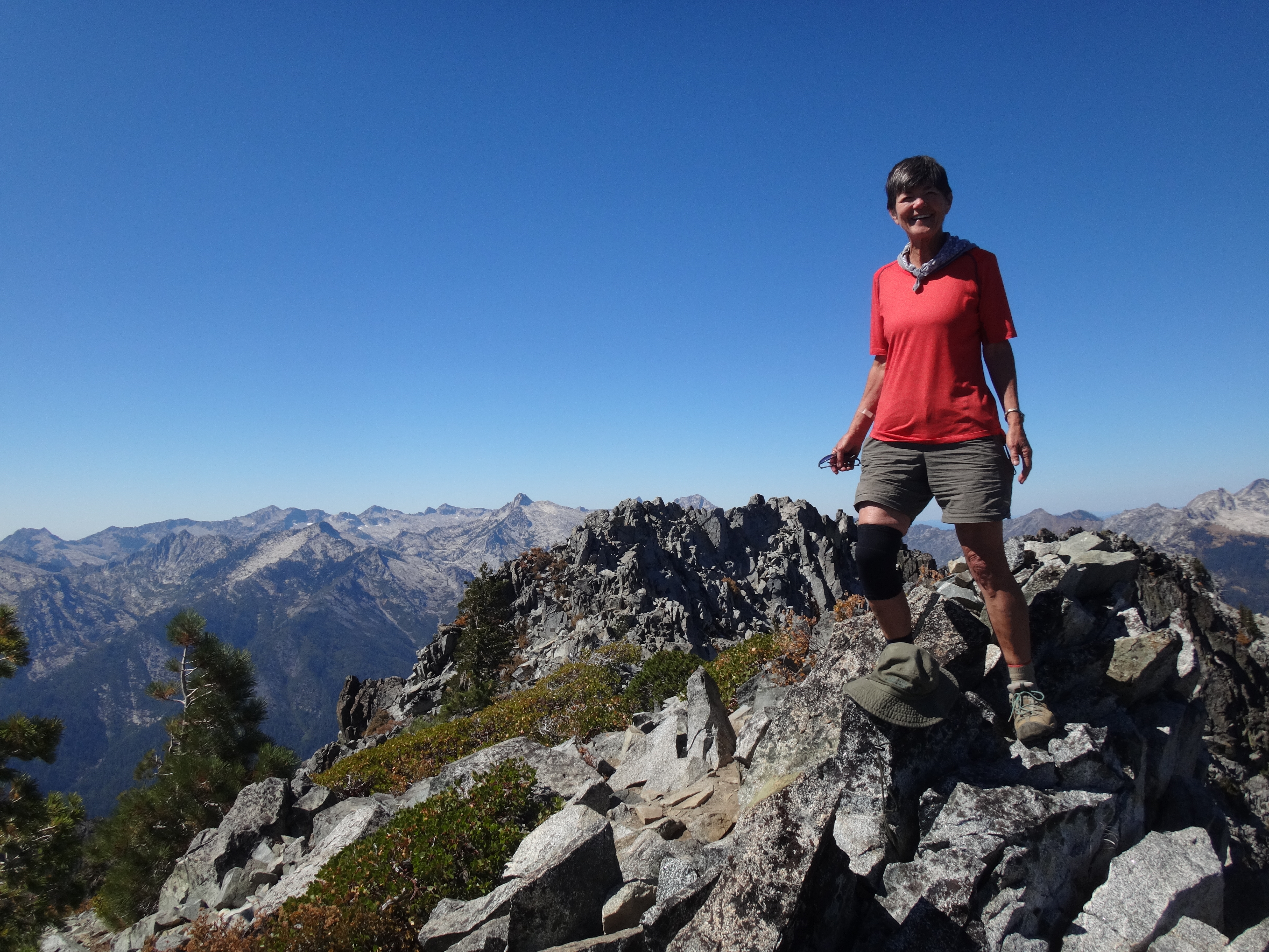
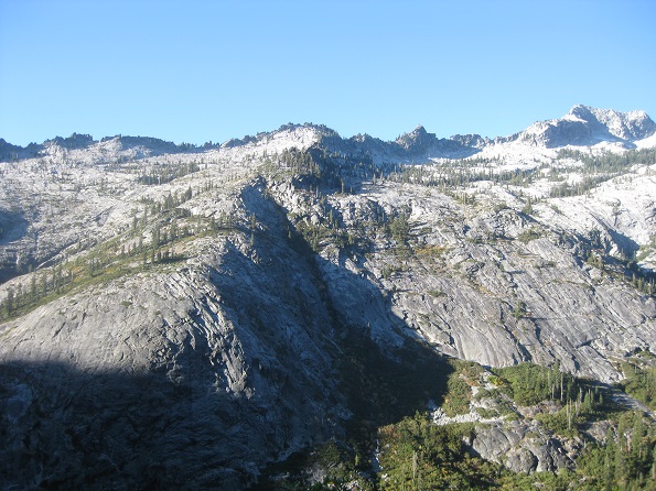
We looked at and took photos of Siligo Peak and decided we had in fact reached the highest ridge point. We also saw Lake Luella and the snowpack above it, which was the fourth and last of the 4 Lakes Loop lakes.
 |
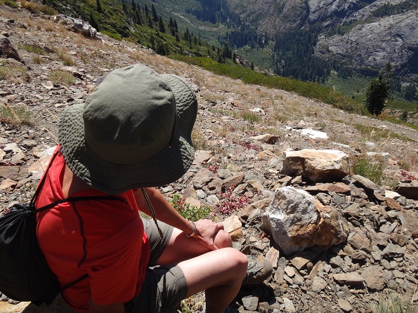
At one point Reenie stopped at a rock on the trail, looked down at her feet, and found an expensive looking pair of bifocal glasses of the type that automatically turned shaded in the sunlight. We carefully took them with us.
We had been wondering if there were a way to get to Deer Lake by following a path beyond the pass, but after a bit of rock scrambling at the pass we saw that was impossible, though we did get a nice view of the top of the canyon with its snow packs and Gibson Peak.
 |
 |
Not trying to do a loop around ridges and past Deer Lake meant that we could now sit and enjoy our picnic at the pass with no time pressure. Our picnic spot was right below 7 Up Peak, which is in fact a bit higher than Siligo Peak. But we were not about to try to climb it.
 |
 |
In the far distance we coud see Trinity Lake. There was not, however, any view of Granite Lake, although if we had continued down the path we were on into the canyon, we would eventually arrive there.
 |
Again, there was no phone reception.
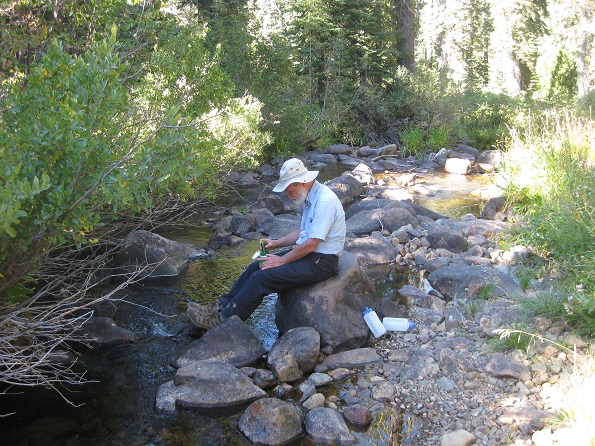
We returned to camp and did our usual chores: Bob Steripenned stream water which Reenie used in preparing another wonderful dinner.
 |
 |
Backpacked about 8 miles along Deer Creek and Stuart Fork trails to a campsite near the Alpine Lake Trailhead, close to where we camped the 2nd night. (net elevation gain -2,400': Total uphill ~500')..
Elevation Profile (understates distance):
 |
Dinner: Spanish Rice with blackbeans, tomatoes and onion. Side of salmon.
Today's video:
While we were still in our tents, a woman with two children came to our campsite. She said she had left an axe stuck in a tree the previous year. We told her we had found that, along with a pad and a hook, all of which were sitting on a log next to the fire pit. She took the axe and thanked us. She asked us if we were hunters. Earlier that morning we had both been awakened by a loud bang that echoed through the canyon.
When she got out of her tent, Reenie found a large dragonfly just outside which apparently had recently died. It looked in perfect condition.
 |
 |
At breakfast a deer joined us and wandered through our campsite. After breakfast we donned our packs for the beginning of the trek home.
|  |
Hiking back was easier than hiking in, particularly since the packs were so much lighter. Although there was definitely some uphill, it was mostly downhill and mostly in forest.
 |
 |
 |
However, as the next two photos show, one could get very, very tired even in these circumstances.
 |
 |
The steepest uphill came as we climbed over the ridge that separates the Deer Creek and Stuart Fork canyons. At the pass between the two we had a nice picnic lunch.
We ran into two guys who were headed up Stuart Fork to Emerald Lake, Brian and Nepthali.
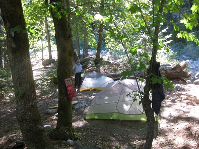
We camped at the trailhead for Alpine Lake trail as we had after the first day of the trip. However, we had to choose a different campsite as the one we originally used was occupied. This one also turned out to be quite nice. We did notice that the other campers gathered wood and built a fire, which was forbidden by the Forest Service, given the fire danger in the very dry forest.
 |
 |
 |
Backpacked about 5 miles to Bridge Camp, where the car was parked, then drove back to Santa Rosa. (net elevation gain -800': Total uphill ~870')..
Elevation Profile (understates distance):
 |
Lunch: Subway All Veggie Sandwich
Today's video:
Our last day in the wilderness, sorry to leave it, but also looking forward to fresh veggies and home. At one point we met two deer which as the photo shows had incredibly glowing eyes, although I do not actually remember that being the case. And now that I check the videos above, the glow is hidden there, too. How odd.
 |
 |
 |
 |
On the hike back to our car we met a guy with a rifle going up to Morris Meadows. We asked him what he was hunting. He told us a bear. Said he had not been able to kill one in his last 2 tries and hoped to be successful this time.
Then we met a Forest Ranger - as he was down the trail and coming toward us he moved a log off the trail - for which we thanked him. He was talkative. Told us that anyone killing a bear was required to take the carcass out of the forest. Given the size of a bear and what we saw of our bear hunter, it seemed very unlikely he would be able to do so. As we were talking, 4 other hunters passed us heading out of the wilderness. The ranger also did us the favor of taking the glasses we had found, hence letting us avoid going to the forest service office in Weaverville to drop them off.
Although our backpacks were by now much lighter, the end of the hike seemed to last a long time. However, we were suddenly at the car and all was well at the end of our perfectly glorious backpacking trip. We will be coming back to the Trinity Alps. The ranger had given us a couple of suggestions. And Bob had only to add 1/2 quart of oil to the car, as opposed to 2 quarts on his last backpacking trip.
The drive home was pretty uneventful, although we did cut the time estimated by Google Maps to get back by about an hour or so. Of course, we were in the fast lane on Hwy 5, going faster than many, many cars. Reenie and Bob shared the driving.
Upon reaching home and looking into the contents of hitchhikers' bag, it was clear it belonged to the woman, but she had left no contact information, so there was no way to return it.
We had calculated pretty well how much food we would need for the backpack, so at the end had only one package of Gouda cheese and half a bag of salmon left over.
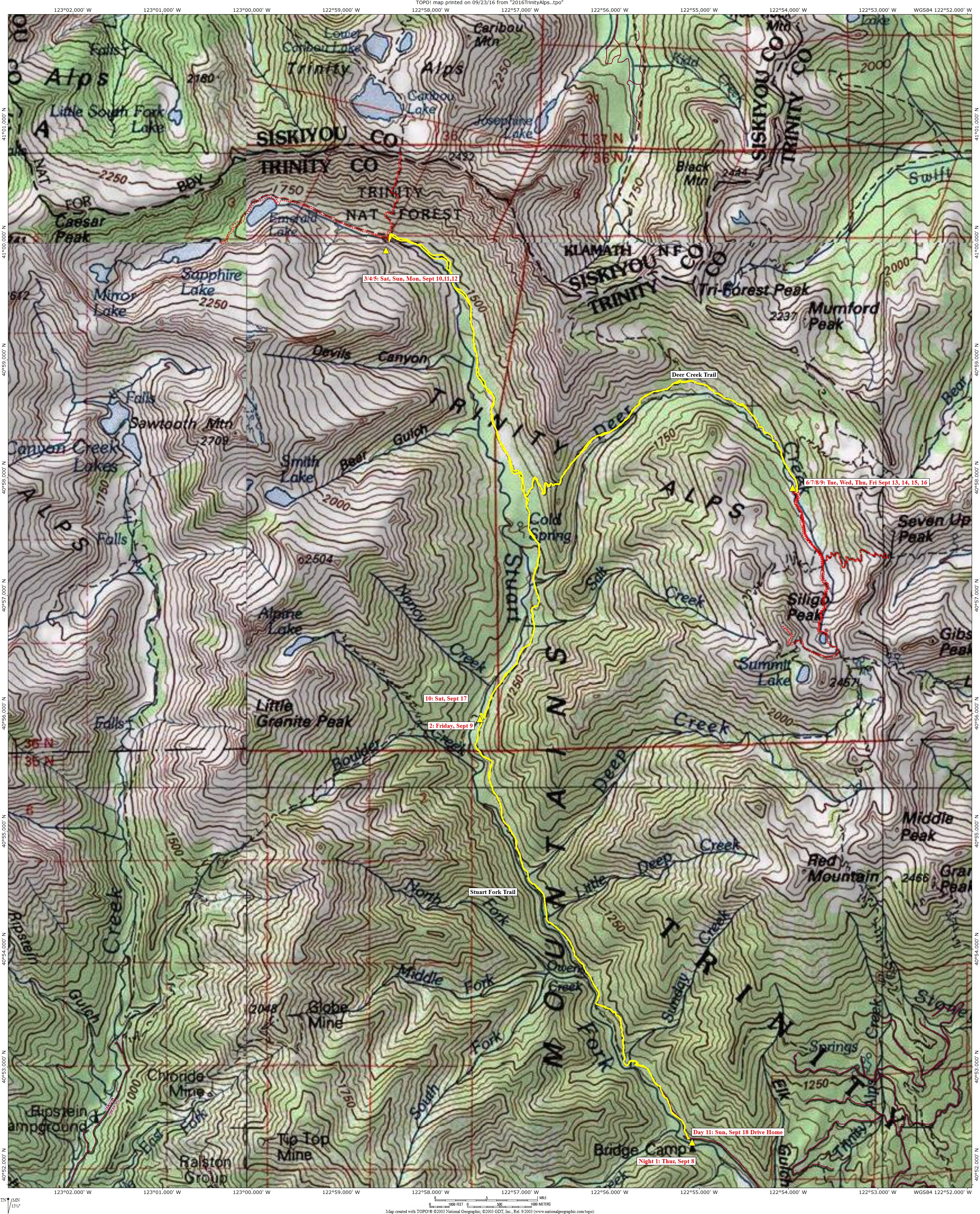
The map below shows our backpacking and dayhiking routes. Backpacking is a solid yellow line, dayhiking is in dotted red. Click on map image to get a higher resolution version.
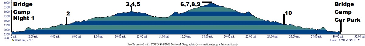
The elevation profile below the map shows in feet the elevations of the backpacking route (it does not show day hike elevations). The distances shown on the profile seriously underestimates the actual trail distances. The profile does give a good idea of the climbing involved, however.
 |
 |
Photos and narrative were contributed by both of us: Reenie and Bob
Here are all of the backpacking trips Reenie and Bob have taken Other Websites
By Bob:
Bob Phillips [phillips bob 27 at yahoo dot com - no spaces]
Santa Rosa, CA
August, 2012